
Maps Collection
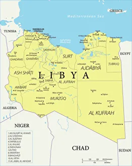
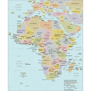
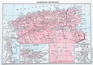
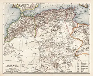
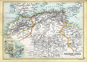
Algeria is a country located in North Africa, bordered by the Mediterranean Sea to the north and east, Tunisia to the northeast, Libya to the east
Choose a picture from our Maps Collection for your Wall Art and Photo Gifts
158 items


All Professionally Made to Order for Quick Shipping
-
Maps Collection
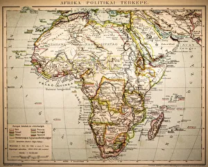
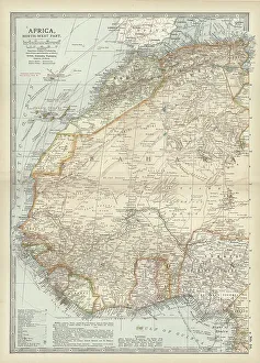
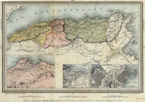
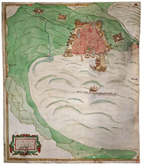
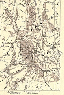
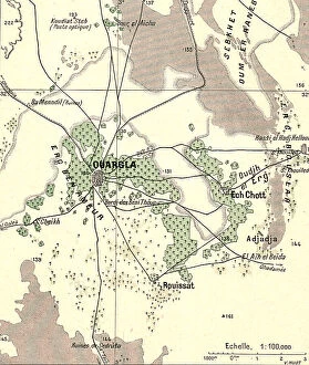
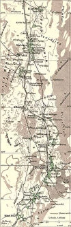
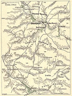
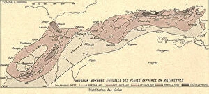
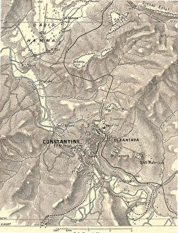
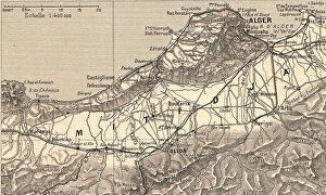
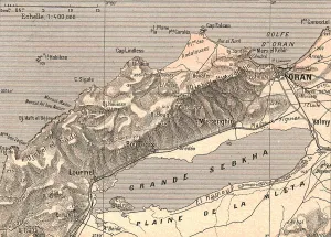
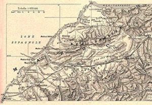
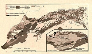
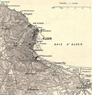
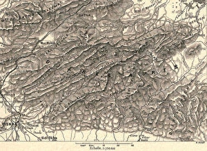
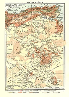
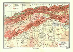
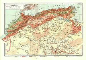
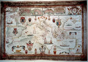
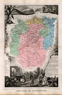
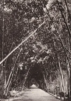
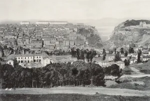
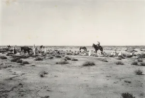
Algeria is a country located in North Africa, bordered by the Mediterranean Sea to the north and east, Tunisia to the northeast, Libya to the east, Niger to the southeast, Mali and Mauritania to the southwest and Morocco to the west. Maps of Algeria are available in various formats including physical maps showing terrain features such as mountains, rivers and lakes; political maps showing administrative divisions; road maps; satellite images; topographical maps; tourist attractions maps and more. The capital city of Algiers is located on Algeria's Mediterranean coast. In addition to its rich cultural heritage with ancient cities like Timbuktu and Ghardaïa, Algeria also has some of Africa's most spectacular natural landscapes such as Tassili n'Ajjer National Park in southern Algeria which is home to some of Africa's oldest rock art.
+
Our beautiful pictures are available as Framed Prints, Photos, Wall Art and Photo Gifts
Media Storehouse offers a collection of Maps of Algeria Africa, which includes wall art and framed prints. Our collection features various maps that showcase the geography and topography of Algeria, including its cities, towns, rivers, mountains, and deserts. These maps are not only informative but also aesthetically pleasing with their intricate details and vibrant colors. The Maps of Algeria Africa collection is perfect for those who have an interest in Algerian history or geography or want to add a unique touch to their home decor. The prints are available in different sizes and formats to suit individual preferences. Our Maps of Algeria Africa collection provides a comprehensive range of high-quality prints that capture the essence of this North African country's landscape. Whether you're looking for educational resources or decorative pieces for your home or office space, these maps offer something for everyone interested in exploring the beauty and diversity of Algeria.
+
What are Maps of Algeria Africa art prints?
Maps of Algeria Africa art prints are beautiful and intricate depictions of the country of Algeria in North Africa. These prints showcase the diverse terrain, cities, and landmarks that make up this fascinating nation. From the Sahara Desert to the Mediterranean coastline, these maps provide a detailed view of Algeria's geography. These art prints are perfect for anyone interested in Algerian culture or history. They can be used as decorative pieces in homes or offices, or as educational tools for students studying geography or world cultures. The maps come in a variety of sizes and styles to suit any taste. We offer a wide selection of Maps of Algeria Africa art prints that are high-quality reproductions made from original cartographic sources. Each print is carefully crafted using advanced printing techniques to ensure accurate color reproduction and sharp detail. Whether you're looking for a vintage-style map or a modern interpretation, we have something for everyone who loves Algerian culture and history.
+
What Maps of Algeria Africa art prints can I buy from Media Storehouse?
We offer a wide range of Maps of Algeria Africa art prints that are perfect for anyone looking to add a touch of culture and history to their home or office. These maps showcase the beauty and diversity of Algeria, highlighting its rich cultural heritage, stunning landscapes, and unique landmarks. Some popular options include vintage maps that capture the country's colonial past, as well as more modern designs that feature detailed topographical information. You can also choose from different sizes and styles to suit your preferences, whether you want a large canvas print or a smaller framed piece. These Maps of Algeria Africa art prints make great gifts for anyone who loves travel or has an interest in geography. They are also ideal for decorating classrooms or offices with an educational theme. With so many beautiful designs available at Media Storehouse, you're sure to find the perfect map print to suit your needs.
+
How do I buy Maps of Algeria Africa art prints?
To buy Maps of Algeria Africa art prints from Media Storehouse, you can browse our collection online and select the print that catches your eye. Once you have found the print you want to purchase, simply add it to your cart and proceed to checkout. You will be prompted to enter your shipping information and payment details before finalizing your order. We offer a wide range of high-quality art prints featuring maps of Algeria in various styles and sizes. Whether you are looking for a vintage map or a modern interpretation, there is something for everyone. Their selection includes both framed and unframed options, so you can choose the best option based on your personal preference. With fast and reliable shipping options available, buying Maps of Algeria Africa art prints from Media Storehouse is easy and hassle-free.
+
How much do Maps of Algeria Africa art prints cost?
As a provider of Maps of Algeria Africa art prints, we offer a range of options at varying prices to suit different budgets and preferences. Our selection includes high-quality prints in various sizes and formats, including framed and unframed options. The cost of these prints will depend on factors such as the size, format, and quality selected by the customer. We strive to provide competitive pricing for all our products while maintaining the highest standards of quality. Our Maps of Algeria Africa art prints are perfect for anyone looking to add some cultural or historical flair to their home or office decor. They make great gifts for friends or family members who have an interest in geography or African culture. Whether you're looking for something small and simple or large and intricate, we have something that will meet your needs without breaking the bank.
+
How will my Maps of Algeria Africa art prints be delivered to me?
Your Maps of Algeria Africa art prints will be delivered to you in a safe and secure manner. We take great care in packaging your artwork, ensuring that it arrives at your doorstep undamaged. Our team uses high-quality materials to protect the print during transit. We offer various delivery options depending on your location and preferences. You can choose standard shipping or express delivery for faster arrival times. Additionally, we provide tracking information so you can keep an eye on the progress of your order. Our goal is to make sure that you receive your Maps of Algeria Africa art prints in perfect condition as quickly as possible. If there are any issues with the delivery or if you have any questions about our process, please do not hesitate to contact us and we will be happy to assist you.