
Maps Collection
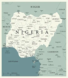
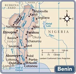
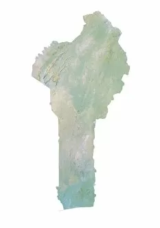
Benin, located in West Africa, is a small country with a rich history and culture and can bordered by Niger to the east, Nigeria to the west
Choose a picture from our Maps Collection for your Wall Art and Photo Gifts
26 items


All Professionally Made to Order for Quick Shipping
-
Maps Collection
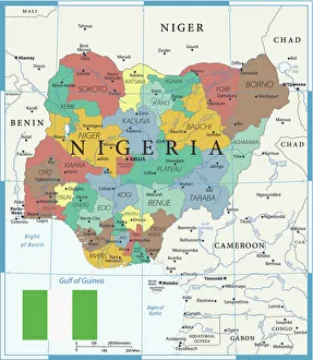
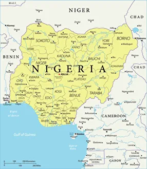
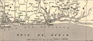
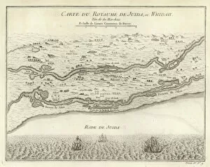
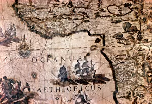
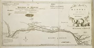
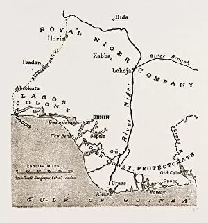
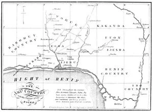
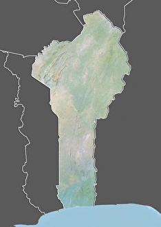
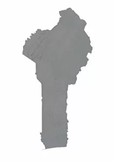
Benin, located in West Africa, is a small country with a rich history and culture and can bordered by Niger to the east, Nigeria to the west, Burkina Faso to the north and Togo to the south. The capital of Benin is Porto-Novo. The terrain of Benin consists mostly of low plains with some hills in the northwest region. There are several rivers that flow through Benin including the Ouémé River which flows from north to south and empties into Lake Nokoue near Cotonou. The coastline of Benin stretches over 120 km along the Bight of Benin in the Gulf of Guinea on Africa’s Atlantic coast. Benin has many different climates ranging from tropical in its southern region to semi-arid in its northern region. It also has many natural resources such as oil, gold and limestone which have been exploited for centuries by various empires that have occupied it throughout its history including France who colonized it until 1960 when it gained independence as a republic nation state known today as The Republic Of Benin or Dahomey (its former name).
+
Our beautiful pictures are available as Framed Prints, Photos, Wall Art and Photo Gifts
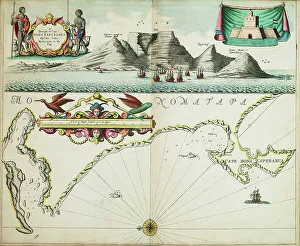
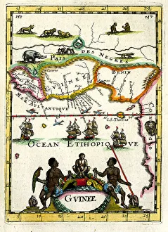
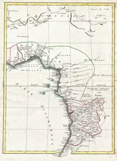
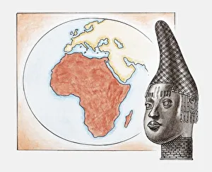
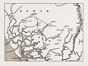
The Maps of Benin Africa collection from Media Storehouse is a stunning assortment of wall art and framed prints that showcase the beauty and diversity of the African nation. Our collection features an array of maps, ranging from antique to modern, which provide a unique glimpse into the country's rich history and culture. Each print in our collection has been carefully curated to capture the essence of Benin, highlighting its natural landscapes, cultural landmarks, and architectural wonders. From colorful street markets to ancient palaces, these prints offer a fascinating insight into one of Africa's most vibrant nations. Whether you're looking for a striking centerpiece for your living room or an inspiring addition to your office decor, the Maps of Benin Africa collection has something for everyone. With high-quality printing techniques and premium materials used throughout each piece, these prints are sure to impress both casual viewers and serious collectors alike.
+
What are Maps of Benin Africa art prints?
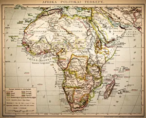
Maps of Benin Africa art prints are beautiful and intricate depictions of the country of Benin in West Africa. These maps showcase the geography, topography, and landmarks that make up this unique African nation. They are created using a variety of artistic techniques such as watercolor painting, pen and ink drawing, or digital design. These art prints can be used for decorative purposes in homes or offices, serving as a conversation starter or a way to display one's interest in African culture. They also make great gifts for anyone interested in travel, geography or history. Maps of Benin Africa art prints come in various sizes and styles to suit different preferences. Some feature bright colors while others have muted tones; some show detailed street layouts while others highlight natural features like rivers and mountains. Maps of Benin Africa art prints offer an excellent way to appreciate the beauty and complexity of this fascinating country from afar.
+
What Maps of Benin Africa art prints can I buy from Media Storehouse?
We offer a wide range of Maps of Benin Africa art prints that are perfect for anyone looking to add some African-inspired decor to their home or office. These maps showcase the beautiful country of Benin, highlighting its geography, landmarks, and historical sites. Some popular options include vintage-style maps that feature intricate details and vibrant colors. You can also find more modern designs that use bold lines and minimalist graphics to create a sleek look. Whether you're interested in traditional cartography or contemporary art, there is sure to be a map print that suits your style. In addition to standard paper prints, Media Storehouse also offers canvas prints and framed options for those who want something more substantial. With so many different styles and sizes available, it's easy to find the perfect Maps of Benin Africa art print for your space.
+
How do I buy Maps of Benin Africa art prints?
To buy Maps of Benin Africa art prints from Media Storehouse, you can browse our extensive collection online. Simply search for "Maps of Benin Africa" in the search bar on our website and select the print that catches your eye. Once you have found a print that you like, click on it to see more details about the product. From there, you can choose the size and format of your print. You may also be able to customize certain aspects such as framing or matting options depending on what is available. Once you have made all necessary selections, simply add the item to your cart and proceed to checkout. At this point, you will need to enter your shipping information and payment details before finalizing your purchase. We offer high-quality art prints at affordable prices with a wide range of customization options available for each piece. With easy online ordering and fast shipping times, buying Maps of Benin Africa art prints has never been easier.
+
How much do Maps of Benin Africa art prints cost?
We offer a wide range of Maps of Benin Africa art prints that vary in price depending on the size and type of print. Our collection includes vintage maps, modern interpretations, and artistic renditions of Benin's geography. We pride ourselves on providing high-quality prints that are perfect for both personal and professional use. Our Maps of Benin Africa art prints come in various sizes ranging from small to large formats suitable for framing or hanging as wall decor. We also offer different types of paper finishes such as glossy or matte to suit your preferences. We understand the importance of preserving African culture through art, which is why our Maps of Benin Africa art prints are affordable without compromising quality. Whether you're looking to decorate your home or office space with unique artwork or seeking a thoughtful gift for someone special, our collection has something for everyone at reasonable prices.
+
How will my Maps of Benin Africa art prints be delivered to me?
We take great care in ensuring that your Maps of Benin Africa art prints are delivered to you safely and securely. We use high-quality packaging materials to protect your artwork during transit, so it arrives at your doorstep in pristine condition. We work with trusted shipping partners who have extensive experience in handling delicate items like art prints. They will deliver your order directly to the address you provide us with when placing your order. Once your order has been dispatched, we will send you a confirmation email containing tracking information so you can keep an eye on its progress. If for any reason there is a delay or issue with delivery, our customer service team will be on hand to assist you and ensure that any problems are resolved as quickly as possible. We strive to provide a seamless and hassle-free delivery experience for all of our customers.