
Maps Collection
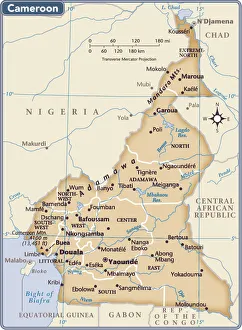
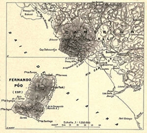
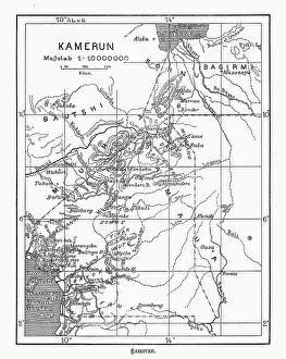
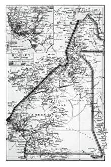
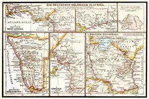
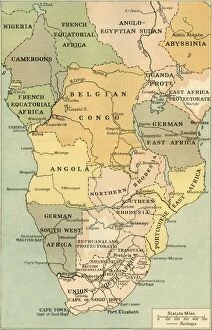
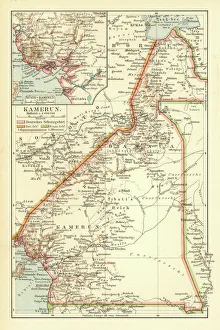
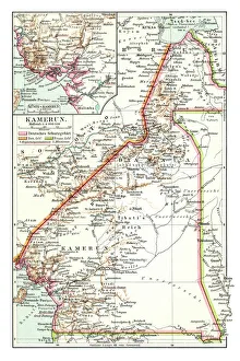
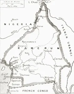
Cameroon is a country located in Central Africa, bordered by Nigeria to the west, Chad to the northeast
Choose a picture from our Maps Collection for your Wall Art and Photo Gifts
33 items


All Professionally Made to Order for Quick Shipping
-
Maps Collection
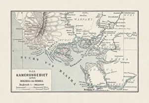
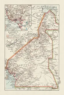
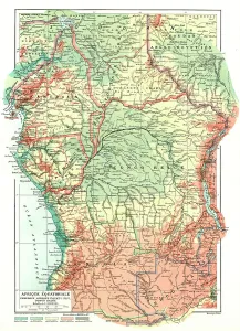
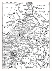
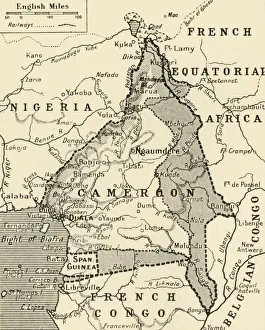
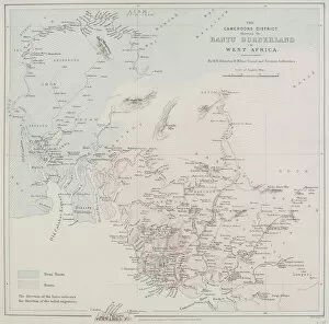
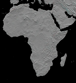
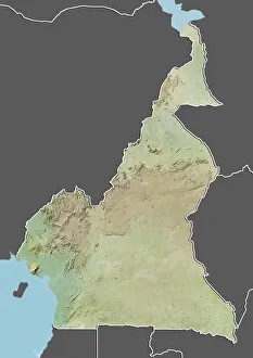
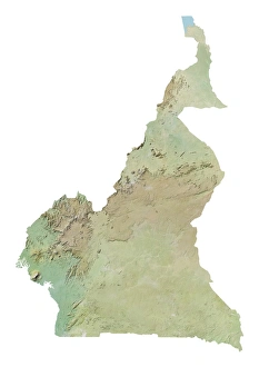
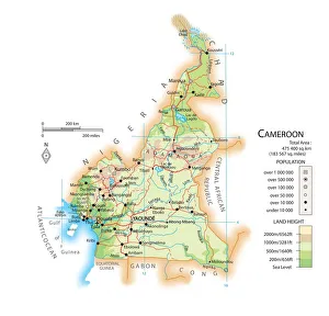
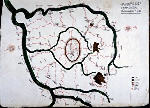
Cameroon is a country located in Central Africa, bordered by Nigeria to the west, Chad to the northeast, the Central African Republic to the east and Equatorial Guinea, Gabon and the Republic of Congo to the south. Maps of Cameroon show its diverse geography which includes mountains, rainforests and savannas. The country has an extensive coastline on both sides of its territory along with many rivers and lakes. Cameroon's capital city is Yaoundé while its largest city is Douala. The country has a population of over 24 million people who are divided into more than 200 distinct ethnic groups speaking over 250 languages. Cameroon also boasts some impressive natural resources including oil reserves as well as timber and agricultural products such as coffee and cocoa beans. Maps of Cameroon provide an invaluable resource for those looking to explore this fascinating African nation.
+
Our beautiful pictures are available as Framed Prints, Photos, Wall Art and Photo Gifts
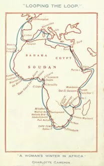
The Maps of Cameroon Africa collection from Media Storehouse is a stunning assortment of wall art and framed prints that showcase the beauty and diversity of Cameroon's geography. Our collection features an array of vintage maps, topographical charts, and satellite images that capture the country's unique terrain, including its lush rainforests, sprawling savannas, and towering mountains. Each piece in our collection has been carefully selected for its historical significance or aesthetic appeal. Some prints feature intricate details such as rivers, lakes, and mountain ranges while others highlight important landmarks like cities or national parks. Whether you're looking to add a touch of African flair to your home decor or simply appreciate the beauty of cartography, our collection offers something for everyone. The Maps of Cameroon Africa collection is a must-see for anyone interested in exploring this fascinating country through art. With so many beautiful pieces to choose from, it's easy to find something that will inspire you every time you look at it.
+
What are Maps of Cameroon Africa art prints?
Maps of Cameroon Africa art prints are high-quality reproductions of maps that depict the geography and topography of Cameroon, a country located in Central Africa. These art prints showcase the intricate details and features of the land, including its rivers, mountains, forests, and cities. These maps are not only informative but also visually appealing. They make great decorative pieces for homes or offices and can add an interesting touch to any room's decor. Maps of Cameroon Africa art prints come in various sizes to fit different spaces and preferences. Whether you're a lover of geography or simply looking for unique wall art with cultural significance, these maps offer something special. They provide insight into the rich history and diverse landscape of Cameroon while also serving as beautiful pieces of artwork that can be appreciated by anyone.
+
What Maps of Cameroon Africa art prints can I buy from Media Storehouse?
We offer a wide range of Cameroon Africa art prints that are perfect for adding a touch of culture and history to your home or office. You can choose from various maps, including vintage maps, topographical maps, political maps, and satellite imagery. These high-quality prints showcase the diverse landscape and geography of Cameroon, highlighting its mountains, rivers, forests, and cities. In addition to traditional paper prints in different sizes and finishes such as gloss or matte finish you can also purchase canvas prints which offer a more contemporary look. Our collection features artwork created by talented photographers and artists who have captured the beauty of Cameroon through their lenses or brushes. Whether you're looking for an educational tool for your classroom or simply want to decorate your living space with unique wall art that celebrates African heritage - Media Storehouse has something for everyone.
+
How do I buy Maps of Cameroon Africa art prints?
To buy Maps of Cameroon Africa art prints, you can visit our online gallery. We offer a wide range of high-quality art prints that are perfect for decorating your home or office. You can browse through our collection and select the print that best suits your taste and style. Once you have found the print you want to purchase, simply add it to your cart and proceed to checkout. At this point, you will be asked to provide some basic information such as your name, address, and payment details. We accept various forms of payment including credit cards and PayPal. Once your order has been processed, they will ship the print directly to your doorstep. Buying Maps of Cameroon Africa art prints from Media Storehouse is a simple process that allows you to enjoy beautiful artwork in the comfort of your own home.
+
How much do Maps of Cameroon Africa art prints cost?
We offer a wide range of Maps of Cameroon Africa art prints that vary in price depending on the size and type of print. Our collection includes high-quality paper prints, canvas prints, and framed prints that are perfect for adding a touch of African culture to your home or office decor. Our prices are competitive and affordable, making it easy for you to find the perfect piece within your budget. We pride ourselves on providing our customers with top-notch customer service and quality products that will exceed their expectations. Whether you're looking for a large-scale map print or something smaller to fit into an existing gallery wall display, we have something for everyone. Explore our selection today to find the perfect Maps of Cameroon Africa art print that speaks to you.
+
How will my Maps of Cameroon Africa art prints be delivered to me?
We take great care in ensuring that your Maps of Cameroon Africa art prints are delivered to you safely and securely. We use high-quality packaging materials to protect your artwork during transit and ensure it arrives in pristine condition. Your art print will be carefully rolled and placed inside a sturdy cardboard tube for protection. The tube is then sealed with tape to prevent any damage or moisture from entering the package. We work with trusted shipping partners who provide reliable delivery services worldwide. Once your order has been dispatched, you will receive a tracking number so you can monitor its progress and estimated delivery date. We understand the importance of receiving your artwork promptly, which is why we strive to deliver all orders as quickly as possible without compromising on quality or safety. We hope that our attention to detail ensures that you receive your Maps of Cameroon Africa art prints in perfect condition every time.