
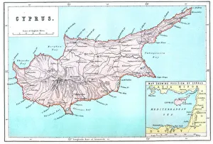
Maps Collection
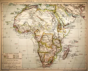
Maps of Egypt Africa are a type of cartographic representation that depict the physical features, political boundaries
Choose a picture from our Maps Collection for your Wall Art and Photo Gifts
535 items


All Professionally Made to Order for Quick Shipping
-
Maps Collection
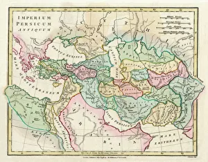
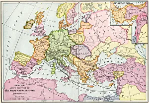
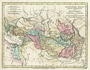
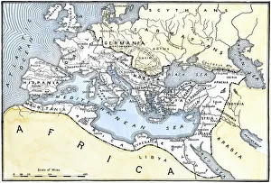
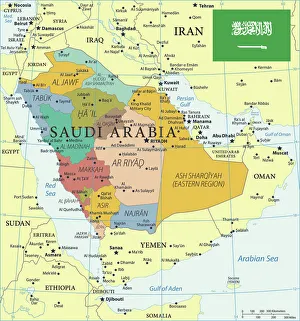
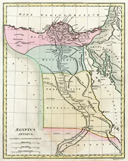
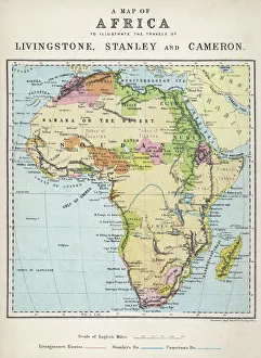
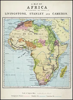
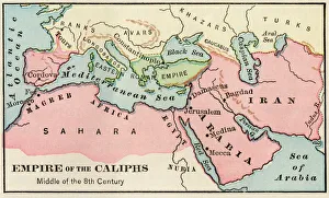
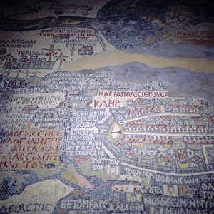
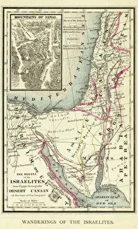
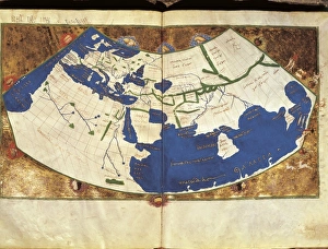
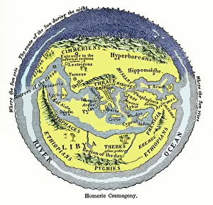
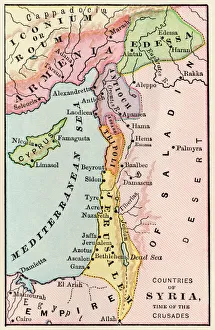
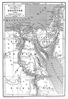
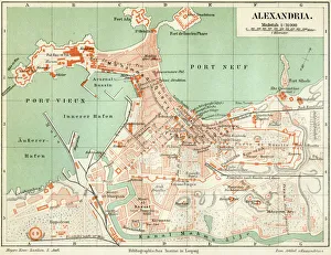
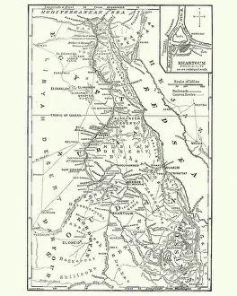
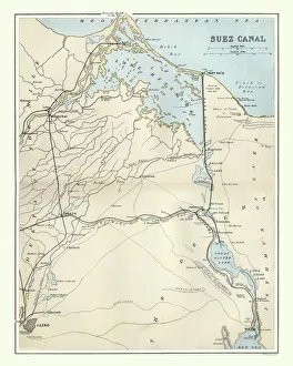
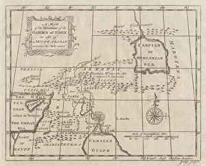
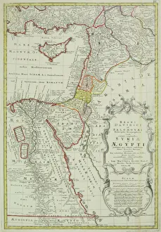
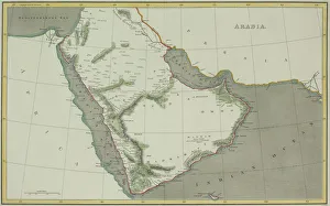
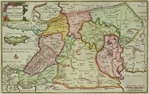
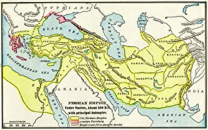
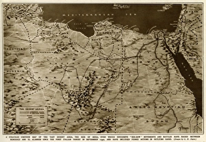
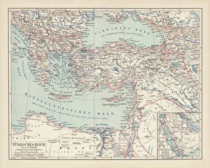
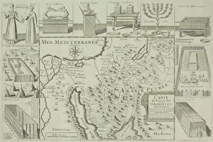
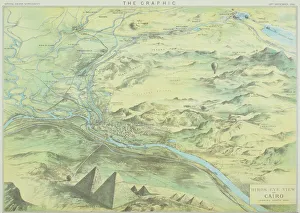
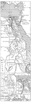
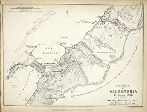
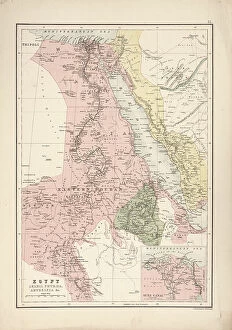
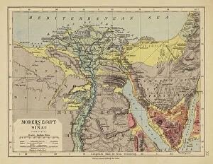
Maps of Egypt Africa are a type of cartographic representation that depict the physical features, political boundaries, and other elements of the African country and can be used for a variety of purposes, such as navigation, research, education and tourism, and are be found in various formats including paper maps, digital maps and online maps. Paper they can usually printed on large sheets of paper or cardstock and may include detailed information about roads, cities and other features. Digital they can available in various formats such as GIS (Geographic Information System) data sets or vector files which can be viewed on computers or mobile devices. Online mapping services provide interactive web-based applications which allow users to view detailed information about an area with the help of satellite images. It also provide valuable insight into the history and culture of Egypt by highlighting important sites such as monuments and archaeological sites which have been preserved over time.
+
Our beautiful pictures are available as Framed Prints, Photos, Wall Art and Photo Gifts
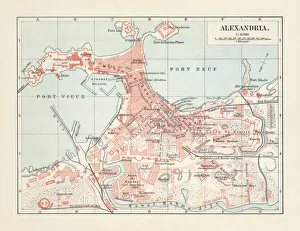
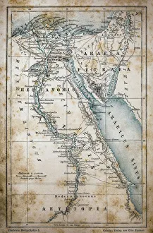
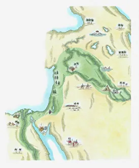
Media Storehouse offers a stunning collection of Maps of Egypt Africa wall art and framed prints. Our collection features a range of vintage maps that showcase the beauty and diversity of this region, from ancient Egyptian kingdoms to modern-day cities. These maps are perfect for those who love history, geography or simply want to add some unique decor to their home or office. The Maps of Egypt Africa collection includes detailed depictions of famous landmarks such as the Pyramids at Giza, the Nile River, and the Sahara Desert. The artwork is available in various sizes and styles to suit any taste or budget. Whether you prefer a classic antique look or something more contemporary, there is sure to be something in our collection that will catch your eye. Our Maps of Egypt Africa collection is an excellent choice for anyone looking for high-quality wall art that celebrates the rich cultural heritage and natural beauty of this fascinating region.
+
What are Maps of Egypt Africa art prints?
Maps of Egypt Africa art prints are high-quality reproductions of historical and contemporary maps depicting the geography, topography, and landmarks of Egypt and surrounding African countries. These art prints showcase intricate details such as cities, rivers, mountains, deserts, and other natural features that make up the unique landscape of this region. These maps have been carefully selected from a vast collection to offer a diverse range of styles including antique engravings, vintage illustrations, modern satellite imagery and more. They are printed on premium quality paper using state-of-the-art printing technology to ensure vibrant colors and sharp detail. Maps of Egypt Africa art prints are perfect for anyone interested in history or geography or those who simply appreciate beautiful artwork. They can be used to decorate homes or offices with an exotic touch or as educational tools for schools or libraries. With their timeless appeal and cultural significance, these art prints make excellent gifts for any occasion.
+
What Maps of Egypt Africa art prints can I buy from Media Storehouse?
We offer a wide range of Maps of Egypt Africa art prints that are perfect for anyone interested in the history and geography of this fascinating region. These maps showcase the various cities, landmarks, and natural features that make up Egypt and Africa, including the Nile River, Sahara Desert, Pyramids of Giza, and more. Some popular options include antique-style maps from centuries past as well as modern-day satellite images that offer a unique perspective on these iconic locations. Whether you're looking to decorate your home or office with beautiful artwork or simply want to learn more about this part of the world, we have something for everyone. In addition to traditional paper prints, many maps are also available in canvas or framed formats to suit your individual preferences. So why not explore our collection today and discover all the amazing Maps of Egypt Africa art prints we have on offer?
+
How do I buy Maps of Egypt Africa art prints?
To buy Maps of Egypt Africa art prints from Media Storehouse, you can browse our extensive collection online. We offer a wide range of maps depicting different regions and historical periods in Egypt and Africa. Once you have found the map that you would like to purchase, simply add it to your cart and proceed to checkout. You will be prompted to enter your shipping information and payment details. We offer high-quality art prints that are perfect for home or office decor. Their prints are produced using state-of-the-art printing technology on premium paper stock, ensuring vibrant colors and sharp detail. Whether you are looking for a vintage map of Cairo or a modern interpretation of the African continent, we have something for everyone. Buying Maps of Egypt Africa art prints from Media Storehouse is easy and convenient. With their vast selection of maps and hassle-free ordering process, you can find the perfect print to suit your style and taste in no time at all.
+
How much do Maps of Egypt Africa art prints cost?
We offer a wide range of Maps of Egypt Africa art prints at varying prices depending on the size and type of print. Our collection includes antique maps, modern maps, topographical maps, political maps and more. The cost of each print is determined by factors such as the quality of the paper used for printing, the size of the print and whether it is framed or unframed. Our Maps of Egypt Africa art prints are perfect for anyone who loves history, geography or travel. They make great gifts for friends and family members who have an interest in these subjects too. We take pride in offering high-quality products that are both affordable and visually stunning. Whether you're looking to decorate your home or office with a beautiful map print or simply want to add to your collection, we have something for everyone at Media Storehouse. So why not browse our selection today?
+
How will my Maps of Egypt Africa art prints be delivered to me?
Your Maps of Egypt Africa art prints will be delivered to you in a safe and secure manner. We take great care in packaging your order so that it arrives at your doorstep in perfect condition. Our team uses high-quality materials to ensure that the artwork is protected during transit. Once your order has been processed, we will dispatch it for delivery using our trusted courier partners. You can track the progress of your shipment online and receive updates on its estimated arrival time. We understand how important it is for you to receive your artwork promptly, which is why we strive to deliver all orders as quickly as possible. However, please note that delivery times may vary depending on your location and other factors beyond our control. Rest assured that when you purchase from Media Storehouse, you can expect a hassle-free experience from start to finish.