Fraud Blocker Skip to main content

Home > Africa > Egypt > Maps

Maps Collection (page 2)

Maps of Egypt Africa are a type of cartographic representation that depict the physical features, political boundaries

516 items

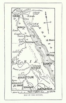
Background imageMaps Collection: Map of the Soudan (engraving)

Map of the Soudan (engraving)
8669248 Map of the Soudan (engraving) by English School, (19th century); Private Collection; (add.info.: Map of the Soudan)

Background imageMaps Collection: Chart of Alexandria, 1799 (coloured manuscript)

Chart of Alexandria, 1799 (coloured manuscript)
7339380 Chart of Alexandria, 1799 (coloured manuscript) by Unknown artist, (18th century); 55x76 cm; National Maritime Museum, London, UK; (add.info.: Creator: Anonymous Single sheet. Col. ms)

Background imageMaps Collection: Map of Upper Egypt in the late 19th century. From El Mundo Ilustrado, published Barcelona, 1880

Map of Upper Egypt in the late 19th century. From El Mundo Ilustrado, published Barcelona, 1880
478328 Map of Upper Egypt in the late 19th century. From El Mundo Ilustrado, published Barcelona, 1880.; Private Collection

Background imageMaps Collection: Map Of Upper Egypt In The Late 19Th Century. From El Mundo Ilustrado, Published Barcelona

Map Of Upper Egypt In The Late 19Th Century. From El Mundo Ilustrado, Published Barcelona, 1880 ©UIG/Leemage
UIG5420442 Map Of Upper Egypt In The Late 19Th Century. From El Mundo Ilustrado, Published Barcelona, 1880 ©UIG/Leemage

Background imageMaps Collection: Plan of the Suez Canal (Egypt), with portraits of Ferdinand de Lesseps (1805-1894)

Plan of the Suez Canal (Egypt), with portraits of Ferdinand de Lesseps (1805-1894)
CSO4983168 Plan of the Suez Canal (Egypt), with portraits of Ferdinand de Lesseps (1805-1894), Ismail Pasha (1830-1895) Khedive of Egypt and Sudan

Background imageMaps Collection: Map of the Middle East (Middle East) in antiquity, birth of civilization

Map of the Middle East (Middle East) in antiquity, birth of civilization. We see the territories of: Egypt, Nubia
NWI4860542 Map of the Middle East (Middle East) in antiquity, birth of civilization. We see the territories of: Egypt, Nubia, Ethiopia, the Red Sea, Babylon, Phenicia, Tyre, Mesopotamia, Armenia

Background imageMaps Collection: Map depicting the divisions of the empire of Alexander The Great (Alexander III of Macedoine)

Map depicting the divisions of the empire of Alexander The Great (Alexander III of Macedoine, 356-323 BC) at his death
NWI4910200 Map depicting the divisions of the empire of Alexander The Great (Alexander III of Macedoine, 356-323 BC) at his death, constitutes of the kingdom of Cassandra of Macedonian (358-397 BC)

Background imageMaps Collection: Egypt: Cook cruise on the Nile, tourists rest in the shelter of the heat

Egypt: Cook cruise on the Nile, tourists rest in the shelter of the heat and the sun inside the boat in a room with a
LUX4779132 Egypt: Cook cruise on the Nile, tourists rest in the shelter of the heat and the sun inside the boat in a room with a map of the Nile, 1900; (add.info.: Egypt: Cook cruise on the Nile)

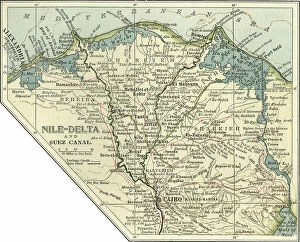
Background imageMaps Collection: Map of the Nile Delta and Suez Canal, c.1900 (engraving)

Map of the Nile Delta and Suez Canal, c.1900 (engraving)
533396 Map of the Nile Delta and Suez Canal, c.1900 (engraving); (add.info.: Map of Nile Delta and Suez Canal, Egypt, circa 1902)

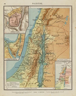
Background imageMaps Collection: Palestine (colour litho)

Palestine (colour litho)
8658804 Palestine (colour litho) by English School, (20th century); Private Collection; (add.info.: Palestine. Illustration for The London School Atlas edited by H O Arnold-Forster)

Background imageMaps Collection: Plan of a Great Tartane of 1789, 18th century (engraving)

Plan of a Great Tartane of 1789, 18th century (engraving)
5944401 Plan of a Great Tartane of 1789, 18th century (engraving); Private Collection; (add.info.: Engraving Plan of a large tartane of 1789 Particular collection.); Photo © Photo Josse

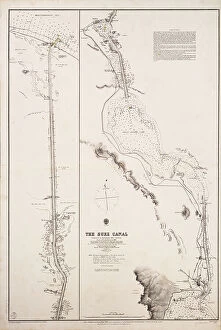
Background imageMaps Collection: Chart of the Suez Canal, 1870-1871, 1875 (engraving)

Chart of the Suez Canal, 1870-1871, 1875 (engraving)
7339423 Chart of the Suez Canal, 1870-1871, 1875 (engraving) by British School, (19th century); 93x63 cm; National Maritime Museum, London

Background imageMaps Collection: The Battle of the Nile, 1 August 1798. Chart of Aboukir Bay and of the action

The Battle of the Nile, 1 August 1798. Chart of Aboukir Bay and of the action, late 18th to early 19th century (pen)
7341920 The Battle of the Nile, 1 August 1798. Chart of Aboukir Bay and of the action, late 18th to early 19th century (pen, black ink, watercolour) by Pocock

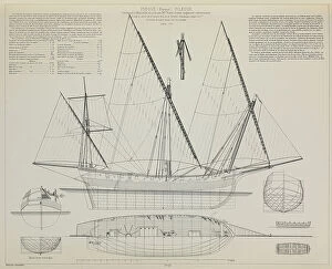
Background imageMaps Collection: Map of a Chebec (chebek) from 1750 to 1786, 18th century (engraving)

Map of a Chebec (chebek) from 1750 to 1786, 18th century (engraving)
5944391 Map of a Chebec (chebek) from 1750 to 1786, 18th century (engraving); Private Collection; (add.info.: Engraving Plan d un Chebec (chebek) from 1750 to 1786 Individual collection

Background imageMaps Collection: Geographic map of ancient Egypt. Colour lithography

Geographic map of ancient Egypt. Colour lithography
NWI4859854 Geographic map of ancient Egypt. Colour lithography.; (add.info.: Geographic map of ancient Egypt. Colour lithography.); Photo © North Wind Pictures

Background imageMaps Collection: Civilization of Antiquity: Alexander The Great conceiving the city of Alexandria, Ancient Egypt

Civilization of Antiquity: Alexander The Great conceiving the city of Alexandria, Ancient Egypt, 332 BC
NWI4911435 Civilization of Antiquity: Alexander The Great conceiving the city of Alexandria, Ancient Egypt, 332 BC. Colour engraving of the 19th century.; (add.info.: Civilization of Antiquity)

Background imageMaps Collection: Egypt, Syria - Arabia, 1700s

Egypt, Syria - Arabia, 1700s
2902289 Egypt, Syria - Arabia, 1700s; (add.info.: Egypt, Syria - Arabia, 1700s.); Buyenlarge Archive/UIG

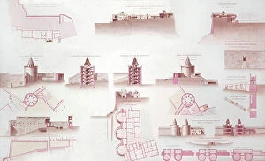
Background imageMaps Collection: map of citadel of Cairo, Egypt, watercolor,19th century

map of citadel of Cairo, Egypt, watercolor,19th century
1743419 map of citadel of Cairo, Egypt, watercolor,19th century; (add.info.: map of citadel of Cairo, Egypt, watercolor,19th century); Photo: Tallandier

Background imageMaps Collection: The Exodus or Journeyings of the Israelites from Egypt to Canaan (colour litho)

The Exodus or Journeyings of the Israelites from Egypt to Canaan (colour litho)
8630306 The Exodus or Journeyings of the Israelites from Egypt to Canaan (colour litho) by English School, (19th century); Private Collection; (add.info)

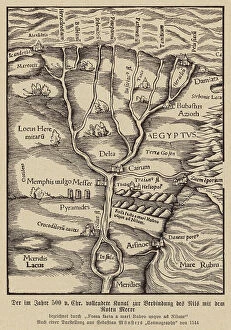
Background imageMaps Collection: Canal connecting the Nile and the Red Sea, 500 BC (engraving)

Canal connecting the Nile and the Red Sea, 500 BC (engraving)
8663872 Canal connecting the Nile and the Red Sea, 500 BC (engraving) by German School, (16th century) (after); Private Collection; (add.info.: Canal connecting the Nile and the Red Sea, Egypt)

Background imageMaps Collection: Map of Nile Djerme sailing from Rosette to Alexandria, 18th century (engraving)

Map of Nile Djerme sailing from Rosette to Alexandria, 18th century (engraving)
5944389 Map of Nile Djerme sailing from Rosette to Alexandria, 18th century (engraving); Private Collection; (add.info.: Engraving Plan of Djerme of the Nile (Scherme)

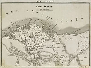
Background imageMaps Collection: Map of Lower Egypt during the eastern countryside of Bonaparte, 18th century (engraving)

Map of Lower Egypt during the eastern countryside of Bonaparte, 18th century (engraving)
5944368 Map of Lower Egypt during the eastern countryside of Bonaparte, 18th century (engraving); Private Collection; (add.info)

Background imageMaps Collection: Map of ancient Egypt. From Cassell's Universal History, published 1888 (b/w engraving)

Map of ancient Egypt. From Cassell's Universal History, published 1888 (b/w engraving)
6867222 Map of ancient Egypt. From Cassell's Universal History, published 1888 (b/w engraving); (add.info.: Map of ancient Egypt)

Background imageMaps Collection: Map of Pinque spinner, 1778, 18th century (engraving)

Map of Pinque spinner, 1778, 18th century (engraving)
5944399 Map of Pinque spinner, 1778, 18th century (engraving); Private Collection; (add.info.: Engraving Plan de Pinque (boat) spinner, built in Marseille in 1778 by M

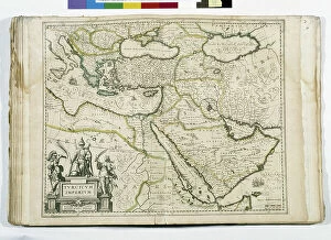
Background imageMaps Collection: The Ottoman Empire: Saudi Arabia, Greece, Egypt, Cyprus, Lebanon, Syria, Anatolia

The Ottoman Empire: Saudi Arabia, Greece, Egypt, Cyprus, Lebanon, Syria, Anatolia
JEB4874587 The Ottoman Empire: Saudi Arabia, Greece, Egypt, Cyprus, Lebanon, Syria, Anatolia... map of Nicolas and William Sanson of Abbevile. Municipal library of Marseille

Background imageMaps Collection: CARTOGRAPHY Map of the Mediterranean of the 18th century highlighting the places where 'The Seven

CARTOGRAPHY Map of the Mediterranean of the 18th century highlighting the places where "The Seven Wonders of
6202962 CARTOGRAPHY Map of the Mediterranean of the 18th century highlighting the places where "The Seven Wonders of the World" are located; (add.info)

Background imageMaps Collection: Map showing the route of the Israelites from Egypt to the passage of the Jordan ers 1451 BC (Exodus)

Map showing the route of the Israelites from Egypt to the passage of the Jordan ers 1451 BC (Exodus)
ELD4921971 Map showing the route of the Israelites from Egypt to the passage of the Jordan ers 1451 BC (Exodus) (Map showing the exodus route from Egypt to Canaan land)

Background imageMaps Collection: Al-Idrisi (1099-1164)

Al-Idrisi (1099-1164)
3499734 Al-Idrisi (1099-1164); (add.info.: Al-Idrisi (1099-1164). Muslim geographer belonging to Idrisy dinasty. World map of Al-Idrisi, 1154. Manuscript Pocock. Fol.375, 3v-4r., Cairo, Egypt

Background imageMaps Collection: 'Le Caire. Environs Du Caire; Le Nord-Est Africain, 1914. Creator: Unknown

'Le Caire. Environs Du Caire; Le Nord-Est Africain, 1914. Creator: Unknown
'Le Caire. Environs Du Caire; Le Nord-Est Africain, 1914. From "Grande Geographie Bong Illustree", 1914

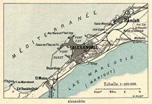
Background imageMaps Collection: 'Alexandrie; Le Nord-Est Africain, 1914. Creator: Unknown

'Alexandrie; Le Nord-Est Africain, 1914. Creator: Unknown
'Alexandrie; Le Nord-Est Africain, 1914. From "Grande Geographie Bong Illustree", 1914

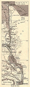
Background imageMaps Collection: 'Canal de Suez; Le Nord-Est Africain, 1914. Creator: Unknown

'Canal de Suez; Le Nord-Est Africain, 1914. Creator: Unknown
'Canal de Suez; Le Nord-Est Africain, 1914. From "Grande Geographie Bong Illustree", 1914

Background imageMaps Collection: 'Peninsule du Sinai; Le Nord-Est Africain, 1914. Creator: Unknown

'Peninsule du Sinai; Le Nord-Est Africain, 1914. Creator: Unknown
'Peninsule du Sinai; Le Nord-Est Africain, 1914. From "Grande Geographie Bong Illustree", 1914

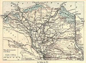
Background imageMaps Collection: 'Le Delta du Nil; Le Nord-Est Africain, 1914. Creator: Unknown

'Le Delta du Nil; Le Nord-Est Africain, 1914. Creator: Unknown
'Le Delta du Nil; Le Nord-Est Africain, 1914. From "Grande Geographie Bong Illustree", 1914

Background imageMaps Collection: 'Barrage d'Assouan; Le Nord-Est Africain, 1914. Creator: Unknown

'Barrage d'Assouan; Le Nord-Est Africain, 1914. Creator: Unknown
'Barrage d'Assouan; Le Nord-Est Africain, 1914. From "Grande Geographie Bong Illustree", 1914

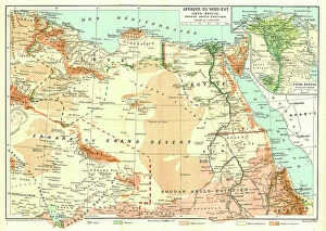
Background imageMaps Collection: 'Afrique Du Nord-Est; Le Nord-Est Africain, 1914. Creator: Unknown

'Afrique Du Nord-Est; Le Nord-Est Africain, 1914. Creator: Unknown
'Afrique Du Nord-Est; Le Nord-Est Africain, 1914.. From "Grande Geographie Bong Illustree", 1914

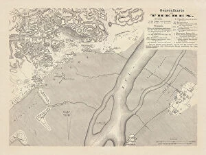
Background imageMaps Collection: Historical map of Thebes, Egypt, wood engraving, published in 1879

Historical map of Thebes, Egypt, wood engraving, published in 1879
Historical map of Thebes, Egypt. Wood engraving, published in 1879

Background imageMaps Collection: Map of Egypt during the Roman Empire, lithograph, published 1893

Map of Egypt during the Roman Empire, lithograph, published 1893
Map of ancient Egypt during the Roman Empire. Lithograph, published in 1893

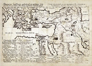
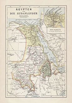
Background imageMaps Collection: Map of Egypt, Nile Delta and Sudan, lithograph, published 1893

Map of Egypt, Nile Delta and Sudan, lithograph, published 1893
Historical map of Egypt, Nile Delta and Sudan. Description in German. Lithograph, published in 1893

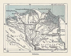
Background imageMaps Collection: Historical map of the Nile Delta, Egypt, lithograph, published 1893

Historical map of the Nile Delta, Egypt, lithograph, published 1893
Historical map of the Nile Delta in Egypt - one of the world's largest river deltas - from Alexandria in the west to Port Said in the east, it covers 240 km (150 mi) of Mediterranean coastline

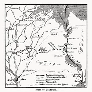
Background imageMaps Collection: Map of the Suez Canal, Egypt, wood engraving, published in 1869

Map of the Suez Canal, Egypt, wood engraving, published in 1869
Historical map of the Suez Canal - an artificial sea-level waterway in Egypt, connecting the Mediterranean Sea to the Red Sea through the Isthmus of Suez and dividing Africa and Asia

Background imageMaps Collection: 1 Maps 42

1 Maps 42
Emiliano Deificus

Background imageMaps Collection: 0042 City

0042 City
Emiliano Deificus

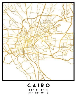
Background imageMaps Collection: Cairo (City Breaks)

Cairo (City Breaks)
Simon Goggin

Background imageMaps Collection: Cairo (City Breaks)

Cairo (City Breaks)
Simon Goggin

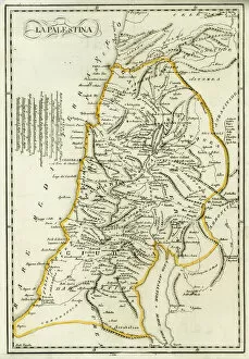
Background imageMaps Collection: Map of Palestine, circa 1800

Map of Palestine, circa 1800. From Gaza and Ashkelon in the south to Tyre and Sidon (Lebanon) in the north. La Palestina. Handcoloured copperplate engraving after Giulio Ferrario in his Costumes
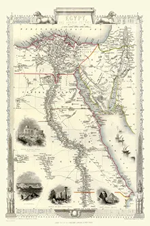
Background imageMaps Collection: Old Map of Egypt and Arabia Petraea 1851 by John Tallis

Old Map of Egypt and Arabia Petraea 1851 by John Tallis
A fine facimile artworked from an antique original map of Egypt and Arabia Petraea, issued as part of the 1851 edition of John Tallis and Companys " The Illustrated Atlas

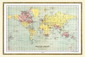
Background imageMaps Collection: Old Map of the World 1875

Old Map of the World 1875
THE WORLD THAT WAS 1875 - Britain under Disraeli buys the Suez Canal to protect the sea route to India. USA expands settlement into Oregon. Egyptian invasion of Ethiopia

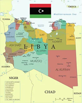
Background imageMaps Collection: Reference Map of Libya with Keys

Reference Map of Libya with Keys
Libya is an African nation situated in North Africa, along the Mediterranean Sea. Libya shares borders with Egypt, Sudan, Chad, Niger, Algeria, and Tunisia


All Professionally Made to Order for Quick Shipping


-

Maps Collection

Maps of Egypt Africa are a type of cartographic representation that depict the physical features, political boundaries, and other elements of the African country and can be used for a variety of purposes, such as navigation, research, education and tourism, and are be found in various formats including paper maps, digital maps and online maps. Paper they can usually printed on large sheets of paper or cardstock and may include detailed information about roads, cities and other features. Digital they can available in various formats such as GIS (Geographic Information System) data sets or vector files which can be viewed on computers or mobile devices. Online mapping services provide interactive web-based applications which allow users to view detailed information about an area with the help of satellite images. It also provide valuable insight into the history and culture of Egypt by highlighting important sites such as monuments and archaeological sites which have been preserved over time.
+

Our beautiful pictures are available as Framed Prints, Photos, Wall Art and Photo Gifts

Media Storehouse offers a stunning collection of Maps of Egypt Africa wall art and framed prints. Our collection features a range of vintage maps that showcase the beauty and diversity of this region, from ancient Egyptian kingdoms to modern-day cities. These maps are perfect for those who love history, geography or simply want to add some unique decor to their home or office. The Maps of Egypt Africa collection includes detailed depictions of famous landmarks such as the Pyramids at Giza, the Nile River, and the Sahara Desert. The artwork is available in various sizes and styles to suit any taste or budget. Whether you prefer a classic antique look or something more contemporary, there is sure to be something in our collection that will catch your eye. Our Maps of Egypt Africa collection is an excellent choice for anyone looking for high-quality wall art that celebrates the rich cultural heritage and natural beauty of this fascinating region.
+

What are Maps of Egypt Africa art prints?

Maps of Egypt Africa art prints are high-quality reproductions of historical and contemporary maps depicting the geography, topography, and landmarks of Egypt and surrounding African countries. These art prints showcase intricate details such as cities, rivers, mountains, deserts, and other natural features that make up the unique landscape of this region. These maps have been carefully selected from a vast collection to offer a diverse range of styles including antique engravings, vintage illustrations, modern satellite imagery and more. They are printed on premium quality paper using state-of-the-art printing technology to ensure vibrant colors and sharp detail. Maps of Egypt Africa art prints are perfect for anyone interested in history or geography or those who simply appreciate beautiful artwork. They can be used to decorate homes or offices with an exotic touch or as educational tools for schools or libraries. With their timeless appeal and cultural significance, these art prints make excellent gifts for any occasion.
+

What Maps of Egypt Africa art prints can I buy from Media Storehouse?

We offer a wide range of Maps of Egypt Africa art prints that are perfect for anyone interested in the history and geography of this fascinating region. These maps showcase the various cities, landmarks, and natural features that make up Egypt and Africa, including the Nile River, Sahara Desert, Pyramids of Giza, and more. Some popular options include antique-style maps from centuries past as well as modern-day satellite images that offer a unique perspective on these iconic locations. Whether you're looking to decorate your home or office with beautiful artwork or simply want to learn more about this part of the world, we have something for everyone. In addition to traditional paper prints, many maps are also available in canvas or framed formats to suit your individual preferences. So why not explore our collection today and discover all the amazing Maps of Egypt Africa art prints we have on offer?
+

How do I buy Maps of Egypt Africa art prints?

To buy Maps of Egypt Africa art prints from Media Storehouse, you can browse our extensive collection online. We offer a wide range of maps depicting different regions and historical periods in Egypt and Africa. Once you have found the map that you would like to purchase, simply add it to your cart and proceed to checkout. You will be prompted to enter your shipping information and payment details. We offer high-quality art prints that are perfect for home or office decor. Their prints are produced using state-of-the-art printing technology on premium paper stock, ensuring vibrant colors and sharp detail. Whether you are looking for a vintage map of Cairo or a modern interpretation of the African continent, we have something for everyone. Buying Maps of Egypt Africa art prints from Media Storehouse is easy and convenient. With their vast selection of maps and hassle-free ordering process, you can find the perfect print to suit your style and taste in no time at all.
+

How much do Maps of Egypt Africa art prints cost?

We offer a wide range of Maps of Egypt Africa art prints at varying prices depending on the size and type of print. Our collection includes antique maps, modern maps, topographical maps, political maps and more. The cost of each print is determined by factors such as the quality of the paper used for printing, the size of the print and whether it is framed or unframed. Our Maps of Egypt Africa art prints are perfect for anyone who loves history, geography or travel. They make great gifts for friends and family members who have an interest in these subjects too. We take pride in offering high-quality products that are both affordable and visually stunning. Whether you're looking to decorate your home or office with a beautiful map print or simply want to add to your collection, we have something for everyone at Media Storehouse. So why not browse our selection today?
+

How will my Maps of Egypt Africa art prints be delivered to me?

Your Maps of Egypt Africa art prints will be delivered to you in a safe and secure manner. We take great care in packaging your order so that it arrives at your doorstep in perfect condition. Our team uses high-quality materials to ensure that the artwork is protected during transit. Once your order has been processed, we will dispatch it for delivery using our trusted courier partners. You can track the progress of your shipment online and receive updates on its estimated arrival time. We understand how important it is for you to receive your artwork promptly, which is why we strive to deliver all orders as quickly as possible. However, please note that delivery times may vary depending on your location and other factors beyond our control. Rest assured that when you purchase from Media Storehouse, you can expect a hassle-free experience from start to finish.