Fraud Blocker Skip to main content

Home > Africa > Egypt > Maps

Maps Collection (page 6)

Maps of Egypt Africa are a type of cartographic representation that depict the physical features, political boundaries

516 items

Background imageMaps Collection: Map of the Battle of the Nile, published by William Blackwood and Sons

Map of the Battle of the Nile, published by William Blackwood and Sons
746928 Map of the Battle of the Nile, published by William Blackwood and Sons, Edinburgh & London, 1848 (hand-coloured engraving) by Johnston

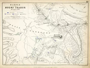
Background imageMaps Collection: Map of the Battle of Mount Thabor, published by William Blackwood and Sons

Map of the Battle of Mount Thabor, published by William Blackwood and Sons
746927 Map of the Battle of Mount Thabor, published by William Blackwood and Sons, Edinburgh & London, 1848 (hand-coloured engraving) by Johnston

Background imageMaps Collection: Map of the Siege of St. Jean d Acre, published by William Blackwood and Sons
Map of the Siege of St. Jean d Acre, published by William Blackwood and Sons
746925 Map of the Siege of St. Jean d Acre, published by William Blackwood and Sons, Edinburgh & London, 1848 (hand-coloured engraving) by Johnston

Background imageMaps Collection: Map of Sixteenth Century Egypt, from the Sala delle Carte Geografiche

Map of Sixteenth Century Egypt, from the Sala delle Carte Geografiche
BEN90573 Map of Sixteenth Century Egypt, from the Sala delle Carte Geografiche (Hall of Geographical Maps) 1575 (oil on panel) by Bonsignori, Stefano and Danti

Background imageMaps Collection: Map of Ancient Egypt, 1584

Map of Ancient Egypt, 1584
STC217077 Map of Ancient Egypt, 1584 by Ortelius, Abraham (1527-98); Private Collection; The Stapleton Collection; Flemish, out of copyright

Background imageMaps Collection: Map of Cairo, from Civitates Orbis Terrarum by Georg Braun (1541-1622

Map of Cairo, from Civitates Orbis Terrarum by Georg Braun (1541-1622
STC121076 Map of Cairo, from Civitates Orbis Terrarum by Georg Braun (1541-1622) and Frans Hogenberg (1535-90), c.1572 (coloured engraving) by Hoefnagel

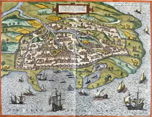
Background imageMaps Collection: Map of Alexandria, from Civitates Orbis Terrarum

Map of Alexandria, from Civitates Orbis Terrarum
STC121075 Map of Alexandria, from Civitates Orbis Terrarum by Georg Braun (1541-1622) and Frans Hogenberg (1535-90), c.1572 (coloured engraving) by Hoefnagel

Background imageMaps Collection: Map: Map of the Coast and Environs of Alexandria; Lower Egypt (colour litho)

Map: Map of the Coast and Environs of Alexandria; Lower Egypt (colour litho)
6004704 Map: Map of the Coast and Environs of Alexandria; Lower Egypt (colour litho) by English School, (19th century); Private Collection; (add.info)

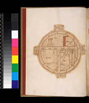
Background imageMaps Collection: Ms 315. Horace, Ars Poetica and Epistulae, f. 1v. T-O Map of the world

Ms 315. Horace, Ars Poetica and Epistulae, f. 1v. T-O Map of the world
5979507 Ms 315. Horace, Ars Poetica and Epistulae, f.1v. T-O Map of the world, with a tower representing Jerusalem, 14th Century (parchment) by Italian School

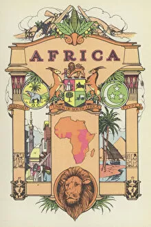
Background imageMaps Collection: Africa (colour litho)

Africa (colour litho)
5996926 Africa (colour litho) by English School, (20th century); Private Collection; (add.info.: Africa. Illustration from The Modern World Encyclopedia)

Background imageMaps Collection: Map of Cairo, a bird s-eye view, 1549 (woodcut map on 21 sheets)

Map of Cairo, a bird s-eye view, 1549 (woodcut map on 21 sheets)
1195485 Map of Cairo, a bird s-eye view, 1549 (woodcut map on 21 sheets) by Venetian School, (16th century); 98x197 cm; Private Collection; Photo eChristies Images; Italian, out of copyright

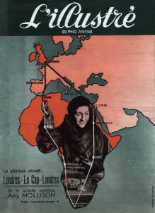
Background imageMaps Collection: Tour of the English aviator Amy Mollison (1903-1941): London (England), Barcelona (Spain)

Tour of the English aviator Amy Mollison (1903-1941): London (England), Barcelona (Spain)
XEE4182995 Tour of the English aviator Amy Mollison (1903-1941): London (England), Barcelona (Spain), Oran (Algeria), Gao (Mali), Benguella Mossamedes, Cape Town (South Africa), Juba (Somalia)

Background imageMaps Collection: Plan of Rhodes (Rodos) - in 'Voyage de levant made by the command of the king

Plan of Rhodes (Rodos) - in "Voyage de levant made by the command of the king
LSE4106238 Plan of Rhodes (Rodos) - in " Voyage de levant made by the command of the king in the year 1621", edited in 1629 (under the reign of Louis XIII Le Juste) by Unknown Artist

Background imageMaps Collection: Map of Alexandria - by Abraham Ortelius, Antwerp, 1595

Map of Alexandria - by Abraham Ortelius, Antwerp, 1595
LSE4102712 Map of Alexandria - by Abraham Ortelius, Antwerp, 1595 by Ortelius, Abraham (1527-98); Private Collection; (add.info.: Map of Alexandria - by Abraham Ortelius, Antwerp)

Background imageMaps Collection: Map of Cairo (engraving, 16th century)

Map of Cairo (engraving, 16th century)
LRI4646971 Map of Cairo (engraving, 16th century) by Hogenberg, Franz (1540-c.1590); Private Collection; (add.info.: Map of Cairo engraving from " Civitates Orbis Terrarum" by Georg Braun)

Background imageMaps Collection: The Red Sea and the Suez Canal (portulan, 1602)

The Red Sea and the Suez Canal (portulan, 1602)
LRI4648160 The Red Sea and the Suez Canal (portulan, 1602) by Maggiolo, Giacomo (16th Century); Museo Navale di Pegli, Genoa

Background imageMaps Collection: Map of Egypt with the cities of the Nile and Carthage (Tunisia), 1570 (engraving)

Map of Egypt with the cities of the Nile and Carthage (Tunisia), 1570 (engraving)
LRI4705015 Map of Egypt with the cities of the Nile and Carthage (Tunisia), 1570 (engraving) by Ortelius, Abraham (1527-98); Museo Navale di Pegli, Genoa

Background imageMaps Collection: View of Alexandria (Alexandria), Egypt (etching, 1572-1617)

View of Alexandria (Alexandria), Egypt (etching, 1572-1617)
LRI4707581 View of Alexandria (Alexandria), Egypt (etching, 1572-1617) by Hogenberg, Franz (1540-c.1590); Private Collection; (add.info.: View of Alexandria (Alexandria)

Background imageMaps Collection: Cotton, growing countries (colour litho)

Cotton, growing countries (colour litho)
3648637 Cotton, growing countries (colour litho) by English School, (20th century); Private Collection; (add.info.: Cotton, growing countries)

Background imageMaps Collection: The Evacuation of Fashoda, Sketch Map showing the Positions occupied by the British

The Evacuation of Fashoda, Sketch Map showing the Positions occupied by the British and French Troops (engraving)
1064145 The Evacuation of Fashoda, Sketch Map showing the Positions occupied by the British and French Troops (engraving) by English School

Background imageMaps Collection: Map showing the British Operations in Egypt and the Soudan, 1882-1898 (engraving)

Map showing the British Operations in Egypt and the Soudan, 1882-1898 (engraving)
1063822 Map showing the British Operations in Egypt and the Soudan, 1882-1898 (engraving) by English School, (19th century); Private Collection; (add.info)

Background imageMaps Collection: The Suez Canal (engraving)

The Suez Canal (engraving)
1103929 The Suez Canal (engraving) by English School, (19th century); Private Collection; (add.info.: The Suez Canal. Illustration for The Illustrated London News)

Background imageMaps Collection: Map of Lower Egypt, showing the Lines of Railway and Projected Isthmus of Suez Canal (engraving)

Map of Lower Egypt, showing the Lines of Railway and Projected Isthmus of Suez Canal (engraving)
1098101 Map of Lower Egypt, showing the Lines of Railway and Projected Isthmus of Suez Canal (engraving) by Dower, John (fl.c.1845-55); Private Collection; (add.info.: Map of Lower Egypt)

Background imageMaps Collection: Picture taken on the Western Desert of Egypt. Polish Officer who is 2nd in command

Picture taken on the Western Desert of Egypt. Polish Officer who is 2nd in command (left) studying the maps, which an offer from The Free Free French Unit is on the telephone

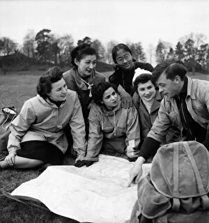
Background imageMaps Collection: Which way is North? Huguette Borrelly (France), Mrs

Which way is North? Huguette Borrelly (France), Mrs. Yenawaki (Japan), Safia Hamly (Egypt), Raji Sundram (Malayan Indian)

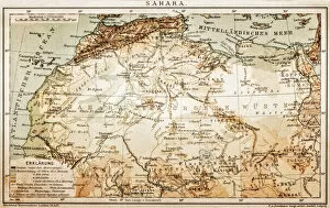
Background imageMaps Collection: Map of Sahara

Map of Sahara
Antique Map of Sahara from 1898

Background imageMaps Collection: Ancient Thebes Map, Egypt

Ancient Thebes Map, Egypt
Illustration of a Ancient Thebes Map, Egypt

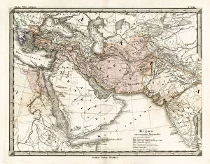
Background imageMaps Collection: Antique Map of Alexander the Greats Empire

Antique Map of Alexander the Greats Empire
Antique Map from 1862 of the kingdoms of the successors of Alexander the Great. Maps text is written in Latin. [b]View More:[/b] [url=][img][/img][/url][url=][img][/img][/url]

Background imageMaps Collection: MA Berkshire Adams Vector Road Map

MA Berkshire Adams Vector Road Map. All source data is in the public domain. U.S. Census Bureau Census Tiger. Used Layers: areawater, linearwater, roads, rails, cousub, pointlm, uac10

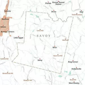
Background imageMaps Collection: MA Berkshire Savoy Vector Road Map

MA Berkshire Savoy Vector Road Map. All source data is in the public domain. U.S. Census Bureau Census Tiger. Used Layers: areawater, linearwater, roads, rails, cousub, pointlm, uac10

Background imageMaps Collection: MAP / AFRICA / EGYPT / COAST

MAP / AFRICA / EGYPT / COAST
Map of Egypt: the coastline near Alexandria, at the time of the Battle of the Nile (1 August 1798) Date: 1798

Background imageMaps Collection: MAP / AFRICA / SAHARA 1719

MAP / AFRICA / SAHARA 1719
Map of the Sahara Desert with Nubia, part of Egypt and part of Abyssinia Date: 1719

Background imageMaps Collection: Map of Africa illustrating travels of explorers

Map of Africa illustrating travels of explorers
A map of Africa which illustrates the travels of the explorers Livingstone, Stanley and Cameron. Date: 19th Century

Background imageMaps Collection: (insert)

(insert)

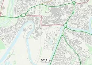
Background imageMaps Collection: Warrington WA1 1 Map

Warrington WA1 1 Map
Postcode Sector Map of Warrington WA1 1

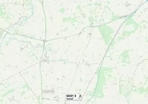
Background imageMaps Collection: Winchester SO21 3 Map

Winchester SO21 3 Map
Postcode Sector Map of Winchester SO21 3

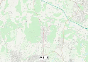
Background imageMaps Collection: South Buckinghamshire SL2 3 Map

South Buckinghamshire SL2 3 Map
Postcode Sector Map of South Buckinghamshire SL2 3

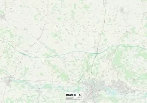
Background imageMaps Collection: West Berkshire RG20 8 Map

West Berkshire RG20 8 Map
Postcode Sector Map of West Berkshire RG20 8

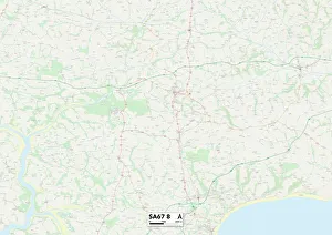
Background imageMaps Collection: Pembrokeshire SA67 8 Map

Pembrokeshire SA67 8 Map
Postcode Sector Map of Pembrokeshire SA67 8

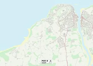
Background imageMaps Collection: Isle of Wight PO31 8 Map

Isle of Wight PO31 8 Map
Postcode Sector Map of Isle of Wight PO31 8

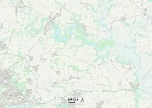
Background imageMaps Collection: Norfolk NR13 6 Map

Norfolk NR13 6 Map
Postcode Sector Map of Norfolk NR13 6

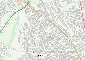
Background imageMaps Collection: Nottingham NG7 7 Map

Nottingham NG7 7 Map
Postcode Sector Map of Nottingham NG7 7

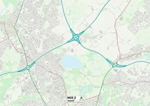
Background imageMaps Collection: Bury M25 2 Map

Bury M25 2 Map
Postcode Sector Map of Bury M25 2

Background imageMaps Collection: Aylesbury Vale HP19 8 Map

Aylesbury Vale HP19 8 Map
Postcode Sector Map of Aylesbury Vale HP19 8

Background imageMaps Collection: Kingston upon Hull HU9 5 Map

Kingston upon Hull HU9 5 Map
Postcode Sector Map of Kingston upon Hull HU9 5

Background imageMaps Collection: Stroud GL6 0 Map

Stroud GL6 0 Map
Postcode Sector Map of Stroud GL6 0

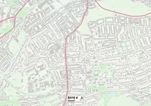
Background imageMaps Collection: Edinburgh EH10 4 Map

Edinburgh EH10 4 Map
Postcode Sector Map of Edinburgh EH10 4

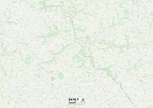
Background imageMaps Collection: Exeter EX18 7 Map

Exeter EX18 7 Map
Postcode Sector Map of Exeter EX18 7


All Professionally Made to Order for Quick Shipping


-

Maps Collection

Maps of Egypt Africa are a type of cartographic representation that depict the physical features, political boundaries, and other elements of the African country and can be used for a variety of purposes, such as navigation, research, education and tourism, and are be found in various formats including paper maps, digital maps and online maps. Paper they can usually printed on large sheets of paper or cardstock and may include detailed information about roads, cities and other features. Digital they can available in various formats such as GIS (Geographic Information System) data sets or vector files which can be viewed on computers or mobile devices. Online mapping services provide interactive web-based applications which allow users to view detailed information about an area with the help of satellite images. It also provide valuable insight into the history and culture of Egypt by highlighting important sites such as monuments and archaeological sites which have been preserved over time.
+

Our beautiful pictures are available as Framed Prints, Photos, Wall Art and Photo Gifts

Media Storehouse offers a stunning collection of Maps of Egypt Africa wall art and framed prints. Our collection features a range of vintage maps that showcase the beauty and diversity of this region, from ancient Egyptian kingdoms to modern-day cities. These maps are perfect for those who love history, geography or simply want to add some unique decor to their home or office. The Maps of Egypt Africa collection includes detailed depictions of famous landmarks such as the Pyramids at Giza, the Nile River, and the Sahara Desert. The artwork is available in various sizes and styles to suit any taste or budget. Whether you prefer a classic antique look or something more contemporary, there is sure to be something in our collection that will catch your eye. Our Maps of Egypt Africa collection is an excellent choice for anyone looking for high-quality wall art that celebrates the rich cultural heritage and natural beauty of this fascinating region.
+

What are Maps of Egypt Africa art prints?

Maps of Egypt Africa art prints are high-quality reproductions of historical and contemporary maps depicting the geography, topography, and landmarks of Egypt and surrounding African countries. These art prints showcase intricate details such as cities, rivers, mountains, deserts, and other natural features that make up the unique landscape of this region. These maps have been carefully selected from a vast collection to offer a diverse range of styles including antique engravings, vintage illustrations, modern satellite imagery and more. They are printed on premium quality paper using state-of-the-art printing technology to ensure vibrant colors and sharp detail. Maps of Egypt Africa art prints are perfect for anyone interested in history or geography or those who simply appreciate beautiful artwork. They can be used to decorate homes or offices with an exotic touch or as educational tools for schools or libraries. With their timeless appeal and cultural significance, these art prints make excellent gifts for any occasion.
+

What Maps of Egypt Africa art prints can I buy from Media Storehouse?

We offer a wide range of Maps of Egypt Africa art prints that are perfect for anyone interested in the history and geography of this fascinating region. These maps showcase the various cities, landmarks, and natural features that make up Egypt and Africa, including the Nile River, Sahara Desert, Pyramids of Giza, and more. Some popular options include antique-style maps from centuries past as well as modern-day satellite images that offer a unique perspective on these iconic locations. Whether you're looking to decorate your home or office with beautiful artwork or simply want to learn more about this part of the world, we have something for everyone. In addition to traditional paper prints, many maps are also available in canvas or framed formats to suit your individual preferences. So why not explore our collection today and discover all the amazing Maps of Egypt Africa art prints we have on offer?
+

How do I buy Maps of Egypt Africa art prints?

To buy Maps of Egypt Africa art prints from Media Storehouse, you can browse our extensive collection online. We offer a wide range of maps depicting different regions and historical periods in Egypt and Africa. Once you have found the map that you would like to purchase, simply add it to your cart and proceed to checkout. You will be prompted to enter your shipping information and payment details. We offer high-quality art prints that are perfect for home or office decor. Their prints are produced using state-of-the-art printing technology on premium paper stock, ensuring vibrant colors and sharp detail. Whether you are looking for a vintage map of Cairo or a modern interpretation of the African continent, we have something for everyone. Buying Maps of Egypt Africa art prints from Media Storehouse is easy and convenient. With their vast selection of maps and hassle-free ordering process, you can find the perfect print to suit your style and taste in no time at all.
+

How much do Maps of Egypt Africa art prints cost?

We offer a wide range of Maps of Egypt Africa art prints at varying prices depending on the size and type of print. Our collection includes antique maps, modern maps, topographical maps, political maps and more. The cost of each print is determined by factors such as the quality of the paper used for printing, the size of the print and whether it is framed or unframed. Our Maps of Egypt Africa art prints are perfect for anyone who loves history, geography or travel. They make great gifts for friends and family members who have an interest in these subjects too. We take pride in offering high-quality products that are both affordable and visually stunning. Whether you're looking to decorate your home or office with a beautiful map print or simply want to add to your collection, we have something for everyone at Media Storehouse. So why not browse our selection today?
+

How will my Maps of Egypt Africa art prints be delivered to me?

Your Maps of Egypt Africa art prints will be delivered to you in a safe and secure manner. We take great care in packaging your order so that it arrives at your doorstep in perfect condition. Our team uses high-quality materials to ensure that the artwork is protected during transit. Once your order has been processed, we will dispatch it for delivery using our trusted courier partners. You can track the progress of your shipment online and receive updates on its estimated arrival time. We understand how important it is for you to receive your artwork promptly, which is why we strive to deliver all orders as quickly as possible. However, please note that delivery times may vary depending on your location and other factors beyond our control. Rest assured that when you purchase from Media Storehouse, you can expect a hassle-free experience from start to finish.