
Maps Collection
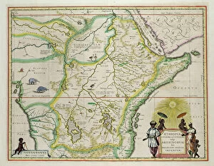
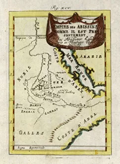
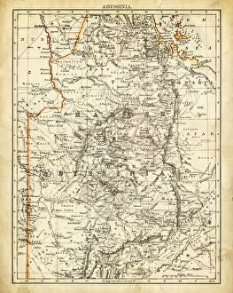
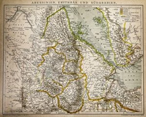
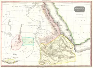
Maps of Ethiopia, also known as Abyssinia, are maps of the African country located in the Horn of Africa, and is bordered by Eritrea to the north
Choose a picture from our Maps Collection for your Wall Art and Photo Gifts
37 items


All Professionally Made to Order for Quick Shipping
-
Maps Collection
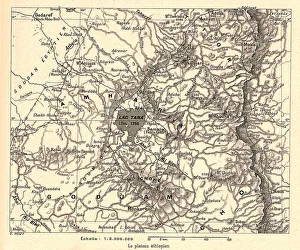
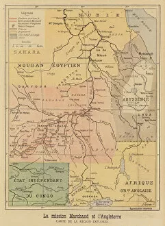
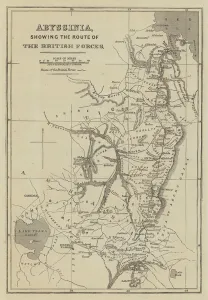
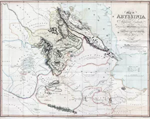
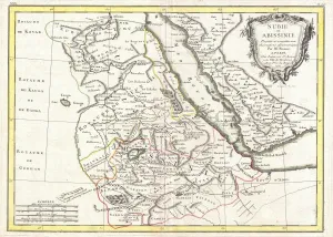
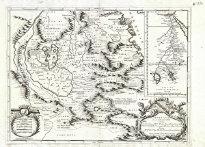
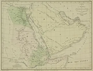
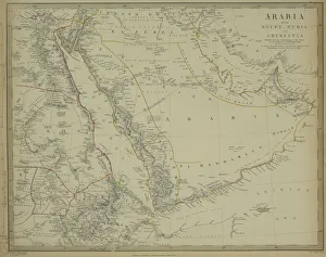
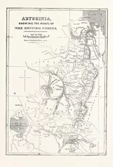
Maps of Ethiopia, also known as Abyssinia, are maps of the African country located in the Horn of Africa, and is bordered by Eritrea to the north, Djibouti and Somalia to the east, Sudan and South Sudan to the west, and Kenya to the south. The country has a total area of 1.1 million square kilometers and a population estimated at over 100 million people in 2019. Maps of Ethiopia show its diverse geography which includes highlands, deserts, lowlands and savannahs as well as rivers such as Blue Nile River and Lake Tana. The capital city is Addis Ababa which is located in central Ethiopia at an elevation of 2335 meters above sea level. It also shows major cities such as Dire Dawa in eastern Ethiopia; Mekele in northern Ethiopia; Bahir Dar on Lake Tana; Jimma in western Ethiopia; Awasa on Lake Awasa; Harar near Somaliland border; Gondar near Sudan border; Dessie near Eritrea border etcetera.
+
Our beautiful pictures are available as Framed Prints, Photos, Wall Art and Photo Gifts
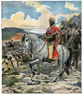
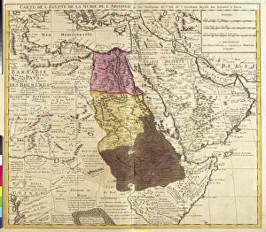
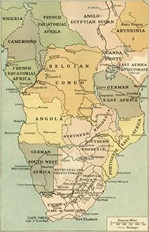
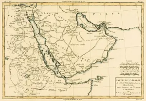
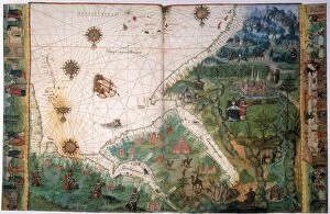
The Maps of Ethiopia (Abyssinia) Africa collection from Media Storehouse is a stunning display of historical maps that showcase the geography and evolution of Ethiopia over time. Our collection includes antique maps dating back to the 16th century, depicting various regions and cities in Abyssinia, as well as more recent topographical maps highlighting natural features such as mountains, rivers, and lakes. These beautifully crafted prints are available in a range of sizes and styles, including framed or unframed options. They make for an excellent addition to any home or office space, adding both aesthetic value and educational insight into Ethiopian history. Whether you're interested in exploring the country's rich cultural heritage or simply appreciate the beauty of cartography artistry, our collection has something for everyone. With its high-quality printing techniques and attention to detail, Maps of Ethiopia (Abyssinia) Africa is a must-have for anyone looking to add some historical flair to their decor.
+
What are Maps of Ethiopia (Abyssinia) Africa art prints?
Maps of Ethiopia (Abyssinia) Africa art prints are beautiful and unique pieces of artwork that showcase the geography, history, and culture of Ethiopia. These maps are created by skilled artists who use a variety of techniques to produce high-quality prints that capture the essence of this fascinating country. These art prints feature detailed depictions of Ethiopia's diverse landscapes, including its mountains, rivers, deserts, and forests. They also highlight important landmarks such as cities, towns, historical sites, and cultural centers. In addition to their aesthetic appeal, Maps of Ethiopia (Abyssinia) Africa art prints have educational value as well. They provide an excellent resource for students studying geography or history and can be used in classrooms or at home for reference purposes. These art prints offer a wonderful way to appreciate the beauty and complexity of Ethiopia while also learning more about its rich heritage. Whether you're looking for a decorative piece for your home or office or a gift for someone special interested in African culture and history - Maps of Ethiopia (Abyssinia) Africa art prints are sure to impress.
+
What Maps of Ethiopia (Abyssinia) Africa art prints can I buy from Media Storehouse?
We offer a wide range of Maps of Ethiopia (Abyssinia) Africa art prints that you can choose from. These maps are beautifully crafted and showcase the rich history and culture of Ethiopia. Some of the popular options include vintage maps, antique illustrations, and contemporary designs. You can find detailed topographical maps that depict the landscape features of Ethiopia in great detail. There are also political maps that show the administrative boundaries and major cities in the country. If you're interested in historical perspectives, we have several old maps dating back to different periods. In addition to traditional paper prints, Media Storehouse also offers canvas prints that add a touch of elegance to any room decor. The canvas prints come ready-to-hang with sturdy frames for easy installation. Whether you're an art enthusiast or simply looking for unique wall decor ideas, we have something for everyone's taste and budget when it comes to Maps of Ethiopia (Abyssinia) Africa art prints.
+
How do I buy Maps of Ethiopia (Abyssinia) Africa art prints?
To buy Maps of Ethiopia (Abyssinia) Africa art prints, you can visit our online gallery. We offer a wide range of high-quality art prints that feature different maps of Ethiopia and Abyssinia from various artists. You can browse through our collection and choose the one that suits your preference. Once you have selected your desired print, simply add it to your cart and proceed to checkout. The process is straightforward, and they accept various payment methods for your convenience. Media Storehouse ensures that all their products are made using premium materials to guarantee longevity and durability. Their art prints are printed on high-quality paper with fade-resistant inks to ensure long-lasting vibrancy. Buying Maps of Ethiopia (Abyssinia) Africa art prints from Media Storehouse is an easy process that guarantees quality products at affordable prices.
+
How much do Maps of Ethiopia (Abyssinia) Africa art prints cost?
We offer a wide range of Maps of Ethiopia (Abyssinia) Africa art prints that are available at varying prices. The cost of these prints depends on several factors such as the size, quality, and type of print you choose. We have different options to suit your preferences including canvas prints, framed prints, and poster prints. Our Maps of Ethiopia (Abyssinia) Africa art prints are created using high-quality materials and printing techniques to ensure that they last for many years without fading or losing their vibrancy. They make great additions to any home or office space and can also be given as gifts to friends and family who appreciate African culture. Whether you're looking for a small-sized print or a large one, we have something for everyone at Media Storehouse. Our collection is constantly updated with new designs so you can always find something unique that suits your taste.
+
How will my Maps of Ethiopia (Abyssinia) Africa art prints be delivered to me?
We take pride in ensuring that your Maps of Ethiopia (Abyssinia) Africa art prints are delivered to you in a safe and timely manner. Our delivery process is simple and hassle-free, designed to make sure that your artwork arrives at your doorstep in perfect condition. Once you have placed an order with us, our team will carefully pack your print using high-quality materials to protect it during transit. We work with trusted courier partners who offer reliable shipping services worldwide. Your Maps of Ethiopia (Abyssinia) Africa art prints will be delivered straight to your address within the specified timeframe. You can track the progress of your shipment through our online tracking system for added peace of mind. We understand how important it is for you to receive your artwork promptly and securely, which is why we strive to provide excellent customer service throughout the entire delivery process.