
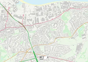
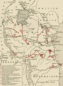
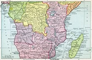
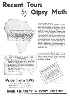
Maps Collection
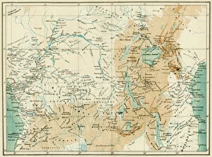
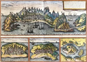
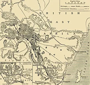
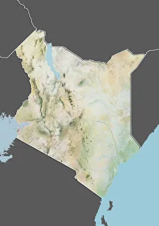
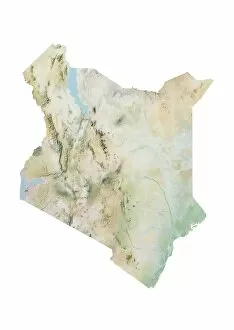
Kenya is a country located in East Africa, bordered by Ethiopia to the north, Somalia to the east, Tanzania to the south
Choose a picture from our Maps Collection for your Wall Art and Photo Gifts
40 items


All Professionally Made to Order for Quick Shipping
-
Maps Collection
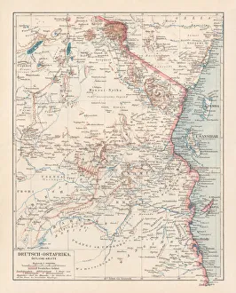
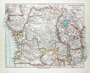
Kenya is a country located in East Africa, bordered by Ethiopia to the north, Somalia to the east, Tanzania to the south, Uganda to the west and Sudan to the northwest. Maps of Kenya provide an overview of its geography and topography. The country is divided into 47 counties and has a population of over 50 million people and has a diverse landscape with mountains, rivers, lakes and savannahs. The capital city Nairobi is home to many national parks such as Tsavo National Park which contains some of Africa's most iconic wildlife species such as elephants and lions. It also shows important roads that connect major cities across Kenya including Mombasa-Nairobi highway which connects two major ports on either side of Kenya's coastline. Additionally they are be used for navigation purposes when travelling around this vast country with its varied terrain from deserts in northern regions to lush rainforests in western parts.
+
Our beautiful pictures are available as Framed Prints, Photos, Wall Art and Photo Gifts
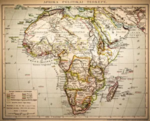
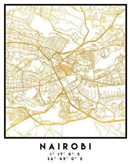
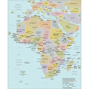
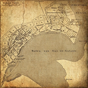
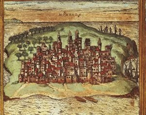
Media Storehouse offers a unique collection of Maps of Kenya Africa wall art and framed prints. Our collection features a variety of maps that showcase the diverse regions, cities, and landmarks in Kenya. From vintage maps dating back to 1892 to modern-day satellite images, our collection provides an excellent opportunity for history enthusiasts or those who want to learn more about Kenya's geography. The Maps of Kenya Africa collection includes detailed topographical maps that highlight the country's mountain ranges, rivers, lakes, and national parks. Additionally, there are city street maps that show Nairobi's bustling streets or Mombasa's coastal roads. These high-quality prints come in various sizes and frames options to suit any decor style. They make great gifts for anyone interested in African culture or geography. Overall Media Storehouse has curated an impressive selection of Maps of Kenya Africa wall art and framed prints that will undoubtedly add character to any room they are displayed in.
+
What are Maps of Kenya Africa art prints?
Maps of Kenya Africa art prints are high-quality reproductions of maps that depict the geography and topography of Kenya, a country located in East Africa. These prints showcase the intricate details and features of the land, including rivers, mountains, cities, and other landmarks. These art prints can be used for various purposes such as educational materials or decorative pieces in homes or offices. They provide an excellent way to learn about the geography and history of Kenya while also adding a touch of sophistication to any space. The Maps of Kenya Africa art prints come in different sizes and styles to suit individual preferences. Some feature vintage designs while others have modern interpretations with vibrant colors. Regardless of style, these prints offer a unique perspective on one of Africa's most beautiful countries. Maps of Kenya Africa art prints are an excellent choice for anyone looking to add some cultural flair to their home or office décor while also learning more about this fascinating country.
+
What Maps of Kenya Africa art prints can I buy from Media Storehouse?
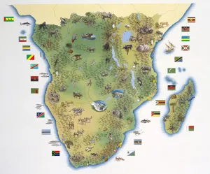
We offer a wide range of Maps of Kenya Africa art prints that are perfect for anyone looking to add some African flair to their home or office. These maps come in various styles, including vintage and modern designs, and showcase the diverse landscape and culture of Kenya. Some popular options include detailed topographical maps that highlight the country's mountain ranges, rivers, and national parks. Other prints feature colorful illustrations of Kenya's wildlife, such as elephants, lions, giraffes, and zebras. In addition to traditional paper prints, Media Storehouse also offers canvas prints that can be stretched over a wooden frame for a more contemporary look. These high-quality reproductions are sure to impress any visitor with their vibrant colors and intricate details. Whether you're an avid traveler or simply appreciate the beauty of African artistry, we have something for everyone when it comes to Maps of Kenya Africa art prints.
+
How do I buy Maps of Kenya Africa art prints?
To buy Maps of Kenya Africa art prints from Media Storehouse, you can browse our extensive collection of maps and select the one that catches your eye. Once you have found the print you want to purchase, simply add it to your cart and proceed to checkout. At this point, you will be prompted to enter your payment details and shipping address. We offer a range of different sizes for their prints, so make sure to choose the size that best suits your needs. We also offer a variety of framing options if you would like your print framed before delivery. If you have any questions or concerns about purchasing Maps of Kenya Africa art prints from Media Storehouse, don't hesitate to reach out to our customer service team who are always happy to help with any queries or issues.
+
How much do Maps of Kenya Africa art prints cost?
We offer a wide range of Maps of Kenya Africa art prints at varying prices. Our collection includes vintage maps, contemporary designs and everything in between. The cost of each print is determined by factors such as the size, quality and complexity of the design. We understand that everyone has different tastes and budgets, which is why we strive to provide options for every customer. Our Maps of Kenya Africa art prints are perfect for adding character and style to any room or office space. They make great gifts for anyone who loves travel or geography. Whether you're looking for a small print to fit on your desk or a large statement piece for your living room wall, we have something that will suit your needs. We take pride in offering high-quality products at affordable prices without compromising on quality or service. Our team is dedicated to ensuring that our customers receive their orders promptly and with care so they can enjoy their new artwork as soon as possible.
+
How will my Maps of Kenya Africa art prints be delivered to me?
We offer a variety of delivery options for your Maps of Kenya Africa art prints. Our standard delivery service is through our trusted courier partners who will deliver your artwork directly to your doorstep. We also offer express delivery services for those who require their prints urgently. To ensure that your art prints arrive in perfect condition, we use high-quality packaging materials and protective measures during the shipping process. This includes using sturdy cardboard tubes or flat packaging with reinforced corners to prevent any damage during transit. Once you have placed an order with us, you will receive a confirmation email which will include tracking information so that you can keep track of your package's progress until it arrives at its destination. We take great pride in delivering exceptional customer service and ensuring that our customers are satisfied with their purchases. If you have any questions about the delivery process or need assistance with placing an order, please do not hesitate to contact us.