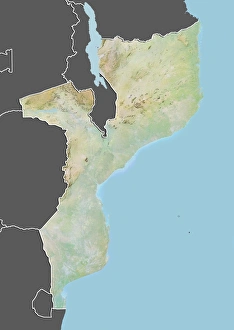
Maps Collection
Malawi is a small, landlocked country in southeastern Africa, and is bordered by Zambia to the west
Choose a picture from our Maps Collection for your Wall Art and Photo Gifts
11 items
All Professionally Made to Order for Quick Shipping
-
Maps Collection
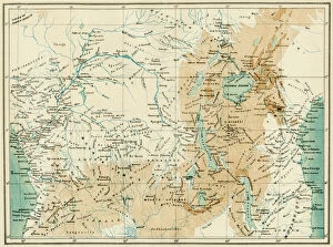
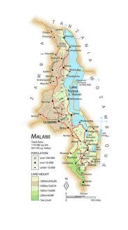
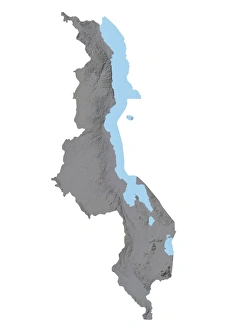
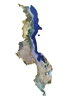
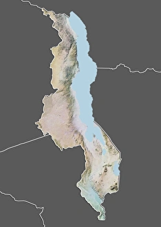
Malawi is a small, landlocked country in southeastern Africa, and is bordered by Zambia to the west, Tanzania to the north and Mozambique to the east and south. Maps of Malawi show its diverse terrain, which includes highlands in the north and south, plains in the central region and Lake Malawi along its eastern border. The country has an abundance of natural resources including minerals such as coal, uranium and bauxite. Agriculture is a major industry with maize being the primary crop grown for both domestic consumption and export. The capital city of Lilongwe is located on Lake Malawi's southern shore while Blantyre lies further inland on its western side. Other major cities include Mzuzu in the north-central region and Zomba near Lake Chilwa in southern Malawi. It also highlight national parks such as Liwonde National Park along Shire River Valley where wildlife can be observed including elephants, hippos and crocodiles among other species.
+
Our beautiful pictures are available as Framed Prints, Photos, Wall Art and Photo Gifts
The Maps of Malawi Africa collection from Media Storehouse is a stunning assortment of wall art and framed prints that showcase the beauty and diversity of Malawi, a landlocked country in southeastern Africa. Our collection features an array of vintage maps, illustrations, and photographs that capture the rich cultural heritage and natural splendor of this African nation. From detailed topographical maps to colorful illustrations depicting local flora and fauna, each piece in our collection offers a unique glimpse into the history and geography of Malawi. Whether you're looking for a striking centerpiece for your living room or an inspiring addition to your office decor, these high-quality prints are sure to impress. With their vibrant colors, intricate details, and expert craftsmanship, the Maps of Malawi Africa collection is perfect for anyone who loves exploring new cultures or appreciates beautiful artwork. So why not bring a touch of African charm into your home with one (or more.) pieces from this exceptional collection?
+
What are Maps of Malawi Africa art prints?
Maps of Malawi Africa art prints are artistic representations of the country of Malawi, located in southeastern Africa. These prints depict the geography and topography of Malawi, including its lakes, rivers, mountains, and cities. They may also include cultural or historical landmarks such as national parks or monuments. These art prints are a beautiful way to showcase your love for this African nation and make a great addition to any home or office decor. Whether you have visited Malawi before or simply appreciate its natural beauty from afar, these maps offer a unique perspective on the country's landscape. Maps of Malawi Africa art prints come in various sizes and styles to suit your personal taste. You can choose from traditional paper prints or opt for canvas prints that add depth and texture to your wall display. With their vibrant colors and intricate details, these maps are sure to be conversation starters among guests who admire them.
+
What Maps of Malawi Africa art prints can I buy from Media Storehouse?
We offer a wide range of Maps of Malawi Africa art prints that you can buy. These maps are available in various sizes and styles, including vintage, modern, and antique designs. You can choose from different types of maps such as political maps, physical maps, topographical maps or roadmaps. The Maps of Malawi Africa art prints available at Media Storehouse showcase the beauty and diversity of this African country. They feature detailed information about the geography, landmarks, cities and towns in Malawi. The prints are perfect for anyone who loves to travel or has an interest in African culture. Whether you're looking for a unique piece to decorate your home or office space or want to give someone a thoughtful gift that captures their love for travel and adventure - these Maps of Malawi Africa art prints will not disappoint. With so many options to choose from at Media Storehouse, you'll surely find something that suits your taste and style preferences.
+
How do I buy Maps of Malawi Africa art prints?
To buy Maps of Malawi Africa art prints, you can visit our online store. We offer a wide selection of high-quality art prints that are perfect for decorating your home or office. You can browse through our collection and choose the print that best suits your taste and style. Once you have found the print you want to purchase, simply add it to your cart and proceed to checkout. At checkout, you will be prompted to enter your shipping information and payment details. We offer secure payment options such as credit card and PayPal, so you can rest assured that your transaction is safe and protected. After completing your purchase, Media Storehouse will process your order promptly and ship it directly to your address. With their fast shipping times, you can expect to receive your Maps of Malawi Africa art print in no time.
+
How much do Maps of Malawi Africa art prints cost?
We offer a wide range of Maps of Malawi Africa art prints that vary in price depending on the size and type of print you choose. Our collection includes high-quality paper prints, canvas prints, and framed prints that are perfect for decorating your home or office space. We work with some of the best photographers and artists to bring you unique and stunning pieces that capture the beauty of Malawi's landscapes. Our Maps of Malawi Africa art prints are affordable and accessible to everyone who loves African culture and wants to add a touch of it to their living spaces. Whether you're looking for a small print or a large one, we have something for every budget. You can browse our selection online at any time from anywhere in the world, making it easy to find exactly what you're looking for without leaving your home.
+
How will my Maps of Malawi Africa art prints be delivered to me?
Your Maps of Malawi Africa art prints will be delivered to you via a trusted courier service. The prints are carefully packaged to ensure they arrive in pristine condition, and the delivery process is fully tracked so that you can monitor your order every step of the way. Once your order has been dispatched, you will receive an email confirmation with tracking information. We take great care to ensure that our customers receive their orders promptly and securely. We understand how important it is for our customers to have access to high-quality artwork from around the world, which is why we work hard to make sure that every aspect of the ordering process runs smoothly. Whether you're looking for Maps of Malawi Africa or any other type of artwork, Media Storehouse is here to help. With a wide range of prints available at competitive prices, we're confident that you'll find something that's perfect for your home or office.

