
Maps Collection
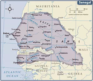
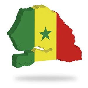
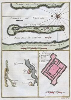
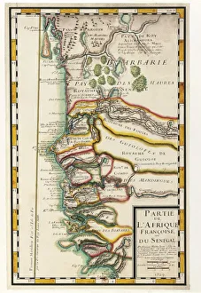
Senegal is a country located in West Africa, bordered by the Atlantic Ocean to the west, Mauritania to the north
Choose a picture from our Maps Collection for your Wall Art and Photo Gifts
45 items


All Professionally Made to Order for Quick Shipping
-
Maps Collection
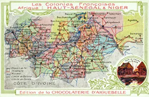
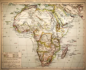
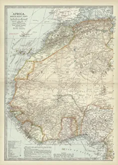
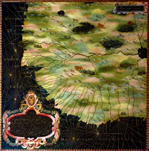
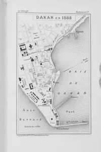
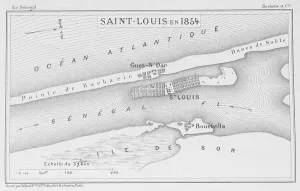
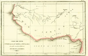
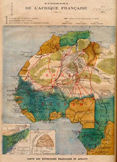
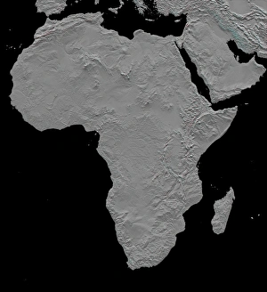
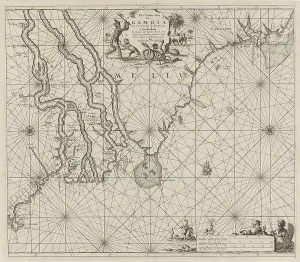
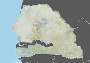
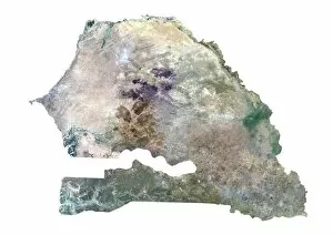
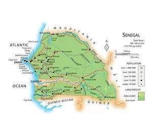
Senegal is a country located in West Africa, bordered by the Atlantic Ocean to the west, Mauritania to the north, Mali to the east and Guinea and Guinea-Bissau to the south. Maps of Senegal provide an overview of its geography and terrain. The capital city is Dakar, located on the western coast. The country is divided into four regions: Dakar, Diourbel, Fatick and Kaolack and has a total area of 197,000 square kilometers with a population of approximately 16 million people. The terrain consists mostly of low rolling hills with some higher areas in the southeast near Tambacounda. There are several rivers that flow through Senegal including Casamance River which forms part of Senegal's border with Guinea-Bissau; Faleme River which flows through eastern Senegal; Saloum River which forms part of Senegal's border with Mauritania; and Gambia River which flows along most of western Senegal's border with Gambia. It also shows major cities such as St Louis in northern Senegal; Ziguinchor in southern Casamance region; Thies in central region; Kaolack in southeastern region; Louga in northwestern region; Kedougou near Gambian border and many more smaller towns throughout this beautiful country.
+
Our beautiful pictures are available as Framed Prints, Photos, Wall Art and Photo Gifts
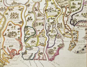
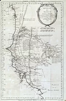
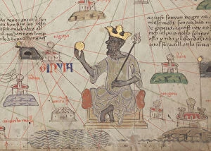
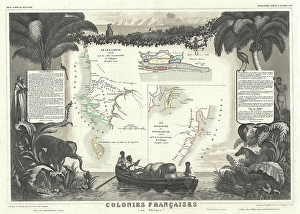
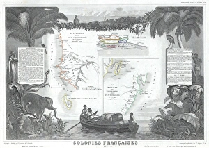
The Maps of Senegal Africa collection from Media Storehouse is a stunning compilation of vintage and contemporary maps that depict the geography, culture, and history of Senegal. Our collection features an array of high-quality wall art and framed prints that showcase the country's diverse landscapes, including its coastline, rivers, mountains, and deserts. These maps also highlight important landmarks such as cities, towns, villages, national parks, and historical sites. The Maps of Senegal Africa collection provides a unique opportunity for individuals to explore the rich cultural heritage of this West African nation. From colonial-era maps to modern-day satellite imagery, these pieces offer a fascinating glimpse into how Senegal has evolved over time. Whether you're interested in geography or simply looking for beautiful artwork to adorn your walls with, our collection is sure to impress. Our Maps of Senegal Africa collection is an excellent resource for anyone seeking to learn more about this vibrant country while adding some visual interest to their home or office décor.
+
What are Maps of Senegal Africa art prints?
Maps of Senegal Africa art prints are high-quality reproductions of maps that depict the geography, topography, and political boundaries of the West African nation of Senegal. These prints are created using state-of-the-art printing technology to ensure that every detail is captured with precision and accuracy. These maps are not only functional but also serve as beautiful works of art that can be displayed in homes or offices. We offer a unique way to explore and appreciate the beauty and complexity of Senegal's landscape while providing valuable information about its history, culture, and people. Whether you're a collector looking for rare pieces or someone who simply appreciates fine art, Maps of Senegal Africa art prints from Media Storehouse are an excellent choice. With their vibrant colors, intricate details, and stunning visual appeal, these prints will add elegance and sophistication to any space they occupy.
+
What Maps of Senegal Africa art prints can I buy from Media Storehouse?
We offer a wide range of Maps of Senegal Africa art prints that you can purchase. These maps showcase the geography and topography of Senegal, including its rivers, lakes, mountains, and cities. You can choose from different styles and designs to suit your preferences or needs. Some of the popular Maps of Senegal Africa art prints available at Media Storehouse include antique maps dating back to the 19th century or earlier, colorful political maps highlighting the country's administrative regions and borders with neighboring countries, physical maps showing elevation contours and landforms in detail, as well as satellite imagery capturing the landscape from above. Whether you are a collector looking for rare vintage pieces or an enthusiast seeking educational resources or decorative items for your home or office space, we have something for everyone. With high-quality printing techniques on premium paper stock using archival inks that ensure long-lasting vibrancy and clarity, these Maps of Senegal Africa art prints are sure to impress.
+
How do I buy Maps of Senegal Africa art prints?
To buy Maps of Senegal Africa art prints from Media Storehouse, you can browse through our collection online. We offer a wide range of maps in different sizes and styles to suit your preferences. Once you have selected the map that you like, simply add it to your cart and proceed to checkout. During the checkout process, you will be prompted to provide your shipping information and payment details. We accept various forms of payment including credit cards and PayPal. Once your order has been processed, Media Storehouse will print the map on high-quality paper using state-of-the-art printing technology. The finished product will then be carefully packaged and shipped directly to your doorstep. Whether you are looking for a unique piece of wall art or a gift for someone special, Maps of Senegal Africa art prints from Media Storehouse are an excellent choice. With their vast selection and easy ordering process, it's never been easier to bring a touch of African beauty into your home or office.
+
How much do Maps of Senegal Africa art prints cost?
We offer a wide range of Maps of Senegal Africa art prints that vary in price depending on the size and type of print. Our collection includes high-quality posters, canvas prints, framed prints, and photographic prints that showcase the beauty and diversity of Senegal's landscapes. Whether you're looking for a colorful map to hang in your living room or an artistic representation of Senegal's cities and landmarks, our selection has something for everyone. We take pride in offering affordable prices without compromising on quality. Our Maps of Senegal Africa art prints are printed using state-of-the-art technology that ensures vibrant colors and sharp details. We also use premium materials that guarantee longevity so you can enjoy your artwork for years to come. Our Maps of Senegal Africa art prints are reasonably priced considering their exceptional quality and unique designs.
+
How will my Maps of Senegal Africa art prints be delivered to me?
Your Maps of Senegal Africa art prints will be delivered to you in a safe and secure manner. We take great care in packaging your order to ensure that it arrives at your doorstep undamaged. Our team uses high-quality materials to protect your print during transit, including sturdy cardboard tubes or flat packages with reinforced corners. We work with trusted shipping partners who are experienced in handling delicate items like art prints. Depending on your location, we offer various delivery options such as standard or express shipping. You can track the progress of your shipment through our online tracking system. Once you receive your package, please inspect it carefully for any damage during transit. If there is any issue with the condition of the print, please contact us immediately so we can resolve the matter promptly. We strive to provide our customers with exceptional service and quality products. We hope you enjoy displaying your Maps of Senegal Africa art prints in your home or office.