
Maps Collection
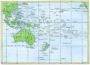
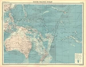
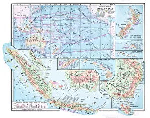
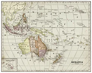
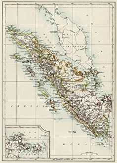
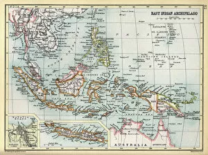
Maps of Indonesia Asia are a type of map that shows the physical features and political boundaries of the Indonesian archipelago
Choose a picture from our Maps Collection for your Wall Art and Photo Gifts
154 items


All Professionally Made to Order for Quick Shipping
-
Maps Collection
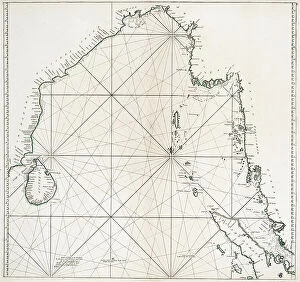
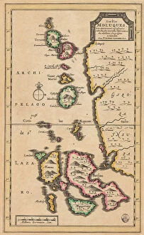
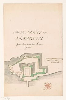
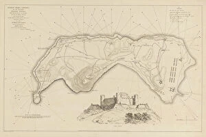
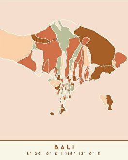
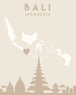
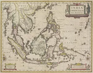
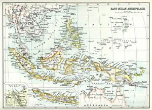
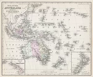
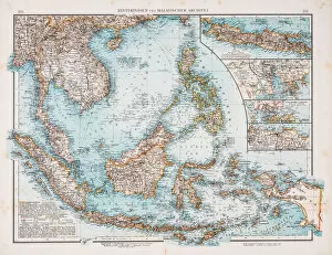
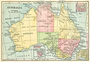
Maps of Indonesia Asia are a type of map that shows the physical features and political boundaries of the Indonesian archipelago. They include all 17,000 islands that make up the country, as well as its surrounding waters. They also show major cities, rivers and lakes, mountains and other geographical features and can be used to plan trips or to gain an understanding of the country’s geography. Maps of Indonesia Asia are available in both digital and print formats from various sources such as bookstores, libraries and online retailers. They are be used for educational purposes or for navigation while traveling in Indonesia.
+
Our beautiful pictures are available as Framed Prints, Photos, Wall Art and Photo Gifts
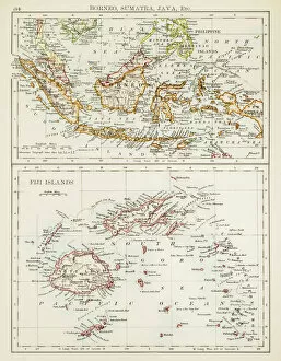
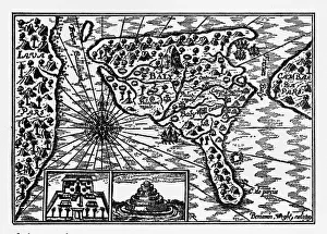
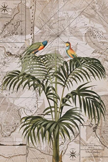
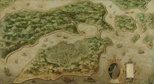
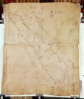
The Maps of Indonesia Asia collection from Media Storehouse offers a stunning array of wall art and framed prints that showcase the beauty and diversity of this fascinating region. Featuring maps dating back to the 16th century, these pieces offer a unique glimpse into the history and culture of Indonesia, as well as its place in the wider Asian continent. From intricate depictions of trade routes and shipping lanes to detailed topographical maps highlighting mountain ranges, rivers, and coastlines, our collection offers something for everyone interested in geography or world history. Whether you're looking for a conversation piece for your living room or office space or simply want to add some visual interest to your home decor, these prints are sure to impress. With high-quality printing techniques that bring out every detail in vivid color and clarity, these pieces are perfect for anyone who wants to explore the rich tapestry of Indonesian culture through beautiful artwork. So why wait? Browse our selection today and discover all that this amazing collection has to offer.
+
What are Maps of Indonesia Asia art prints?
Maps of Indonesia Asia art prints are a collection of beautifully designed and detailed maps depicting the geography, topography, and landmarks of Indonesia. These art prints showcase the country's diverse landscapes, including its mountains, forests, beaches, rivers, and cities. They also feature important cultural sites such as temples and historical monuments. These maps are not only aesthetically pleasing but also informative. They provide valuable information about the country's history, culture, and natural resources. Whether you're an avid traveler or simply interested in learning more about Indonesia's rich heritage and geography, these art prints make for a great addition to any home or office space. Maps of Indonesia Asia art prints come in various sizes and styles to suit different preferences. They can be framed or hung on their own as wall decor pieces. With their intricate details and vibrant colors, they add character to any room while educating viewers about one of Southeast Asia's most fascinating countries.
+
What Maps of Indonesia Asia art prints can I buy from Media Storehouse?
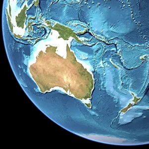
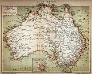
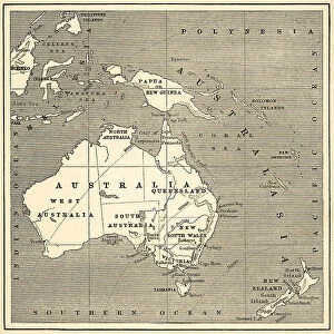
We offer a wide range of Maps of Indonesia Asia art prints that are perfect for both home and office decor. These maps showcase the beautiful landscapes, cities, and regions of Indonesia in stunning detail. You can choose from different styles such as vintage, modern or satellite imagery to suit your taste. Some popular options include detailed topographic maps that highlight the country's mountain ranges, rivers, and coastlines. There are also political maps that show the administrative divisions of Indonesia along with major cities and towns. In addition to these standard map prints, Media Storehouse also offers customized options where you can add your own text or images to create a unique piece of artwork. Whether you're looking for a gift for someone who loves geography or simply want to add some color to your walls, there is something for everyone in their collection.
+
How do I buy Maps of Indonesia Asia art prints?
To buy Maps of Indonesia Asia art prints from Media Storehouse, you can start by browsing through their vast collection of artwork online. Once you have found the print that you like, simply add it to your cart and proceed to checkout. You will be prompted to enter your shipping and payment details before finalizing your purchase. We offer a variety of sizes for their art prints, so make sure to choose the one that best fits your needs. We also offer framing options if you want a ready-to-hang piece. If you have any questions or concerns about purchasing from Media Storehouse, they have a customer service team available to assist you via email or phone. Buying Maps of Indonesia Asia art prints from Media Storehouse is an easy and convenient process that allows you to bring beautiful artwork into your home or office space.
+
How much do Maps of Indonesia Asia art prints cost?
We offer a wide range of Maps of Indonesia Asia art prints that vary in price depending on the size and type of print. Our collection includes vintage maps, contemporary designs, and artistic interpretations of the region. We strive to provide high-quality prints at affordable prices so that everyone can enjoy beautiful artwork in their homes or offices. Our selection is perfect for those who love travel, history, or simply appreciate stunning visuals. Whether you are looking for a small print to add to your gallery wall or a large statement piece for your living room, we have something for everyone. We take pride in offering unique and diverse artwork from talented artists around the world. Please visit our website to browse our full collection and find the perfect Maps of Indonesia Asia art print for you.
+
How will my Maps of Indonesia Asia art prints be delivered to me?
We take great care in delivering your Maps of Indonesia Asia art prints to you. We use high-quality packaging materials to ensure that your artwork arrives safely and undamaged. Depending on the size and quantity of your order, we may ship it using a courier service or standard postal delivery. Our team will carefully pack your artwork into a sturdy cardboard tube or flat package, depending on the type of print you have ordered. Each package is labelled with clear instructions for handling and opening. We also provide tracking information so that you can keep an eye on the progress of your delivery. If there are any issues with shipping or if you have any questions about delivery times, our customer service team is always available to assist you. We strive to make sure that receiving your Maps of Indonesia Asia art prints from Media Storehouse is a hassle-free experience.