
Maps Collection
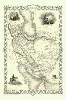
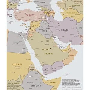
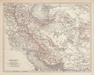
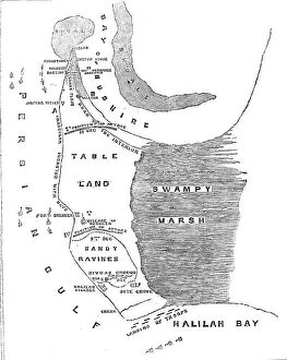
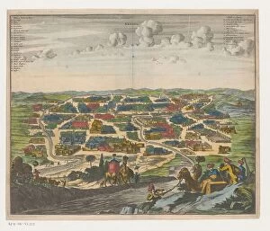
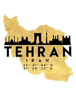
Maps of Iran Asia are a collection that show the physical geography, political boundaries, and cultural features of the region
Choose a picture from our Maps Collection for your Wall Art and Photo Gifts
212 items


All Professionally Made to Order for Quick Shipping
-
Maps Collection
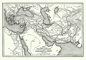
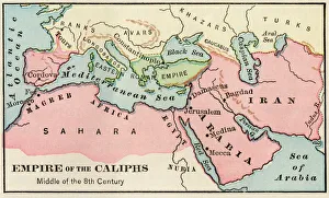
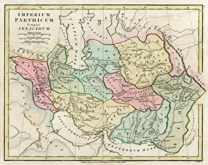
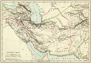
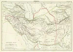
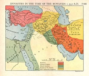
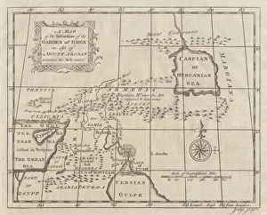
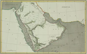
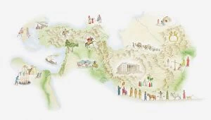
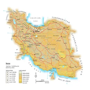
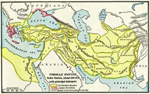
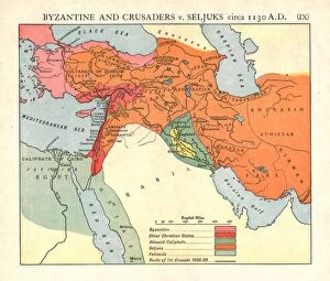
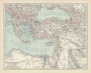
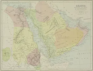
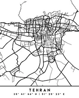
Maps of Iran Asia are a collection that show the physical geography, political boundaries, and cultural features of the region. The maps provide detailed information about the country's terrain, rivers, mountains, cities and towns. They also include information on its population density and major economic activities. Maps of Iran Asia also feature important historical sites such as ancient ruins and archaeological sites. Additionally, they provide information on the country's climate zones and its natural resources such as oil reserves. They can useful for travelers who wish to explore this fascinating region or for those seeking to gain a better understanding of its culture and history.
+
Our beautiful pictures are available as Framed Prints, Photos, Wall Art and Photo Gifts
Media Storehouse offers a collection of Maps of Iran Asia wall art and framed prints. Our collection features an array of maps that showcase the geography, topography, and political boundaries of Iran and its surrounding regions in Asia. These maps are sourced from various archives, libraries, and museums worldwide. The Maps of Iran Asia collection includes antique maps dating back to the 16th century as well as contemporary ones. They come in different sizes to suit different spaces such as homes, offices or public places like schools or museums. The frames are made with high-quality materials that ensure durability and longevity. These maps provide not only decorative value but also educational insights into the history, culture, and geopolitics of Iran's region. They can be used for personal enjoyment or academic purposes by students or researchers interested in Iranian studies. Our Maps of Iran Asia collection is a valuable resource for anyone seeking to explore this fascinating part of the world through visual representations.
+
What are Maps of Iran Asia art prints?
Maps of Iran Asia art prints are beautiful and intricate depictions of the geography, topography, and landmarks of Iran. These maps showcase the diverse terrain of this fascinating country, from its rugged mountains to its vast deserts and lush forests. They also highlight important cities, towns, and historical sites that make up the rich cultural heritage of Iran. These art prints are created using high-quality printing techniques that capture every detail with stunning clarity. They come in a variety of sizes to suit any space or decor style, making them a perfect addition to any home or office. Whether you're an avid traveler looking for a unique way to remember your trip to Iran or simply appreciate the beauty and complexity of maps as works of art in their own right, Maps of Iran Asia art prints are sure to impress. With their intricate details and vibrant colors, we offer a captivating glimpse into one of the world's most fascinating countries.
+
What Maps of Iran Asia art prints can I buy from Media Storehouse?
We offer a wide range of Maps of Iran Asia art prints that are perfect for anyone who loves history or geography. These maps showcase the intricate details and unique features of Iran's landscape, including its mountains, rivers, cities, and other landmarks. Some of the most popular Maps of Iran Asia art prints available from Media Storehouse include antique maps dating back to the 18th century as well as more modern versions that highlight current political boundaries and transportation networks. You can choose from a variety of sizes and styles to suit your preferences, whether you want a large canvas print to hang on your wall or a smaller framed print for your desk. In addition to traditional paper prints, Media Storehouse also offers high-quality metal prints that are durable and long-lasting. Whether you're looking for an educational tool or simply want to decorate your home with beautiful artwork, there is sure to be a Maps of Iran Asia art print at Media Storehouse that will meet your needs.
+
How do I buy Maps of Iran Asia art prints?
To buy Maps of Iran Asia art prints from Media Storehouse, you can browse our collection online and select the print that catches your eye. Once you have found the perfect piece, simply add it to your cart and proceed to checkout. During checkout, you will be prompted to enter your shipping and payment information. We offer a wide range of maps of Iran Asia art prints that are available in various sizes and formats such as canvas or framed prints. You can choose the format that best suits your needs and preferences. If you have any questions about purchasing a map of Iran Asia art print from Media Storehouse, we offer customer support services via email or phone. We are happy to assist with any queries or concerns you may have regarding their products or services. Buying a map of Iran Asia art print from Media Storehouse is easy and straightforward, allowing you to enjoy beautiful artwork in no time.
+
How much do Maps of Iran Asia art prints cost?
We offer a wide range of Maps of Iran Asia art prints that are available at varying prices. The cost of these prints depends on several factors such as the size, type of paper used, and the quality of the print. We have different sizes ranging from small to large formats to cater for all our customers' needs. Our Maps of Iran Asia art prints are created using high-quality materials and printing techniques to ensure that they last long while maintaining their original beauty. Our collection features various styles and designs suitable for any decor or taste. We take pride in offering affordable prices without compromising on quality. Our aim is to provide our customers with beautiful artwork that they can enjoy without breaking the bank. Please note that shipping costs may apply depending on your location, but we strive to keep them as low as possible so you can enjoy your purchase without worrying about additional expenses.
+
How will my Maps of Iran Asia art prints be delivered to me?
We take great care in delivering your Maps of Iran Asia art prints to you. We use reliable and trusted courier services to ensure that your artwork arrives safely and securely at your doorstep. Our delivery partners are experienced in handling fragile items such as art prints, so you can be assured that your order will arrive in perfect condition. We offer a range of delivery options depending on the size and weight of your order, including standard shipping or express delivery for urgent orders. You will receive an email confirmation with tracking information once your order has been dispatched from our warehouse. All our Maps of Iran Asia art prints are carefully packaged using high-quality materials to protect them during transit. If for any reason there is damage to your artwork upon arrival, please contact us immediately so we can arrange a replacement or refund. We strive to provide excellent customer service and aim to make sure that you are completely satisfied with every purchase from Media Storehouse.