
Maps Collection
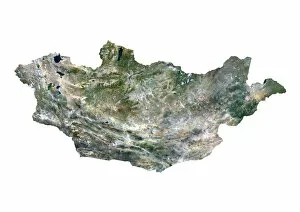
Maps of Mongolia Asia are detailed representations of the country's geography
Choose a picture from our Maps Collection for your Wall Art and Photo Gifts
53 items


All Professionally Made to Order for Quick Shipping
-
Maps Collection
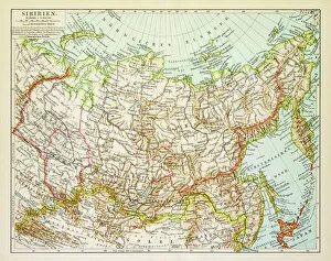
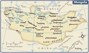
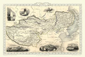
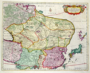
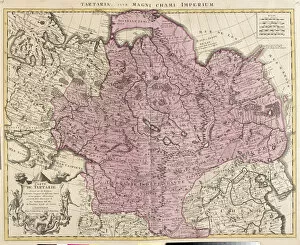
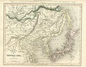
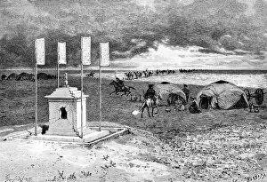
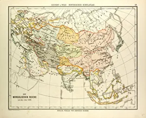
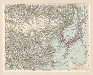
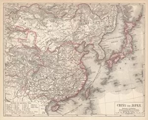
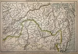
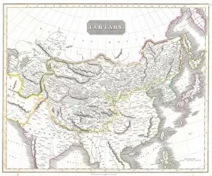
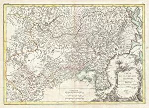
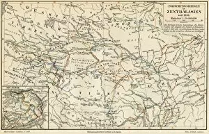
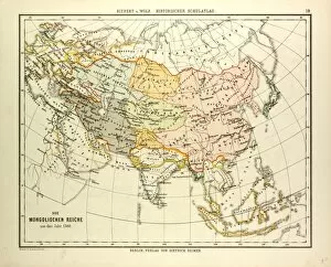
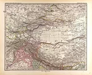
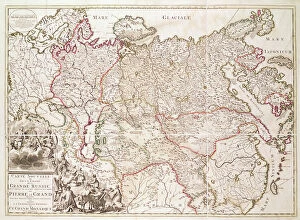
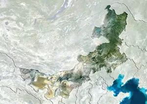
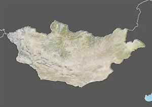
Maps of Mongolia Asia are detailed representations of the country's geography. They show the physical features of the land, including mountains, rivers, deserts and plains. They also show major cities and towns, roads and railroads, airports, national parks and other points of interest, and are be used to plan trips or explore different regions in Mongolia and can also be used to help understand the political boundaries between countries in Asia as well as those within Mongolia itself and can an invaluable tool for anyone interested in learning more about this fascinating part of the world.
+
Our beautiful pictures are available as Framed Prints, Photos, Wall Art and Photo Gifts
The Maps of Mongolia Asia collection from Media Storehouse is a stunning compilation of vintage and contemporary maps that showcase the beauty and diversity of Mongolia. Our collection features an extensive range of maps, including topographical, political, historical, and cultural maps that provide a comprehensive view of this fascinating country. Each map in our collection is carefully selected for its unique style and visual appeal. From hand-drawn antique maps to modern satellite images, these prints are perfect for anyone who loves geography or wants to learn more about Mongolia's history and culture. The Maps of Mongolia Asia collection is available as wall art or framed prints in various sizes to suit any space. These high-quality prints are made using premium materials that ensure they will last for years without fading or deteriorating. Whether you're looking to decorate your home or office with beautiful artwork or want to give a thoughtful gift to someone special, the Maps of Mongolia Asia collection from Media Storehouse is sure to impress.
+
What are Maps of Mongolia Asia art prints?
Maps of Mongolia Asia art prints are high-quality reproductions of maps that depict the geography, topography, and other features of Mongolia. These prints are created using advanced printing techniques and materials to ensure that they accurately capture the details and colors of the original maps. These art prints are not only visually appealing but also serve as valuable educational resources for students, researchers, historians, travelers, and anyone interested in learning more about this fascinating country. They can be used to study Mongolian history or geography or simply as decorative pieces for homes or offices. Maps of Mongolia Asia art prints come in a variety of sizes and styles to suit different tastes and preferences. Whether you prefer vintage-style maps with an antique look or modern designs with bold colors and graphics, there is something for everyone. Maps of Mongolia Asia art prints offer a unique way to explore this beautiful country from afar while adding a touch of sophistication to any space.
+
What Maps of Mongolia Asia art prints can I buy from Media Storehouse?
We offer a wide range of Maps of Mongolia Asia art prints that are perfect for anyone who loves to explore the world through maps. These art prints showcase different aspects of Mongolia, including its geography, topography, and landmarks. You can choose from vintage or modern styles, depending on your preference. One popular option is the "Mongolia Map" print which features an antique-style map with intricate details such as mountain ranges and rivers. Another great choice is the "Gobi Desert Map" print which highlights one of Mongolia's most famous natural wonders. If you're looking for something more artistic, Media Storehouse also has several abstract Mongolian maps available in various colors and designs. These unique pieces would make a great addition to any home or office decor. There are plenty of options when it comes to Maps of Mongolia Asia art prints at Media Storehouse. Whether you're interested in history or aesthetics, there's sure to be something that catches your eye.
+
How do I buy Maps of Mongolia Asia art prints?
To buy Maps of Mongolia Asia art prints from Media Storehouse, you can browse through our extensive collection of maps and select the one that catches your eye. Once you have found the print you want to purchase, simply add it to your cart and proceed to checkout. You will be prompted to enter your shipping information and payment details. We offer a variety of payment options including credit card, PayPal, and Apple Pay. We also offer worldwide shipping so no matter where you are located, you can receive your Maps of Mongolia Asia art print. Their prints are produced using high-quality materials such as fine art paper or canvas which ensures that they last for many years without fading or deteriorating. Whether you're looking for a unique piece of wall decor or a thoughtful gift for someone special, we have something for everyone with their vast selection of Maps of Mongolia Asia art prints.
+
How much do Maps of Mongolia Asia art prints cost?
We offer a wide range of Maps of Mongolia Asia art prints that vary in price depending on the size and type of print. Our selection includes both framed and unframed options, as well as canvas prints and posters. We strive to provide affordable prices for our customers while maintaining high-quality products. The cost of each print is determined by several factors such as the printing process used, the materials used, and the size of the print. However, we can assure you that our prices are competitive within the market. If you're interested in purchasing one of our Maps of Mongolia Asia art prints, please visit our website or contact us for more information about pricing and availability.
+
How will my Maps of Mongolia Asia art prints be delivered to me?
We take great care in delivering your Maps of Mongolia Asia art prints to you. We use high-quality packaging materials to ensure that your prints arrive in perfect condition. Depending on the size and quantity of your order, we may use either a sturdy cardboard tube or a flat package with protective padding to ship your prints. We work with trusted shipping partners who are experienced in handling delicate items like art prints. Once your order is processed and shipped, you will receive an email notification with tracking information so that you can monitor the progress of your delivery. We understand how important it is for our customers to receive their orders promptly and safely. That's why we strive to provide reliable shipping services that meet our customers' needs and expectations. Whether you're ordering from within the UK or internationally, rest assured that we'll do everything possible to get your Maps of Mongolia Asia art prints delivered to you quickly and securely.