
Maps Collection
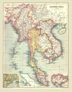
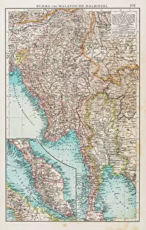
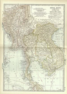
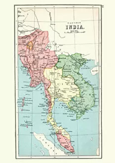
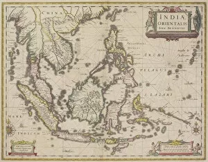
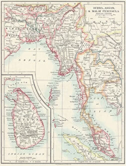
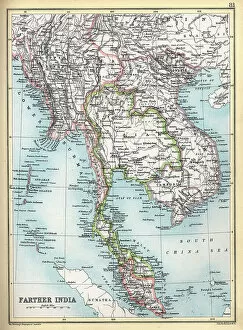
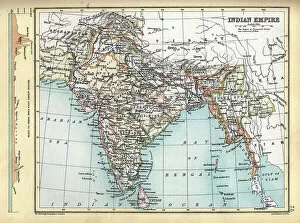
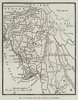
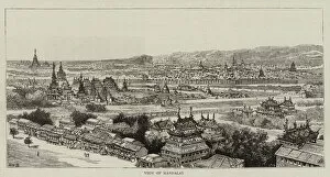
Myanmar, formerly known as Burma, is a Southeast Asian country located in the western part of the Indochina Peninsula
Choose a picture from our Maps Collection for your Wall Art and Photo Gifts
105 items


All Professionally Made to Order for Quick Shipping
-
Maps Collection
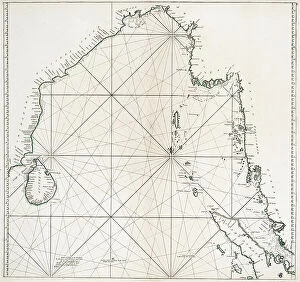
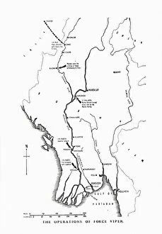
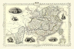
Myanmar, formerly known as Burma, is a Southeast Asian country located in the western part of the Indochina Peninsula, and is bordered by India and Bangladesh to the west, Thailand and Laos to the east, and China to the north. Myanmar has a long history of cartography; maps of its territory have been produced since at least the 16th century. These maps depict various aspects of Myanmar's geography including its mountain ranges, rivers, lakes and other topographical features. In addition to physical maps, there are also political maps which show administrative divisions such as states and regions. Maps of Myanmar can be found in a variety of formats including digital versions available online or printed versions from bookstores or libraries and can an important tool for understanding this fascinating country with its diverse cultures and landscapes.
+
Our beautiful pictures are available as Framed Prints, Photos, Wall Art and Photo Gifts
The Maps of Myanmar Asia collection from Media Storehouse offers a unique and fascinating glimpse into the history and geography of Myanmar. Our collection features a range of high-quality wall art and framed prints that showcase various maps of Myanmar, including antique maps dating back to the 18th century as well as more modern depictions. These maps offer insight into the country's rich cultural heritage, its diverse landscapes, and its complex political history. They also provide valuable information about trade routes, transportation networks, and other important aspects of life in Myanmar. Whether you're a history buff or simply looking for an eye-catching piece of artwork to adorn your walls, the Maps of Myanmar Asia collection is sure to impress. With its stunning visuals and informative content, our collection is a must-have for anyone interested in exploring this beautiful Southeast Asian nation.
+
What are Maps of Myanmar Asia art prints?
Maps of Myanmar Asia art prints are high-quality reproductions of antique and contemporary maps depicting the geography, topography, and political boundaries of Myanmar. These prints showcase the intricate details and artistic styles used in creating these maps throughout history. These art prints offer a unique way to appreciate the beauty and complexity of cartography while also providing valuable historical information about Myanmar's past. They can be used for educational purposes or as decorative pieces in homes, offices, or public spaces. We offer a wide selection of Maps of Myanmar Asia art prints that cater to different tastes and preferences. You can choose from vintage-style maps with sepia tones or more modern designs with vibrant colors. The company uses high-quality materials to ensure that each print is durable and long-lasting. Maps of Myanmar Asia art prints are an excellent choice for anyone interested in history, geography, or art. They provide a fascinating glimpse into the evolution of map-making while also serving as beautiful works of art in their own right.
+
What Maps of Myanmar Asia art prints can I buy from Media Storehouse?
We offer a wide range of Maps of Myanmar Asia art prints that are perfect for anyone who is interested in the geography and history of this fascinating country. These maps come in various styles, sizes, and formats to suit different tastes and preferences. Some of the popular options include antique maps, vintage maps, topographic maps, political maps, physical maps, satellite imagery maps, and more. Each map is carefully curated by our team of experts to ensure that it meets our high standards for quality and accuracy. We use only the best printing technology to produce these art prints on premium-quality paper or canvas materials that are designed to last a lifetime. Whether you're looking for a decorative piece for your home or office or an educational tool for your classroom or library, we have something to offer. So why not explore our collection today and discover the beauty and richness of Myanmar through our stunning Maps of Myanmar Asia art prints?
+
How do I buy Maps of Myanmar Asia art prints?
To buy Maps of Myanmar Asia art prints from Media Storehouse, you can browse our extensive collection online. You can search for specific keywords or browse through different categories to find the perfect print that suits your taste and style. Once you have found the artwork that you like, simply add it to your cart and proceed with the checkout process. During checkout, make sure to provide accurate shipping information so that your order will be delivered promptly. Payment options may vary depending on your location and preference, but most major credit cards are accepted. We offer a wide range of high-quality art prints featuring stunning images of Myanmar's landscapes, culture, and history. Whether you're looking for a beautiful piece to decorate your home or office or searching for a unique gift for someone special, we have something for everyone.
+
How much do Maps of Myanmar Asia art prints cost?
We offer a wide range of Maps of Myanmar Asia art prints that vary in price depending on the size and type of print chosen. Our selection includes high-quality paper prints, canvas prints, and framed prints. The cost of these items will depend on the specific product selected by the customer. We take pride in offering affordable prices for our customers without compromising on quality. Our Maps of Myanmar Asia art prints are sourced from reputable artists and photographers to ensure that each piece is unique and visually stunning. Our online store provides a user-friendly platform where you can browse through our collection with ease. We also offer various payment options to make purchasing as convenient as possible. We strive to provide exceptional service to all our clients while ensuring that they receive value for their money.
+
How will my Maps of Myanmar Asia art prints be delivered to me?
Your Maps of Myanmar Asia art prints will be delivered to you in a safe and secure manner. We take great care in packaging your artwork so that it arrives at your doorstep in pristine condition. Our delivery partners are reliable and efficient, ensuring that your order is delivered to you as quickly as possible. We offer a range of delivery options depending on your location and the size of your order. For smaller orders, we use standard postal services while larger orders may require specialist couriers or freight companies. Once your order has been dispatched, we will send you an email with tracking information so that you can keep track of its progress. If for any reason there are delays or issues with delivery, our customer service team will be on hand to assist you. We pride ourselves on providing high-quality products and exceptional customer service. We look forward to delivering your Maps of Myanmar Asia art prints soon.