
Maps Collection
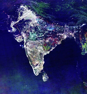
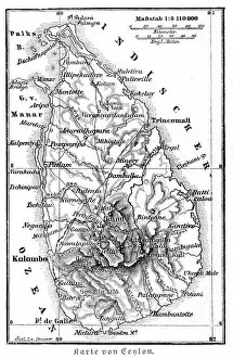
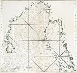
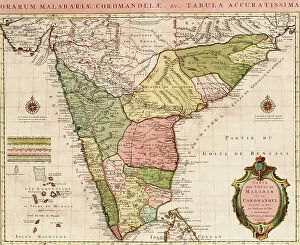
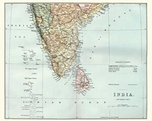
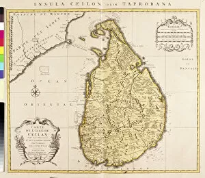
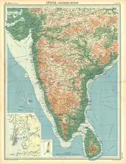
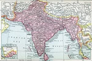
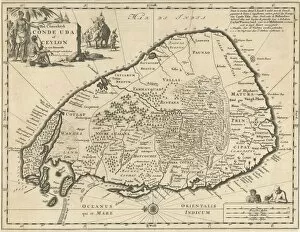
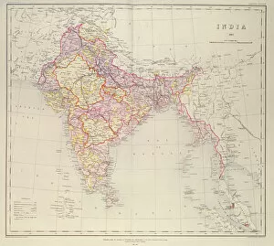
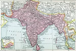
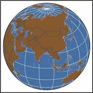
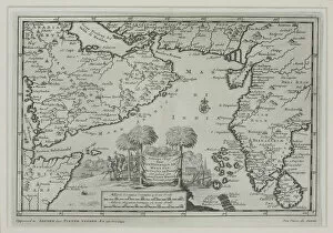
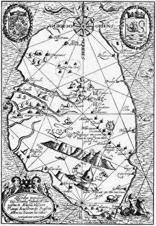
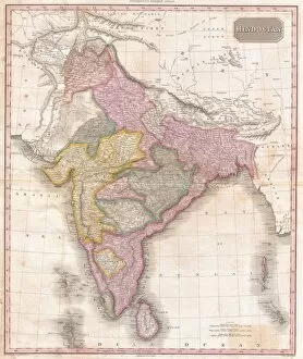
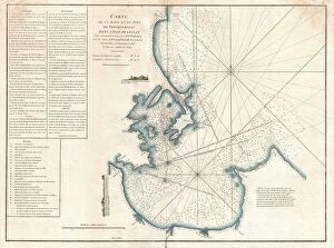
Sri Lanka, an island nation located in South Asia, is home to a wide variety of maps
Choose a picture from our Maps Collection for your Wall Art and Photo Gifts
66 items


All Professionally Made to Order for Quick Shipping
-
Maps Collection
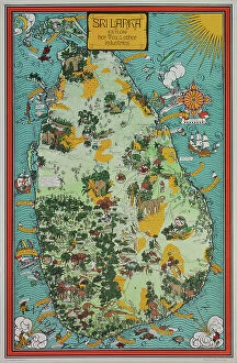
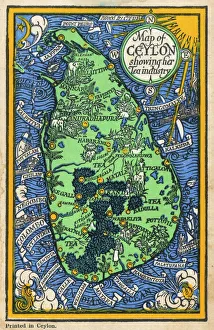
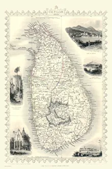
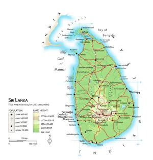
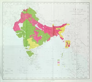
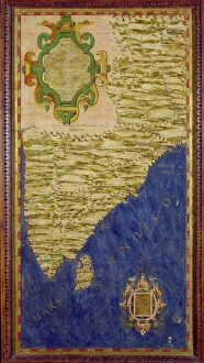
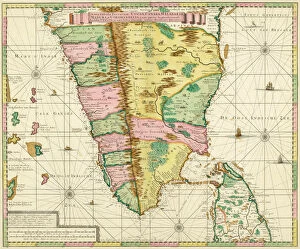
Sri Lanka, an island nation located in South Asia, is home to a wide variety of maps. These maps range from historical and political to topographical and geological. Historical maps show the evolution of the country's boundaries over time while political maps illustrate the administrative divisions of Sri Lanka. Topographical maps provide detailed information about elevation, landforms and bodies of water while geological maps depict the distribution of rocks and minerals across the island they can be used to identify important landmarks such as temples, monuments and national parks as well as infrastructure such as roads, railways and airports. With its diverse landscape, Sri Lanka is a great destination for map enthusiasts looking for an interesting place to explore.
+
Our beautiful pictures are available as Framed Prints, Photos, Wall Art and Photo Gifts
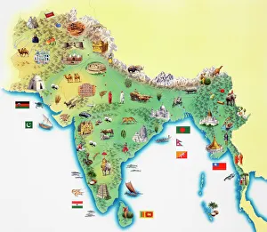
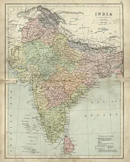
Media Storehouse offers a stunning collection of Maps of Sri Lanka Asia, featuring wall art and framed prints that showcase the beauty and diversity of this South Asian country. Our collection includes vintage maps dating back to the 19th century, as well as modern interpretations that capture the vibrant culture and landscapes of Sri Lanka. Each map is carefully selected for its artistic value, historical significance, and accuracy in depicting the geography and topography of Sri Lanka. From detailed city plans to panoramic views of mountains, forests, rivers, and beaches, these maps offer a unique perspective on this fascinating destination. Whether you are looking to decorate your home or office with a piece of art that reflects your love for travel or history, or simply want to learn more about Sri Lanka's rich heritage and natural wonders, our Maps of Sri Lanka Asia collection has something for everyone. With high-quality printing techniques and framing options available at affordable prices, it's easy to bring a piece of this exotic paradise into your life.
+
What are Maps of Sri Lanka Asia art prints?
Maps of Sri Lanka Asia art prints are beautiful and intricate depictions of the island nation of Sri Lanka. These prints showcase the geography, landmarks, and cultural aspects of Sri Lanka in stunning detail. They are perfect for those who love to travel or have a special connection to this part of the world. These art prints come in a variety of styles, from vintage maps to modern designs. They can be printed on high-quality paper or canvas, making them suitable for framing and displaying in your home or office. Maps of Sri Lanka Asia art prints also make great gifts for friends and family members who have visited or lived in Sri Lanka. We offer a unique way to remember their experiences on this beautiful island. Maps of Sri Lanka Asia art prints are an excellent addition to any collection and provide a wonderful way to appreciate the beauty and culture that is unique to this part of the world.
+
What Maps of Sri Lanka Asia art prints can I buy from Media Storehouse?
We offer a wide range of Sri Lanka Asia art prints that capture the beauty and diversity of this island nation. From stunning landscapes to vibrant cityscapes, you can find a variety of maps that showcase different aspects of Sri Lanka's culture and geography. Some popular options include vintage maps that highlight the country's colonial history, as well as contemporary designs that feature landmarks like Sigiriya Rock Fortress or the Temple of the Tooth in Kandy. You can also choose from different sizes and formats, including canvas prints, framed prints, and posters. Whether you're looking for a unique piece to decorate your home or office space or want to give a thoughtful gift to someone who loves travel and adventure, we have something for everyone. With high-quality printing techniques and durable materials, these Sri Lanka Asia art prints are sure to impress.
+
How do I buy Maps of Sri Lanka Asia art prints?
To buy Maps of Sri Lanka Asia art prints from Media Storehouse, you can browse our extensive collection of maps and select the one that best suits your needs. Once you have found the map you want to purchase, simply add it to your cart and proceed to checkout. You will be prompted to enter your shipping information and payment details before completing the transaction. We offer a variety of sizes for their maps, so make sure to choose the size that fits your space. We also offer framing options if you prefer a ready-to-hang piece. If you have any questions about purchasing or need assistance with selecting a map, we have customer service representatives available via email or phone who can help guide you through the process. With their high-quality printing technology and vast selection of maps, buying Maps of Sri Lanka Asia art prints from Media Storehouse is an easy way to add some unique decor to your home or office.
+
How much do Maps of Sri Lanka Asia art prints cost?
We offer a wide range of Maps of Sri Lanka Asia art prints that vary in price depending on the size and type of print. Our collection includes high-quality reproductions of antique maps, contemporary designs, and artistic interpretations of Sri Lanka's geography. We strive to provide affordable options for all budgets without compromising on quality or authenticity. Whether you're looking for a small poster or a large canvas print, our selection has something for everyone. Our Maps of Sri Lanka Asia art prints are perfect for adding character and charm to any room in your home or office space. They also make great gifts for anyone interested in history, travel, or art. Check out our website to browse through our extensive collection and find the perfect map print that suits your style and budget.
+
How will my Maps of Sri Lanka Asia art prints be delivered to me?
We take great care in ensuring that your Maps of Sri Lanka Asia art prints are delivered to you safely and securely. We use high-quality packaging materials to protect your artwork during transit, so it arrives at your doorstep in pristine condition. We work with trusted shipping partners who provide reliable delivery services across the world. Depending on where you live, we may use a variety of carriers including national postal services or courier companies. When you place an order with us, we will keep you updated on the progress of your shipment via email notifications. You can also track your package using the tracking number provided once it has been dispatched from our warehouse. Rest assured that we strive to make sure that every aspect of our service is designed to meet and exceed our customers' expectations. So sit back and relax while we take care of delivering your beautiful Maps of Sri Lanka Asia art prints right to your door.