Fraud Blocker Skip to main content

Home > Asia > Syria > Maps

Maps Collection

Syria is a country located in the Middle East, bordered by Turkey, Iraq, Jordan, Israel and Lebanon

Choose a picture from our Maps Collection for your Wall Art and Photo Gifts

162 items

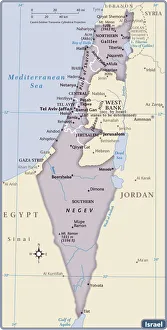
Background imageMaps Collection: Israel Country Map 2011 Edition

Israel Country Map 2011 Edition
Israel is a country in the Middle East, located at the eastern end of the Mediterranean Sea. It is bounded to the north by Lebanon, to the northeast by Syria, to the east and southeast by Jordan

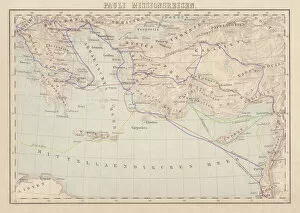
Background imageMaps Collection: Apostle Pauls Missionary Journeys, lithograph, published in 1886

Apostle Pauls Missionary Journeys, lithograph, published in 1886
Apostle Pauls Missionary Journeys: 1st (green); 2nd (red); 3rd (blue); last to Rome (yellow). Lithograph, published in 1886. Paul travelled over 10, 000 miles proclaiming the gospel of Jesus Christ

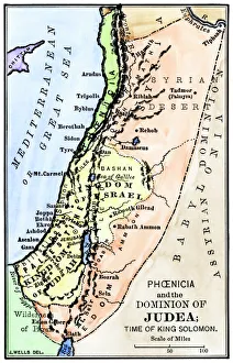
Background imageMaps Collection: Map of ancient Palestine kingdoms of Judah and Israel

Map of ancient Palestine kingdoms of Judah and Israel
Map of Phoenicia and Judea in the time of King Solomon, 10th century BC. Hand-colored woodcut of a 19th-century illustration

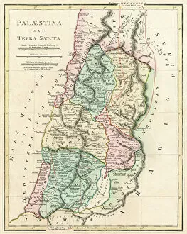
Background imageMaps Collection: Map of Palestine and the Holy Land

Map of Palestine and the Holy Land - all places named in their Latin form. Date: 1806

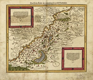
Background imageMaps Collection: Map of Palestine, 1588

Map of Palestine, 1588
16th century map of Palestine. North is towards upper right. Published in 1588, this German map shows the geography of Palestine, centred on the area that later become the state of Israel

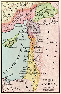
Background imageMaps Collection: Mideast map during the Crusades

Mideast map during the Crusades
Map of the Middle East at the time of the Crusades. Printed color lithograph

Background imageMaps Collection: PANC2A-00003

PANC2A-00003
Map of the empire of Alexander the Great in 323 BC. Printed color lithograph of a 19th-century illustration

Background imageMaps Collection: Ancient Mesopotamia

Ancient Mesopotamia
Map of the ancient Tigris and Euphrates region. Printed color 19th-century illustration

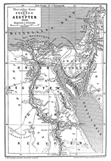
Background imageMaps Collection: Map of Napoleons Campaign in Egypt 1798 - French campaign in Egypt and Syria

Map of Napoleons Campaign in Egypt 1798 - French campaign in Egypt and Syria
Illustration of a Map of Napoleons Campaign in Egypt 1798 - French campaign in Egypt and Syria

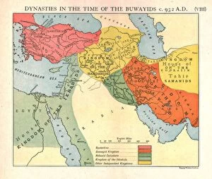
Background imageMaps Collection: Dynasties in the time of the Buwayids, circa 932 A. D. c1915. Creator: Emery Walker Ltd

Dynasties in the time of the Buwayids, circa 932 A. D. c1915. Creator: Emery Walker Ltd
Dynasties in the time of the Buwayids, circa 932 A.D. c1915. Map of civilisations in the Middle East during the 10th century: Byzantine, Buwayid Kingdom, Abbasid Caliphate, Kingdom of the Ikhshids

Background imageMaps Collection: Antique map of the Middle East with Egypt, Syria, and Israel

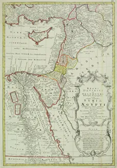
Antique map of the Middle East with Egypt, Syria, and Israel. Date unknown

Background imageMaps Collection: Antique map of the Middle East by Halma

Antique map of the Middle East by Halma

Background imageMaps Collection: Persian Empire about 500 BC

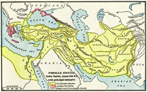
Persian Empire about 500 BC
Map of the Persian Empire under Darius I, with principal satrapies, about 500 BC. Color lithograph reproduction of a 19th-century illustration

Background imageMaps Collection: Byzantine and Crusaders v. Seljuks, circa 1130 A. D. c1915. Creator: Emery Walker Ltd

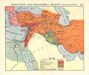
Byzantine and Crusaders v. Seljuks, circa 1130 A. D. c1915. Creator: Emery Walker Ltd
Byzantine and Crusaders v. Seljuks, circa 1130 A.D. c1915. Map of civilisations in the Middle East during the 12th century: Byzantine, other Christian states, Abbasid Caliphate, Seljuks, Fatimids

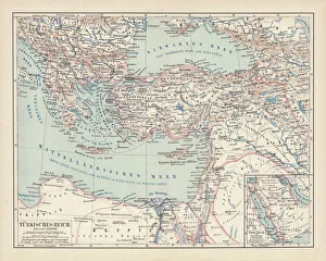
Background imageMaps Collection: Ottoman Empire, lithograph, published in 1878

Ottoman Empire, lithograph, published in 1878
Ancient map of Ottoman Empire. Lithograph, published in 1878

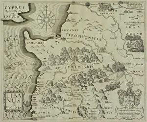
Background imageMaps Collection: Antique map of holy land including Syria and Lebanon

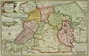
Antique map of holy land including Syria and Lebanon

Background imageMaps Collection: Mount Hermon, Syria, 1895. Artist: Armand Kohl

Mount Hermon, Syria, 1895. Artist: Armand Kohl
Mount Hermon, Syria, 1895. As seen from Rasheya. From The Universal Geography with Illustrations and Maps, division XVII, written by Elisee Reclus and published by Virtue & Co. Limited (London, 1895)

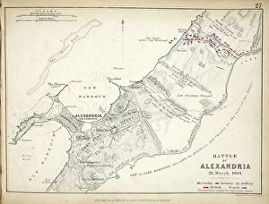
Background imageMaps Collection: Map of the Battle of Alexandria, published by William Blackwood and Sons

Map of the Battle of Alexandria, published by William Blackwood and Sons
746917 Map of the Battle of Alexandria, published by William Blackwood and Sons, Edinburgh & London, 1848 (hand-coloured engraving) by Johnston

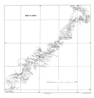
Background imageMaps Collection: Neri to Akra, c1915. Creator: Stanfords Geographical Establishment

Neri to Akra, c1915. Creator: Stanfords Geographical Establishment
Neri to Akra, c1915. Map showing the journey of British writer, soldier and diplomatic advisor Mark Sykes in Turkey, (at that time part of the Ottoman Empire)

Background imageMaps Collection: Syria country map

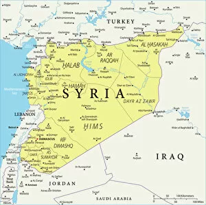
Syria country map
2011 edition

Map of Asia Minor, Syria, and Mesopotamia during the first centuries of the Christian era (print)
7420041 Map of Asia Minor, Syria, and Mesopotamia during the first centuries of the Christian era (print); (add.info.: Map of Asia Minor, Syria)

Map of the empire of Alexander III of Macedonian, known as the Great (356-323 BC), after the Battle of Ipsos (Turkey)
NWI4912667 Map of the empire of Alexander III of Macedonian, known as the Great (356-323 BC), after the Battle of Ipsos (Turkey), in 301 BC

Egypt, Syria - Arabia, 1700s
2902289 Egypt, Syria - Arabia, 1700s; (add.info.: Egypt, Syria - Arabia, 1700s.); Buyenlarge Archive/UIG

Background imageMaps Collection: The Ottoman Empire: Saudi Arabia, Greece, Egypt, Cyprus, Lebanon, Syria, Anatolia

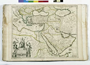
The Ottoman Empire: Saudi Arabia, Greece, Egypt, Cyprus, Lebanon, Syria, Anatolia
JEB4874587 The Ottoman Empire: Saudi Arabia, Greece, Egypt, Cyprus, Lebanon, Syria, Anatolia... map of Nicolas and William Sanson of Abbevile. Municipal library of Marseille

Background imageMaps Collection: Syria Reference Map

Syria Reference Map

Background imageMaps Collection: Middle East Ancient Map, Garden of Eden, 1675

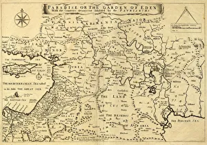
Middle East Ancient Map, Garden of Eden, 1675
This may appear to be a straightforward map of the Middle East. However, closer inspection will reveal some extraordinary details, a number of descriptions on the map refer to stories from the Bible

Background imageMaps Collection: Syria Under Allied Control Hostilities Ended

Syria Under Allied Control Hostilities Ended
Syria under allied control, WWII. Hostilities in Syria ended at midnight on 12-13 July, 1941 after a five weeks campaign, the course of which is shown on this map. From The War in Pictures, Sixth Year

Background imageMaps Collection: Map of Mesopotamia

Map of Mesopotamia
3779671 Map of Mesopotamia; (add.info.: Map of Mesopotamia, Babylon, Syria and Assyria from late 18th century.); Lebrecht History

Background imageMaps Collection: Antique map of Ancient Syria, Mesopotamia, Assyria, Atlas of Ancient Geography

Antique map of Ancient Syria, Mesopotamia, Assyria, Atlas of Ancient Geography
Vintage illustration of Antique map of Ancient Syria, Mesopotamia, Assyria, Atlas of Ancient Geography. By Samuel Butler

Background imageMaps Collection: Syria 1851

Syria 1851
A fine facimile artworked from an antique original map of Syria, issued as part of the 1851 edition of John Tallis and Companys " The Illustrated Atlas and Modern History of the World"

Background imageMaps Collection: Ottoman and Persian, after 1450 A. D. c1915. Creator: Emery Walker Ltd

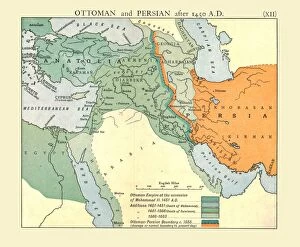
Ottoman and Persian, after 1450 A. D. c1915. Creator: Emery Walker Ltd
Ottoman and Persian, after 1450 A.D. c1915. Map of empires in the Middle East during the 15th-17th centuries: Ottoman Empire at the accession of Mohammed II, 1451 AD, Additions 1481-1683

Background imageMaps Collection: Rome v. Persia (Sassanian), circa 300 A. D. c1915. Creator: Emery Walker Ltd

Rome v. Persia (Sassanian), circa 300 A. D. c1915. Creator: Emery Walker Ltd
Rome v. Persia (Sassanian), circa 300 A.D. c1915. Map of the eastern Mediterranean and Near East, showing the ancient empires of Rome, Persia, and Armenia

Background imageMaps Collection: The Abbasid Caliphate v. Byzantine Empire, circa 786 A. D. c1915. Creator: Emery Walker Ltd

The Abbasid Caliphate v. Byzantine Empire, circa 786 A. D. c1915. Creator: Emery Walker Ltd
The Abbasid Caliphate v. Byzantine Empire, circa 786 A.D. c1915. Map of civilisations in the Middle East during the 8th century, and also showing the eastern Mediterranean, Red Sea, Caspian Sea

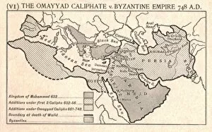
Background imageMaps Collection: The Omayyad Caliphate v. Byzantine Empire, circa 748 A. D. c1915. Creator: Emery Walker Ltd

The Omayyad Caliphate v. Byzantine Empire, circa 748 A. D. c1915. Creator: Emery Walker Ltd
The Omayyad Caliphate v. Byzantine Empire, circa 748 A.D. c1915. Map of the Mediterranean and Near East, showing the Kingdom of Mohammed, Additions under the Caliphs

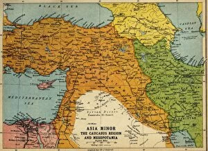
Background imageMaps Collection: Asia Minor, the Caucasus Region and Mesopotamia, First World War, c1915, (c1920)

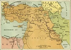
Asia Minor, the Caucasus Region and Mesopotamia, First World War, c1915, (c1920). Map of part of the Middle East, showing eastern Turkey, Cyprus, Syria, Lebanon, Palestine

Background imageMaps Collection: Map to Illustrate the Mesopotamian Expedition, 1919. Creator: George Philip & Son Ltd

Map to Illustrate the Mesopotamian Expedition, 1919. Creator: George Philip & Son Ltd
Map to Illustrate the Mesopotamian Expedition, 1919. Showing the Middle Eastern theatre of World War I, including the Turkish or Ottoman Empire, and parts of Russia, Persia and Egypt

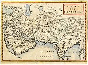
Background imageMaps Collection: Antique map of Persia and Arabia 1730

Antique map of Persia and Arabia 1730
Original antique copper engraved map by H. Moll, titled Persia Sive Shahistana, published in 1747 for the Universal History (London, T. Osborne & J. Shipton, 8 vols. 1747)

Background imageMaps Collection: Map of Syria, 1851. Artist: John Tallis

Map of Syria, 1851. Artist: John Tallis
Map of Syria, 1851. From The Illustrated Atlas, And Modern History Of The World Geographical, Political, Commercial & Statistical edited by R. Montgomery Martin, Esq. [J & F

Background imageMaps Collection: Bay of Acre, Syria

Bay of Acre, Syria

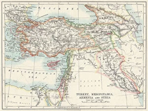
Background imageMaps Collection: Map of Turkey

Map of Turkey, Mesopotania, Armenia and Syria Date: circa 1910

Background imageMaps Collection: Map of Turkey, Persia, Afghanistan, Syria

Map of Turkey, Persia, Afghanistan, Syria
Marcus Ward's Home Atlas - London, 1894

Background imageMaps Collection: Asia Minor and the States of the Crusaders in Syria, about 1140 (colour litho)

Asia Minor and the States of the Crusaders in Syria, about 1140 (colour litho)
6016347 Asia Minor and the States of the Crusaders in Syria, about 1140 (colour litho) by Shepherd, William R. (1871-1934); Private Collection; (add.info)

Background imageMaps Collection: Map of the Near East in ancient times (coloured engraving)

Map of the Near East in ancient times (coloured engraving)
7148248 Map of the Near East in ancient times (coloured engraving) by Kiepert, Heinrich (1818-99); Private Collection; (add.info.: Map of the Near East in ancient times)

Background imageMaps Collection: Running for 'A Ring'(colour litho)

Running for "A Ring"(colour litho)
7169087 Running for " A Ring" (colour litho) by English School, (19th century); Private Collection; (add.info.: Running for " A Ring." Illustration for English Country Life by)

Background imageMaps Collection: Le lievre (engraving)

Le lievre (engraving)
7194454 Le lievre (engraving) by French School, (19th century); Private Collection; (add.info.: Le lievre. Illustration for La Chasse Illustree (Firmin Didot, 1867-68).); © Look and Learn

Background imageMaps Collection: Memoires d un lievre (engraving)

Memoires d un lievre (engraving)
7199905 Memoires d un lievre (engraving) by French School, (19th century); Private Collection; (add.info.: Memoires d un lievre)

Background imageMaps Collection: La chasse des levriers (engraving)

La chasse des levriers (engraving)
7194449 La chasse des levriers (engraving) by French School, (19th century); Private Collection; (add.info.: La chasse des levriers)

Background imageMaps Collection: Le lievre des Alpes (engraving)

Le lievre des Alpes (engraving)
7197981 Le lievre des Alpes (engraving) by French School, (19th century); Private Collection; (add.info.: Le lievre des Alpes)


All Professionally Made to Order for Quick Shipping


-

Maps Collection

Syria is a country located in the Middle East, bordered by Turkey, Iraq, Jordan, Israel and Lebanon, and is part of the larger region known as the Middle East or West Asia. Maps of Syria Asia provide an overview of this region and its surrounding countries. These maps show physical features such as mountains, rivers and deserts; political boundaries between countries; major cities; and other important landmarks. They also include information about population density, climate zones and natural resources. Maps of Syria Asia can be used to gain insight into the history and culture of this region as well as to plan trips or research projects related to it.
+

Our beautiful pictures are available as Framed Prints, Photos, Wall Art and Photo Gifts

The Maps of Syria Asia collection from Media Storehouse is a stunning range of wall art and framed prints that showcases the geography and history of Syria, one of the oldest inhabited regions in the world. Our collection features a wide variety of maps, ranging from ancient depictions to modern-day satellite imagery, highlighting the country's rich cultural heritage and strategic location at the crossroads between Europe, Asia, and Africa. Each print is carefully crafted using high-quality materials to ensure long-lasting durability and vibrant colors. Whether you're looking for a unique piece to decorate your home or office or searching for an educational tool for students or historians, our collection has something for everyone. From detailed topographical maps to artistic renderings featuring intricate borders and illustrations, these prints offer a fascinating glimpse into Syria's complex past and present. With its diverse selection of styles and sizes available at affordable prices, the Maps of Syria Asia collection is sure to impress anyone with an interest in cartography or Middle Eastern history.
+

What are Maps of Syria Asia art prints?

Maps of Syria Asia art prints are high-quality reproductions of antique and contemporary maps depicting the region of Syria in Asia. These prints showcase detailed cartography, highlighting the topography, cities, towns, rivers, and other geographical features of this historically significant area. These art prints offer a unique way to explore the rich history and culture of Syria through its geography. They can be used as educational tools for students studying world history or geography or as decorative pieces for homes or offices. Maps of Syria Asia art prints come in various sizes and styles to suit different preferences. Some feature intricate illustrations while others have a more minimalist design. They are printed on premium quality paper using advanced printing techniques that ensure vibrant colors and sharp details. Whether you're looking to add some character to your living space or want to learn more about the fascinating country of Syria, Maps of Syria Asia art prints are an excellent choice that will provide both aesthetic appeal and educational value.
+

What Maps of Syria Asia art prints can I buy from Media Storehouse?

We offer a wide range of Maps of Syria Asia art prints that are perfect for anyone who is interested in geography, history or art. These maps showcase the intricate details and features of the region, including its cities, rivers, mountains and other landmarks. Some popular options include antique maps from the 19th century that depict Syria and neighboring countries such as Turkey, Lebanon and Iraq. These vintage pieces offer a unique glimpse into how cartographers viewed this part of the world during an era when travel was much more difficult than it is today. In addition to antique maps, Media Storehouse also has contemporary prints that feature modern-day borders and political boundaries. These pieces can be a great way to stay up-to-date on current events or simply add some color to your home or office decor. If you're looking for high-quality Maps of Syria Asia art prints that are both informative and visually stunning, we have plenty of options to choose from.
+

How do I buy Maps of Syria Asia art prints?

To buy Maps of Syria Asia art prints from Media Storehouse, you can browse our extensive collection of artwork online. Simply search for "Maps of Syria Asia" in the search bar on our website and select the print that catches your eye. Once you have found a piece that you like, add it to your cart and proceed to checkout. At checkout, fill out all necessary information such as billing and shipping address. You will also be prompted to choose a payment method which may include credit card or PayPal. Once your order is confirmed, Media Storehouse will process it and ship it directly to your chosen address. Your Maps of Syria Asia art print will arrive ready for framing or display however you choose. We offer high-quality prints with vibrant colors and sharp detail so that every aspect of the artwork is captured beautifully. With our easy-to-use website and secure checkout process, buying Maps of Syria Asia art prints has never been easier.
+

How much do Maps of Syria Asia art prints cost?

As We offer a wide range of Maps of Syria Asia art prints, the cost can vary depending on factors such as size and framing options. However, you can expect to find affordable prices for high-quality prints that are perfect for adding a touch of sophistication to any room. Whether you're looking for vintage maps or contemporary designs, there is something to suit every taste and budget. The Maps of Syria Asia art prints available at Media Storehouse are sourced from some of the world's most talented artists and photographers, ensuring that each print is unique and visually stunning. With so many options available, it's easy to find the perfect piece to complement your home decor or add character to your office space. So why not browse through our collection today and discover the beauty of Maps of Syria Asia art prints?
+

How will my Maps of Syria Asia art prints be delivered to me?

Your Maps of Syria Asia art prints will be delivered to you in a safe and secure manner. We take great care in packaging your order to ensure that it arrives at your doorstep undamaged. Our standard delivery method is through postal services, but we also offer express shipping options for those who need their orders sooner. We use high-quality materials for our packaging, including sturdy cardboard tubes or flat boxes with protective layers to prevent any bending or creasing during transit. Your print will be rolled carefully and placed inside the tube or box along with additional padding material as needed. Once your order has been dispatched, you will receive an email confirmation with tracking information so that you can monitor its progress until it reaches you. If there are any issues with the delivery of your Maps of Syria Asia art prints, please do not hesitate to contact us and we'll do everything possible to resolve the issue promptly.