
Maps Collection
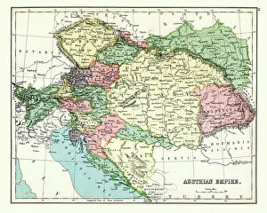
Austria is a landlocked country in Central Europe and is bordered by eight other countries and has a rich cultural heritage and stunning landscapes
Choose a picture from our Maps Collection for your Wall Art and Photo Gifts
733 items


All Professionally Made to Order for Quick Shipping
-
Maps Collection
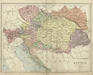
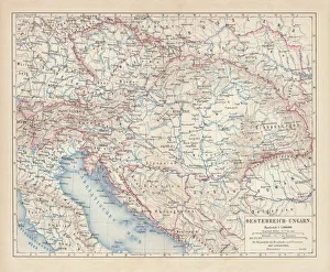
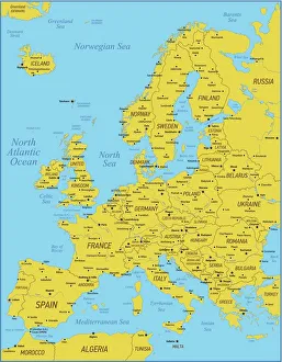
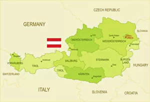
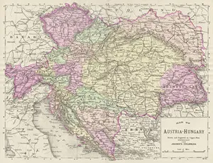
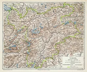
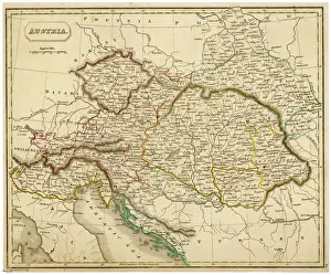
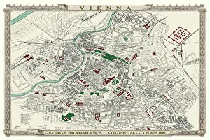
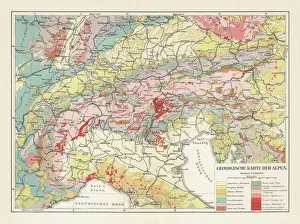
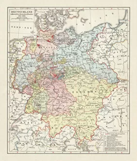
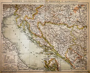
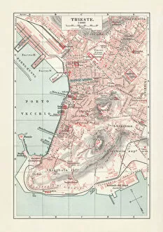
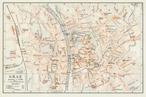
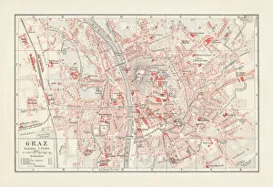
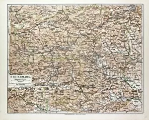
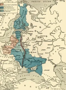
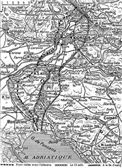
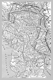
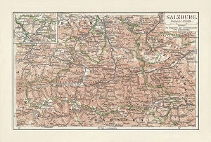
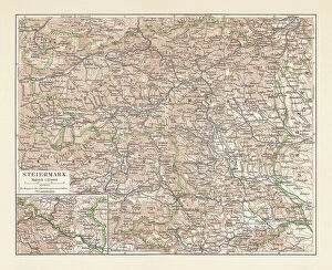
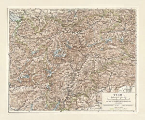
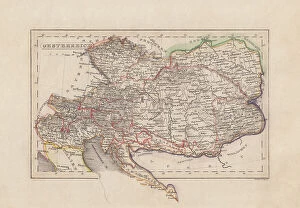
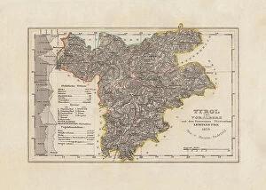
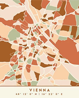
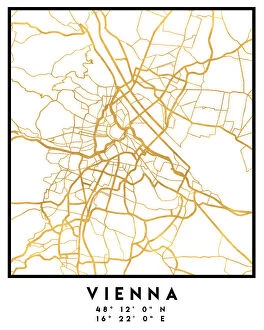
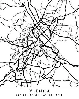
Austria is a landlocked country in Central Europe and is bordered by eight other countries and has a rich cultural heritage and stunning landscapes, making it a popular tourist destination. Austria covers an area of 83,879 square kilometres and has a population of 8.9 million people. The country is divided into nine states, each with its own unique culture and attractions. Maps of Austria Europe are essential for navigating the country's varied terrain, including its mountains, rivers, lakes, forests and cities. It also provide information on the major roads that connect the different regions as well as important landmarks such as castles and churches. In addition to physical maps of Austria Europe, there are also digital versions available online which can be used to plan trips or simply explore the region from home.
+
Our beautiful pictures are available as Framed Prints, Photos, Wall Art and Photo Gifts
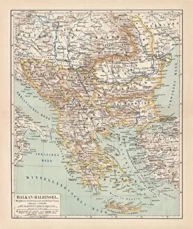
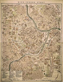
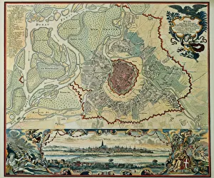
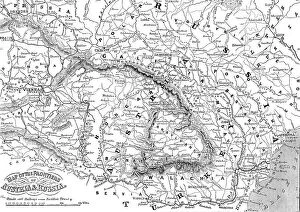
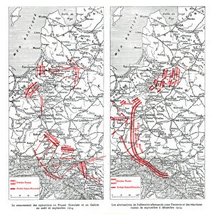
The Maps of Austria Europe collection from Media Storehouse is a stunning selection of wall art and framed prints that showcase the beauty and history of Austria. Our collection features a wide range of maps, including antique maps dating back to the 16th century, as well as modern-day maps highlighting key landmarks and cities. Each print in our collection is expertly crafted using high-quality materials to ensure longevity and durability. Whether you're looking for a unique piece to add to your home decor or an eye-catching gift for someone special, our collection has something for everyone. From intricate details depicting mountain ranges and rivers to vibrant colors showcasing cultural landmarks such as Vienna's Schönbrunn Palace or Salzburg's Hohensalzburg Fortress, these prints are sure to impress. The Maps of Austria Europe collection offers a beautiful way to explore the rich history and geography of this fascinating country.
+
What are Maps of Austria Europe art prints?
Maps of Austria Europe art prints are high-quality reproductions of antique and contemporary maps that depict the geography, topography, and landmarks of Austria. These prints are created using advanced printing technologies that ensure accurate color reproduction and sharpness. Maps of Austria Europe art prints are popular among collectors, historians, travelers, and anyone who appreciates the beauty and intricacy of cartography. They can be used to decorate homes, offices, libraries, museums or any other space where a touch of elegance is desired. These art prints come in various sizes and formats including framed or unframed options. The framed versions usually feature high-quality frames made from wood or metal that complement the artwork while protecting it from damage. Whether you're looking for a vintage map to add character to your living room or a modern one for your office wall, Maps of Austria Europe art prints offer an excellent way to showcase your love for this beautiful country.
+
What Maps of Austria Europe art prints can I buy from Media Storehouse?
We offer a wide range of Maps of Austria Europe art prints that are perfect for adding a touch of elegance and sophistication to any space. These maps showcase the beautiful landscapes, cities, and regions of Austria in stunning detail, making them ideal for anyone who loves this country or wants to learn more about it. Some popular options include vintage-style maps that feature intricate illustrations and detailed labeling, as well as modern designs that use bold colors and typography to create a contemporary look. You can choose from different sizes and formats such as canvas prints, framed prints or photographic prints depending on your preference. Whether you're looking for something classic or trendy, we have plenty of options available to suit your style. With their high-quality printing technology and attention to detail, these Maps of Austria Europe art prints are sure to impress anyone who sees them.
+
How do I buy Maps of Austria Europe art prints?
To buy Maps of Austria Europe art prints from Media Storehouse, you can browse through our extensive collection of maps and select the one that catches your eye. Once you have found the map you want to purchase, simply add it to your cart and proceed to checkout. You will be prompted to enter your shipping information and payment details. We offer a variety of sizes for their art prints, so make sure to choose the size that best fits your needs. We also offer different framing options if you would like to have your print framed before delivery. If you have any questions or concerns about purchasing a Maps of Austria Europe art print from Media Storehouse, they have a customer service team available to assist you. Simply reach out via email or phone and they will be happy to help guide you through the process.
+
How much do Maps of Austria Europe art prints cost?
We offer a wide range of Maps of Austria Europe art prints at various price points. The cost of these prints depends on several factors such as the size and type of print selected. We have options ranging from small to large sizes, with different finishes like canvas or framed prints. Our collection includes vintage maps, modern designs and artistic interpretations that cater to diverse tastes and preferences. Our you can choose from a variety of styles including colorful abstracts, black-and-white sketches or detailed topographical maps. We take pride in providing high-quality products that are affordable for our customers without compromising on quality. Our Maps of Austria Europe art prints are perfect for decorating homes or offices while also serving as educational tools. The cost of our Maps of Austria Europe art prints is reasonable and competitive within the market. We strive to provide excellent value for money while delivering exceptional customer service.
+
How will my Maps of Austria Europe art prints be delivered to me?
Your Maps of Austria Europe art prints will be delivered to you in a safe and secure manner. We take great care in packaging your order so that it arrives at your doorstep in pristine condition. Your art prints will be rolled up and placed inside a sturdy cardboard tube, which is then sealed with tape to prevent any damage during transit. We work with trusted delivery partners who ensure that your package is handled carefully throughout the journey from our warehouse to your address. You can track the progress of your delivery online using the tracking number provided once we dispatch your order. Upon receiving your Maps of Austria Europe art prints, we recommend unrolling them carefully and allowing them to rest flat for a few hours before framing or hanging them on display. This will help eliminate any curling or creases caused by being rolled up during shipping. You can expect a hassle-free delivery experience when ordering from Media Storehouse.