
Maps Collection
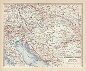
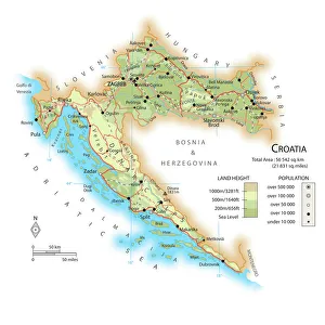
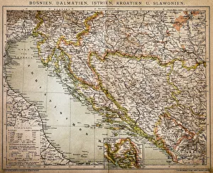
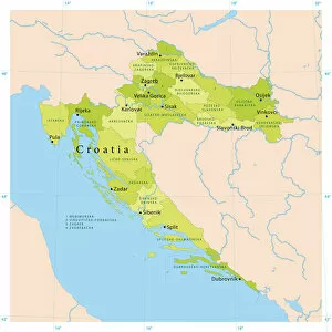
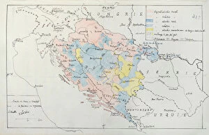
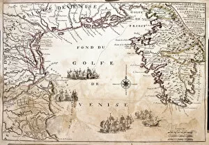
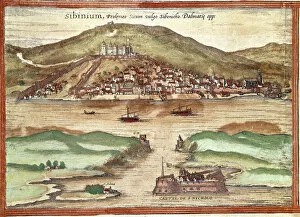
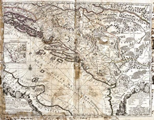
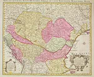
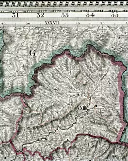
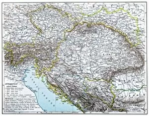
Croatia is a country located in southeastern Europe, on the Adriatic Sea and can a long and varied history
Choose a picture from our Maps Collection for your Wall Art and Photo Gifts
62 items


All Professionally Made to Order for Quick Shipping
-
Maps Collection
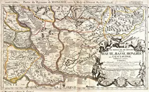
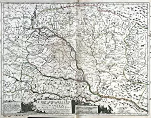
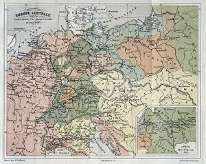
Croatia is a country located in southeastern Europe, on the Adriatic Sea and can a long and varied history, with influences from both the Roman Empire and the Ottoman Empire. Maps show its diverse geography, which includes mountains, rivers, islands and coastal areas. The country is divided into 20 counties and its capital city is Zagreb. Croatia has a rich cultural heritage that can be seen in its architecture, cuisine and art. It also boasts some of the most beautiful beaches in Europe as well as numerous national parks for visitors to explore. Croatia is an increasingly popular tourist destination due to its stunning scenery, vibrant culture and friendly people. Maps ofare essential for anyone planning a trip to this fascinating country.
+
Our beautiful pictures are available as Framed Prints, Photos, Wall Art and Photo Gifts
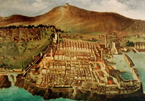
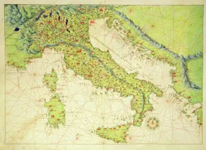
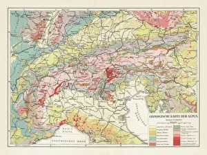
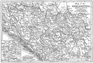
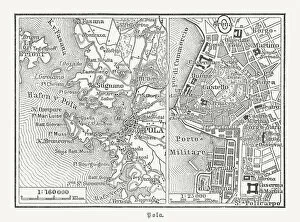
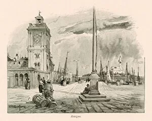
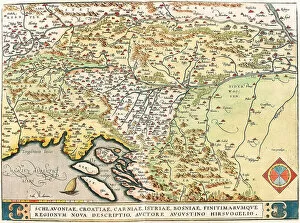
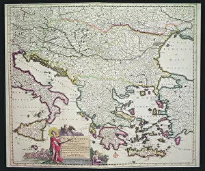
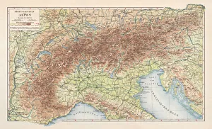
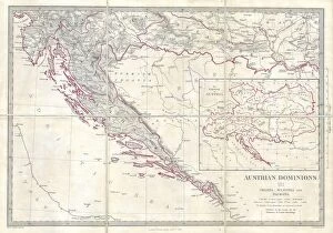
The Maps of Croatia Europe collection from Media Storehouse offers a stunning array of wall art and framed prints that showcase the beauty and diversity of this fascinating country. From detailed topographical maps to vintage travel posters, our collection has something for everyone interested in Croatian history, culture, or geography. One standout piece is the 1850 Map of Dalmatia by J. Bartholomew & Co., which depicts the region's intricate coastline and mountainous interior with incredible accuracy. Another popular print is the Vintage Travel Poster for Dubrovnik, which captures the city's medieval architecture and sparkling Adriatic Sea views. Whether you're a seasoned traveler or simply looking to add some unique decor to your home or office, the Maps of Croatia Europe collection is sure to impress. With high-quality printing techniques and a wide range of sizes available, these prints are perfect for anyone who wants to celebrate all that makes Croatia such a special place.
+
What are Maps of Croatia Europe art prints?
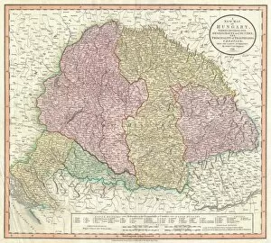
Maps of Croatia Europe art prints are high-quality reproductions of maps that depict the geography and topography of Croatia, a country located in southeastern Europe. These prints showcase the intricate details of the region's landscapes, including its mountains, rivers, lakes, and coastlines. These art prints are perfect for anyone who is interested in history or geography and wants to learn more about this beautiful country. They can be used as educational tools or simply as decorative pieces to add character to any living space. Maps of Croatia Europe art prints come in a variety of sizes and styles to suit different tastes and preferences. Whether you prefer vintage-style maps or modern interpretations, there is something for everyone. These art prints offer a unique way to explore the beauty and complexity of Croatia's landscape while adding an artistic touch to your home decor.
+
What Maps of Croatia Europe art prints can I buy from Media Storehouse?
We offer a wide range of Maps of Croatia Europe art prints that are perfect for anyone looking to add some unique and interesting decor to their home or office. These maps come in various sizes, styles, and designs, allowing you to choose the one that best suits your taste and preferences. Some of the popular options include vintage-style maps featuring intricate details and illustrations, modern abstract designs with bold colors and patterns, as well as more traditional topographical maps showing geographical features such as mountains, rivers, and coastlines. Whether you're a history buff interested in exploring Croatia's rich cultural heritage or simply looking for an eye-catching piece of wall art that will spark conversation among guests, we have something for everyone. With high-quality printing techniques used on premium materials like canvas or paper stock available at affordable prices - these Maps of Croatia Europe art prints are sure to impress.
+
How do I buy Maps of Croatia Europe art prints?
To purchase Maps of Croatia Europe art prints from Media Storehouse, you can browse our extensive collection online. Simply search for "Maps of Croatia" in the search bar on our website and select the print that catches your eye. Once you have found the perfect print, click on it to view more details about its size and framing options. From there, add your chosen print to your cart and proceed to checkout. You will be prompted to enter your shipping information and payment details before finalizing your order. We offer a variety of high-quality printing options including canvas prints, framed prints, and photographic prints. We also offer a range of sizes so you can find the perfect fit for any space. Whether you are looking for a unique piece of wall art or a gift for someone special, our selection of Maps of Croatia Europe art prints is sure to impress.
+
How much do Maps of Croatia Europe art prints cost?
We offer a wide range of Maps of Croatia Europe art prints at varying prices. Our collection includes different sizes and styles to suit your preferences and budget. We have vintage maps that showcase the historical evolution of Croatia's borders, as well as contemporary designs that highlight the country's natural beauty and cultural landmarks. Our Maps of Croatia Europe art prints are printed on high-quality paper using advanced printing technology to ensure vibrant colors and sharp details. They are perfect for decorating your home or office with a touch of Croatian charm. We take pride in offering affordable prices without compromising quality, so you can enjoy beautiful artwork without breaking the bank. Whether you're looking for a small print to add to your gallery wall or a large statement piece for your living room, we've got you covered with our extensive selection of Maps of Croatia Europe art prints.
+
How will my Maps of Croatia Europe art prints be delivered to me?
We take great care in ensuring that your Maps of Croatia Europe art prints are delivered to you safely and securely. We use high-quality packaging materials to protect your artwork during transit and ensure that it arrives in pristine condition. Your art prints will be rolled up carefully and placed into a sturdy cardboard tube for delivery. This method ensures that the print remains flat and avoids any creases or damage during transportation. We work with trusted courier partners who offer reliable delivery services across the world. Once your order has been dispatched, you will receive a tracking number so you can monitor its progress online. We pride ourselves on our exceptional customer service and attention to detail. If you have any questions about your order or delivery, please do not hesitate to contact us – we’re always here to help.