
Maps Collection
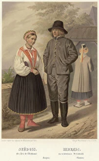
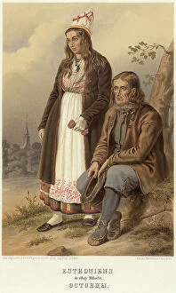
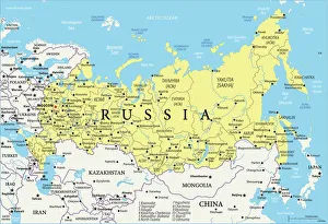
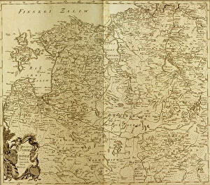
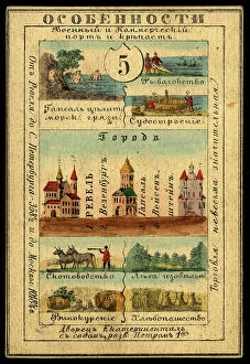
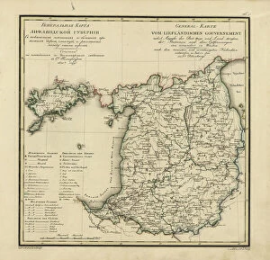
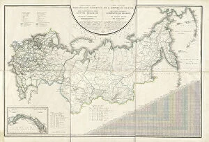
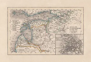
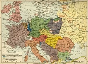
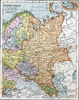
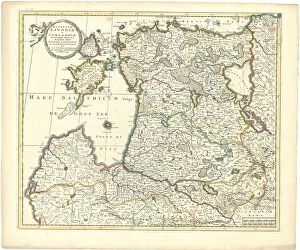
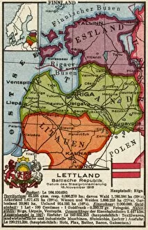
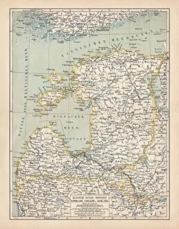
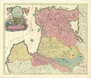
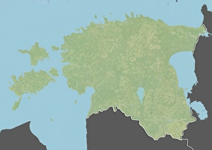
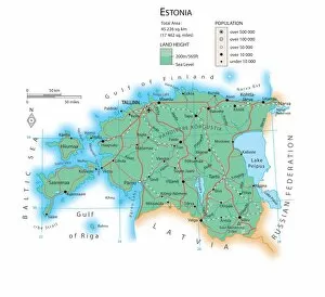
Estonia is a country in Northern Europe, located on the eastern coast of the Baltic Sea, and is bordered by Latvia to the south, Russia to the east
Choose a picture from our Maps Collection for your Wall Art and Photo Gifts
45 items


All Professionally Made to Order for Quick Shipping
-
Maps Collection
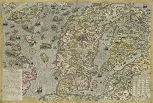
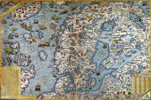
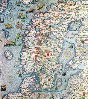
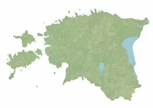
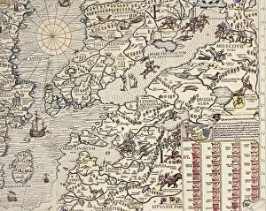
Estonia is a country in Northern Europe, located on the eastern coast of the Baltic Sea, and is bordered by Latvia to the south, Russia to the east, and Finland and Sweden to the north. Maps of Estonia are available in both physical and digital formats. Physical maps show Estonia's terrain features such as rivers, lakes, mountains and forests as well as its administrative divisions into counties and cities. Digital maps provide detailed information about roads, points of interest (POIs) such as restaurants or hotels, public transport routes and other useful information for travelers. They also provide an overview of Estonia's political boundaries with neighboring countries. Maps of Estonia are essential for anyone planning a trip or conducting research about this fascinating country.
+
Our beautiful pictures are available as Framed Prints, Photos, Wall Art and Photo Gifts
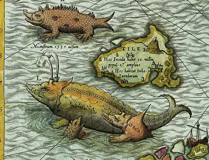
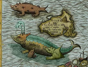
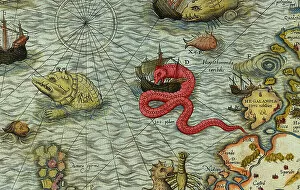
Media Storehouse offers a collection of Maps of Estonia Europe, which includes wall art and framed prints. Our collection features various maps that showcase the geography and topography of Estonia, including its cities, towns, rivers, lakes, forests and other landmarks. These maps are available in different sizes to suit any space or decor style. The Maps of Estonia Europe collection is an ideal choice for those who love history or have an interest in cartography. They can be used to decorate homes, offices or public spaces such as museums or libraries. The high-quality printing ensures that the details on each map are clear and accurate. Whether you want to display your Estonian heritage or simply appreciate the beauty of this Baltic state's landscape from a historical perspective, our Maps of Estonia Europe collection has something for everyone. With its wide range of options at affordable prices, it is easy to find the perfect map print that will add character and charm to any room.
+
What are Maps of Estonia Europe art prints?
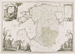
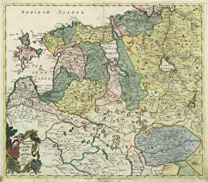
Maps of Estonia Europe art prints are high-quality reproductions of maps depicting the country of Estonia and its surrounding areas in Europe. These prints showcase the intricate details, landmarks, and topography of this beautiful region. They are perfect for those who want to display their love for geography or history or simply add a touch of sophistication to their home decor. These art prints come in various sizes and styles, from vintage-inspired designs to modern interpretations. Some feature colorful illustrations while others have a more minimalist aesthetic. Regardless of the style, these maps make excellent conversation starters and can be used as educational tools for children. We offer a wide selection of Maps of Estonia Europe art prints that cater to different tastes and preferences. With our easy-to-use website, you can browse through our collection and find the perfect print that suits their needs. Our high-quality printing process ensures that each map is reproduced with exceptional clarity and detail so that it looks just like an original antique map.
+
What Maps of Estonia Europe art prints can I buy from Media Storehouse?
We offer a wide range of Maps of Estonia Europe art prints that you can buy. These maps are perfect for anyone who loves geography or wants to decorate their home with unique and interesting artwork. You can find antique maps, modern maps, and everything in between. Some of the most popular Maps of Estonia Europe art prints available at Media Storehouse include detailed topographical maps, historical city plans, and colorful political boundary maps. Whether you're looking for something to hang in your living room or office, there is sure to be a map that suits your needs. In addition to traditional paper prints, Media Storehouse also offers canvas prints and framed options so you can customize your purchase according to your preferences. With such a vast selection available online, it's easy to find the perfect Maps of Estonia Europe art print that will add character and charm to any space.
+
How do I buy Maps of Estonia Europe art prints?
To purchase Maps of Estonia Europe art prints from Media Storehouse, you can browse our vast collection of high-quality images and select the one that best suits your needs. Once you have found the print you want to buy, simply add it to your cart and proceed to checkout. At this point, you will be prompted to enter your shipping details and payment information. We offer a variety of payment options including credit card, PayPal, and Apple Pay. They also provide secure online transactions for added peace of mind. Once your order has been processed, Media Storehouse will carefully package your Maps of Estonia Europe art print and ship it directly to your doorstep. With their fast delivery times and excellent customer service, buying art prints from Media Storehouse is a hassle-free experience that allows you to enjoy beautiful artwork in the comfort of your own home or office.
+
How much do Maps of Estonia Europe art prints cost?
We offer a wide range of Maps of Estonia Europe art prints at varying prices. Our collection includes high-quality reproductions of antique maps as well as contemporary designs featuring the latest cartographic data. The cost of each print depends on several factors such as size, framing options, and printing materials. Our you can choose from a variety of sizes ranging from small to large format prints suitable for display in homes or offices. We also offer different framing options that include classic wooden frames, modern acrylic frames, and unframed prints for those who prefer to customize their own frame. We take pride in our commitment to providing affordable yet high-quality art prints that are accessible to everyone. Whether you're looking for a vintage map or a modern design, we have something for every taste and budget.
+
How will my Maps of Estonia Europe art prints be delivered to me?
We take great care in ensuring that your Maps of Estonia Europe art prints are delivered to you safely and securely. We use high-quality packaging materials to protect your artwork during transit and ensure that it arrives at your doorstep in pristine condition. Your Maps of Estonia Europe art prints will be shipped directly from our printing facility using a reliable courier service. You can expect to receive regular updates on the status of your delivery, including tracking information so you can monitor its progress. We understand how important it is for our customers to receive their orders promptly, which is why we work hard to dispatch all orders as quickly as possible. Once dispatched, you can typically expect your order to arrive within a few business days depending on your location. Whether you're purchasing artwork for yourself or as a gift for someone else, rest assured that we'll do everything we can to make sure it arrives safely and on time.