Fraud Blocker Skip to main content

Home > Europe > France > Maps

Maps Collection (page 7)

Maps of France Europe are essential tools for travelers and tourists who want to explore the continent

13,046 items

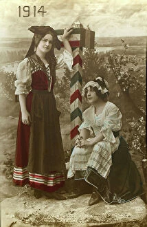
First World War: Patriotic map showing a young Lorraine and a young Alsatian in local costume eagerly awaiting
LUX4744376 First World War: Patriotic map showing a young Lorraine and a young Alsatian in local costume eagerly awaiting the arrival of the French

First World War: Patriotic map showing in a medallion an Alsatian in traditional dress
LUX4744309 First World War: Patriotic map showing in a medallion an Alsatian in traditional dress and in a headdress behind a French flag, 1915

First World War: Patriotic map showing a soldier in uniform telling during a leave a story of these battles, 1915
LUX4744243 First World War: Patriotic map showing a soldier in uniform telling during a leave a story of these battles, 1915

Background imageMaps Collection: First World War: Patriotic map showing a little boy and a little girl sends to their father at

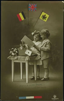
First World War: Patriotic map showing a little boy and a little girl sends to their father at the forehead a wooden
LUX4744189 First World War: Patriotic map showing a little boy and a little girl sends to their father at the forehead a wooden crate with a card and kitten

First World War: Patriotic map showing the image of a relief gun an artillery scene
LUX4744140 First World War: Patriotic map showing the image of a relief gun an artillery scene and titled Remembrance of the 57th Infantry Regiment

First World War: Patriotic Map showing the arrival of the hairy on leave by train and titled en Vitesse, 1918
LUX4744135 First World War: Patriotic Map showing the arrival of the hairy on leave by train and titled en Vitesse, 1918; (add.info.: World War I - War 14-18 (1914-1918) - World War I (WWI or WW1)

First World War: Patriotic map showing a little girl praying in front of the photograph of her father in uniform
LUX4744120 First World War: Patriotic map showing a little girl praying in front of the photograph of her father in uniform hanging on the wall

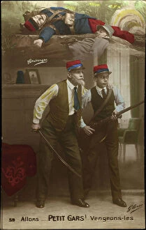
First World War: Patriotic map showing a grandfather driving his grandson to avenge the French soldiers who died in
LUX4744067 First World War: Patriotic map showing a grandfather driving his grandson to avenge the French soldiers who died in battle and titled Alons Petity Guy Venges Them, 1915

First World War: Patriotic Map showing a soldier rising the war and titled Remembrance of the 63rd Infantry Regiment
LUX4744042 First World War: Patriotic Map showing a soldier rising the war and titled Remembrance of the 63rd Infantry Regiment and with the names of the campaigns carried out

Patriotic map showing France advising a soldier in uniform and titled Victory Inspiration, 1915
LUX4743880 Patriotic map showing France advising a soldier in uniform and titled Victory Inspiration, 1915; (add.info.: Patriotic map showing France advising a soldier in uniform)

First World War: Patriotic map showing in a battlefield landscape scene glowing a sunrise with a soldier in uniform
LUX4743941 First World War: Patriotic map showing in a battlefield landscape scene glowing a sunrise with a soldier in uniform on guard and titled Dawn of Glory, 1915

Plan of the Suez Canal (Egypt), with portraits of Ferdinand de Lesseps (1805-1894)
CSO4983168 Plan of the Suez Canal (Egypt), with portraits of Ferdinand de Lesseps (1805-1894), Ismail Pasha (1830-1895) Khedive of Egypt and Sudan

Battle of Sedan, 1870. Map
7301610 Battle of Sedan, 1870. Map.; Private Collection; (add.info.: The Battle of Sedan 1 - 2 September 1870 during the Franco-Prussian War 1870 - 1871)

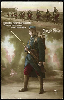
First World War: France, Patriotic Map showing under a platoon of cyclists a soldier guarding with his rifle
LUX4740460 First World War: France, Patriotic Map showing under a platoon of cyclists a soldier guarding with his rifle and bayonet and titled "On the Front"

Background imageMaps Collection: Geographic map of the French Empire and Kingdom of Italy in 1809

Geographic map of the French Empire and Kingdom of Italy in 1809 (Map of french empire and kingdom of Italy)
ELD4925058 Geographic map of the French Empire and Kingdom of Italy in 1809 (Map of french empire and kingdom of Italy, 1809) Engraving from "" Atlas Universel"" by Houze

Map of France at the times of King Philip I of France death, 1108 Engraving from "" Atlas Universel"" by Houze 1851
ELD4921663 Map of France at the times of King Philip I of France death, 1108 Engraving from "" Atlas Universel"" by Houze 1851 Private collection; (add.info)

Background imageMaps Collection: Map of the Eastern Empire after the fall of Constantinople by the French Crusaders in 1204

Map of the Eastern Empire after the fall of Constantinople by the French Crusaders in 1204
ELD4927970 Map of the Eastern Empire after the fall of Constantinople by the French Crusaders in 1204 and map of Italy during the Guelphs and Ghibellin fights (Guelfi e ghibellini)

Map of France at the end of the carolingian dynasty, 987 (Map of France at the end of the carolingian dynasty)
ELD4921526 Map of France at the end of the carolingian dynasty, 987 (Map of France at the end of the carolingian dynasty, 987)

Map of French geography of the territory of the five Iroquois nations (Seneca, Onondaga, Oneida)
NWI4897904 Map of French geography of the territory of the five Iroquois nations (Seneca, Onondaga, Oneida, Cayuga and Mohawk) and Fort Orange (Albany, New York, USA), circa 1660

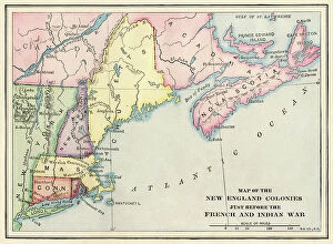
New England colonies just before the French and Indian War
NWI4853909 New England colonies just before the French and Indian War.; (add.info.: New England colonies just before the French and Indian War.); Photo © North Wind Pictures

Geographic map of European claims on North American territories in 1733 when the last colony, Georgia was founded
NWI4853381 Geographic map of European claims on North American territories in 1733 when the last colony, Georgia was founded

Geographic map of the island of Panama (Central America) in 1744, taken from "" History of adventurers who have made
NWI4846299 Geographic map of the island of Panama (Central America) in 1744, taken from "" History of adventurers who have made their mark in India"" by Alexandre Olivier Exquemelin (or Oexmelin)

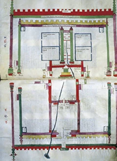
Map of the Temple of Jerusalem
CUL4852994 Map of the Temple of Jerusalem; (add.info.: Map of the Temple of Jerusalem - LYRE, Nicholas de (1270-1340). Theologian. Plan and description of the Temple of Jerusalem

Napoleon Bonaparte (1769-1821) and Tsar Alexander I Emperor of Russia (1801-1825)
NWI4835723 Napoleon Bonaparte (1769-1821) and Tsar Alexander I Emperor of Russia (1801-1825) negociating a treaty of alliance at Tilsit (Tilsitt), 1807

Map of Hudson Bay in Canada in 1722, showing Hudson Detroit. Engraving. Map of Hudson's Bay, Canada, 1722
NWI4902142 Map of Hudson Bay in Canada in 1722, showing Hudson Detroit. Engraving. Map of Hudson's Bay, Canada, 1722, showing Hudson's Strait.; (add.info.: Map of Hudson Bay in Canada in 1722)

Allegory of the British Empire as the Colossus of Rhodes, 19th century
CUL4940269 Allegory of the British Empire as the Colossus of Rhodes, 19th century; (add.info.: Il Colosso di Rodi. Allegory of the British Empire as the 'Colossus of Rhodes" monitoring)

France: Humorous fantasy map showing a black woman cook doing her calculations, 1902
LUX4725896 France: Humorous fantasy map showing a black woman cook doing her calculations, 1902; (add.info.: France: Humorous fantasy map showing a black woman cook doing her calculations)

First World War: France, While her husband fights at the front, a young woman shows a map of France to her little
LUX4737125 First World War: France, While her husband fights at the front, a young woman shows a map of France to her little daughter

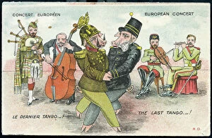
First World War: France, Humorous map showing the two Austrian and German emperors in pig on a dance imposed by
LUX4736554 First World War: France, Humorous map showing the two Austrian and German emperors in pig on a dance imposed by the allies and nicknamed "the last tango""

First World War: France, Postcard, studio photo showing a French soldier in uniform in a flower field next to
LUX4736083 First World War: France, Postcard, studio photo showing a French soldier in uniform in a flower field next to the German border post destroyed

First World War: France, Postcard, photo studio of two soldiers in uniform with machine gun in a green field
LUX4735869 First World War: France, Postcard, photo studio of two soldiers in uniform with machine gun in a green field and protected by France in helmet and flag

France, Portrait in photographic medallion on an illustrated map by Madame G. Gosseut, 1860
LUX4733148 France, Portrait in photographic medallion on an illustrated map by Madame G. Gosseut, 1860; (add.info.: France, Portrait in photographic medallion on an illustrated map by Madame G)

First World War: France, A French soldier regains the flag from a wounded soldier holding him
LUX4737906 First World War: France, A French soldier regains the flag from a wounded soldier holding him, map titled: 'Defense of the Flag'

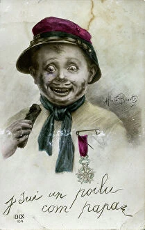
First World War: France, Patriotic map showing a child disguise in hairy with fake mustache and war cross declaring
LUX4738045 First World War: France, Patriotic map showing a child disguise in hairy with fake mustache and war cross declaring: 'I am a hairy as dad', 1915

First World War: France, Patriotic Map showing a soldier in an idyllic, bucolic trench posing next to his 75 star gun
LUX4737364 First World War: France, Patriotic Map showing a soldier in an idyllic, bucolic trench posing next to his 75 star gun of battles

Patriotic map showing a lucky shell with four young children coming out with flags that are inscribed Victoire, 1915
LUX4743277 Patriotic map showing a lucky shell with four young children coming out with flags that are inscribed Victoire

First World War: France, Patriotic Map showing a little girl in tricolour clothing
LUX4742323 First World War: France, Patriotic Map showing a little girl in tricolour clothing and holding a French flag famous immortal France

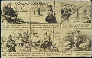
First World War: France, Patriotic Map showing the simple story of a hairy man, 1915
LUX4741312 First World War: France, Patriotic Map showing the simple story of a hairy man, 1915; (add.info.: First World War - War 14-18 (1914-1918) - World War I (WWI or WW1): France

First World War: France, Patriotic Map showing a good sister caring for wounded soldiers, in a field hospital, 1915
LUX4741813 First World War: France, Patriotic Map showing a good sister caring for wounded soldiers, in a field hospital, 1915

First World War: France, Patriotic Map showing France with its Phrygian cap
LUX4741174 First World War: France, Patriotic Map showing France with its Phrygian cap and its flag bringing back two little girls a Lorraine and an Alsatian representing her children

First World War: France, Patriotic Map showing Napoleon 1st trampling the German flag saying
LUX4741666 First World War: France, Patriotic Map showing Napoleon 1st trampling the German flag saying: I got your Rhine and we'll have it again

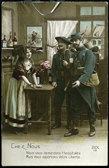
First World War: France, Patriotic Map showing a young Alsatian receiving two French soldiers in a cafe in Alsace
LUX4741053 First World War: France, Patriotic Map showing a young Alsatian receiving two French soldiers in a cafe in Alsace and thanks them for being liberated, titled: 'chez nous'

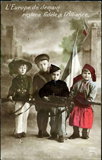
Background imageMaps Collection: First World War: France, Patriotic Map showing four young children in Italian, English

First World War: France, Patriotic Map showing four young children in Italian, English
LUX4738398 First World War: France, Patriotic Map showing four young children in Italian, English, Belgian and Russian soldier uniforms around the French flag

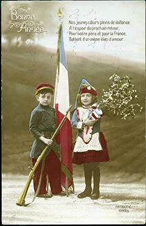
First World War: France, Patriotic Map showing a little boy in kepi and in uniform with his rifle and flag
LUX4738385 First World War: France, Patriotic Map showing a little boy in kepi and in uniform with his rifle and flag and a little girl in a canteen wearing a bouquet of Guy

First World War: France, Patriotic Map showing a little boy dresses as a soldier
LUX4738348 First World War: France, Patriotic Map showing a little boy dresses as a soldier and looking behind a rock the enemy with his rifle, above a little girl sleeping in his bed, 1916

First World War: France, Patriotic Map showing a young boy and a young girl and kepi
LUX4738290 First World War: France, Patriotic Map showing a young boy and a young girl and kepi and Alsatian hat piercing a scarecrow wearing a German helmet

First World War: France, Patriotic Map showing new natures going to be placed in a barracks
LUX4738255 First World War: France, Patriotic Map showing new natures going to be placed in a barracks and going out with uniforms, titled: 'Enrolement des jeunes hairy'

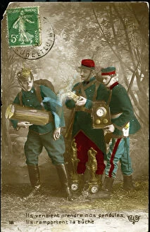
First World War: France, Comedy patriotic map showing the German soldier leaving the clocks
LUX4737553 First World War: France, Comedy patriotic map showing the German soldier leaving the clocks and candlesticks flying to pick up a buche


All Professionally Made to Order for Quick Shipping


-

Maps Collection

Maps of France Europe are essential tools for travelers and tourists who want to explore the continent. They provide an overview of the country, its major cities, and its attractions and are show roads, rivers, mountains, lakes, and other natural features that make up the landscape. Additionally, they often include information about local customs and culture as well as points of interest such as museums or monuments, and are be found in bookstores or online in various formats including paper maps or digital versions that can be accessed on mobile devices. With a map of France Europe in hand travelers will have no trouble navigating their way around this beautiful country.
+

Our beautiful pictures are available as Framed Prints, Photos, Wall Art and Photo Gifts

The Maps of France Europe collection is a stunning assortment of wall art and framed prints that showcase the beauty and diversity of France. Our collection features an extensive range of maps, including antique maps dating back to the 16th century, as well as modern-day maps highlighting the country's cities, regions, and landmarks. Each print in our collection has been carefully curated by Media Storehouse to provide customers with a unique glimpse into French history and culture. From detailed depictions of Parisian streets to panoramic views of the Alps, these prints are sure to captivate anyone who loves France or European geography. Whether you're looking for a beautiful piece of artwork for your home or office or want to give someone special a thoughtful gift, Maps of France Europe offers something for everyone. With its high-quality printing techniques and durable framing options, our collection is sure to impress even the most discerning art enthusiasts.
+

What are Maps of France Europe art prints?

Maps of France Europe art prints are high-quality reproductions of vintage and contemporary maps showcasing the geography, topography, and landmarks of France and its neighboring European countries. These prints are perfect for those who love history, travel, or simply appreciate the beauty of cartography. The collection includes a wide range of styles, from antique maps dating back to the 16th century to modern designs featuring vibrant colors and intricate details. Some prints focus on specific regions or cities within France or Europe while others provide an overview of the entire continent. These art prints can be used to decorate any room in your home or office, adding a touch of sophistication and elegance to your space. They also make great gifts for anyone with an interest in geography or history. Whether you're looking for a unique piece to add to your personal collection or want to give someone special a thoughtful gift they'll treasure forever, Maps of France Europe art prints from Media Storehouse are sure to impress.
+

What Maps of France Europe art prints can I buy from Media Storehouse?

We offer a wide range of Maps of France Europe art prints that are perfect for those who love to travel or have an interest in geography. These maps come in various styles and designs, including vintage, antique, and modern versions. You can choose from different sizes and formats such as canvas prints, framed prints, posters or photographic prints. Some popular options include the Antique Map of France by John Speed which dates back to 1626; the Vintage Map of Paris which showcases the city's famous landmarks; and the Modern Map of Europe which highlights all major cities across the continent. Whether you're looking for a decorative piece for your home or office space or want to gift it to someone who loves history or geography- Media Storehouse has got you covered with their vast collection of Maps of France Europe art prints.
+

How do I buy Maps of France Europe art prints?

To buy Maps of France Europe art prints from Media Storehouse, you can browse through our extensive collection of maps and select the ones that interest you. Once you have made your selection, add them to your cart and proceed to checkout. You will be prompted to enter your shipping and payment information before completing the purchase. We offer a variety of sizes for their art prints, so make sure to choose the one that best fits your needs. The maps are printed on high-quality paper using state-of-the-art printing technology, ensuring that they look great in any setting. If you have any questions or concerns about purchasing Maps of France Europe art prints from Media Storehouse, our customer service team is available to assist you. They can provide additional information about the products or help with any issues that may arise during the ordering process.
+

How much do Maps of France Europe art prints cost?

We offer a wide range of Maps of France Europe art prints at varying prices. The cost of these prints depends on several factors such as the size, quality, and type of print you choose. Our standard paper prints are more affordable than our premium canvas or framed options. Additionally, some maps may be more intricate and detailed than others which can also impact the price. We strive to provide high-quality products at reasonable prices for all customers. Our Maps of France Europe art prints make great additions to any home or office decor and are perfect for history buffs or those who love travel. With a variety of sizes and styles available, there is something for everyone's taste and budget. We encourage customers to browse our selection online to find the perfect map print that fits their needs and preferences without breaking the bank.
+

How will my Maps of France Europe art prints be delivered to me?

We take great care in delivering your Maps of France Europe art prints to you. We use high-quality packaging materials to ensure that your artwork arrives in pristine condition. Your print will be carefully rolled and placed inside a sturdy tube for protection during transit. We work with trusted shipping partners who offer reliable delivery services. Once your order has been dispatched, you will receive an email notification with tracking information so that you can monitor the progress of your shipment. Our team is dedicated to providing excellent customer service, and we are always available to answer any questions or concerns you may have about the delivery process. If there are any issues with your order upon arrival, please contact us immediately so that we can resolve them as quickly as possible. You can trust Media Storehouse to deliver your Maps of France Europe art prints safely and efficiently straight to your doorstep.