Fraud Blocker Skip to main content

Home > Europe > France > Paris > Maps

Maps Collection (page 2)

Maps of Paris, France, Europe are invaluable resources for anyone visiting or living in the city

2,413 items

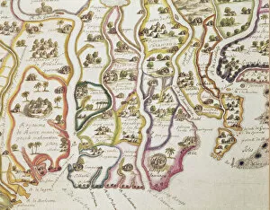
Background imageMaps Collection: Map of the Coast of Africa and the River Gambia, 1622 (coloured engraving)

Map of the Coast of Africa and the River Gambia, 1622 (coloured engraving)
884601 Map of the Coast of Africa and the River Gambia, 1622 (coloured engraving) by French School, (17th century); Bibliotheque Nationale, Paris

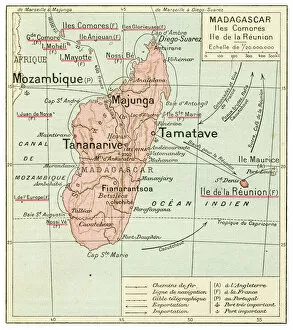
Background imageMaps Collection: Madagascar Comores Islands map 1887

Madagascar Comores Islands map 1887
Map from La Premiere Annee de Geographie par P. Foncin - Paris 1887

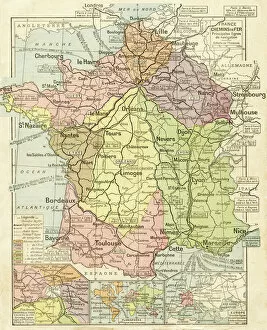
Background imageMaps Collection: France railways system map 1887

France railways system map 1887
Map from La Premiere Annee de Geographie par P. Foncin - Paris 1887

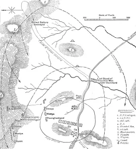
Background imageMaps Collection: Plan of the Battle of Isandhlwana, (Jan. 22, 1879), c1880

Plan of the Battle of Isandhlwana, (Jan. 22, 1879), c1880. From British Battles on Land and Sea, Vol. IV, by James Grant. [Cassell Petter & Galpin, London, Paris & Melbourne, c1880]

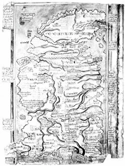
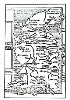
Background imageMaps Collection: MAP OF ENGLAND, c1250. One of the earliest detailed maps of Great Britain extant

MAP OF ENGLAND, c1250. One of the earliest detailed maps of Great Britain extant, drawn about 1250 A.D. by Matthew Paris, artist, historian and monk of St. Albans

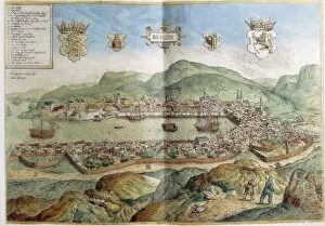
Background imageMaps Collection: Map of Bergen in 16th c. Engraving. FRANCE. Paris

Map of Bergen in 16th c. Engraving. FRANCE. Paris. National Library

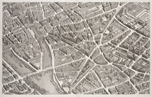
Background imageMaps Collection: View Pont Neuf Left Bank 1739 Plan de Paris commence l annee

View Pont Neuf Left Bank 1739 Plan de Paris commence l annee
View of the Pont Neuf and Left Bank, 1739, Plan de Paris: commence l annee 1734, dessine et grave sous les ordres de messire Michel Etienne Turgot, Marquis de Sousmons

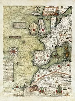
Background imageMaps Collection: CRESQUES, Jafuda (1350-1410); CRESQUES, Abraham

CRESQUES, Jafuda (1350-1410); CRESQUES, Abraham ( -1381). Catalan Atlas. 1375. Third and Fourth Leaves. Map of the world known in the 14th c. (Finisterre and the Mediterranean)

Background imageMaps Collection: CRESQUES, Jafuda (1350-1410); CRESQUES, Abraham

CRESQUES, Jafuda (1350-1410); CRESQUES, Abraham ( -1381). Catalan Atlas. 1375. Third and Fourth Leaves. Map of the world known in the 14th c. (Finisterre and the Mediterranean)

Background imageMaps Collection: Star map using Hebrew characters

Star map using Hebrew characters
Star map. A map of stars with their positions and groupings defined using modified Hebrew characters. This woodcut illustration comes from Curiositez invoyes sur la sculpture talismaique des Persans

Background imageMaps Collection: Map of Magellans round the world voyage, 1519-1521

Map of Magellans round the world voyage, 1519-1521. A Portuguese-born navigator sponsored by Spain, Ferdinand Magellan (c1480-1521)

Background imageMaps Collection: Plan of the harbour, fort, town and environs of Fort Royal in Martinique, 1793 (engraving)

Plan of the harbour, fort, town and environs of Fort Royal in Martinique, 1793 (engraving)
7340437 Plan of the harbour, fort, town and environs of Fort Royal in Martinique, 1793 (engraving) by Booth, William (18th century); 88x70 cm; National Maritime Museum, London

Background imageMaps Collection: Middle course: map of the rail networks of Orleans and the State, c.1880-90 (print)

Middle course: map of the rail networks of Orleans and the State, c.1880-90 (print)
8713434 Middle course: map of the rail networks of Orleans and the State, c.1880-90 (print); 22 x 17 cm; Private Collection; (add.info.: in "Practical method of writing-reading by A)

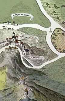
Background imageMaps Collection: Montmartre Abbey, 16th century (engraving)

Montmartre Abbey, 16th century (engraving)
8698354 Montmartre Abbey, 16th century (engraving); (add.info.: Geography. France. Montmartre Abbey in Paris. Map, France, 16th cent.); © Archives Charmet

Background imageMaps Collection: First World War: Patriotic map showing the monument to death under the Arc de Triomphe

First World War: Patriotic map showing the monument to death under the Arc de Triomphe
LUX4745444 First World War: Patriotic map showing the monument to death under the Arc de Triomphe, titled 'Honor and Fatherland'

Background imageMaps Collection: gut9896

gut9896
PCT5618415 gut9896; (add.info.: Crue de la Seine a Paris en janvier 1910 : plan de l'inondation en aglomeration dresse par M. Jules Petit, geometre en chef de la Ville de Paris)

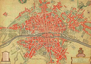
Background imageMaps Collection: 18th century map of Paris, France. (print)

18th century map of Paris, France. (print)
7420032 18th century map of Paris, France. (print); (add.info.: 18th century map of Paris, France with its suburbs and environs.); Photo © Ken Welsh. All rights reserved 2024

Background imageMaps Collection: Cosmographia (Geography) by Ptolemy, 1477 (book)

Cosmographia (Geography) by Ptolemy, 1477 (book)
7415661 Cosmographia (Geography) by Ptolemy, 1477 (book); Bibliotheque Nationale, Paris, France; (add.info.: Claude Ptolemy (c.90-168) Cosmographia (Geography) Printed by Dominicus de Lapis Bologna

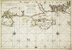
Background imageMaps Collection: Chart of the English Channel and the Atlantic coasts of southern Britain and northern France

Chart of the English Channel and the Atlantic coasts of southern Britain and northern France, 1692 (coloured engraving)
7339354 Chart of the English Channel and the Atlantic coasts of southern Britain and northern France, 1692 (coloured engraving) by Sanson D'Abbeville

Background imageMaps Collection: Map of Paris with fortifications and exterior forts (Vincennes, romainville, Nogent, Nogent), walls

Map of Paris with fortifications and exterior forts (Vincennes, romainville, Nogent, Nogent), walls
ELD4902514 Map of Paris with fortifications and exterior forts (Vincennes, romainville, Nogent, Nogent), walls. 19th century (engraving); Private Collection; Photo © The Holbarn Archive

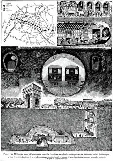
Background imageMaps Collection: Metropolitan tubular railway from Vincennes to the Bois de Boulogne (Parisian metro)

Metropolitan tubular railway from Vincennes to the Bois de Boulogne (Parisian metro) - Elabore project by M
PCT4291518 Metropolitan tubular railway from Vincennes to the Bois de Boulogne (Parisian metro) - Elabore project by M. Berlier for the 1900 exhibition in Paris - map of the route

Background imageMaps Collection: Paris, France, Map depicting the Eiffel Tower illuminated with bright multicolored, 1907

Paris, France, Map depicting the Eiffel Tower illuminated with bright multicolored, 1907
LUX4741910 Paris, France, Map depicting the Eiffel Tower illuminated with bright multicolored, 1907; (add.info.: Paris, France, Map depicting the Eiffel Tower illuminated with bright multicolored)

Background imageMaps Collection: City Plan, Paris, 1700

City Plan, Paris, 1700
2900896 City Plan, Paris, 1700; (add.info.: City Plan, Paris, 1700.); Buyenlarge Archive/UIG

Background imageMaps Collection: Map of Paris, 1300, engraving (1875)

Map of Paris, 1300, engraving (1875)
1758001 Map of Paris, 1300, engraving (1875); (add.info.: Map of Paris, 1300, engraving (1875)); Photo: Tallandier

Background imageMaps Collection: 5th map of Paris at time of with layout by Charles V (1356-1383), engraving

5th map of Paris at time of with layout by Charles V (1356-1383), engraving
1757999 5th map of Paris at time of with layout by Charles V (1356-1383), engraving; (add.info.: 5th map of Paris at time of with layout by Charles V (1356-1383), engraving); Photo: Tallandier

Background imageMaps Collection: Presentation to the king of France Louis XIV of the map of Royal Hotel of the Invalides, engraving

Presentation to the king of France Louis XIV of the map of Royal Hotel of the Invalides, engraving
1749853 Presentation to the king of France Louis XIV of the map of Royal Hotel of the Invalides, engraving. It was built from 1670 in Paris by Liberal Bruant then Jules Hardouin Mansart

Background imageMaps Collection: Cartouche with a dedication to Cardinal Richelieu (1585-1642)

Cartouche with a dedication to Cardinal Richelieu (1585-1642), and a map of the Low Countries at the time of the Thirty
CHT191867 Cartouche with a dedication to Cardinal Richelieu (1585-1642), and a map of the Low Countries at the time of the Thirty Years war (1618-48)

Background imageMaps Collection: Mediaeval Paris (litho)

Mediaeval Paris (litho)
8652505 Mediaeval Paris (litho) by Bartholomew, John George (1860-1920) ; Private Collection; (add.info.: Mediaeval Paris)

Background imageMaps Collection: Plan of Paris from 1422-1589, 19th century (engraving)

Plan of Paris from 1422-1589, 19th century (engraving)
5942942 Plan of Paris from 1422-1589, 19th century (engraving); Private Collection; (add.info.: Plan of Paris from the beginning of the regne of Charles VII (1422)

Background imageMaps Collection: Admiral in the French Navy, 1844 (print)

Admiral in the French Navy, 1844 (print)
5912650 Admiral in the French Navy, 1844 (print); (add.info.: Uniform of an admiral or amiral in the French Navy, 1844. Handcoloured woodblock print by Pauquet after Andre Castan from Eugene Panini's)

Background imageMaps Collection: A map of 13th-century Britain by Matthew Paris. Matthew Paris (1200-1259) a Benedictine monk

A map of 13th-century Britain by Matthew Paris. Matthew Paris (1200-1259) a Benedictine monk, English chronicler
5312352 A map of 13th-century Britain by Matthew Paris. Matthew Paris (1200-1259) a Benedictine monk, English chronicler, artist and cartographer, 13th century; Universal History Archive/UIG

Background imageMaps Collection: Map of the railway from Paris to Saint Germain by Perrot. Benoit Paul Emile CLAPEYRON (1799-1864)

Map of the railway from Paris to Saint Germain by Perrot. Benoit Paul Emile CLAPEYRON (1799-1864)
XEE5028713 Map of the railway from Paris to Saint Germain by Perrot. Benoit Paul Emile CLAPEYRON (1799-1864) He was one of the main promoters of the railway from Paris to Saint-Germain; (add.info)

Background imageMaps Collection: Patriotic map showing France with an olive branch thinking of the statue of the triumph arch

Patriotic map showing France with an olive branch thinking of the statue of the triumph arch representing
LUX4743873 Patriotic map showing France with an olive branch thinking of the statue of the triumph arch representing the Marseillaise and titled France has its victorious heros

Background imageMaps Collection: Allegory of the British Empire as the Colossus of Rhodes, 19th century

Allegory of the British Empire as the Colossus of Rhodes, 19th century
CUL4940269 Allegory of the British Empire as the Colossus of Rhodes, 19th century; (add.info.: Il Colosso di Rodi. Allegory of the British Empire as the 'Colossus of Rhodes" monitoring)

Background imageMaps Collection: Letter F, G, H and I. Engraving (Chromolithography - Chromo) in ' Le grand alphabet de Bebe'

Letter F, G, H and I. Engraving (Chromolithography - Chromo) in " Le grand alphabet de Bebe"
DUV4210181 Letter F, G, H and I. Engraving (Chromolithography - Chromo) in " Le grand alphabet de Bebe". Paul Bernardin, bookseller-publisher, Paris, circa 1900. Bibliotheque des Bebes

Background imageMaps Collection: Muhammad al-Idrisi. Paris transcript of V-4. The map displays: the northern shoreline of Marmara Sea

Muhammad al-Idrisi. Paris transcript of V-4. The map displays: the northern shoreline of Marmara Sea
529625 Muhammad al-Idrisi. Paris transcript of V-4. The map displays: the northern shoreline of Marmara Sea, Gallipoli Peninsula

Background imageMaps Collection: Map of the Theatre des Champs Elysees in Paris built in 1913 by Auguste Perret

Map of the Theatre des Champs Elysees in Paris built in 1913 by Auguste Perret
1759791 Map of the Theatre des Champs Elysees in Paris built in 1913 by Auguste Perret; (add.info.: Map of the Theatre des Champs Elysees in Paris built in 1913 by Auguste Perret); Photo: Tallandier

Background imageMaps Collection: Map Port-Royal monastery in Paris founded in 1625 , map dating 17th century at the time of

Map Port-Royal monastery in Paris founded in 1625 , map dating 17th century at the time of the building
1747449 Map Port-Royal monastery in Paris founded in 1625 , map dating 17th century at the time of the building; (add.info.: Map Port-Royal monastery in Paris founded in 1625)

Background imageMaps Collection: Map of Paris by Turgot, 1734 : with Cite island on Seine river, engraving

Map of Paris by Turgot, 1734 : with Cite island on Seine river, engraving
1747341 Map of Paris by Turgot, 1734 : with Cite island on Seine river, engraving; (add.info.: Map of Paris by Turgot, 1734 : with Cite island on Seine river, engraving); Photo: Tallandier

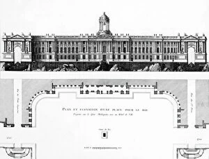
Background imageMaps Collection: project of square and town hall on Malaquet bank along the Seine river in Paris

project of square and town hall on Malaquet bank along the Seine river in Paris, map by architect Patte 18th century
1749414 project of square and town hall on Malaquet bank along the Seine river in Paris, map by architect Patte 18th century; (add.info)

Background imageMaps Collection: Map of the new Royal Palace, Paris, c.1742 (engraving)

Map of the new Royal Palace, Paris, c.1742 (engraving)
1968557 Map of the new Royal Palace, Paris, c.1742 (engraving); Musee de la Ville de Paris, Musee Carnavalet, Paris, France; (add.info.: Plan of the new Royal Palace (development of the gardens)

Background imageMaps Collection: Map of the march of emperor Napoleon 1st towards Paris when he came back from Elbe island in march

Map of the march of emperor Napoleon 1st towards Paris when he came back from Elbe island in march 1815
1754274 Map of the march of emperor Napoleon 1st towards Paris when he came back from Elbe island in march 1815; (add.info)

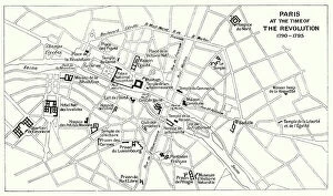
Background imageMaps Collection: Paris at the Time of the Revolution, 1790-1795 (litho)

Paris at the Time of the Revolution, 1790-1795 (litho)
8652504 Paris at the Time of the Revolution, 1790-1795 (litho) by Bartholomew, John George (1860-1920) ; Private Collection; (add.info.: Paris at the Time of the Revolution, 1790-1795)

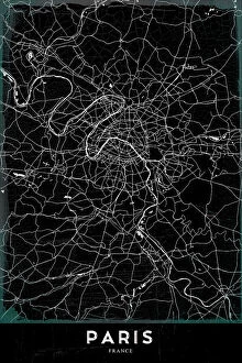
Background imageMaps Collection: PARIS

PARIS
StudioSix

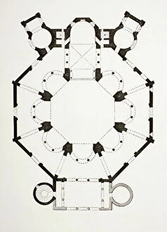
Background imageMaps Collection: Floor Plan Of The 6Th Century Byzantine San Vitale Church In Ravenna, Italy

Floor Plan Of The 6Th Century Byzantine San Vitale Church In Ravenna, Italy
UIG5420216 Floor Plan Of The 6Th Century Byzantine San Vitale Church In Ravenna, Italy. From Les Artes Au Moyen Age, Published Paris 1873 ©UIG/Leemage

Background imageMaps Collection: Chart of the English coast, Isle of Wight and Portsmouth harbour, 1693 (coloured engraving)

Chart of the English coast, Isle of Wight and Portsmouth harbour, 1693 (coloured engraving)
7339372 Chart of the English coast, Isle of Wight and Portsmouth harbour, 1693 (coloured engraving) by Jaillot, Alexis-Hubert (1632-1712); 64x97 cm; National Maritime Museum, London

Background imageMaps Collection: Chart of western Europe showing Paris meridian as the Prime, 1771 (coloured engraving)

Chart of western Europe showing Paris meridian as the Prime, 1771 (coloured engraving)
7339416 Chart of western Europe showing Paris meridian as the Prime, 1771 (coloured engraving) by Bellin, Jacques Nicolas (1703-72) ; 62x78 cm; National Maritime Museum, London

Background imageMaps Collection: Map of the Isle of Bourbon prepared at the depository of maps and seacharts

Map of the Isle of Bourbon prepared at the depository of maps and seacharts, 1763 (coloured engraving)
7339382 Map of the Isle of Bourbon prepared at the depository of maps and seacharts, 1763 (coloured engraving) by Bellin, Jacques Nicolas (1703-72) ; 67x77 cm; National Maritime Museum, London


All Professionally Made to Order for Quick Shipping


-

Maps Collection

Maps of Paris, France, Europe are invaluable resources for anyone visiting or living in the city. They provide an overview of the city's layout, including its streets and landmarks. They also show public transportation routes and stations, as well as points of interest such as parks and museums. Many it also include information about nearby cities and towns, allowing visitors to plan day trips outside the city limits. Additionally they can help visitors find their way around Paris more easily by providing detailed directions from one point to another. With a map in hand, travelers can explore all that Paris has to offer with confidence.
+

Our beautiful pictures are available as Framed Prints, Photos, Wall Art and Photo Gifts

The Maps of Paris France Europe collection from Media Storehouse is a stunning assortment of wall art, framed prints, photo prints, canvas prints, jigsaw puzzles and greeting cards that capture the beauty and history of Paris. Our collection features a wide range of maps depicting different eras in the city's rich cultural heritage. From antique maps dating back to the 18th century to modern-day street maps highlighting popular landmarks such as the Eiffel Tower and Notre-Dame Cathedral, our collection offers something for everyone. Each piece in our collection is carefully crafted using high-quality materials to ensure long-lasting durability and vibrant colors that will stand out on any wall. Whether you're looking for a unique gift or want to add some French charm to your home or office decor, these beautiful pieces are sure to impress. With so many options available at affordable prices, it's easy to find exactly what you need from this impressive selection of artwork.
+

What are Maps of Paris France Europe art prints?

Maps of Paris France Europe art prints are beautiful and detailed depictions of the city of Paris, France, and its surrounding regions. These maps showcase the intricate layout of streets, landmarks, and buildings throughout the area. They are often created using a combination of traditional cartography techniques and modern design elements to produce an aesthetically pleasing representation. These art prints serve as both decorative pieces for your home or office space as well as educational tools for those interested in geography or history. They can be used to plan trips to Paris or simply admired for their artistic value. Maps of Paris France Europe art prints come in various sizes and styles, ranging from vintage designs that capture the essence of old-world charm to contemporary interpretations that reflect modern-day trends. Regardless of your personal style preferences, there is sure to be a map print that will suit your tastes perfectly.
+

What Maps of Paris France Europe art prints can I buy from Media Storehouse?

We offer a wide range of Maps of Paris, France and Europe art prints that are perfect for home decor or as gifts. These maps come in various sizes and styles to suit your preferences. You can choose from vintage-style maps that showcase the intricate details of the city's streets, landmarks, and neighborhoods, or modern designs that highlight its vibrant culture and history. Some popular options include detailed street maps of Paris with iconic landmarks such as the Eiffel Tower, Notre Dame Cathedral, and Arc de Triomphe highlighted. There are also antique-style world maps featuring Europe prominently along with other continents. Media Storehouse also offers panoramic views of Paris' skyline at different times of day including sunrise or sunset which make great wall art pieces for any room in your home. Whether you're looking for something classic or contemporary, we have a vast collection of Maps of Paris France Europe art prints to choose from.
+

How do I buy Maps of Paris France Europe art prints?

To buy Maps of Paris France Europe art prints from Media Storehouse, you can browse our extensive collection of maps and select the one that best suits your preferences. Once you have found the map you want to purchase, simply add it to your cart and proceed to checkout. You will be prompted to enter your shipping information and payment details before finalizing your order. We offer a variety of sizes for their art prints, so make sure to choose the size that fits your needs. We also offer different framing options if you prefer a framed print. If you have any questions or concerns about purchasing Maps of Paris France Europe art prints from Media Storehouse, they have a customer service team available to assist you. Simply reach out via email or phone and they will be happy to help guide you through the process.
+

How much do Maps of Paris France Europe art prints cost?

We offer a wide range of Maps of Paris France Europe art prints, which vary in price depending on the size and type of print. The cost for these prints can be affected by factors such as the quality of paper or canvas used, the printing method employed, and any additional features that may be included with the print. However, it is important to note that Media Storehouse strives to offer affordable prices for all their products while maintaining high-quality standards. You can expect reasonable pricing options for Maps of Paris France Europe art prints without compromising on quality. Whether you are looking for vintage maps or contemporary designs, we have something to suit every taste and budget. With a vast collection available online, you can easily browse through different options before making their purchase decision.
+

How will my Maps of Paris France Europe art prints be delivered to me?

We take great care in ensuring that your Maps of Paris France Europe art prints are delivered to you safely and securely. We use high-quality packaging materials to protect your print during transit, so it arrives at your doorstep in pristine condition. Your print will be carefully rolled and placed inside a protective tube before being shipped out to you. This ensures that the print is not damaged or creased during shipping. Additionally, we work with trusted courier services to ensure timely delivery of your order. Once your package has been dispatched, you will receive a tracking number via email which allows you to track the progress of your shipment online. If for any reason there are issues with the delivery of your order, our customer service team is always available to assist you. We hope that receiving your Maps of Paris France Europe art prints brings joy and inspiration into your home or office space.