Fraud Blocker Skip to main content

Home > Europe > France > Paris > Maps

Maps Collection (page 3)

Maps of Paris, France, Europe are invaluable resources for anyone visiting or living in the city

2,413 items

Background imageMaps Collection: Map of the city of Paris from Jules Cesar to the regne of Clovis, 19th century (engraving)

Map of the city of Paris from Jules Cesar to the regne of Clovis, 19th century (engraving)
5942890 Map of the city of Paris from Jules Cesar to the regne of Clovis, 19th century (engraving); Private Collection; (add.info)

Background imageMaps Collection: A map of 13th-century Britain by Matthew Paris. Matthew Paris (1200-1259) a Benedictine monk

A map of 13th-century Britain by Matthew Paris. Matthew Paris (1200-1259) a Benedictine monk, English chronicler
5312350 A map of 13th-century Britain by Matthew Paris. Matthew Paris (1200-1259) a Benedictine monk, English chronicler, artist and cartographer, 13th century; Universal History Archive/UIG

Background imageMaps Collection: BRAUN, George (1541-1622). ORTELIUS, Abraham (1527-1598). HOGENBERG, Franz (1535-1590)

BRAUN, George (1541-1622). ORTELIUS, Abraham (1527-1598). HOGENBERG, Franz (1535-1590)
CUL4853482 BRAUN, George (1541-1622). ORTELIUS, Abraham (1527-1598). HOGENBERG, Franz (1535-1590). Civitatis Orbis Terrarum (Theatrum orbis terrarum). 1572-1617. Paris (1572). Volume I. Etching

Background imageMaps Collection: Map of North American territories (from the polar circle to Central America)

Map of North American territories (from the polar circle to Central America) on the eve of the American revolution
NWI4852058 Map of North American territories (from the polar circle to Central America) on the eve of the American revolution, during the Paris trade in 1783

Background imageMaps Collection: First World War: France, Patriotic Map Showing Hairy Permission in Paris Fun with Women of Little

First World War: France, Patriotic Map Showing Hairy Permission in Paris Fun with Women of Little Virtue, 1915
LUX4739457 First World War: France, Patriotic Map Showing Hairy Permission in Paris Fun with Women of Little Virtue, 1915; (add.info)

Background imageMaps Collection: World War I - War 14-18 (1914-1918) - World War I (WWI or WW1)

World War I - War 14-18 (1914-1918) - World War I (WWI or WW1): Patriotic map showing the republic of deguises as a
LUX4744587 World War I - War 14-18 (1914-1918) - World War I (WWI or WW1): Patriotic map showing the republic of deguises as a dragon promising the recovery of Alsace and Lorraine

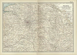
Background imageMaps Collection: Map of France, c.1900 (engraving)

Map of France, c.1900 (engraving)
532949 Map of France, c.1900 (engraving); (add.info.: Map of north central France, in the vicinity of Paris, circa 1902, from the 10th edition of Encyclopaedia Britannica)

Background imageMaps Collection: 19th Century Map of Paris with the River Seine depicted

19th Century Map of Paris with the River Seine depicted
1578945 19th Century Map of Paris with the River Seine depicted; (add.info.: 19th Century Map of Paris with the River Seine depicted. Dated 1880); Universal History Archive/UIG

Background imageMaps Collection: Map of Paris in 1540 with Philippe-Auguste wall, 19th century (engraving)

Map of Paris in 1540 with Philippe-Auguste wall, 19th century (engraving)
1801358 Map of Paris in 1540 with Philippe-Auguste wall, 19th century (engraving); (add.info.: Map of Paris in 1540 : wee see the Philippe-Auguste wall, measuring 5km long and 10m high)

Background imageMaps Collection: Map of the north western coast of Africa, from the Strait of Gibraltar to the Canary Islands

Map of the north western coast of Africa, from the Strait of Gibraltar to the Canary Islands, 1753 (engraving)
7339418 Map of the north western coast of Africa, from the Strait of Gibraltar to the Canary Islands, 1753 (engraving) by Bellin, Jacques Nicolas (1703-72) ; 63.5x93.5 cm; National Maritime Museum

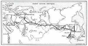
Background imageMaps Collection: Route of Trans - Siberian Railway

Route of Trans - Siberian Railway
2603882 Route of Trans - Siberian Railway; (add.info.: The route of the Trans - Siberian Railway. From "La Nature", Paris, 1904. Engraving)

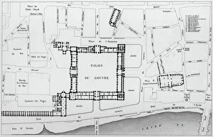
Background imageMaps Collection: Map of the Louvre area in 1836 in Paris : c : the Louvre palace, engraving by Dufour after Hoffbauer

Map of the Louvre area in 1836 in Paris : c : the Louvre palace, engraving by Dufour after Hoffbauer
1760479 Map of the Louvre area in 1836 in Paris : c : the Louvre palace, engraving by Dufour after Hoffbauer; (add.info.: Map of the Louvre area in 1836 in Paris : c : the Louvre palace)

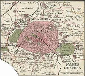
Background imageMaps Collection: Map of Paris, c.1900 (engraving)

Map of Paris, c.1900 (engraving)
532819 Map of Paris, c.1900 (engraving); (add.info.: Map of Paris, circa 1900, from the 10th edition of Encyclopaedia Britannica.); Encyclopaedia Britannica/UIG

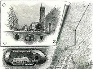
Background imageMaps Collection: First tubular tramway project in Paris (underground electric railway between Vincennes)

First tubular tramway project in Paris (underground electric railway between Vincennes and Bois de Boulogne)
PCT4293716 First tubular tramway project in Paris (underground electric railway between Vincennes and Bois de Boulogne) - map of the route - cut under the rue de Rivoli showing the tunnel

Background imageMaps Collection: Floor Plan Of The 13Th Century Ogive Style Notre Dame Cathedral In Rouen

Floor Plan Of The 13Th Century Ogive Style Notre Dame Cathedral In Rouen, France From Les Artes Au Moyen Age
UIG5420223 Floor Plan Of The 13Th Century Ogive Style Notre Dame Cathedral In Rouen, France From Les Artes Au Moyen Age, Published Paris 1873 ©UIG/Leemage

Background imageMaps Collection: 4th map of Paris at time of Philippe Auguste (1165-1223), engraving

4th map of Paris at time of Philippe Auguste (1165-1223), engraving
1758000 4th map of Paris at time of Philippe Auguste (1165-1223), engraving; (add.info.: 4th map of Paris at time of Philippe Auguste (1165-1223), engraving); Photo: Tallandier

Background imageMaps Collection: Map of the march of emperor Napoleon 1st towards Paris when he came back from Elbe island in march

Map of the march of emperor Napoleon 1st towards Paris when he came back from Elbe island in march 1815
1754553 Map of the march of emperor Napoleon 1st towards Paris when he came back from Elbe island in march 1815; (add.info)

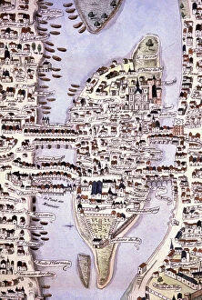
Background imageMaps Collection: Island of the City map, Paris, c.1540 (engraving)

Island of the City map, Paris, c.1540 (engraving)
1801425 Island of the City map, Paris, c.1540 (engraving); (add.info.: Paris. L'ile de la Cite, Notre Dame, la seine. Coll. Part.); Photo © CCI

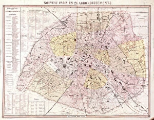
Background imageMaps Collection: Map of Paris at the time of the Second Empire (1852-1870) after 1860

Map of Paris at the time of the Second Empire (1852-1870) after 1860
1748983 Map of Paris at the time of the Second Empire (1852-1870) after 1860; (add.info.: Map of Paris at the time of the Second Empire (1852-1870) after 1860); Photo: Tallandier

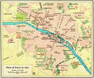
Background imageMaps Collection: Plan of Paris, France in 1789. From Historical Atlas, published 1923 (print)

Plan of Paris, France in 1789. From Historical Atlas, published 1923 (print)
2603517 Plan of Paris, France in 1789. From Historical Atlas, published 1923 (print)

Background imageMaps Collection: Map of Paris metro lines. in 'Plan de Paris en 12 coupures', Hachette, Paris, 1920

Map of Paris metro lines. in "Plan de Paris en 12 coupures", Hachette, Paris, 1920
LSE4323107 Map of Paris metro lines. in "Plan de Paris en 12 coupures", Hachette, Paris, 1920. by French School, (20th century); Private Collection; (add.info.: Map of Paris metro lines)

Background imageMaps Collection: map of Paris in 1611: the ramparts of the city, in the center the City Island and the river Seine

map of Paris in 1611: the ramparts of the city, in the center the City Island and the river Seine
1750307 map of Paris in 1611: the ramparts of the city, in the center the City Island and the river Seine, in the background are the mills

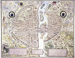
Background imageMaps Collection: Plan of Paris in 1576, with the enclosure of Philip Augustus

Plan of Paris in 1576, with the enclosure of Philip Augustus and the fortification walls of Charles V. 1576 (Engraving)
LRI4676690 Plan of Paris in 1576, with the enclosure of Philip Augustus and the fortification walls of Charles V. 1576 (Engraving); Musee de la Ville de Paris, Musee Carnavalet, Paris

Background imageMaps Collection: The Moluccas, page from a portolan atlas by Lopo Homem and Pedro Reinel, c.1519 (vellum)

The Moluccas, page from a portolan atlas by Lopo Homem and Pedro Reinel, c.1519 (vellum)
XZL151165 The Moluccas, page from a portolan atlas by Lopo Homem and Pedro Reinel, c.1519 (vellum); Bibliotheque Nationale, Paris, France; out of copyright

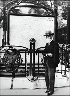
Background imageMaps Collection: Mr. Fulgence Bienvenue to Paris, around 1930

Mr. Fulgence Bienvenue to Paris, around 1930
LSE4402893 Mr. Fulgence Bienvenue to Paris, around 1930.; Private Collection; (add.info.: Mr. Fulgence Bienvenue (1851-1936) to Paris, around 1930.); Photo © Leonard de Selva

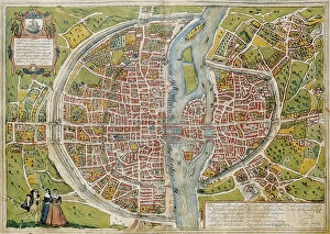
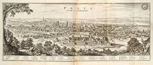
Background imageMaps Collection: Paris. From Topographia Galliae , 1655-1660. Creator: Merian, Caspar (1627-1686)

Paris. From Topographia Galliae , 1655-1660. Creator: Merian, Caspar (1627-1686)
Paris. From Topographia Galliae , 1655-1660. Private Collection

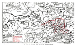
Background imageMaps Collection: Le Theatre de l'epopee de Verdun; Le champ de bataille du 21 fevrier au decembre 1916, 1916

Le Theatre de l'epopee de Verdun; Le champ de bataille du 21 fevrier au decembre 1916, 1916. Creator: Unknown
Le Theatre de l'epopee de Verdun; Le champ de bataille du 21 fevrier au decembre 1916, 1916. From "L'Album de la Guerre 1914-1919, Volume 1" [L'Illustration, Paris, 1924]

Background imageMaps Collection: Model of a Battlefield; On the eve of the attack of June 7, 1917...1917 Creator: Unknown

Model of a Battlefield; On the eve of the attack of June 7, 1917...1917 Creator: Unknown
Model of a Battlefield; On the eve of the attack of June 7, 1917, on the German side of Wytschaete-Messines, Australians of the Plumer army study a huge map in relief, made in cement

Background imageMaps Collection: Le Champ de Bataille de L'Italie; mouvement des operations Italiennes jusqu'a la fin... 1917

Le Champ de Bataille de L'Italie; mouvement des operations Italiennes jusqu'a la fin... 1917. Creator: Unknown
Le Champ de Bataille de L'Italie; mouvement des operations Italiennes jusqu'a la fin de l'annee 1917, 1917. First World War

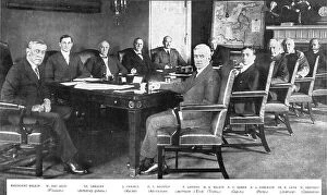
Background imageMaps Collection: Les collaborateurs du president Wilson; Le president Wilson et ses ministres, 1917. Creator: Unknown

Les collaborateurs du president Wilson; Le president Wilson et ses ministres, 1917. Creator: Unknown
Les collaborateurs du president Wilson; Le president Wilson et ses ministres, 1917. President Wilson and his ministers. From "L'Album de la Guerre 1914-1919, Volume 1" [L'Illustration

Background imageMaps Collection: Le Theatre de Notre Offensive de la Somme; Nos progres et le developpement de la bataille du 1er

Le Theatre de Notre Offensive de la Somme; Nos progres et le developpement de la bataille du 1er ju Creator: Unknown
Le Theatre de Notre Offensive de la Somme; Nos progres et le developpement de la bataille du 1er juillet au mois d'octobre 1916, 1916

Background imageMaps Collection: Le grand effort ennemi de la Derniere Annee, 1918. Creator: Unknown

Le grand effort ennemi de la Derniere Annee, 1918. Creator: Unknown
Le grand effort ennemi de la Derniere Annee, 1918. From "L'Album de la Guerre 1914-1919, Volume 2" [L'Illustration, Paris, 1924]

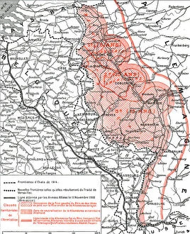
Background imageMaps Collection: L'Execution de L'Armistice; Les territoires que rendit ou livra aux allies la defaite... 1918

L'Execution de L'Armistice; Les territoires que rendit ou livra aux allies la defaite... 1918
L'Execution de L'Armistice; Les territoires que rendit ou livra aux allies la defaite allemande, 1918. From "L'Album de la Guerre 1914-1919, Volume 2" [L'Illustration, Paris, 1924]

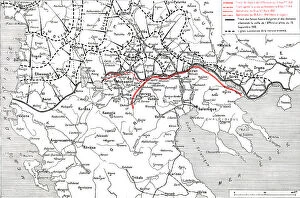
Background imageMaps Collection: 'Le Front D'Orient, de L'Adriatique a L'Egee; Le developpement des operations... 1918

'Le Front D'Orient, de L'Adriatique a L'Egee; Le developpement des operations... 1918. Creator: Unknown
'Le Front D'Orient, de L'Adriatique a L'Egee; Le developpement des operations, de Septembre 1916 A Octobre 1918, 1918. From "L'Album de la Guerre 1914-1919, Volume 2" [L'Illustration

Background imageMaps Collection: Sketch Map of the Theatre of War in Ashanti, 1900, c1900. Creator: Unknown

Sketch Map of the Theatre of War in Ashanti, 1900, c1900. Creator: Unknown
Sketch Map of the Theatre of War in Ashanti, 1900, c1900. Showing Hodgson's line of retreat, line of advance, friendly towns, rivers, roads and sites of battles

Background imageMaps Collection: Diagram Showing Positions of the Troops in South Africa, 31st January 1900, (c1900)

Diagram Showing Positions of the Troops in South Africa, 31st January 1900, (c1900). Creator: Unknown
Diagram Showing Positions of the Troops in South Africa, 31st January 1900, (c1900). Boer Wars. Map showing lines of communication and the positions of the British and the Boers

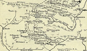
Background imageMaps Collection: Map of the Tirah Campaign, c1900. Creator: Unknown

Map of the Tirah Campaign, c1900. Creator: Unknown
Map of the Tirah Campaign, c1900. The Tirah expedition was an Indian frontier campaign from September 1897 to April 1898. Tirah is a mountainous tract of country in what was formally known as

Background imageMaps Collection: The World at the Beginning of the 20th Century Showing British Possessions, c1900

The World at the Beginning of the 20th Century Showing British Possessions, c1900. Creator: Artists Illustrators Ltd
The World at the Beginning of the 20th Century Showing British Possessions [in pink], c1900. From "Cassell's History of England, Vol. IX"

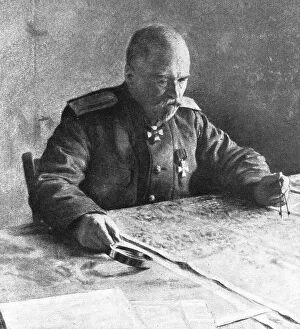
Background imageMaps Collection: 'L'offensive russe; Le general Sakharoff, 1916 (1924) Creator: Unknown

'L'offensive russe; Le general Sakharoff, 1916 (1924) Creator: Unknown
'L'offensive russe; Le general Sakharoff, 1916. From "L'Album de la Guerre 1914-1919, Volume I" [L'Illustration, Paris, 1924]

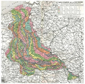
Background imageMaps Collection: Les Etapes de la Victoire. Du 1er juillet au 11 novembre 1918 (Armistice). Reduction de la

Les Etapes de la Victoire. Du 1er juillet au 11 novembre 1918 (Armistice). Reduction de la... 1918 Creator: Unknown
Les Etapes de la Victoire. Du 1er juillet au 11 novembre 1918 (Armistice). Reduction de la carte d'Etat-major placee dans le cabinet de travail du marechal Foch, a son quartier general de Senlis

Background imageMaps Collection: Nouveau plan de Paris (Map of Paris showing illustrations, streets, main monuments, and... 1817)

Nouveau plan de Paris (Map of Paris showing illustrations, streets, main monuments, and... 1817. Creator: Anonymous)
Nouveau plan de Paris (Map of Paris showing illustrations, streets, main monuments, and public buildings), 1817. Private Collection

Background imageMaps Collection: Plan de Paris, 1890. Offert par l'Hôtel Moderne, Place de la République, Paris, 1890

Plan de Paris, 1890. Offert par l'Hôtel Moderne, Place de la République, Paris, 1890. Creator: Anonymous
Plan de Paris, 1890. Offert par l'Hotel Moderne, Place de la Republique, Paris, 1890. Private Collection

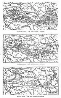
Background imageMaps Collection: 'Les Jours decisifs de la Marne; 8, 9, 10 septembre, 1914. Creator: Unknown

'Les Jours decisifs de la Marne; 8, 9, 10 septembre, 1914. Creator: Unknown
'Les Jours decisifs de la Marne; 8, 9, 10 septembre, 1914. From "L'Album de la Guerre 1914-1919: Volume I". [L'Illustration, Paris, 1926]

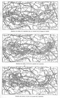
Background imageMaps Collection: 'Les Jours decisifs de la Marne; 5, 6, 7, septembre, 1914. Creator: Unknown

'Les Jours decisifs de la Marne; 5, 6, 7, septembre, 1914. Creator: Unknown
'Les Jours decisifs de la Marne; 5, 6, 7 septembre, 1914. From "L'Album de la Guerre 1914-1919: Volume I". [L'Illustration, Paris, 1926]

Background imageMaps Collection: 'L'Ultimatum a la Serbie; Le President du conseil des ministres de Serbie, M Pachitch, 1914

'L'Ultimatum a la Serbie; Le President du conseil des ministres de Serbie, M Pachitch, 1914. Creator: Unknown
'L'Ultimatum a la Serbie; Le President du conseil des ministres de Serbie, M Pachitch, 1914. From "L'Album de la Guerre 1914-1919, Volume I" [L'Illustration, Paris, 1924]

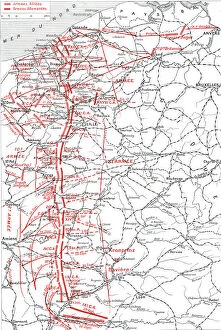
Background imageMaps Collection: 'La Course a la Mer; Les positions successives des armes alliees, du septembre au 17 october

'La Course a la Mer; Les positions successives des armes alliees, du septembre au 17 october, 1914 Creator: Unknown
'La Course a la Mer; Les positions successives des armes alliees, du septembre au 17 october, 1914. From "L'Album de la Guerre 1914-1919: Volume I". [L'Illustration, Paris, 1926]

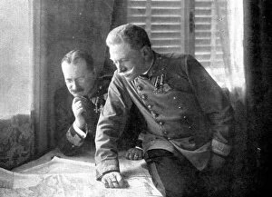
Background imageMaps Collection: 'Les Premiers coups de canon; Le General Conrad de Hotzendorf, 1914. Creator:s Chernov

'Les Premiers coups de canon; Le General Conrad de Hotzendorf, 1914. Creator:s Chernov
'Les Premiers coups de canon; Le General Conrad de Hotzendorf, 1914. From "L'Album de la Guerre 1914-1919, Volume I" [L'Illustration, Paris, 1924]

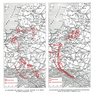
Background imageMaps Collection: 'Les operations du front oriental, 1914. Creator: Unknown

'Les operations du front oriental, 1914. Creator: Unknown
'Les operations du front oriental, 1914. From "L'Album de la Guerre 1914-1919: Volume I". [L'Illustration, Paris, 1926]


All Professionally Made to Order for Quick Shipping


-

Maps Collection

Maps of Paris, France, Europe are invaluable resources for anyone visiting or living in the city. They provide an overview of the city's layout, including its streets and landmarks. They also show public transportation routes and stations, as well as points of interest such as parks and museums. Many it also include information about nearby cities and towns, allowing visitors to plan day trips outside the city limits. Additionally they can help visitors find their way around Paris more easily by providing detailed directions from one point to another. With a map in hand, travelers can explore all that Paris has to offer with confidence.
+

Our beautiful pictures are available as Framed Prints, Photos, Wall Art and Photo Gifts

The Maps of Paris France Europe collection from Media Storehouse is a stunning assortment of wall art, framed prints, photo prints, canvas prints, jigsaw puzzles and greeting cards that capture the beauty and history of Paris. Our collection features a wide range of maps depicting different eras in the city's rich cultural heritage. From antique maps dating back to the 18th century to modern-day street maps highlighting popular landmarks such as the Eiffel Tower and Notre-Dame Cathedral, our collection offers something for everyone. Each piece in our collection is carefully crafted using high-quality materials to ensure long-lasting durability and vibrant colors that will stand out on any wall. Whether you're looking for a unique gift or want to add some French charm to your home or office decor, these beautiful pieces are sure to impress. With so many options available at affordable prices, it's easy to find exactly what you need from this impressive selection of artwork.
+

What are Maps of Paris France Europe art prints?

Maps of Paris France Europe art prints are beautiful and detailed depictions of the city of Paris, France, and its surrounding regions. These maps showcase the intricate layout of streets, landmarks, and buildings throughout the area. They are often created using a combination of traditional cartography techniques and modern design elements to produce an aesthetically pleasing representation. These art prints serve as both decorative pieces for your home or office space as well as educational tools for those interested in geography or history. They can be used to plan trips to Paris or simply admired for their artistic value. Maps of Paris France Europe art prints come in various sizes and styles, ranging from vintage designs that capture the essence of old-world charm to contemporary interpretations that reflect modern-day trends. Regardless of your personal style preferences, there is sure to be a map print that will suit your tastes perfectly.
+

What Maps of Paris France Europe art prints can I buy from Media Storehouse?

We offer a wide range of Maps of Paris, France and Europe art prints that are perfect for home decor or as gifts. These maps come in various sizes and styles to suit your preferences. You can choose from vintage-style maps that showcase the intricate details of the city's streets, landmarks, and neighborhoods, or modern designs that highlight its vibrant culture and history. Some popular options include detailed street maps of Paris with iconic landmarks such as the Eiffel Tower, Notre Dame Cathedral, and Arc de Triomphe highlighted. There are also antique-style world maps featuring Europe prominently along with other continents. Media Storehouse also offers panoramic views of Paris' skyline at different times of day including sunrise or sunset which make great wall art pieces for any room in your home. Whether you're looking for something classic or contemporary, we have a vast collection of Maps of Paris France Europe art prints to choose from.
+

How do I buy Maps of Paris France Europe art prints?

To buy Maps of Paris France Europe art prints from Media Storehouse, you can browse our extensive collection of maps and select the one that best suits your preferences. Once you have found the map you want to purchase, simply add it to your cart and proceed to checkout. You will be prompted to enter your shipping information and payment details before finalizing your order. We offer a variety of sizes for their art prints, so make sure to choose the size that fits your needs. We also offer different framing options if you prefer a framed print. If you have any questions or concerns about purchasing Maps of Paris France Europe art prints from Media Storehouse, they have a customer service team available to assist you. Simply reach out via email or phone and they will be happy to help guide you through the process.
+

How much do Maps of Paris France Europe art prints cost?

We offer a wide range of Maps of Paris France Europe art prints, which vary in price depending on the size and type of print. The cost for these prints can be affected by factors such as the quality of paper or canvas used, the printing method employed, and any additional features that may be included with the print. However, it is important to note that Media Storehouse strives to offer affordable prices for all their products while maintaining high-quality standards. You can expect reasonable pricing options for Maps of Paris France Europe art prints without compromising on quality. Whether you are looking for vintage maps or contemporary designs, we have something to suit every taste and budget. With a vast collection available online, you can easily browse through different options before making their purchase decision.
+

How will my Maps of Paris France Europe art prints be delivered to me?

We take great care in ensuring that your Maps of Paris France Europe art prints are delivered to you safely and securely. We use high-quality packaging materials to protect your print during transit, so it arrives at your doorstep in pristine condition. Your print will be carefully rolled and placed inside a protective tube before being shipped out to you. This ensures that the print is not damaged or creased during shipping. Additionally, we work with trusted courier services to ensure timely delivery of your order. Once your package has been dispatched, you will receive a tracking number via email which allows you to track the progress of your shipment online. If for any reason there are issues with the delivery of your order, our customer service team is always available to assist you. We hope that receiving your Maps of Paris France Europe art prints brings joy and inspiration into your home or office space.