Fraud Blocker Skip to main content

Home > Europe > France > Paris > Maps

Maps Collection (page 6)

Maps of Paris, France, Europe are invaluable resources for anyone visiting or living in the city

2,429 items

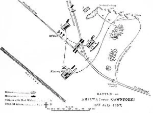
Background imageMaps Collection: Plan of the Battle of Bithoor, c1891. Creator: James Grant

Plan of the Battle of Bithoor, c1891. Creator: James Grant
Plan of the Battle of Bithoor, c1891. From " Cassells Illustrated History of India Vol. II.", by James Grant. [Cassell Petter & Galpin, London, Paris and New York]

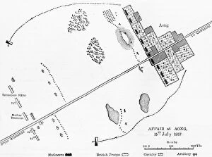
Background imageMaps Collection: Plan of the Affair at Aong, c1891. Creator: James Grant

Plan of the Affair at Aong, c1891. Creator: James Grant
Plan of the Affair at Aong, c1891. From " Cassells Illustrated History of India Vol. II.", by James Grant. [Cassell Petter & Galpin, London, Paris and New York]

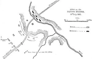
Background imageMaps Collection: Plan of the Affair at Pandoo Nuddee, c1891. Creator: James Grant

Plan of the Affair at Pandoo Nuddee, c1891. Creator: James Grant
Plan of the Affair at Pandoo Nuddee, c1891. From " Cassells Illustrated History of India Vol. II.", by James Grant. [Cassell Petter & Galpin, London, Paris and New York]

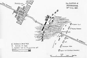
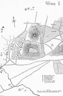
Background imageMaps Collection: Plan of the Battle of Futtehpore, c1891. Creator: James Grant

Plan of the Battle of Futtehpore, c1891. Creator: James Grant
Plan of the Battle of Futtehpore, c1891. From " Cassells Illustrated History of India Vol. II.", by James Grant. [Cassell Petter & Galpin, London, Paris and New York]

Background imageMaps Collection: Plan of the Advance on Koreigaum, c1891. Creator: James Grant

Plan of the Advance on Koreigaum, c1891. Creator: James Grant
Plan of the Advance on Koreigaum, c1891. From " Cassells Illustrated History of India Vol. I.", by James Grant. [Cassell Petter & Galpin, London, Paris and New York]

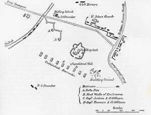
Background imageMaps Collection: Plan of the Entrenchment at Cawnpore, June, 1857, c1891. Creator: James Grant

Plan of the Entrenchment at Cawnpore, June, 1857, c1891. Creator: James Grant
Plan of the Entrenchment at Cawnpore, June, 1857, c1891. From " Cassells Illustrated History of India Vol. II.", by James Grant. [Cassell Petter & Galpin, London, Paris and New York]

Background imageMaps Collection: Plan of the Defence of Seetabuldee Hill, c1891. Creator: James Grant

Plan of the Defence of Seetabuldee Hill, c1891. Creator: James Grant
Plan of the Defence of Seetabuldee Hill, c1891. From " Cassells Illustrated History of India Vol. I.", by James Grant. [Cassell Petter & Galpin, London, Paris and New York]

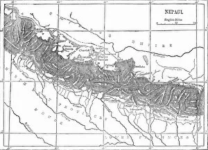
Background imageMaps Collection: Map of Nepaul, c1891. Creator: James Grant

Map of Nepaul, c1891. Creator: James Grant
Map of Nepaul, c1891. From " Cassells Illustrated History of India Vol. I.", by James Grant. [Cassell Petter & Galpin, London, Paris and New York]

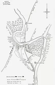
Background imageMaps Collection: Plan of the Battle of Meanee, c1891. Creator: James Grant

Plan of the Battle of Meanee, c1891. Creator: James Grant
Plan of the Battle of Meanee, c1891. From " Cassells Illustrated History of India Vol. II.", by James Grant. [Cassell Petter & Galpin, London, Paris and New York]

Background imageMaps Collection: Map of Afghanistan, c1891. Creator: James Grant

Map of Afghanistan, c1891. Creator: James Grant
Map of Afghanistan, c1891. From " Cassells Illustrated History of India Vol. II.", by James Grant. [Cassell Petter & Galpin, London, Paris and New York]

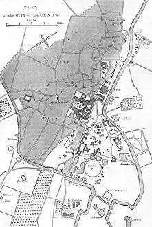
Background imageMaps Collection: Plan of Lucknow, c1891. Creator: James Grant

Plan of Lucknow, c1891. Creator: James Grant
Plan of Lucknow, c1891. From " Cassells Illustrated History of India Vol. II.", by James Grant. [Cassell Petter & Galpin, London, Paris and New York]

Background imageMaps Collection: Plan of the Battle of Sobraon, c1891. Creator: James Grant

Plan of the Battle of Sobraon, c1891. Creator: James Grant
Plan of the Battle of Sobraon, c1891. From " Cassells Illustrated History of India Vol. II.", by James Grant. [Cassell Petter & Galpin, London, Paris and New York]

Background imageMaps Collection: Plan of Cawnpore, c1891. Creator: James Grant

Plan of Cawnpore, c1891. Creator: James Grant
Plan of Cawnpore, c1891. From " Cassells Illustrated History of India Vol. II.", by James Grant. [Cassell Petter & Galpin, London, Paris and New York]

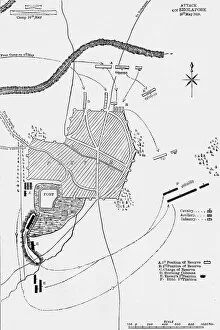
Background imageMaps Collection: Plan of the Attack on Sholapore, c1891. Creator: James Grant

Plan of the Attack on Sholapore, c1891. Creator: James Grant
Plan of the Attack on Sholapore, c1891. From " Cassells Illustrated History of India Vol. I.", by James Grant. [Cassell Petter & Galpin, London, Paris and New York]

Background imageMaps Collection: Plan of British Positions at the First Attack on Koreigaum, c1891. Creator: James Grant

Plan of British Positions at the First Attack on Koreigaum, c1891. Creator: James Grant
Plan of British Positions at the First Attack on Koreigaum, c1891. From " Cassells Illustrated History of India Vol. I.", by James Grant

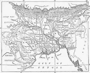
Background imageMaps Collection: Map of Bengal, Behar, and Orissa, c1891. Creator: James Grant

Map of Bengal, Behar, and Orissa, c1891. Creator: James Grant
Map of Bengal, Behar, and Orissa, c1891. From " Cassells Illustrated History of India Vol. I.", by James Grant. [Cassell Petter & Galpin, London, Paris and New York]

Background imageMaps Collection: Map of Ceylon, c1891. Creator: James Grant

Map of Ceylon, c1891. Creator: James Grant
Map of Ceylon, c1891. From " Cassells Illustrated History of India Vol. I.", by James Grant. [Cassell Petter & Galpin, London, Paris and New York]

Background imageMaps Collection: Territory of Calcutta When Attacked by Surajah Dowlah, 1756, c1891. Creator: James Grant

Territory of Calcutta When Attacked by Surajah Dowlah, 1756, c1891. Creator: James Grant
Territory of Calcutta When Attacked by Surajah Dowlah, 1756, c1891. From " Cassells Illustrated History of India Vol. I.", by James Grant

Background imageMaps Collection: Plan of the Battle of Laswaree, c1891. Creator: James Grant

Plan of the Battle of Laswaree, c1891. Creator: James Grant
Plan of the Battle of Laswaree, c1891. From " Cassells Illustrated History of India Vol. I.", by James Grant. [Cassell Petter & Galpin, London, Paris and New York]

Background imageMaps Collection: Map of Presidency of Bombay, c1891. Creator: James Grant

Map of Presidency of Bombay, c1891. Creator: James Grant
Map of Presidency of Bombay, c1891. From " Cassells Illustrated History of India Vol. I.", by James Grant. [Cassell Petter & Galpin, London, Paris and New York]

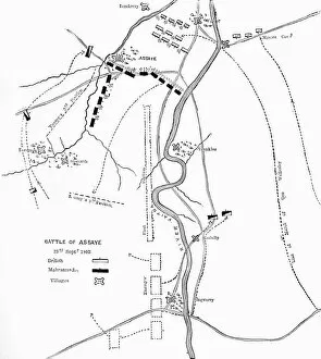
Background imageMaps Collection: Plan of the Battle of Assaye, c1891. Creator: James Grant

Plan of the Battle of Assaye, c1891. Creator: James Grant
Plan of the Battle of Assaye, c1891. From " Cassells Illustrated History of India Vol. I.", by James Grant. [Cassell Petter & Galpin, London, Paris and New York]

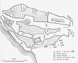
Background imageMaps Collection: Plan of the Attack on Seringapatam, c1891. Creator: James Grant

Plan of the Attack on Seringapatam, c1891. Creator: James Grant
Plan of the Attack on Seringapatam, c1891. From " Cassells Illustrated History of India Vol. I.", by James Grant. [Cassell Petter & Galpin, London, Paris and New York]

Background imageMaps Collection: Map of Oude and the North-West Provinces, c1891. Creator: James Grant

Map of Oude and the North-West Provinces, c1891. Creator: James Grant
Map of Oude and the North-West Provinces, c1891. From " Cassells Illustrated History of India Vol. I.", by James Grant. [Cassell Petter & Galpin, London, Paris and New York]

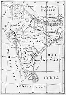
Background imageMaps Collection: Sketch Map of India, c1891. Creator: James Grant

Sketch Map of India, c1891. Creator: James Grant
Sketch Map of India, c1891. From " Cassells Illustrated History of India Vol. I.", by James Grant. [Cassell Petter & Galpin, London, Paris and New York]

Background imageMaps Collection: Map of the Presidency of Madras, c1891. Creator: James Grant

Map of the Presidency of Madras, c1891. Creator: James Grant
Map of the Presidency of Madras, c1891. From " Cassells Illustrated History of India Vol. I.", by James Grant. [Cassell Petter & Galpin, London, Paris and New York]

Background imageMaps Collection: Catalan Atlas, Sheet 10, 1375 (pen with coloured inks on parchment)

Catalan Atlas, Sheet 10, 1375 (pen with coloured inks on parchment)
5054670 Catalan Atlas, Sheet 10, 1375 (pen with coloured inks on parchment) by Cresques, Abraham (1325-87); Bibliotheque Nationale, Paris, France; (add.info.: World map made in Majorca)

Background imageMaps Collection: Geographic map of Gauls showing the borders with Germany and Italy

Geographic map of Gauls showing the borders with Germany and Italy. Realised by cartographer Jean Jolivet (16th century)
JLJ4571925 Geographic map of Gauls showing the borders with Germany and Italy. Realised by cartographer Jean Jolivet (16th century), 1578

Background imageMaps Collection: Map of the city of Paris in 1876. - France and its Colonies. Atlas illustrates one hundred

Map of the city of Paris in 1876. - France and its Colonies. Atlas illustrates one hundred
XEE4144404 Map of the city of Paris in 1876. - France and its Colonies. Atlas illustrates one hundred and five maps drawn from the maps of the depot of war, bridges and footwear and the Navy by M

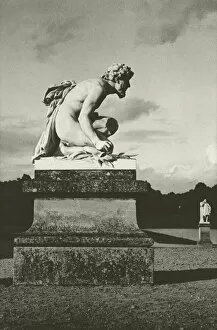
Background imageMaps Collection: Paris: Chantilly, Park (b / w photo)

Paris: Chantilly, Park (b / w photo)
7163073 Paris: Chantilly, Park (b/w photo) by Bucovich, Mario (1884-1947); Private Collection; (add.info.: Chantilly, Park)

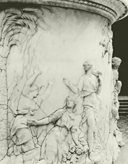
Background imageMaps Collection: Paris: Versailles, Detail de la Colonnade (b / w photo)

Paris: Versailles, Detail de la Colonnade (b / w photo)
7163071 Paris: Versailles, Detail de la Colonnade (b/w photo) by Bucovich, Mario (1884-1947); Private Collection; (add.info.: Versailles, Detail de la Colonnade)

Background imageMaps Collection: Paris: St Cloud, Autos pour le Transport des Chevaux de Course (b / w photo)

Paris: St Cloud, Autos pour le Transport des Chevaux de Course (b / w photo)
7163069 Paris: St Cloud, Autos pour le Transport des Chevaux de Course (b/w photo) by Bucovich, Mario (1884-1947); Private Collection; (add.info.: St Cloud)

Background imageMaps Collection: Paris: Fabrication de Matelas (b / w photo)

Paris: Fabrication de Matelas (b / w photo)
7163062 Paris: Fabrication de Matelas (b/w photo) by Bucovich, Mario (1884-1947); Private Collection; (add.info.: Fabrication de Matelas)

Background imageMaps Collection: Paris: Pecheurs a la ligne (b / w photo)

Paris: Pecheurs a la ligne (b / w photo)
7163050 Paris: Pecheurs a la ligne (b/w photo) by Bucovich, Mario (1884-1947); Private Collection; (add.info.: Pecheurs a la ligne)

Background imageMaps Collection: Paris: Musee Carnavalet (b / w photo)

Paris: Musee Carnavalet (b / w photo)
7163045 Paris: Musee Carnavalet (b/w photo) by Bucovich, Mario (1884-1947); Private Collection; (add.info.: Musee Carnavalet)

Background imageMaps Collection: Paris: Palais de Justice et Prefecture vus du Pont Neuf (b / w photo)

Paris: Palais de Justice et Prefecture vus du Pont Neuf (b / w photo)
7163038 Paris: Palais de Justice et Prefecture vus du Pont Neuf (b/w photo) by Bucovich, Mario (1884-1947); Private Collection; (add.info.: Palais de Justice et Prefecture vus du Pont Neuf)

Background imageMaps Collection: Paris: La Bourse (b / w photo)

Paris: La Bourse (b / w photo)
7163031 Paris: La Bourse (b/w photo) by Bucovich, Mario (1884-1947); Private Collection; (add.info.: La Bourse. Illustration for Paris with photographs by Mario v Bucovich (Albertus-Verlag)

Background imageMaps Collection: Paris: Tombeau du Soldat Inconnu (b / w photo)

Paris: Tombeau du Soldat Inconnu (b / w photo)
7163030 Paris: Tombeau du Soldat Inconnu (b/w photo) by Bucovich, Mario (1884-1947); Private Collection; (add.info.: Tombeau du Soldat Inconnu)

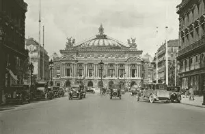
Background imageMaps Collection: Paris: L Opera (b / w photo)

Paris: L Opera (b / w photo)
7163024 Paris: L Opera (b/w photo) by Bucovich, Mario (1884-1947); Private Collection; (add.info.: L Opera. Illustration for Paris with photographs by Mario v Bucovich (Albertus-Verlag)

Background imageMaps Collection: Q. Quarreller

Q. Quarreller
6523709 Q. Quarreller by Henreaux, Lucien L. (pseudonym LSH) (active 1904); Private Collection; (add.info.: in " Silhouettes -- Alphabet. Publisher unknown, 1904 (legal depot BNF)

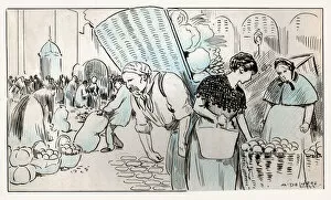
Background imageMaps Collection: Food market in Paris, ca 1930

Food market in Paris, ca 1930
7143784 Food market in Paris, ca 1930 by Delierre, Auguste (1829-1891); Private Collection; (add.info.: Food and Beverage. A market in Paris. Illustration by A)

Background imageMaps Collection: Portrait of a student of the Ecole Polytechnique, early twentieth century (b / w photo)

Portrait of a student of the Ecole Polytechnique, early twentieth century (b / w photo)
7211483 Portrait of a student of the Ecole Polytechnique, early twentieth century (b/w photo) by Gerschel, Charles (1871-1948); (add.info)

Background imageMaps Collection: 'The Popsipetel Picture-History of King Jong Thinkalot frontispiece illustration from The Voyages

"The Popsipetel Picture-History of King Jong Thinkalot frontispiece illustration from The Voyages of Doctor
7214602 " The Popsipetel Picture-History of King Jong Thinkalot frontispiece illustration from The Voyages of Doctor Dolittle, 1922 by Lofting

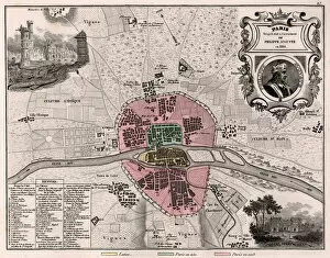
Background imageMaps Collection: The city of Paris as it was in the future of Philippe Auguste in 1180. - France and its Colonies

The city of Paris as it was in the future of Philippe Auguste in 1180. - France and its Colonies
XEE4144408 The city of Paris as it was in the future of Philippe Auguste in 1180. - France and its Colonies. Atlas illustrates one hundred and five maps from the maps of the depot of war

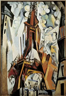
Background imageMaps Collection: The Eiffel Tower Painting by Robert Delaunay (1885-1941) 1910

The Eiffel Tower Painting by Robert Delaunay (1885-1941) 1910
JLJ4569149 The Eiffel Tower Painting by Robert Delaunay (1885-1941) 1910. by Delaunay, Robert (1885-1941); Musee des Beaux-Arts, Tours

Background imageMaps Collection: A window or design for three windows. Painting by Robert Delaunay (1885-1941), 1912, 1. 11 x 0

A window or design for three windows. Painting by Robert Delaunay (1885-1941), 1912, 1. 11 x 0. 9 m. Oil on canvas
JLJ4576189 A window or design for three windows. Painting by Robert Delaunay (1885-1941), 1912, 1.11 x 0.9 m. Oil on canvas. Paris, musee national d art moderne - A window or study for three windows

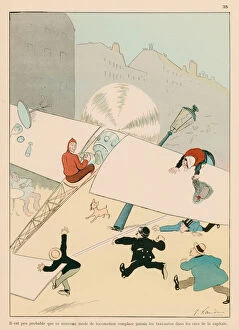
Background imageMaps Collection: It is scarcely probable that this new mode of travelling will replace taxi-cabs in the streets of

It is scarcely probable that this new mode of travelling will replace taxi-cabs in the streets of the capital
7181024 It is scarcely probable that this new mode of travelling will replace taxi-cabs in the streets of the capital (colour litho) by Echau

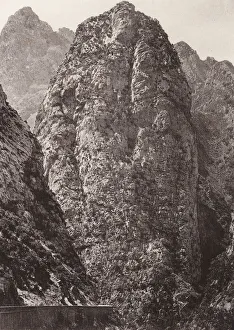
Background imageMaps Collection: Chabet el Akhra Gorges, Algeria (b / w photo)

Chabet el Akhra Gorges, Algeria (b / w photo)
7202074 Chabet el Akhra Gorges, Algeria (b/w photo) by Geiser, Jean (1848-1923); Private Collection; (add.info.: Chabet el Akhra Gorges, Algeria)

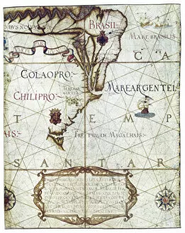
Background imageMaps Collection: Map of South America, in Universa ac Navigabilis Totius Terrarum Orbis Descriptio 1559

Map of South America, in Universa ac Navigabilis Totius Terrarum Orbis Descriptio 1559 (colour manuscript)
AIS5334419 Map of South America, in Universa ac Navigabilis Totius Terrarum Orbis Descriptio 1559 (colour manuscript) by Homem, Andre (16th century); Bibliotheque Nationale, Paris


All Professionally Made to Order for Quick Shipping


-

Maps Collection

Maps of Paris, France, Europe are invaluable resources for anyone visiting or living in the city. They provide an overview of the city's layout, including its streets and landmarks. They also show public transportation routes and stations, as well as points of interest such as parks and museums. Many it also include information about nearby cities and towns, allowing visitors to plan day trips outside the city limits. Additionally they can help visitors find their way around Paris more easily by providing detailed directions from one point to another. With a map in hand, travelers can explore all that Paris has to offer with confidence.
+

Our beautiful pictures are available as Framed Prints, Photos, Wall Art and Photo Gifts

The Maps of Paris France Europe collection from Media Storehouse is a stunning assortment of wall art, framed prints, photo prints, canvas prints, jigsaw puzzles and greeting cards that capture the beauty and history of Paris. Our collection features a wide range of maps depicting different eras in the city's rich cultural heritage. From antique maps dating back to the 18th century to modern-day street maps highlighting popular landmarks such as the Eiffel Tower and Notre-Dame Cathedral, our collection offers something for everyone. Each piece in our collection is carefully crafted using high-quality materials to ensure long-lasting durability and vibrant colors that will stand out on any wall. Whether you're looking for a unique gift or want to add some French charm to your home or office decor, these beautiful pieces are sure to impress. With so many options available at affordable prices, it's easy to find exactly what you need from this impressive selection of artwork.
+

What are Maps of Paris France Europe art prints?

Maps of Paris France Europe art prints are beautiful and detailed depictions of the city of Paris, France, and its surrounding regions. These maps showcase the intricate layout of streets, landmarks, and buildings throughout the area. They are often created using a combination of traditional cartography techniques and modern design elements to produce an aesthetically pleasing representation. These art prints serve as both decorative pieces for your home or office space as well as educational tools for those interested in geography or history. They can be used to plan trips to Paris or simply admired for their artistic value. Maps of Paris France Europe art prints come in various sizes and styles, ranging from vintage designs that capture the essence of old-world charm to contemporary interpretations that reflect modern-day trends. Regardless of your personal style preferences, there is sure to be a map print that will suit your tastes perfectly.
+

What Maps of Paris France Europe art prints can I buy from Media Storehouse?

We offer a wide range of Maps of Paris, France and Europe art prints that are perfect for home decor or as gifts. These maps come in various sizes and styles to suit your preferences. You can choose from vintage-style maps that showcase the intricate details of the city's streets, landmarks, and neighborhoods, or modern designs that highlight its vibrant culture and history. Some popular options include detailed street maps of Paris with iconic landmarks such as the Eiffel Tower, Notre Dame Cathedral, and Arc de Triomphe highlighted. There are also antique-style world maps featuring Europe prominently along with other continents. Media Storehouse also offers panoramic views of Paris' skyline at different times of day including sunrise or sunset which make great wall art pieces for any room in your home. Whether you're looking for something classic or contemporary, we have a vast collection of Maps of Paris France Europe art prints to choose from.
+

How do I buy Maps of Paris France Europe art prints?

To buy Maps of Paris France Europe art prints from Media Storehouse, you can browse our extensive collection of maps and select the one that best suits your preferences. Once you have found the map you want to purchase, simply add it to your cart and proceed to checkout. You will be prompted to enter your shipping information and payment details before finalizing your order. We offer a variety of sizes for their art prints, so make sure to choose the size that fits your needs. We also offer different framing options if you prefer a framed print. If you have any questions or concerns about purchasing Maps of Paris France Europe art prints from Media Storehouse, they have a customer service team available to assist you. Simply reach out via email or phone and they will be happy to help guide you through the process.
+

How much do Maps of Paris France Europe art prints cost?

We offer a wide range of Maps of Paris France Europe art prints, which vary in price depending on the size and type of print. The cost for these prints can be affected by factors such as the quality of paper or canvas used, the printing method employed, and any additional features that may be included with the print. However, it is important to note that Media Storehouse strives to offer affordable prices for all their products while maintaining high-quality standards. You can expect reasonable pricing options for Maps of Paris France Europe art prints without compromising on quality. Whether you are looking for vintage maps or contemporary designs, we have something to suit every taste and budget. With a vast collection available online, you can easily browse through different options before making their purchase decision.
+

How will my Maps of Paris France Europe art prints be delivered to me?

We take great care in ensuring that your Maps of Paris France Europe art prints are delivered to you safely and securely. We use high-quality packaging materials to protect your print during transit, so it arrives at your doorstep in pristine condition. Your print will be carefully rolled and placed inside a protective tube before being shipped out to you. This ensures that the print is not damaged or creased during shipping. Additionally, we work with trusted courier services to ensure timely delivery of your order. Once your package has been dispatched, you will receive a tracking number via email which allows you to track the progress of your shipment online. If for any reason there are issues with the delivery of your order, our customer service team is always available to assist you. We hope that receiving your Maps of Paris France Europe art prints brings joy and inspiration into your home or office space.