
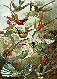
Maps Collection
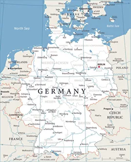
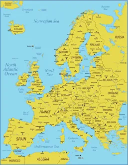
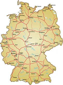
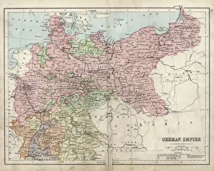
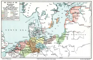
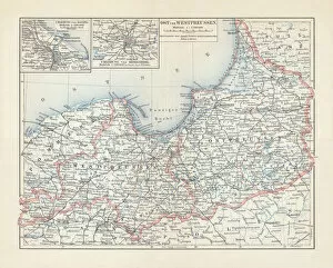
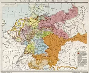
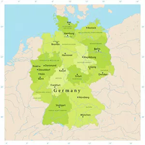
Germany is a country located in Central Europe, and is bordered by nine other countries, including Austria, Belgium, Czech Republic, Denmark, France
Choose a picture from our Maps Collection for your Wall Art and Photo Gifts
6,660 items


All Professionally Made to Order for Quick Shipping
-
Maps Collection
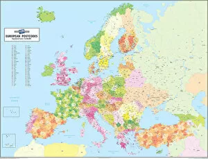
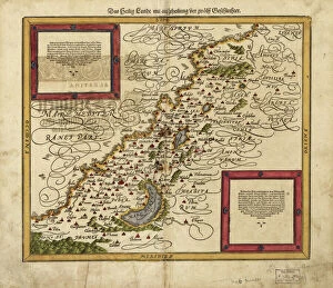
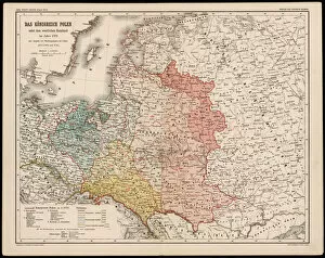
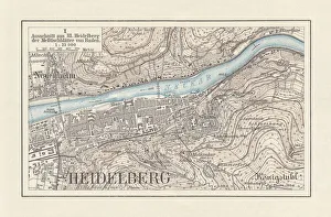
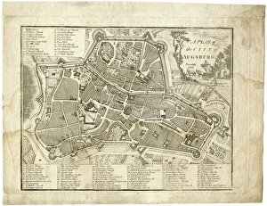
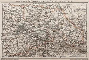
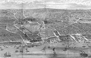
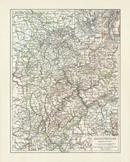
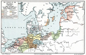
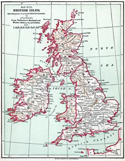
Germany is a country located in Central Europe, and is bordered by nine other countries, including Austria, Belgium, Czech Republic, Denmark, France, Luxembourg, Netherlands, Poland and Switzerland. Germany has a rich history and culture that can be seen through its many maps. Maps of Germany Europe provide an overview of the country's geography as well as its political divisions and major cities. They also show the location of rivers and lakes throughout the country. Additionally, they often include information about transportation networks such as roads and railways. Maps of Germany Europe are useful for travelers who want to explore this fascinating country or for those who wish to learn more about its history and culture.
+
Our beautiful pictures are available as Framed Prints, Photos, Wall Art and Photo Gifts
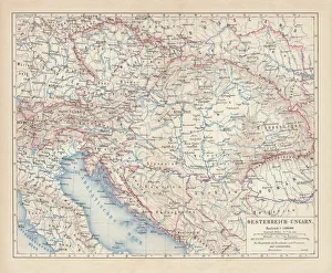
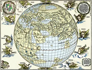
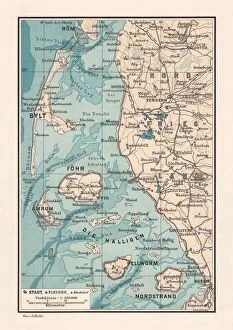
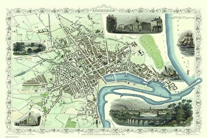
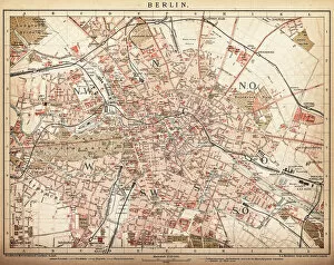
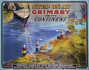
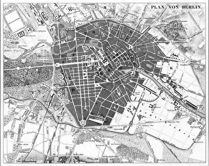
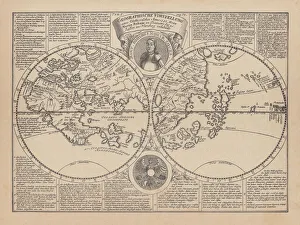
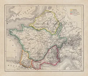
The Maps of Germany Europe collection from Media Storehouse is a stunning array of wall art and framed prints that showcase the rich history and geography of Germany. Our collection features an extensive range of maps, including antique maps dating back to the 16th century as well as modern-day cartography. These maps offer a unique perspective on the evolution of German territories over time, highlighting changes in borders, cities, and landmarks. Each map is beautifully reproduced using high-quality printing techniques that capture every detail with remarkable clarity. Whether you're looking for a vintage map to add character to your home decor or a contemporary piece to inspire your wanderlust, our collection has something for everyone. With its wide selection of sizes and framing options available at affordable prices, the Maps of Germany Europe collection from Media Storehouse offers an excellent opportunity to own a piece of history while enhancing your living space with beautiful artwork.
+
What are Maps of Germany Europe art prints?
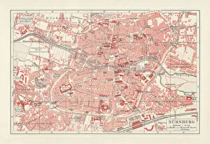
Maps of Germany Europe art prints are high-quality reproductions of vintage or contemporary maps depicting the geography, topography, and political boundaries of Germany and other European countries. These art prints are created using advanced printing techniques that ensure a sharp and vivid image with accurate colors and details. Maps have always been an important tool for navigation, exploration, and education. They provide a visual representation of the world around us, helping us understand our place in it. Maps of Germany Europe art prints offer not only practical information but also aesthetic value as they can be used to decorate homes, offices or public spaces. These art prints come in various sizes and styles to suit different tastes and purposes. Some feature intricate illustrations while others focus on clear lines and labels for easy reading. Whether you're looking for a historical map to display your love for history or a modern one to plan your next trip abroad, Maps of Germany Europe art prints from Media Storehouse offer something for everyone.
+
What Maps of Germany Europe art prints can I buy from Media Storehouse?
We offer a wide range of Maps of Germany Europe art prints that are perfect for decorating your home or office. These maps come in various sizes and styles, including vintage, antique, and modern designs. You can choose from different types of maps such as political maps, physical maps, topographical maps, roadmaps and more. Our collection includes high-quality prints that capture the intricate details of these beautiful maps. Whether you're looking to add some historical charm to your space or want to display your love for geography and travel, their selection has something for everyone. Their Maps of Germany Europe art prints are printed on premium quality paper using state-of-the-art printing technology which ensures they will last a lifetime without fading or losing their vibrancy. So if you're looking for unique wall decor that is both stylish and informative then our Maps of Germany Europe art prints are definitely worth checking out.
+
How do I buy Maps of Germany Europe art prints?
To buy Maps of Germany Europe art prints from Media Storehouse, you can browse our extensive collection online. Simply search for the specific map or location you are interested in and select the print size and format that suits your needs. You can choose from a range of high-quality paper options to ensure your print looks its best. Once you have made your selection, add it to your cart and proceed to checkout. You will be prompted to enter your shipping information and payment details. We accept a variety of payment methods including credit cards, PayPal, and Apple Pay. After completing your purchase, Media Storehouse will process your order and ship it directly to you. Your Map of Germany Europe art print will arrive ready for framing or display as desired. We offer a wide selection of maps from different regions around the world so if you're looking for other locations beyond Germany Europe they may have what you need too.
+
How much do Maps of Germany Europe art prints cost?
We offer a wide range of Maps of Germany and Europe art prints at varying prices. The cost of these prints depends on various factors such as the size, quality, and type of paper used for printing. Our collection includes vintage maps, contemporary designs, and artistic interpretations that cater to different tastes and preferences. We take pride in providing high-quality art prints that are affordable yet visually appealing. Our selection is carefully curated to ensure that customers have access to unique pieces that add character to their homes or offices. We also offer framing options for those who prefer ready-to-hang artwork. The cost of our Maps of Germany and Europe art prints varies depending on several factors. However, we strive to provide our customers with value for money by offering competitive prices without compromising on quality.
+
How will my Maps of Germany Europe art prints be delivered to me?
We take great care in delivering your Maps of Germany Europe art prints to you. We use high-quality packaging materials to ensure that your artwork arrives in perfect condition. Your print will be carefully rolled and placed inside a sturdy tube for protection during transit. We work with trusted shipping partners who offer reliable and secure delivery services worldwide. Once your order is dispatched, you will receive an email notification with tracking information so that you can monitor the progress of your delivery. We understand the importance of timely delivery and strive to ensure that all orders are processed promptly. However, please note that delivery times may vary depending on your location and other factors beyond our control. Rest assured that when you order from us, you can expect a hassle-free experience from start to finish. We pride ourselves on providing excellent customer service and look forward to serving you soon.