
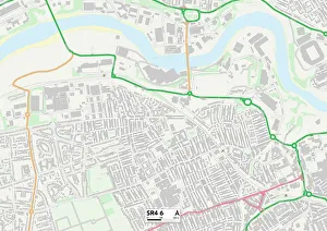
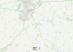
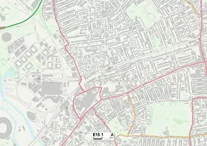
Maps Collection
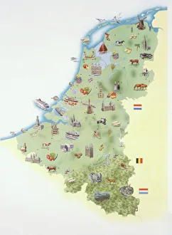
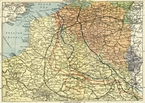
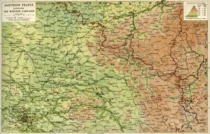
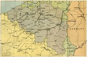
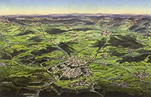
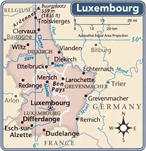
Luxembourg is a small European country located in the Benelux region, and is bordered by Belgium, France, and Germany
Choose a picture from our Maps Collection for your Wall Art and Photo Gifts
83 items


All Professionally Made to Order for Quick Shipping
-
Maps Collection
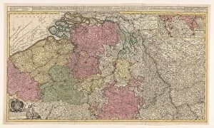
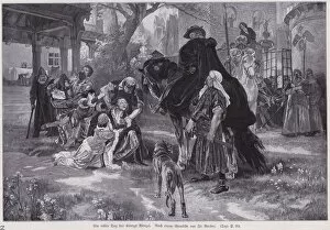
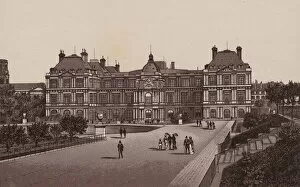
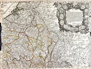
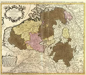
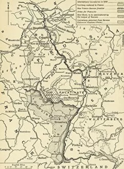
Luxembourg is a small European country located in the Benelux region, and is bordered by Belgium, France, and Germany. Luxembourg has a rich history and culture that can be seen in its architecture, cuisine, and language. Maps of Luxembourg Europe are useful for understanding the geography of this small nation. The maps show the country’s major cities as well as its rivers, mountains, forests, and other features. They also provide information about the roads that connect these places to each other and to neighboring countries. Maps of Luxembourg Europe can help travelers plan their trips more effectively by providing them with an overview of where they should go and what they should do while there.
+
Our beautiful pictures are available as Framed Prints, Photos, Wall Art and Photo Gifts
Media Storehouse offers a collection of Maps of Luxembourg Europe that showcases the country's geography, history, and culture. Our collection features an array of wall art and framed prints that range from vintage maps to modern interpretations. These maps are perfect for those who want to explore the beauty and uniqueness of Luxembourg or for those who have a passion for cartography. The Maps of Luxembourg Europe collection includes detailed topographical maps that highlight the country's mountainous terrain, rivers, forests, and cities. Additionally, there are historical maps that showcase how Luxembourg has evolved over time with its changing borders and political affiliations. These high-quality prints come in various sizes to fit any space or decor style. They make great gifts for travelers or anyone interested in European history. With our easy-to-use website, customers can browse through this extensive collection and choose their favorite map print to adorn their walls at home or office.
+
What are Maps of Luxembourg Europe art prints?
Maps of Luxembourg Europe art prints are high-quality reproductions of maps that depict the geography and topography of Luxembourg, a small country in Western Europe. These prints showcase the intricate details and features of the region, including its cities, towns, rivers, mountains, and landmarks. These art prints are perfect for anyone who loves history or geography or wants to decorate their home or office with unique wall decor. They can be used as educational tools for students studying European geography or as conversation starters for guests. We offer a wide range of Maps of Luxembourg Europe art prints in various sizes and styles to suit different tastes and preferences. Whether you prefer vintage-style maps or modern designs, there is something for everyone. These art prints provide an excellent way to explore the beauty and complexity of Luxembourg's landscape while adding a touch of sophistication to any space.
+
What Maps of Luxembourg Europe art prints can I buy from Media Storehouse?
We offer a wide range of Maps of Luxembourg Europe art prints for purchase. These maps showcase the beautiful country of Luxembourg, highlighting its cities, towns, and landmarks in intricate detail. Whether you're looking for a vintage map or a modern interpretation, we have something to suit your taste. Some popular options include antique maps from the 1800s that depict the borders and topography of Luxembourg with stunning accuracy. Additionally, there are contemporary designs that feature vibrant colors and bold typography to make an eye-catching statement on any wall. Media Storehouse also offers customizable options where you can add your own personal touch by selecting different sizes or framing options to fit your decor style. With so many choices available, it's easy to find the perfect Maps of Luxembourg Europe art print that will bring joy and beauty into your home or office space.
+
How do I buy Maps of Luxembourg Europe art prints?
To buy Maps of Luxembourg Europe art prints from Media Storehouse, you can browse our extensive collection of maps and select the one that catches your eye. Once you have found the map you want to purchase, simply add it to your cart and proceed to checkout. You will be prompted to enter your shipping information and payment details before completing the transaction. We offer a variety of sizes for their art prints, so make sure to choose the size that best fits your needs. We also offer framing options if you would like your print ready-to-hang upon arrival. If you have any questions or concerns about purchasing a Maps of Luxembourg Europe art print from Media Storehouse, our customer service team is available via email or phone to assist with any inquiries. With high-quality printing and fast shipping times, buying an art print from Media Storehouse is a great way to add some unique decor to your home or office space.
+
How much do Maps of Luxembourg Europe art prints cost?
We offer a variety of Maps of Luxembourg Europe art prints at varying prices. Our selection includes both vintage and contemporary maps, as well as different sizes to fit your needs. The cost of our Maps of Luxembourg Europe art prints depends on the size and type of print you choose. We strive to provide affordable options for all customers while maintaining high-quality standards in our products. Our Maps of Luxembourg Europe art prints are perfect for adding a touch of sophistication to any room or office space. Whether you're looking for a unique gift or simply want to decorate your own home, we have something that will suit your style and budget. We take pride in offering exceptional customer service and ensuring that each order is fulfilled with care and attention to detail. Shop our collection today to find the perfect Maps of Luxembourg Europe art print for you.
+
How will my Maps of Luxembourg Europe art prints be delivered to me?
We take great care in ensuring that your Maps of Luxembourg Europe art prints are delivered to you safely and securely. We use high-quality packaging materials to protect your artwork during transit, so it arrives at your doorstep in pristine condition. Your Maps of Luxembourg Europe art prints will be printed on premium quality paper using state-of-the-art printing technology. Once the print is ready, it will be carefully rolled up and placed inside a sturdy cardboard tube for shipping. We work with trusted courier partners who specialize in delivering fragile items like artwork. They will handle your package with care and ensure that it reaches you within the estimated delivery timeframe. When you receive your Maps of Luxembourg Europe art prints from us, simply unroll them and display them as desired. Whether you choose to frame them or hang them directly on the wall, they are sure to add a touch of elegance to any room.