
Maps Collection
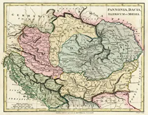
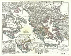
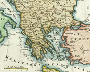
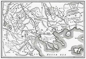
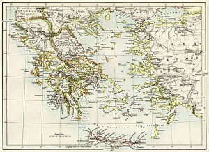
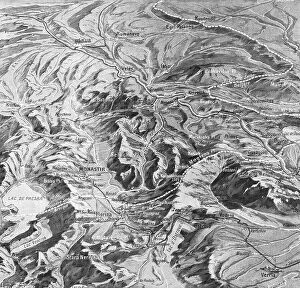
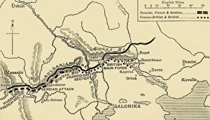
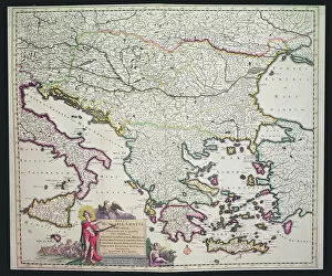
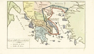
Macedonia is a small landlocked country in the Balkan Peninsula of Southeast Europe, and is bordered by Serbia, Kosovo, Bulgaria, Greece and Albania
Choose a picture from our Maps Collection for your Wall Art and Photo Gifts
78 items


All Professionally Made to Order for Quick Shipping
-
Maps Collection
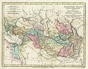
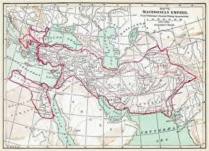
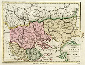
Macedonia is a small landlocked country in the Balkan Peninsula of Southeast Europe, and is bordered by Serbia, Kosovo, Bulgaria, Greece and Albania. The terrain of Macedonia is mostly mountainous with some flatlands in the north and south. The capital city of Skopje lies at the heart of the country and is home to many historical sites such as Kale Fortress, Stone Bridge and Mustafa Pasha Mosque. Macedonia has a rich cultural heritage with influences from both Eastern Orthodox Christianity and Islam. Its geography also features several lakes including Lake Ohrid which is one of Europe’s deepest lakes. Macedonia’s diverse landscape makes it an ideal destination for outdoor activities such as hiking, rafting and skiing in winter months and can essential for navigating this beautiful country so visitors can explore its many attractions without getting lost.
+
Our beautiful pictures are available as Framed Prints, Photos, Wall Art and Photo Gifts
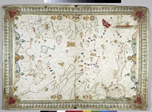
The Maps of Macedonia Europe collection from Media Storehouse is a stunning selection of wall art and framed prints that showcase the beauty and history of this European country. Our collection features a wide range of maps, including vintage maps dating back to the 16th century, as well as more modern interpretations. Each piece in our collection has been carefully selected for its quality and detail, with many featuring intricate illustrations and annotations that provide fascinating insights into Macedonia's geography, culture, and heritage. Whether you're looking to add some historical flair to your home decor or simply want to learn more about this fascinating region, the Maps of Macedonia Europe collection is sure to impress. With its high-quality printing techniques and durable materials, each print in our collection is designed to last for years without fading or losing its vibrancy. So why not explore the rich history and culture of Macedonia today with these beautiful wall art pieces?
+
What are Maps of Macedonia Europe art prints?
Maps of Macedonia Europe art prints are high-quality reproductions of antique and contemporary maps depicting the region of Macedonia in Europe. These prints showcase the intricate details and unique features of this area, including its cities, rivers, mountains, and borders. These art prints are perfect for those who have an interest in history, geography or simply want to add a touch of sophistication to their home decor. They can be used as educational tools or as decorative pieces that bring character and charm to any room. We offer a wide range of Maps of Macedonia Europe art prints that cater to different tastes and preferences. Whether you prefer vintage-style maps with sepia tones or modern designs with vibrant colors, there is something for everyone. These art prints serve as a beautiful reminder of the rich cultural heritage and natural beauty that make up the region of Macedonia in Europe.
+
What Maps of Macedonia Europe art prints can I buy from Media Storehouse?
We offer a wide range of Maps of Macedonia Europe art prints that you can buy. These maps showcase the beautiful landscapes, cities, and historical sites of Macedonia in intricate detail. You can choose from vintage or contemporary styles to suit your taste and decor. Some popular options include antique maps that depict the region's history and cultural heritage, while others feature modern cartography with accurate geographical information. You can also find artistic interpretations that highlight the unique features of Macedonia's topography. Whether you're looking for a large-scale wall print or a smaller framed piece, we have something to offer. Their selection includes high-quality prints on various materials such as canvas, paper, metal, and wood. If you're interested in purchasing Maps of Macedonia Europe art prints for your home or office space, Media Storehouse is an excellent place to start your search.
+
How do I buy Maps of Macedonia Europe art prints?
To buy Maps of Macedonia Europe art prints from Media Storehouse, you can browse our online collection and select the print that catches your eye. Once you have found the desired artwork, click on it to view its details and choose the size and framing options if available. You can then add it to your cart and proceed to checkout. We offer a secure payment system where you can pay using various methods such as credit card, PayPal or Apple Pay. They also provide worldwide shipping services for their customers. If you need any assistance during the buying process or have any questions regarding their products, we have a customer service team who are always ready to help via email or phone. Purchasing Maps of Macedonia Europe art prints from Media Storehouse is an easy and straightforward process that allows you to enjoy high-quality artworks in your home or office.
+
How much do Maps of Macedonia Europe art prints cost?
The cost of Maps of Macedonia Europe art prints varies depending on several factors, such as the size, quality, and type of printing material used. Generally speaking, smaller sizes tend to be less expensive than larger ones. Additionally, different types of paper or canvas can affect the price point. It's important to note that prices may also vary based on where you purchase your print from. However, we offer a wide range of Maps of Macedonia Europe art prints at competitive prices. While we cannot provide specific pricing information in this answer due to the nature of the question prompt, it's worth noting that investing in a high-quality art print is an excellent way to add character and personality to any space while supporting artists and photographers who create beautiful works for us all to enjoy.
+
How will my Maps of Macedonia Europe art prints be delivered to me?
Your Maps of Macedonia Europe art prints will be delivered to you in a safe and secure manner by Media Storehouse. The company takes great care in packaging your artwork so that it arrives at your doorstep undamaged. Your prints will be rolled up and placed inside a sturdy cardboard tube, which is then sealed with tape to prevent any moisture or dust from getting inside. Media Storehouse uses trusted shipping carriers to deliver your order, ensuring that it reaches you on time and in perfect condition. You can track the progress of your delivery using the tracking number provided by the carrier. Once you receive your Maps of Macedonia Europe art prints, simply unroll them carefully and flatten them out before framing or displaying as desired. With our reliable delivery service, you can rest assured that your artwork will arrive safely and ready for display in no time.