
Maps Collection
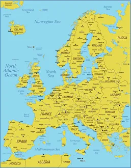
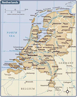
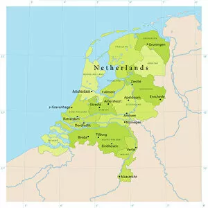
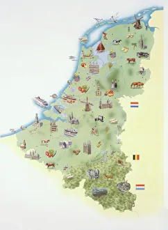
The Netherlands is a country located in northwestern Europe, bordered by Germany to the east, Belgium to the south, and the North Sea to the northwest
Choose a picture from our Maps Collection for your Wall Art and Photo Gifts
684 items


All Professionally Made to Order for Quick Shipping
-
Maps Collection
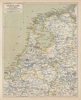
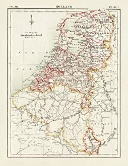
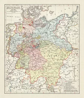
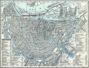
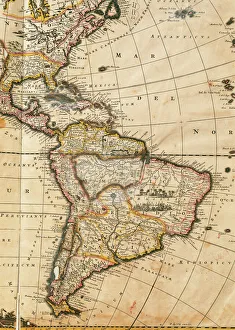
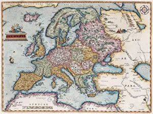
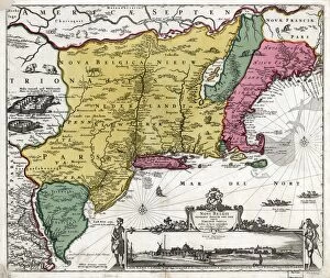
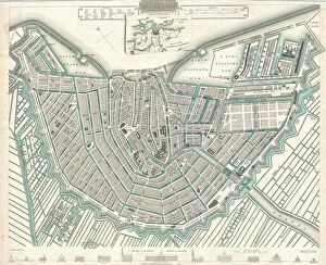
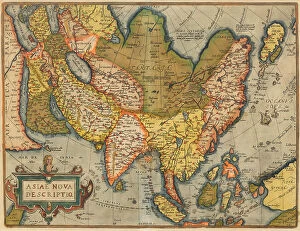
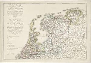
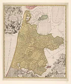
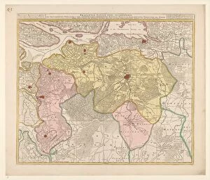
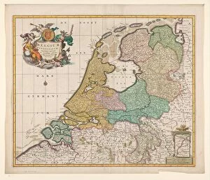
The Netherlands is a country located in northwestern Europe, bordered by Germany to the east, Belgium to the south, and the North Sea to the northwest, and is known for its iconic windmills, tulip fields, and canals. Maps of Netherlands Europe show this small country in great detail. The maps typically include major cities such as Amsterdam and Rotterdam; rivers such as Rhine and Meuse; lakes including Ijsselmeer; national parks like Hoge Veluwe National Park; mountain ranges like Ardennes; coastal areas such as Wadden Sea Islands; and other attractions like Keukenhof Gardens. Maps of Netherlands Europe also provide information on transportation networks including highways, airports, railway lines and ferry routes. These they can essential for travelers who want to explore this beautiful country with its rich history and culture.
+
Our beautiful pictures are available as Framed Prints, Photos, Wall Art and Photo Gifts
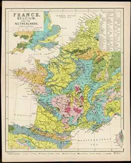
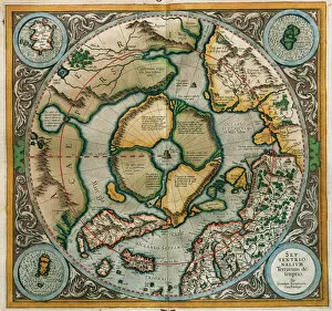
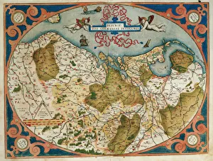
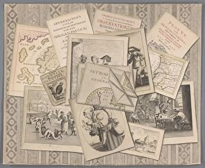
Media Storehouse offers a stunning collection of Maps of Netherlands Europe that are perfect for wall art and framed prints. Our collection features an extensive range of maps, including antique maps from the 16th century to modern-day satellite images. These maps showcase the beauty and diversity of the Netherlands, highlighting its cities, towns, waterways, and landscapes. The Maps of Netherlands Europe collection is ideal for those who appreciate history or geography or want to add a touch of sophistication to their home decor. Whether you're looking for a vintage map as a conversation starter or a contemporary print that captures the essence of modern-day Netherlands, our collection has something for everyone. Each map in the our Maps of Netherlands Europe collection is carefully curated by experts who ensure that only high-quality prints are included in their inventory. With so many options available at affordable prices, it's easy to find the perfect map to suit your style and taste.
+
What are Maps of Netherlands Europe art prints?
Maps of Netherlands Europe art prints are a beautiful and informative way to display the geography of the Netherlands. These prints showcase detailed maps of the country, highlighting its cities, rivers, lakes, and other important landmarks. They are perfect for anyone who loves history or geography, as they provide an accurate representation of the region's topography. These art prints come in a variety of styles and sizes to suit any decor. Some feature vintage designs that harken back to earlier times when cartographers were first mapping out this area. Others have modern graphics that use bright colors and bold lines to create a more contemporary look. Whether you're looking for something traditional or trendy, Maps of Netherlands Europe art prints offer something for everyone. They make great gifts for friends or family members who love travel or want to learn more about this fascinating part of Europe. So why not add one to your collection today?
+
What Maps of Netherlands Europe art prints can I buy from Media Storehouse?
We offer a wide range of Maps of Netherlands Europe art prints that are perfect for anyone who loves the beauty and history of this region. These maps come in various sizes, styles, and designs to suit different tastes and preferences. Some of the popular options include vintage maps, contemporary maps, topographical maps, political maps, and more. Whether you're looking for a stunning wall art piece or an educational tool for your classroom or office space, we have got you covered. You can choose from a variety of materials such as canvas prints, framed prints, metal prints, posters and photographic prints to ensure that your chosen map looks great wherever it is displayed. With its vast collection of high-quality Maps of Netherlands Europe art prints available at affordable prices with fast shipping times worldwide; Media Storehouse is the go-to destination for anyone looking to add some unique flair to their home or workspace décor.
+
How do I buy Maps of Netherlands Europe art prints?
To buy Maps of Netherlands Europe art prints from Media Storehouse, you can browse our extensive collection online. Simply search for "Maps of Netherlands Europe" in the search bar on our website and select your preferred print size and format. You can choose between a range of high-quality paper finishes, including matte, gloss, and satin. Once you have selected your desired print options, add them to your cart and proceed to checkout. At this stage, you will need to provide your shipping details and payment information. We offer secure payment options such as credit card or PayPal. Once your order has been processed, it will be printed on demand using state-of-the-art printing technology before being shipped directly to your address. Buying Maps of Netherlands Europe art prints from Media Storehouse is an easy process that allows you to enjoy stunning artwork in the comfort of your own home or office space.
+
How much do Maps of Netherlands Europe art prints cost?
We offer a wide range of Maps of Netherlands Europe art prints that cater to different tastes and preferences. Our collection includes vintage maps, contemporary designs, and everything in between. The cost of our Maps of Netherlands Europe art prints varies depending on the size, framing options, and other customization choices you make. However, we strive to keep our prices competitive while maintaining high-quality standards for all our products. Our Maps of Netherlands Europe art prints are perfect for adding a touch of sophistication and elegance to your home or office décor. Whether you're looking for a unique gift idea or want to treat yourself to something special, we have something that will suit your needs perfectly. So if you're interested in purchasing one of our beautiful Maps of Netherlands Europe art prints, browse through our collection today.
+
How will my Maps of Netherlands Europe art prints be delivered to me?
We take great care in delivering your Maps of Netherlands Europe art prints to you. We use high-quality packaging materials to ensure that your print arrives in perfect condition. Your print will be carefully rolled and placed into a sturdy cardboard tube for protection during transit. We work with trusted delivery partners who are experienced in handling delicate items such as art prints. Once your order has been dispatched, you will receive an email notification with tracking information so that you can keep track of the progress of your delivery. We understand how important it is for our customers to receive their orders promptly and securely. That's why we always strive to deliver on time and provide excellent customer service throughout the entire process. Whether you're purchasing a Maps of Netherlands Europe art print for yourself or as a gift for someone else, rest assured that it will be delivered safely and efficiently by our team at Media Storehouse.