
Maps Collection
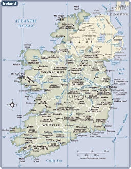
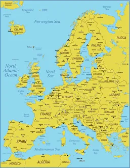
The Republic of Ireland is located in the North Atlantic Ocean and is part of Europe
Choose a picture from our Maps Collection for your Wall Art and Photo Gifts
1,433 items


All Professionally Made to Order for Quick Shipping
-
Maps Collection
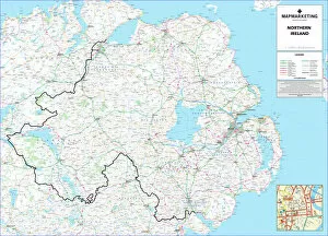
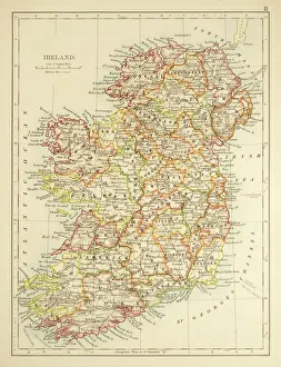
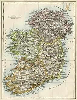
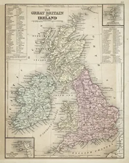
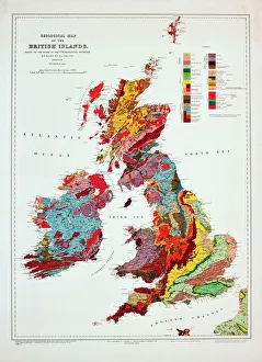
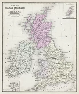
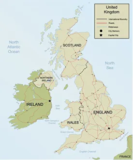
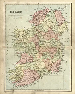
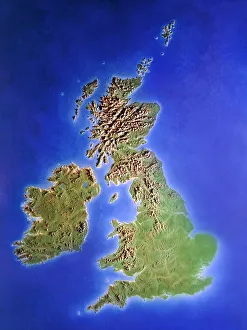
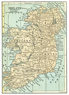
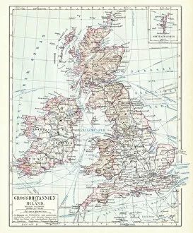
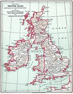
The Republic of Ireland is located in the North Atlantic Ocean and is part of Europe. Maps of the Republic of Ireland are widely available, both online and in print. These maps typically show the country's major cities, rivers, lakes, mountains, national parks and other features. They also often include information about roads and other transportation networks as well as political boundaries. They can useful for travelers who wish to explore the country or plan a route from one destination to another. Additionally, they can be used by businesses looking to expand their operations into new markets or investors seeking potential opportunities in different parts of the country.
+
Our beautiful pictures are available as Framed Prints, Photos, Wall Art and Photo Gifts
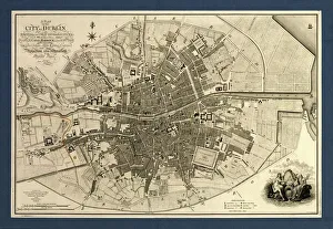
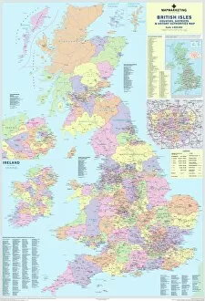
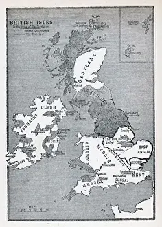
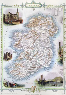
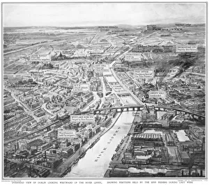
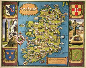
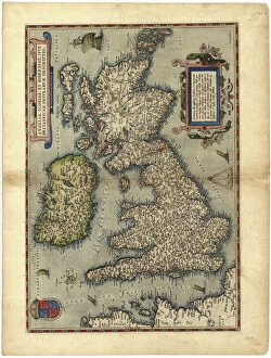
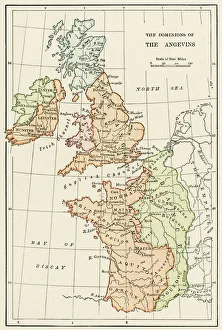
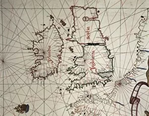
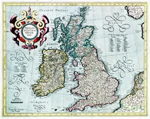
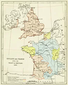
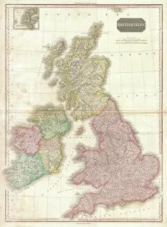
The Maps of Republic of Ireland Europe collection from Media Storehouse is a stunning range of wall art and framed prints that showcase the beauty and diversity of Ireland's landscapes. Our collection features an extensive selection of maps, including antique maps, topographical maps, and modern-day roadmaps. Each print in our collection is carefully crafted to capture the unique character and charm of Ireland's cities, towns, villages, mountains, lakes, rivers and coastlines. Whether you are looking for a striking piece to hang in your home or office or want to give a thoughtful gift to someone special who loves Irish culture and history - our collection has something for everyone. From Dublin's bustling streets to the rugged beauty of Connemara National Park; from the ancient ruins at Newgrange to the rolling hillsides dotted with sheep - these prints offer a glimpse into one of Europe's most enchanting countries. With its rich history, vibrant culture and breathtaking scenery - it's no wonder why so many people fall in love with Ireland.
+
What are Maps of Republic of Ireland Europe art prints?
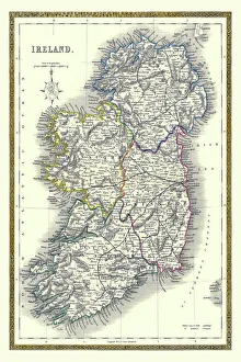
Maps of Republic of Ireland Europe art prints are high-quality reproductions of maps that depict the geography and topography of the Republic of Ireland. These prints showcase intricate details such as cities, towns, rivers, mountains, and other landmarks that make up the Irish landscape. They are designed to be visually appealing and informative at the same time. These art prints are perfect for anyone who loves history or geography or has an interest in exploring new places. They can be used to decorate homes, offices, schools or any space where a touch of sophistication is needed. Maps of Republic of Ireland Europe art prints come in various sizes and styles to suit different preferences. These art prints offer a unique way to appreciate the beauty and complexity of one's surroundings while also providing valuable information about them. Whether you're looking for a decorative piece or something more educational, Maps of Republic of Ireland Europe art prints from Media Storehouse are sure to impress.
+
What Maps of Republic of Ireland Europe art prints can I buy from Media Storehouse?
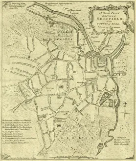
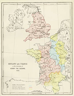
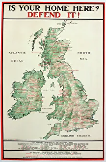
We offer a wide range of Republic of Ireland Europe art prints that are perfect for those who want to add a touch of elegance and sophistication to their home or office. These maps showcase the beauty and intricacy of the region, highlighting its unique features and landmarks. Some popular options include vintage-style maps that capture the history and charm of Ireland, as well as modern designs that offer a fresh take on this stunning country. You can choose from different sizes, styles, and finishes to suit your preferences. Whether you're looking for a statement piece or something more subtle, we have plenty of options to choose from. Their high-quality prints are made using premium materials that ensure they look great for years to come. So if you want to bring some Irish flair into your space, be sure to check out their selection today.
+
How do I buy Maps of Republic of Ireland Europe art prints?
To buy Maps of Republic of Ireland Europe art prints from Media Storehouse, you can browse our extensive collection online. Simply search for the specific map or artwork that you are interested in and add it to your cart. You can also refine your search by selecting different categories such as size, orientation, and color. Once you have added all the items to your cart, proceed to checkout where you will be prompted to enter your shipping and payment information. After completing the purchase process, Media Storehouse will process your order and ship it directly to your desired location. We offer a wide range of high-quality art prints featuring maps of Republic of Ireland Europe that are perfect for decorating any space in your home or office. Whether you're looking for a vintage-style map or a modern interpretation, they have something for everyone's taste and budget. So start exploring our collection today.
+
How much do Maps of Republic of Ireland Europe art prints cost?
As We offer a wide range of maps of the Republic of Ireland and Europe art prints, the cost may vary depending on factors such as size, framing options, and printing materials. However, you can be assured that they will receive high-quality prints at reasonable prices. The company sources its images from top photographers and archives worldwide to ensure that our collection is diverse and unique. Our maps of the Republic of Ireland and Europe art prints are perfect for those who want to add a touch of sophistication to their home or office decor. These prints come in various sizes ranging from small to large formats, making them suitable for any space. You can choose between unframed or framed options based on their preferences. We provide excellent value for money when it comes to purchasing maps of the Republic of Ireland and Europe art prints. Their products are affordable yet maintain exceptional quality standards that meet customer expectations.
+
How will my Maps of Republic of Ireland Europe art prints be delivered to me?
Your Maps of Republic of Ireland Europe art prints will be delivered to you in a safe and secure manner. We take great care in packaging your order so that it arrives at your doorstep without any damage. The prints are carefully rolled and placed inside a sturdy tube, which is then sealed with protective caps on both ends. We use reliable courier services to deliver your order, ensuring that it reaches you within the estimated delivery time frame. You can track your package using the tracking number provided once it has been dispatched from our warehouse. We understand how important it is for our customers to receive their orders promptly and in perfect condition. That's why we have partnered with trusted shipping companies who share our commitment to quality service. Rest assured that when you order Maps of Republic of Ireland Europe art prints from us, they will be delivered to you safely and efficiently.