
Maps Collection
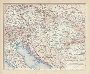
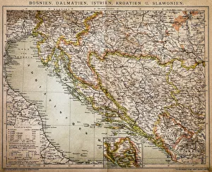
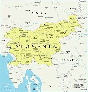
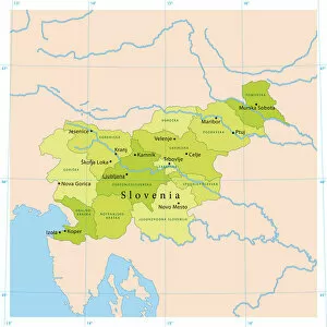
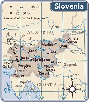
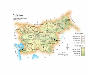
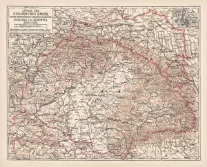
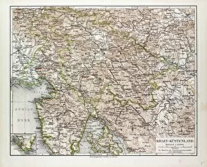
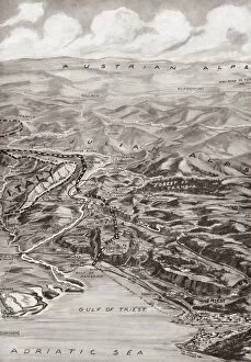
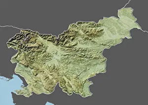
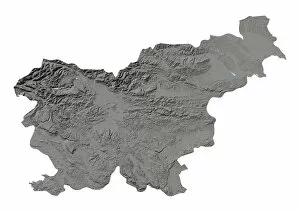
Slovenia is a small country located in Central Europe, bordered by Austria, Croatia, Hungary and Italy
Choose a picture from our Maps Collection for your Wall Art and Photo Gifts
30 items


All Professionally Made to Order for Quick Shipping
-
Maps Collection
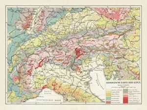
Slovenia is a small country located in Central Europe, bordered by Austria, Croatia, Hungary and Italy, and is known for its stunning natural beauty and diverse landscape. The country has a rich history and culture that can be seen through its many castles, churches and other historical sites. Maps of Slovenia Europe provide an insight into the geography of the region. They show the major cities, rivers, lakes and mountains as well as roads and railways connecting them all together. Additionally they highlight national parks such as Triglav National Park which is home to some of Slovenia's most beautiful scenery. Maps of Slovenia Europe are essential for anyone wanting to explore this fascinating country in more detail or plan their own trip around it.
+
Our beautiful pictures are available as Framed Prints, Photos, Wall Art and Photo Gifts
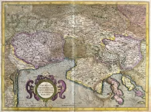
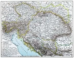
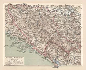
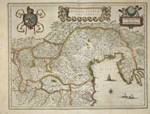
The Maps of Slovenia Europe collection from Media Storehouse offers a stunning array of wall art and framed prints that showcase the beauty and history of Slovenia. Our collection features a range of maps, including antique maps dating back to the 16th century as well as modern-day topographical maps. Each print is expertly crafted using high-quality materials, ensuring that it will last for years to come. Whether you are looking for a unique piece of artwork to decorate your home or office, or simply want to learn more about this fascinating country, the Maps of Slovenia Europe collection has something for everyone. From intricate city plans to detailed depictions of mountain ranges and rivers, these prints offer an unparalleled glimpse into the geography and culture of Slovenia. With their vibrant colors and intricate details, they are sure to make a statement in any space.
+
What are Maps of Slovenia Europe art prints?
Maps of Slovenia Europe art prints are high-quality reproductions of maps depicting the geography and topography of Slovenia, a country located in Central Europe. These prints showcase detailed cartographic information such as borders, cities, rivers, lakes, mountains and other landmarks that make up the Slovenian landscape. These art prints are perfect for those who have an interest in geography or history or simply want to decorate their homes with unique wall art. They can be used to create a focal point in any room or as part of a larger gallery wall display. Maps of Slovenia Europe art prints come in various sizes and styles including vintage maps from different eras and contemporary designs. They are printed on premium quality paper using advanced printing techniques to ensure that they retain their vibrant colors and sharp details for years to come. Whether you're looking for a gift for someone special or just want to add some character to your living space, Maps of Slovenia Europe art prints offer an excellent option that is both beautiful and informative.
+
What Maps of Slovenia Europe art prints can I buy from Media Storehouse?
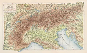
We offer a wide range of Maps of Slovenia Europe art prints that are perfect for those who love geography and history. These maps showcase the beautiful country of Slovenia in intricate detail, highlighting its cities, towns, rivers, mountains and other landmarks. You can choose from vintage-style maps that capture the essence of old-world cartography or contemporary designs that offer a fresh perspective on this stunning region. Some popular options include topographic maps that show elevation changes and terrain features; road maps with detailed information about highways and byways; political maps that display borders between countries and regions; and thematic maps that focus on specific topics such as climate zones or population density. Whether you're looking to decorate your home or office space with unique wall art or want to gift someone special with a meaningful present, we have something for everyone. With high-quality printing techniques used to create these Maps of Slovenia Europe art prints, you can be assured of their durability and longevity.
+
How do I buy Maps of Slovenia Europe art prints?
To buy Maps of Slovenia Europe art prints from Media Storehouse, you can browse our extensive collection of artwork online. Simply search for "Maps of Slovenia" in the search bar on our website and select the print that catches your eye. Once you have found the perfect piece, add it to your cart and proceed to checkout. During checkout, you will be prompted to enter your shipping information and payment details. We accept a variety of payment methods including credit cards and PayPal. After completing your purchase, your Maps of Slovenia Europe art print will be printed on high-quality paper using archival inks to ensure long-lasting color vibrancy. Your order will then be carefully packaged and shipped directly to your doorstep. Whether you are looking for a unique addition to your home decor or a thoughtful gift for someone special, buying Maps of Slovenia Europe art prints from Media Storehouse is easy and convenient.
+
How much do Maps of Slovenia Europe art prints cost?
We offer a wide range of Maps of Slovenia Europe art prints at varying prices. Our collection includes high-quality prints that are perfect for adding a touch of sophistication to any room. The cost of our Maps of Slovenia Europe art prints depends on various factors such as the size, quality, and type of print you choose. We have options ranging from small to large sizes, with different finishes like glossy or matte. Our art prints are created using state-of-the-art printing technology and premium materials to ensure that they last for years without fading or losing their vibrancy. Whether you're looking for a gift for someone special or want to decorate your home with stunning artwork, we have something for everyone in our collection. We take pride in offering affordable prices without compromising on quality so that anyone can enjoy beautiful artwork in their homes. Browse through our selection today and find the perfect Maps of Slovenia Europe art print that suits your style and budget.
+
How will my Maps of Slovenia Europe art prints be delivered to me?
We take great care in delivering your Maps of Slovenia Europe art prints to you. We use high-quality packaging materials to ensure that your artwork arrives in perfect condition. Your print will be carefully rolled and placed into a sturdy tube for safe transportation. We work with trusted delivery partners who offer reliable and efficient services worldwide. Once your order has been dispatched, you will receive an email notification with tracking information so that you can keep track of the progress of your delivery. Our aim is to provide our customers with a hassle-free experience when it comes to receiving their artwork. If for any reason there are issues with the delivery or if the product arrives damaged, please do not hesitate to contact us and we will do our best to resolve any problems as quickly as possible.