Fraud Blocker Skip to main content

Home > Europe > United Kingdom > Wales > Maps

Maps Collection (page 4)

Wales is a country located in the United Kingdom, and it has been mapped for centuries

1,292 items

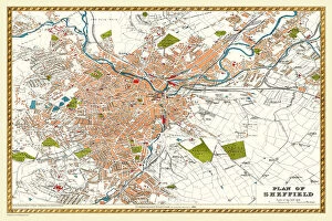
Background imageMaps Collection: Old Map of Sheffield 1893 from the Comprehensive Gazetteer Atlas of England and Wales

Old Map of Sheffield 1893 from the Comprehensive Gazetteer Atlas of England and Wales
J112

Background imageMaps Collection: Old Map of Leeds 1866 by Fullarton & Co

Old Map of Leeds 1866 by Fullarton & Co
This is an interesting and detailed reproduction Victorian town plan of Leeds which was originally published in John Marius Wilsons The Imperial Gazeteer of England and Wales (A.Fullarton & co)

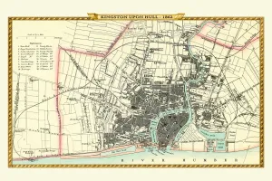
Background imageMaps Collection: Old Map of Kingston Upon Hull 1862 by Fullarton & Co

Old Map of Kingston Upon Hull 1862 by Fullarton & Co
This is an interesting and detailed reproduction Victorian town plan of Kingston-upon-Hull which was originally published in John Marius Wilsons The Imperial Gazeteer of England and Wales

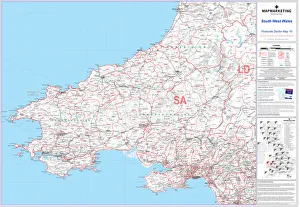
Background imageMaps Collection: Postcode Sector Map sheet 10 South West Wales

Postcode Sector Map sheet 10 South West Wales
This Postcode Sector Map (sheet 10) displays all of the first part of the postcode and the first number of the second part, or Inward Code, (eg EX20 3) for south west Wales

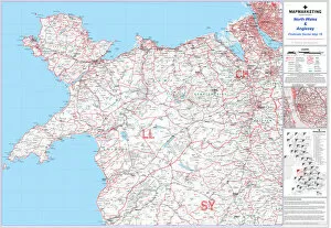
Background imageMaps Collection: Postcode Sector Map sheet 16 North Wales and Anglesey

Postcode Sector Map sheet 16 North Wales and Anglesey
This Postcode Sector Map (sheet 16) displays all of the first part of the postcode and the first number of the second part, or Inward Code

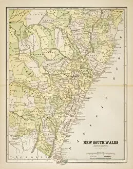
Background imageMaps Collection: Map of New South Wales 1883

Map of New South Wales 1883
Map of the state of New South Wales - Australia

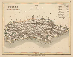
Background imageMaps Collection: Hand coloured antique map of Sussex England

Hand coloured antique map of Sussex England
This detailed map of Sussex is from Dugdales England and Wales Delineated. The map was drawn by G.Cole and engraved by John Roper for publication first in The Beauties Of England And Wales

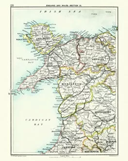
Background imageMaps Collection: Antique map, North Wales, Anglesey, Carnarvon, 19th Century

Antique map, North Wales, Anglesey, Carnarvon, 19th Century
Vintage engraving of a Antique map, North Wales, Anglesey, Carnarvon, Denbigh, Merionete, Montgomery19th Century

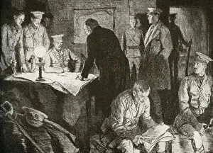
Background imageMaps Collection: WWI - British headquarters underground office

WWI - British headquarters underground office
3789980 WWI - British headquarters underground office; (add.info.: British headquarters underground office. A bomb proof subterranean apartment provides a workspace for generals to work out their)
Background imageMaps Collection: The southern part of England and of the Principate of Wales, engraving by G

The southern part of England and of the Principate of Wales, engraving by G. Zuliani taken from Tome I of the "Newest Atlas" published in Venice in 1778 by Antonio Zatta

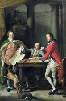
Background imageMaps Collection: Sir Watkin Williams-Wynn (1748-89), Thomas Apperley (1734-1819) and Captain Edward Hamilton

Sir Watkin Williams-Wynn (1748-89), Thomas Apperley (1734-1819) and Captain Edward Hamilton, 1768 (oil on canvas)
NGW184241 Sir Watkin Williams-Wynn (1748-89), Thomas Apperley (1734-1819) and Captain Edward Hamilton, 1768 (oil on canvas) by Batoni

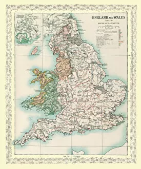
Background imageMaps Collection: Map of England and Wales as it appeared under the House of Lancaster

Map of England and Wales as it appeared under the House of Lancaster
BHISM005

Background imageMaps Collection: Map of England and Wales as it appeared after the Accession of The House of Tuder

Map of England and Wales as it appeared after the Accession of The House of Tuder
BHISM003

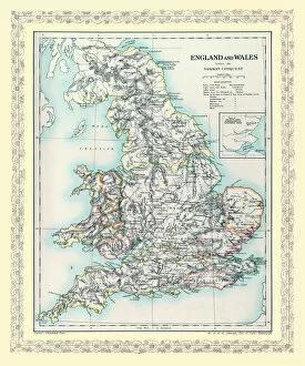
Background imageMaps Collection: Map of England and Wales as it appeared before the Norman Conquest

Map of England and Wales as it appeared before the Norman Conquest
BHISM002

Background imageMaps Collection: Old County Map of Caernarvonshire, Wales 1611 by John Speed

Old County Map of Caernarvonshire, Wales 1611 by John Speed
A facimile of John Speeds historical map of Caernarvonshire originally published for the " Theatre of the Empire of Great Britain"

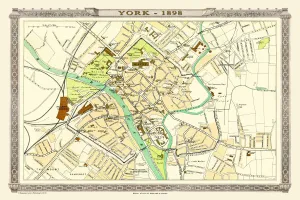
Background imageMaps Collection: Old Map of York 1898 from the Royal Atlas by Bartholomew

Old Map of York 1898 from the Royal Atlas by Bartholomew
A fine very detailed plan of the City of York remastered from an original contained within " The Royal Atlas of England and Wales" ; edited by J.G

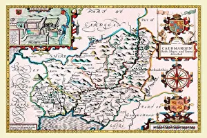
Background imageMaps Collection: Old County Map of Carmarthenshire 1611 by John Speed

Old County Map of Carmarthenshire 1611 by John Speed
A facimile of John Speeds historical map of Carmarthenshire originally published for the " Theatre of the Empire of Great Britain"

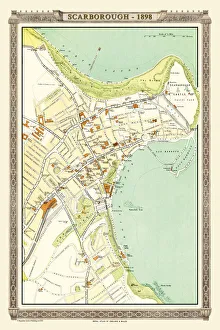
Background imageMaps Collection: Old Map of Scarborough 1898 from the Royal Atlas by Bartholomew

Old Map of Scarborough 1898 from the Royal Atlas by Bartholomew
A fine very detailed plan of the Seaside Town of Scarborough from 1898 remastered from an original contained within " The Royal Atlas of England and Wales" ; edited by J.G

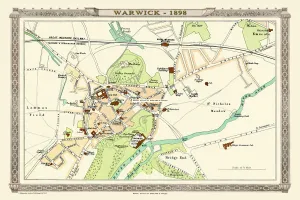
Background imageMaps Collection: Old Map of Warwick 1898 from the Royal Atlas by Bartholomew

Old Map of Warwick 1898 from the Royal Atlas by Bartholomew
A fine very detailed plan of the City of Warwick remastered from an original contained within " The Royal Atlas of England and Wales" ; edited by J.G

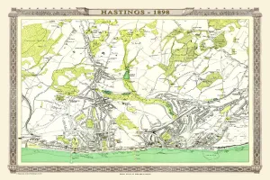
Background imageMaps Collection: Old Map of Hastings 1898 from the Royal Atlas by Bartholomew

Old Map of Hastings 1898 from the Royal Atlas by Bartholomew
A fine very detailed town plan of Hastings from 1898 remastered from an original contained within " The Royal Atlas of England and Wales" ; edited by J.G

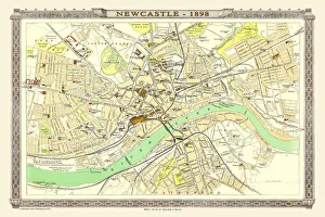
Background imageMaps Collection: Old Map of Newcastle 1898 from the Royal Atlas by Bartholomew

Old Map of Newcastle 1898 from the Royal Atlas by Bartholomew
A fine very detailed plan of the City of Newcastle remastered from an original contained within " The Royal Atlas of England and Wales" ; edited by J.G

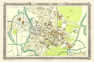
Background imageMaps Collection: Old Map of Oxford 1898 from the Royal Atlas by Bartholomew

Old Map of Oxford 1898 from the Royal Atlas by Bartholomew
A fine very detailed plan of the City of Oxford remastered from an original contained within " The Royal Atlas of England and Wales" ; edited by J.G

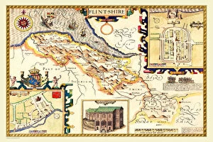
Background imageMaps Collection: Old County Map of Flintshire 1611 by John Speed

Old County Map of Flintshire 1611 by John Speed
A facimile of John Speeds historical map of Flintshire originally published for the " Theatre of the Empire of Great Britain", an atlas to accompany " a history of Great Britain"

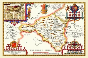
Background imageMaps Collection: Old County Map of Radnorshire, Wales 1611 by John Speed

Old County Map of Radnorshire, Wales 1611 by John Speed
A facimile of John Speeds historical map of Radnorshire originally published for the " Theatre of the Empire of Great Britain", an atlas to accompany " a history of Great Britain"

Background imageMaps Collection: Old County Map of Denbighshire 1611 by John Speed

Old County Map of Denbighshire 1611 by John Speed
A facimile of John Speeds historical map of Denbighshire originally published for the " Theatre of the Empire of Great Britain", an atlas to accompany " a history of Great Britain"

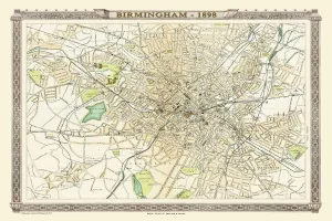
Background imageMaps Collection: Old Map of Birmingham 1898 from the Royal Atlas by Bartholomew

Old Map of Birmingham 1898 from the Royal Atlas by Bartholomew
A fine very detailed plan of the City of Birmingham remastered from an original contained within " The Royal Atlas of England and Wales" ; edited by J.G

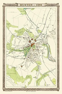
Background imageMaps Collection: Old Map of Buxton 1898 from the Royal Atlas by Bartholomew

Old Map of Buxton 1898 from the Royal Atlas by Bartholomew
A fine very detailed plan of the Spa Town of Buxton from 1898 remastered from an original contained within " The Royal Atlas of England and Wales" ; edited by J.G

Background imageMaps Collection: New South Wales 1851

New South Wales 1851
A fine facimile artworked from an antique original map of New South Wales, Australia, issued as part of the 1851 edition of John Tallis and Companys " The Illustrated Atlas

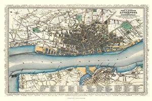
Background imageMaps Collection: Old Map of Liverpool 1866 by Fullarton & Co

Old Map of Liverpool 1866 by Fullarton & Co
This is an interesting and detailed reproduction Victorian town plan of Liverpool which was originally published in John Marius Wilsons The Imperial Gazeteer of England and Wales (A. Fullarton & co)

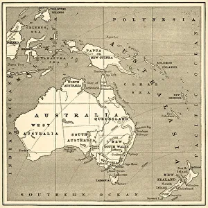
Background imageMaps Collection: Map of Australasia (1898 engraving)

Map of Australasia (1898 engraving)
Old map of Australasia from 1898

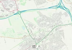
Background imageMaps Collection: Wakefield WF8 1 Map

Wakefield WF8 1 Map
Postcode Sector Map of Wakefield WF8 1

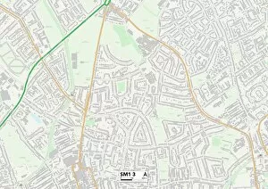
Background imageMaps Collection: Sutton SM1 3 Map

Sutton SM1 3 Map
Postcode Sector Map of Sutton SM1 3

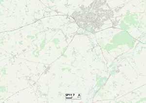
Background imageMaps Collection: Test Valley SP11 7 Map

Test Valley SP11 7 Map
Postcode Sector Map of Test Valley SP11 7

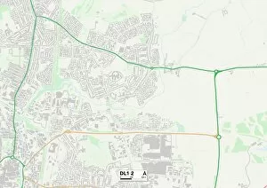
Background imageMaps Collection: Darlington DL1 2 Map

Darlington DL1 2 Map
Postcode Sector Map of Darlington DL1 2

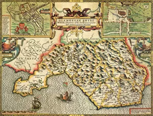
Background imageMaps Collection: Glamorgan Historical John Speed 1610 Map

Glamorgan Historical John Speed 1610 Map
A reproduction of John Speeds historical map of the county of Glamorgan. Originally published as part of his atlas called The Theatre of the Empire of Great Britain in 1610

Background imageMaps Collection: Map of England, with principal towns and cities, 1943. Creator: F Nichols

Map of England, with principal towns and cities, 1943. Creator: F Nichols
Map of England, with principal towns and cities, 1943. Places Mentioned in the Text. From " English Cities and Small Towns", by John Betjeman. [Collins, London, 1943]

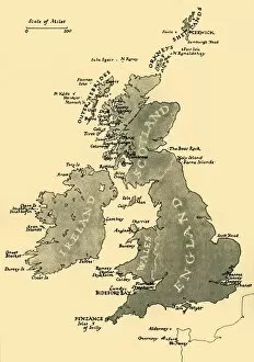
Background imageMaps Collection: Map of the British Isles, 1946. Creator: Unknown

Map of the British Isles, 1946. Creator: Unknown
Map of the British Isles, 1946. Map of England, Wales, Ireland and Scotland, Showing the Chief Places Mentioned in the Text, ie islands off the coast including Holy Island, the Farne Islands, Mersea

Background imageMaps Collection: The Isle of Anglesey, The Isle of Man and the Isle of Wight, 1650, (1946). Creator: Unknown

The Isle of Anglesey, The Isle of Man and the Isle of Wight, 1650, (1946). Creator: Unknown
The Isle of Anglesey, The Isle of Man and the Isle of Wight, 1650, (1946). Three maps of islands off the coast of Britain

Background imageMaps Collection: Map of England and Wales 1889

Map of England and Wales 1889
Comprehensive Geography by James Monteith - American Book Company 1882, 1889

Background imageMaps Collection: Map of Australasia (1882 engraving)

Map of Australasia (1882 engraving)
Old map of Australasia from Royal Geographical Readers no. 5 of Asia, Africa, America and Oceania, publ. T Nelson & Sons, London in 1883

Background imageMaps Collection: Antique map, Pembroke, Carmarthen, Glamorgan, Wales, 19th Century

Antique map, Pembroke, Carmarthen, Glamorgan, Wales, 19th Century
Vintage engraving of a Antique map, Pembroke, Carmarthen, Glamorgan, Wales, 19th Century

Background imageMaps Collection: Antique map, Hereford, Worester, Monmouth, Gloucester, Shropshire, 19th Century

Antique map, Hereford, Worester, Monmouth, Gloucester, Shropshire, 19th Century
Antique map, Hereford, Worester, Monmouth, Gloucester, Shropshire, England and Wales 19th Century

Background imageMaps Collection: Roman roads into Hereford and Monmouth. Artist: James G Wood

Roman roads into Hereford and Monmouth. Artist: James G Wood
Roman roads into Hereford and Monmouth

Background imageMaps Collection: Wales Vector Map

Wales Vector Map
Highly detailed vector map of Wales. File was created on July 22, 2011. The colors in the.eps-file are ready for print (CMYK). Included files: EPS (v8) and Hi-Res JPG

Background imageMaps Collection: A garden shelter at Mounton House, from The English Manor House (b/w photo)

A garden shelter at Mounton House, from The English Manor House (b/w photo)
CLF309177 A garden shelter at Mounton House, from The English Manor House (b/w photo) by English Photographer, (20th century); (add.info)

Background imageMaps Collection: Eastern Australia and New South Wales and Tasmania

Eastern Australia and New South Wales and Tasmania

Background imageMaps Collection: Anglesey And North Wales

Anglesey And North Wales

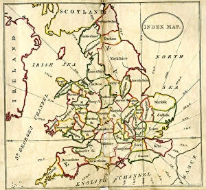
Background imageMaps Collection: England and Wales

England and Wales


All Professionally Made to Order for Quick Shipping


-

Maps Collection

Wales is a country located in the United Kingdom, and it has been mapped for centuries. Maps of Wales have been used to document its geography, topography, and infrastructure. These they are be found in various formats such as paper maps, online maps, and digital GIS systems. They provide detailed information about the physical features of Wales such as mountains, rivers, lakes, roads and railways. Additionally they also show political boundaries between countries within Europe that border Wales such as England and Ireland. Maps of Wales are an invaluable resource for anyone wanting to explore this beautiful country or understand its history better.
+

Our beautiful pictures are available as Framed Prints, Photos, Wall Art and Photo Gifts

Media Storehouse offers a collection of Maps of Wales United Kingdom Europe, which includes various wall art options such as framed prints, photo prints, canvas prints, jigsaw puzzles and greeting cards. The maps showcase the geography and topography of Wales in detail with different scales and styles. Our collection features historical maps from the 16th century to modern-day versions that highlight the country's political boundaries, cities, towns and natural landmarks. These maps are perfect for those interested in Welsh history or geography enthusiasts who want to explore the region's diverse landscapes. The Media Storehouse Maps of Wales United Kingdom Europe collection is an excellent way to add character to any room while also providing educational value. Whether it be for personal use or as a gift idea for someone special, these maps offer something unique that can't be found elsewhere. With so many options available at affordable prices, anyone can find their ideal map print or puzzle within this extensive collection.
+

What are Maps of Wales United Kingdom Europe art prints?

Maps of Wales United Kingdom Europe art prints are high-quality reproductions of historical and contemporary maps that depict the geography, topography, and landmarks of Wales, the United Kingdom, and Europe. These prints showcase the intricate details of each map in stunning clarity and vivid colors. They are perfect for anyone who loves history, geography or wants to add a touch of sophistication to their home decor. These art prints come in various sizes and styles to suit different tastes and preferences. Some feature antique maps from centuries ago while others show modern-day roadmaps with detailed information on cities, towns, highways, rivers, mountains among others. The Maps of Wales United Kingdom Europe art prints make great gifts for students studying geography or history as well as those who have an interest in cartography. Overall these beautiful pieces offer a unique way to explore the rich cultural heritage of Wales UK & Europe through its landscapes depicted on paper.
+

What Maps of Wales United Kingdom Europe art prints can I buy from Media Storehouse?

We offer a wide range of Maps of Wales United Kingdom Europe art prints that showcase the beauty and diversity of this region. You can choose from vintage maps, contemporary designs, and everything in between. These prints are available in various sizes to suit your needs and preferences. Some popular options include antique maps that depict the historical boundaries of Wales or detailed topographical maps that highlight its natural features. You can also find artistic renditions that capture the unique character and charm of Welsh towns and cities. Whether you're looking for a decorative piece for your home or office, or you want to gift someone with a meaningful keepsake, we have something for everyone. Their high-quality prints are produced using state-of-the-art printing technology on premium materials to ensure long-lasting durability and vibrant colors. With so many options to choose from, you're sure to find the perfect map print that captures your love for Wales United Kingdom Europe.
+

How do I buy Maps of Wales United Kingdom Europe art prints?

To purchase Maps of Wales United Kingdom Europe art prints, you can visit our online gallery. We offer a wide range of high-quality maps that are perfect for decorating your home or office space. You can browse through our collection and select the map that best suits your preferences. Once you have selected the map, you can choose from various sizes and framing options to customize it according to your needs. We offer a variety of frames such as black wood, white wood, silver metal, and gold metal. To complete your order, simply add the item to your cart and proceed to checkout. You will be prompted to enter your shipping information and payment details before submitting the order. Media Storehouse ensures that all their products are printed on high-quality paper using state-of-the-art printing technology. This guarantees that you receive a beautiful piece of artwork that is both durable and visually stunning.
+

How much do Maps of Wales United Kingdom Europe art prints cost?

We offer a wide range of Maps of Wales United Kingdom Europe art prints at varying prices. Our collection includes vintage and contemporary maps that showcase the beauty and history of Wales, the United Kingdom, and Europe as a whole. The cost of these prints depends on several factors such as size, framing options, and paper quality. Our you can choose from different sizes ranging from small to large formats to suit their needs. We also provide various framing options such as black or white frames that complement the artwork's style. Additionally, our high-quality paper ensures that each print is durable and long-lasting. Whether you're looking for a unique piece to decorate your home or office space or searching for an ideal gift for someone special who loves maps, we have something for everyone in our collection. So explore our website today to discover beautiful Maps of Wales United Kingdom Europe art prints at affordable prices.
+

How will my Maps of Wales United Kingdom Europe art prints be delivered to me?

We take great care in ensuring that your Maps of Wales United Kingdom Europe art prints are delivered to you safely and securely. We use high-quality packaging materials to protect your artwork during transit, so it arrives at your doorstep in pristine condition. We work with trusted delivery partners who have a proven track record for delivering packages on time and without any damage. Depending on where you live, we may use different carriers to ensure the fastest possible delivery times. Once your order is dispatched from our warehouse, you will receive an email notification with tracking information so that you can keep tabs on its progress. If there are any issues with the delivery or if you have any questions about your order, our customer service team is always available to assist you. We strive to make sure that receiving your Maps of Wales United Kingdom Europe art prints is a hassle-free experience that leaves you completely satisfied with both the product and service provided by Media Storehouse.