Home > Arts > Artists > G > Giovanni Xenodocus da Corfu
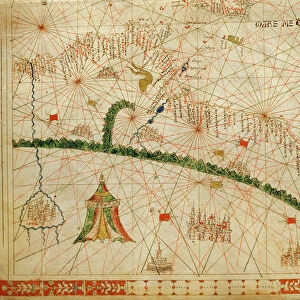
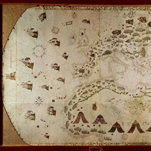
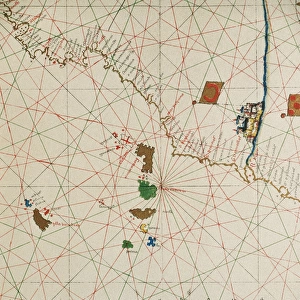
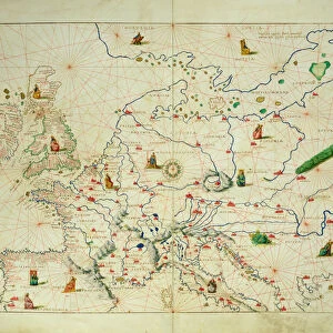
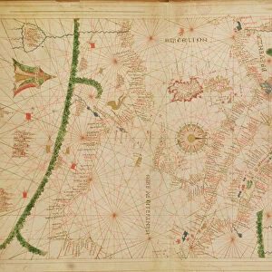
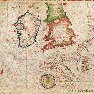
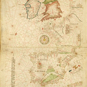
Provence and Italy, from a nautical atlas, 1520 (ink on vellum) (detail from 330915)
 (detail from 330915)")
![]()
Wall Art and Photo Gifts from Fine Art Finder
Provence and Italy, from a nautical atlas, 1520 (ink on vellum) (detail from 330915)
XOT330916 Provence and Italy, from a nautical atlas, 1520 (ink on vellum) (detail from 330915) by Giovanni Xenodocus da Corfu (fl. 16th Century); Museo Correr, Venice, Italy; Greek, out of copyright
Media ID 12852565
© www.bridgemanart.com
Adriatic Chart Corsica Croatia Genoa Mapping Mediterranean Sea Portolan Sardinia
FEATURES IN THESE COLLECTIONS
> Arts
> Artists
> G
> Giovanni Xenodocus da Corfu
> Europe
> Croatia
> Related Images
> Europe
> Greece
> Related Images
> Europe
> Italy
> Liguria
> Genoa
> Fine Art Finder
> Artists
> G
> Giovanni Xenodocus da Corfu Giovanni
> Fine Art Finder
> Artists
> Giovanni Xenodocus da Corfu
EDITORS COMMENTS
This print showcases a detailed section of an ancient nautical atlas, created in 1520 by the talented Giovanni Xenodocus da Corfu. The artwork, inked on vellum, beautifully depicts the stunning regions of Provence and Italy. With its intricate cartography and precise mapping techniques, this piece offers a glimpse into the navigational knowledge of the 16th century. The image transports us to a time when sailors relied on portolan charts like these to navigate through treacherous waters. The Mediterranean Sea takes center stage, with Corsica and Sardinia prominently featured alongside the Adriatic coast of Croatia. Every coastal detail is meticulously rendered, showcasing ports and landmarks crucial for seafaring journeys. As we explore this historical artifact further, it becomes evident that Venice and Genoa played significant roles in maritime trade during that era. These bustling cities served as important hubs for merchants and explorers alike. Preserved within Museo Correr in Venice today, this exquisite work of art reminds us of the rich history embedded within maps and charts. It serves as a testament to human curiosity about our surroundings and our relentless pursuit to understand them better. Through this photograph from Fine Art Finder at www. bridgemanart. com, we are granted access to an extraordinary piece of history that continues to captivate viewers with its timeless beauty.
MADE IN AUSTRALIA
Safe Shipping with 30 Day Money Back Guarantee
FREE PERSONALISATION*
We are proud to offer a range of customisation features including Personalised Captions, Color Filters and Picture Zoom Tools
SECURE PAYMENTS
We happily accept a wide range of payment options so you can pay for the things you need in the way that is most convenient for you
* Options may vary by product and licensing agreement. Zoomed Pictures can be adjusted in the Cart.