Home > Arts > Artists > B > James Bayes
ib. A Plan of the Harbour of Croque in Newfoundland, 1763 (pen & ink and wash)
")
![]()
Wall Art and Photo Gifts from Fine Art Finder
ib. A Plan of the Harbour of Croque in Newfoundland, 1763 (pen & ink and wash)
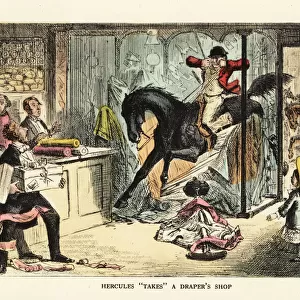
5670246 ib. A Plan of the Harbour of Croque in Newfoundland, 1763 (pen & ink and wash) by Cook, James (1728-79); Mitchell Library, State Library of New South Wales; (add.info.: Original Sketches, Drawings, Maps etc Collected by Admiral Isaac Smith / drawings and watercolours, mainly of Captain Cooks Second Voyage (1772-1775) by William Hodges, Henry Roberts etc
Dimensions: Album measures 49 x 70 cm); Mitchell Library, State Library of New South Wales; English, out of copyright
Media ID 23583474
© Mitchell Library, State Library of New South Wales / Bridgeman Images
Captain Cook Cartographic Cartography Chart Expedition First Voyage Geographical Haven Hydrographic Incomplete Mapping Monochrome North American Numbered Numbers St Johns Survey Surveying Unfinished America Continent Canadians
FEATURES IN THESE COLLECTIONS
> Arts
> Artists
> B
> James Bayes
> Arts
> Artists
> H
> William Hodges
> Arts
> Artists
> J
> William James
> Arts
> Artists
> M
> Robert Mitchell
> Arts
> Artists
> R
> James Roberts
> Arts
> Artists
> S
> Robert Smith
> Europe
> United Kingdom
> Wales
> Maps
> Europe
> United Kingdom
> Wales
> Posters
> Fine Art Finder
> Artists
> James Cook
> Fine Art Finder
> Artists
> Sarah Stone
EDITORS COMMENTS
This print showcases "A Plan of the Harbour of Croque in Newfoundland, 1763" by James Cook. The pen and ink drawing, enhanced with wash technique, is a remarkable piece from Cook's Second Voyage (1772-1775). Preserved in the Mitchell Library at the State Library of New South Wales, this artwork is part of Admiral Isaac Smith's collection. The image presents an intricate map depicting the haven known as Croque in Newfoundland. With its detailed coastline and shoreline, it offers a glimpse into the geography and cartography of this North American region during the 18th century. The monochromatic black and white palette adds to its allure. While labeled as incomplete or unfinished, this plan still provides valuable insights into Captain Cook's exploration expeditions. It serves as a testament to his significant contributions to mapping uncharted territories during his first voyage. The print captures every nuance of this historical artifact with precision. Its dimensions measure 49 x 70 cm, making it an impressive display piece for any admirer of maritime history or cartographic art. Bridgeman Images has expertly reproduced this masterpiece for Fine Art Finder, allowing viewers to appreciate both its artistic value and its importance in documenting early Canadian history.
MADE IN AUSTRALIA
Safe Shipping with 30 Day Money Back Guarantee
FREE PERSONALISATION*
We are proud to offer a range of customisation features including Personalised Captions, Color Filters and Picture Zoom Tools
SECURE PAYMENTS
We happily accept a wide range of payment options so you can pay for the things you need in the way that is most convenient for you
* Options may vary by product and licensing agreement. Zoomed Pictures can be adjusted in the Cart.