Fraud Blocker Skip to main content

Home > Fine Art Finder > Maps (celestial & Terrestrial)

Maps (celestial & Terrestrial) Collection

Choose a picture from our Maps (celestial & Terrestrial) Collection for your Wall Art and Photo Gifts

1,541 items

Background imageMaps (celestial & Terrestrial) Collection: Mappa Mundi, c. 1290 (vellum)

Mappa Mundi, c. 1290 (vellum)
BAL62567 Mappa Mundi, c.1290 (vellum) by Richard of Haldingham (Richard de Bello) (fl.c.1260-1305); Hereford Cathedral, Herefordshire, UK; English, out of copyright

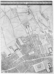
Background imageMaps (celestial & Terrestrial) Collection: A Map of Bloomsbury and Holborn, London, 1746 (engraving)

A Map of Bloomsbury and Holborn, London, 1746 (engraving)
XJF438445 A Map of Bloomsbury and Holborn, London, 1746 (engraving) by Rocque, John (c.1704-d.1762); Private Collection; (add.info.: the map shows the Foundling Hospital)

Background imageMaps (celestial & Terrestrial) Collection: Cumberland and the Ancient City of Carlile, engraved by Jodocus Hondius (1563-1612)

Cumberland and the Ancient City of Carlile, engraved by Jodocus Hondius (1563-1612)
XCF113480 Cumberland and the Ancient City of Carlile, engraved by Jodocus Hondius (1563-1612) from John Speeds Theatre of the Empire of Great Britain, pub

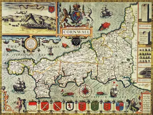
Background imageMaps (celestial & Terrestrial) Collection: Map of Cornwall from the Theatre of the Empire of Great Britain, pub

Map of Cornwall from the Theatre of the Empire of Great Britain, pub
BAL16023 Map of Cornwall from the Theatre of the Empire of Great Britain, pub. in London by George Humble, 1627 edition (hand coloured engraving) by Speed, John (1552-1629); Map House, London

Background imageMaps (celestial & Terrestrial) Collection: Map of the Siege of Quebec by the British Fleet, 1670 (engraving)

Map of the Siege of Quebec by the British Fleet, 1670 (engraving)
STC190699 Map of the Siege of Quebec by the British Fleet, 1670 (engraving) by French School, (17th century); Private Collection; (add.info)

Background imageMaps (celestial & Terrestrial) Collection: Map showing the principal world trade shipping routes, 1912 (colour litho)

Map showing the principal world trade shipping routes, 1912 (colour litho)
CHT277054 Map showing the principal world trade shipping routes, 1912 (colour litho) by French School, (20th century); Private Collection; (add.info)

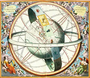
Background imageMaps (celestial & Terrestrial) Collection: The Situation of the Earth in the Heavens, plate 74 from The Celestial Atlas

The Situation of the Earth in the Heavens, plate 74 from The Celestial Atlas
XCF90198 The Situation of the Earth in the Heavens, plate 74 from The Celestial Atlas, or the Harmony of the Universe (Atlas coelestis seu harmonia macrocosmica) pub

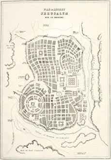
Background imageMaps (celestial & Terrestrial) Collection: Plan of ancient Jerusalem as it was presumed to be at the time of Jesus Christ (litho)

Plan of ancient Jerusalem as it was presumed to be at the time of Jesus Christ (litho)
KW360491 Plan of ancient Jerusalem as it was presumed to be at the time of Jesus Christ (litho) by English School, (19th century); Private Collection; (add.info.: from The Holy Bible)

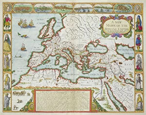
Background imageMaps (celestial & Terrestrial) Collection: A New Map of the Roman Empire, from A Prospect of the Most Famous Parts of the World, pub

A New Map of the Roman Empire, from A Prospect of the Most Famous Parts of the World, pub
BAL42841 A New Map of the Roman Empire, from A Prospect of the Most Famous Parts of the World, pub. by Bassett & Chiswell, 1676 (hand coloured plate engraving) by Speed

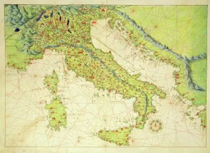
Background imageMaps (celestial & Terrestrial) Collection: Italy, from an Atlas of the World in 33 Maps, Venice, 1st September 1553 (ink on vellum)

Italy, from an Atlas of the World in 33 Maps, Venice, 1st September 1553 (ink on vellum)
XOT330948 Italy, from an Atlas of the World in 33 Maps, Venice, 1st September 1553 (ink on vellum) by Agnese, Battista (1514-64); Museo Correr, Venice, Italy; Italian, out of copyright

Background imageMaps (celestial & Terrestrial) Collection: The siege of Stralsund, Germany, 1628, during the Thirty Years War, c.1880 (engraving)

The siege of Stralsund, Germany, 1628, during the Thirty Years War, c.1880 (engraving)
478467 The siege of Stralsund, Germany, 1628, during the Thirty Years War, c.1880 (engraving); Private Collection; (add.info.: City leaders in council. After a work by Carl von Haberlin)

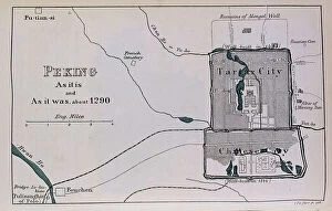
Background imageMaps (celestial & Terrestrial) Collection: Peking, from 'The Book of Ser Marco Polo', 1903 (pen and ink on paper)

Peking, from 'The Book of Ser Marco Polo', 1903 (pen and ink on paper)
BAL115002 Peking, from 'The Book of Ser Marco Polo', 1903 (pen and ink on paper); Private Collection; (add.info.: Peking, c.1290, from 'The Book of Ser Marco Polo', ed. Yule, pub)

Background imageMaps (celestial & Terrestrial) Collection: Head of woman, drawing by Odilon Redon (1840-1916) c. the 1880's-1890's

Head of woman, drawing by Odilon Redon (1840-1916) c. the 1880's-1890's
1755325 Head of woman, drawing by Odilon Redon (1840-1916) c. the 1880's-1890's by Redon, Odilon (1840-1916); (add.info.: Head of woman, drawing by Odilon Redon (1840-1916) c

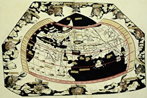
Background imageMaps (celestial & Terrestrial) Collection: Map of the world, based on descriptions and co-ordinates given in Geographia

Map of the world, based on descriptions and co-ordinates given in Geographia
BAL42850 Map of the world, based on descriptions and co-ordinates given in Geographia, by Ptolemy (Claudius Ptolemaeus of Alexandria) (c.90-168 AD); O'Shea Gallery, London, UK

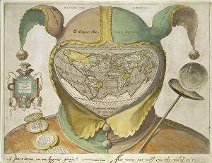
Background imageMaps (celestial & Terrestrial) Collection: Fool's Cap World Map, c.1590 (hand-coloured engraving on off-white paper)

Fool's Cap World Map, c.1590 (hand-coloured engraving on off-white paper, with inscriptions in iron gall ink)
1217928 Fool's Cap World Map, c.1590 (hand-coloured engraving on off-white paper, with inscriptions in iron gall ink) by Unknown Artist, (16th century); 49.7x38.8 cm; Ashmolean Museum

Background imageMaps (celestial & Terrestrial) Collection: Fete de la Federation a Paris

Fete de la Federation a Paris
1997585 Fete de la Federation a Paris; (add.info.: History. French Revolution. The Fete de la Federation at the Champ de Mars, Paris, July, 14, 1790)

Background imageMaps (celestial & Terrestrial) Collection: Map of Europe, from a facsimile of the Miller Atlas by Pedro and Jorge Reinel, and Lopo Homem

Map of Europe, from a facsimile of the Miller Atlas by Pedro and Jorge Reinel, and Lopo Homem, made in 1519
XOT366585 Map of Europe, from a facsimile of the Miller Atlas by Pedro and Jorge Reinel, and Lopo Homem, made in 1519; Bibliotheque Nationale, Paris

Background imageMaps (celestial & Terrestrial) Collection: Map of the northern Mexican archipelago and the West Indies, 1688 (engraving)

Map of the northern Mexican archipelago and the West Indies, 1688 (engraving)
VNK284160 Map of the northern Mexican archipelago and the West Indies, 1688 (engraving) by Coronelli, Vincenzo Maria (1650-1718); Vorontsov Palace, Crimea

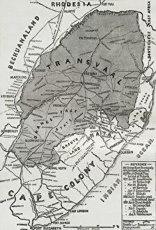
Background imageMaps (celestial & Terrestrial) Collection: Map of the Boer Republics at the end of the 19th century, from South Africa and the Transvaal War

Map of the Boer Republics at the end of the 19th century, from South Africa and the Transvaal War: Vol
KW371000 Map of the Boer Republics at the end of the 19th century, from South Africa and the Transvaal War: Vol. 1 by Louis Creswicke, published 1900 (litho) by English School

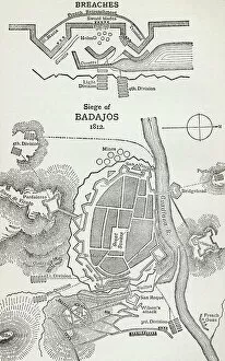
Background imageMaps (celestial & Terrestrial) Collection: Map showing the site of the Siege of Badajoz, Spain in 1812 (litho)

Map showing the site of the Siege of Badajoz, Spain in 1812 (litho)
KW361117 Map showing the site of the Siege of Badajoz, Spain in 1812 (litho) by English School, (19th century); Private Collection; (add.info.: from the book How England Saved Europe)

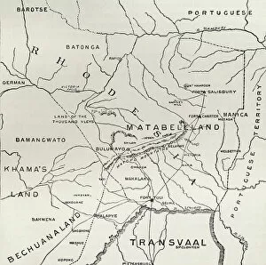
Background imageMaps (celestial & Terrestrial) Collection: Map of Matabeleland in the late 19th century, from South Africa and the Transvaal War: Vol

Map of Matabeleland in the late 19th century, from South Africa and the Transvaal War: Vol
KW371011 Map of Matabeleland in the late 19th century, from South Africa and the Transvaal War: Vol. 1 by Louis Creswicke, published 1900 (litho) by English School, (20th century); Private Collection

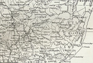
Background imageMaps (celestial & Terrestrial) Collection: Map of Zululand and adjoining portions of Natal at the end of the 19th century

Map of Zululand and adjoining portions of Natal at the end of the 19th century
KW371004 Map of Zululand and adjoining portions of Natal at the end of the 19th century, from South Africa and the Transvaal War: Vol

Background imageMaps (celestial & Terrestrial) Collection: Map of Nancy, from Civitates Orbis Terrarum by Georg Braun (1541-1622)

Map of Nancy, from Civitates Orbis Terrarum by Georg Braun (1541-1622) and Frans Hogenberg (1535-90) c
STC138946 Map of Nancy, from Civitates Orbis Terrarum by Georg Braun (1541-1622) and Frans Hogenberg (1535-90) c.1572-1617 (coloured engraving) by Hoefnagel

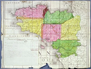
Background imageMaps (celestial & Terrestrial) Collection: Division of Brittany into Six Departments, c. 1789-90 (colour litho)

Division of Brittany into Six Departments, c. 1789-90 (colour litho)
ARH207437 Division of Brittany into Six Departments, c.1789-90 (colour litho) by French School, (18th century); Centre Historique des Archives Nationales, Paris, France; © Archives Charmet

Background imageMaps (celestial & Terrestrial) Collection: 'An Exact Delineation of the Famous City of Bristol and Suburbs', by James Millerd, pub. 1673

"An Exact Delineation of the Famous City of Bristol and Suburbs", by James Millerd, pub. 1673
BAG69790 "An Exact Delineation of the Famous City of Bristol and Suburbs", by James Millerd, pub.1673 by English School, (17th century); Bristol Museum and Art Gallery

Background imageMaps (celestial & Terrestrial) Collection: Metropolitan Board of Works map of Bazalgette's plan for the Lines of Main Intercepting Sewers

Metropolitan Board of Works map of Bazalgette's plan for the Lines of Main Intercepting Sewers
GHL35390 Metropolitan Board of Works map of Bazalgette's plan for the Lines of Main Intercepting Sewers, constructed for the Improved Drainage of the Metropolis, (colour engraving)

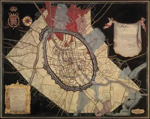
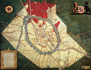
Background imageMaps (celestial & Terrestrial) Collection: Map of Bruges and the Feudal Grounds (oil on canvas)

Map of Bruges and the Feudal Grounds (oil on canvas)
490264 Map of Bruges and the Feudal Grounds (oil on canvas) by Lobberecht, Joannes (18th century) ; Groeningemuseum, Bruges, Belgium; © Art in Flanders

Background imageMaps (celestial & Terrestrial) Collection: Map of the Liberty of Bruges (oil on canvas)

Map of the Liberty of Bruges (oil on canvas)
490262 Map of the Liberty of Bruges (oil on canvas) by Pourbus, Pieter Jansz. (1523-84); 151x322.2 cm; Groeningemuseum, Bruges

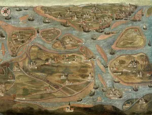
Background imageMaps (celestial & Terrestrial) Collection: Map of Damme and the Spanish Border Fortresses near Sluis (oil on canvas)

Map of Damme and the Spanish Border Fortresses near Sluis (oil on canvas)
490157 Map of Damme and the Spanish Border Fortresses near Sluis (oil on canvas) by Lobberecht, Jacques (17th century); 132x204.5 cm; Groeningemuseum, Bruges, Belgium; © Art in Flanders

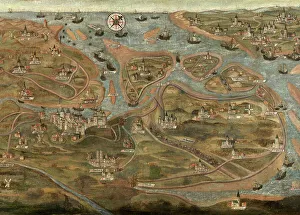
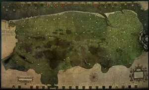
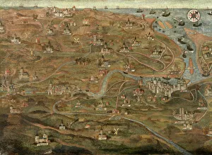
Background imageMaps (celestial & Terrestrial) Collection: Map of the Zwin Area (oil on canvas)

Map of the Zwin Area (oil on canvas)
490039 Map of the Zwin Area (oil on canvas) by Hervy, Jehan de (fl.1472-1507); Groeningemuseum, Bruges, Belgium; (add.info.: See also 490038 & 490040.); © Art in Flanders

Background imageMaps (celestial & Terrestrial) Collection: Map of the Castellany of Bruges (oil on canvas)

Map of the Castellany of Bruges (oil on canvas)
489859 Map of the Castellany of Bruges (oil on canvas) by Claeissens, Pieter II (fl.1571-d.1623); 322.5x151 cm; Groeningemuseum, Bruges, Belgium; © Art in Flanders

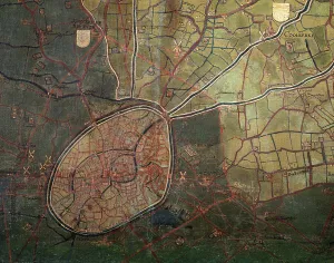
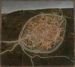
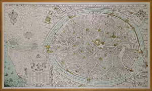
Background imageMaps (celestial & Terrestrial) Collection: Map of Bruges (oil on canvas)

Map of Bruges (oil on canvas)
490265 Map of Bruges (oil on canvas) by Flemish School, (16th century); Groeningemuseum, Bruges, Belgium; © Art in Flanders

Background imageMaps (celestial & Terrestrial) Collection: Map of Bruges and the Waterways (oil on canvas)

Map of Bruges and the Waterways (oil on canvas)
490263 Map of Bruges and the Waterways (oil on canvas) by Lobberecht, Joannes (18th century) ; 177x232 cm; Groeningemuseum, Bruges, Belgium; © Art in Flanders

Background imageMaps (celestial & Terrestrial) Collection: Map of the Zwin Area (oil on canvas)

Map of the Zwin Area (oil on canvas)
490040 Map of the Zwin Area (oil on canvas) by Hervy, Jehan de (fl.1472-1507); Groeningemuseum, Bruges, Belgium; (add.info.: See also 490038 & 490039.); © Art in Flanders

Background imageMaps (celestial & Terrestrial) Collection: Map of the Zwin Area (oil on canvas)

Map of the Zwin Area (oil on canvas)
490038 Map of the Zwin Area (oil on canvas) by Hervy, Jehan de (fl.1472-1507); Groeningemuseum, Bruges, Belgium; (add.info.: See also 490039 & 490040.); © Art in Flanders

Background imageMaps (celestial & Terrestrial) Collection: The City of Bruges, 1562 (colour litho)

The City of Bruges, 1562 (colour litho)
490348 The City of Bruges, 1562 (colour litho) by Gheeraerts, Marcus, the Elder (c.1520-90); Groeningemuseum, Bruges, Belgium; © Art in Flanders

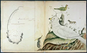
Background imageMaps (celestial & Terrestrial) Collection: Chart of Adventure Bay, Van Dieman's Land, c. 1773 (w/c on paper)

Chart of Adventure Bay, Van Dieman's Land, c. 1773 (w/c on paper)
RNM286357 Chart of Adventure Bay, Van Dieman's Land, c.1773 (w/c on paper) by Fannin, Peter (fl.1773); National Museum of the Royal Navy, Portsmouth, Hampshire

Background imageMaps (celestial & Terrestrial) Collection: Map of the world, from a manuscript of a Commentary on the Apocalypse, written c. 787 and copied c

Map of the world, from a manuscript of a Commentary on the Apocalypse, written c. 787 and copied c
XOT366587 Map of the world, from a manuscript of a Commentary on the Apocalypse, written c.787 and copied c.1109 in the Monastery of Silos, Burgos, Spain (litho) by Spanish School

Background imageMaps (celestial & Terrestrial) Collection: Map of East Prussia. from Le Theatre du Monde or Nouvel Atlas, 1645 (coloured engraving)

Map of East Prussia. from Le Theatre du Monde or Nouvel Atlas, 1645 (coloured engraving)
CHT211402 Map of East Prussia. from Le Theatre du Monde or Nouvel Atlas, 1645 (coloured engraving) by Blaeu, Joan (1596-1673); Bibliotheque des Arts Decoratifs, Paris, France; © Archives Charmet

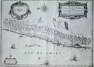
Background imageMaps (celestial & Terrestrial) Collection: Map of Chile, 17th century (litho)

Map of Chile, 17th century (litho)
354835 Map of Chile, 17th century (litho) by Blaeu, Willem (1571-1638) (after); Index Fototeca

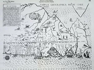
Background imageMaps (celestial & Terrestrial) Collection: Map of Chile made for Alonso de Ovalle, 1646 (engraving)

Map of Chile made for Alonso de Ovalle, 1646 (engraving)
364997 Map of Chile made for Alonso de Ovalle, 1646 (engraving) by Spanish School, (17th century); (add.info.: Alonso de Ovalle (1603-51), Chilean Jesuit priest and historian.); Index Fototeca

Background imageMaps (celestial & Terrestrial) Collection: Map of Spain, from Cosmography, c. 1456 (coloured engraving)

Map of Spain, from Cosmography, c. 1456 (coloured engraving)
IND132966 Map of Spain, from Cosmography, c.1456 (coloured engraving) by Ptolomeus, Claudio (fl. 12th century) (after); Biblioteca Universidad, Salamanca, Spain; Index Fototeca

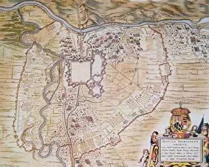
Background imageMaps (celestial & Terrestrial) Collection: Plan of the Citadel of Turin during the siege of 1640 (colour litho)

Plan of the Citadel of Turin during the siege of 1640 (colour litho)
354818 Plan of the Citadel of Turin during the siege of 1640 (colour litho) by Blaeu, Joan (1596-1673) (after); Historical Archive, Turin, Italy; Index Fototeca

Background imageMaps (celestial & Terrestrial) Collection: Canary Islands, from The New Atlas, 1645 (engraving)

Canary Islands, from The New Atlas, 1645 (engraving)
IND113065 Canary Islands, from The New Atlas, 1645 (engraving) by Dutch School, (17th century); Private Collection; Index Fototeca

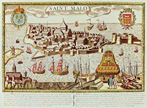
Background imageMaps (celestial & Terrestrial) Collection: View of the port and fortified city of Saint Malo, located on the coast of Brittany

View of the port and fortified city of Saint Malo, located on the coast of Brittany
IND388249 View of the port and fortified city of Saint Malo, located on the coast of Brittany by French School; Private Collection; (add.info.: Vista del puerto y la ciudad fortificada de Saint Malo)

Background imageMaps (celestial & Terrestrial) Collection: The Mappa Mundi of Fra Mauro, a Camaldolese monk from the monastery of San Michele in Murano, 1459

The Mappa Mundi of Fra Mauro, a Camaldolese monk from the monastery of San Michele in Murano, 1459
ALI75764 The Mappa Mundi of Fra Mauro, a Camaldolese monk from the monastery of San Michele in Murano, 1459 by Italian School, (15th century); Palazzo Ducale, Venice, Italy; Alinari

Background imageMaps (celestial & Terrestrial) Collection: Insulae lavae, a large folding map of Java with two insets both depicting views of Batavia

Insulae lavae, a large folding map of Java with two insets both depicting views of Batavia (Jakarta) Dutch
BON93407 Insulae lavae, a large folding map of Java with two insets both depicting views of Batavia (Jakarta) Dutch, published by Gerard van Keulen, Amsterdam, c.1715 (coloured engraving) by Reland

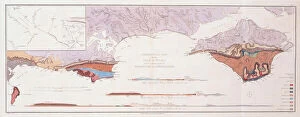
Background imageMaps (celestial & Terrestrial) Collection: Geological Map and Sections of the Isle of Wight and the Adjacent Parts of Hampshire and Dorsetshire

Geological Map and Sections of the Isle of Wight and the Adjacent Parts of Hampshire and Dorsetshire
1765217 Geological Map and Sections of the Isle of Wight and the Adjacent Parts of Hampshire and Dorsetshire, 1816 (hand-coloured engraving) by Webster


All Professionally Made to Order for Quick Shipping


-

Why Choose Us?

We are a leading provider of Art Prints and Photo Gifts since 2004, working in partnership with a range of Sporting Clubs, Charities, Museums and Picture Libraries. A large share of profits from any of their images will go directly towards supporting that charity or club. Our archive of images is carefully curated to bring you a wide range of subjects, including landscapes, wildlife, architecture, and more. We ship from our partner labs in the UK, USA, EU (Netherlands) and Australia.
+

How do I place an order?

Ordering is quick & easy - Just follow 5 Simple Steps:
  1. Find your image: Use our search box or browse our online photo Collections to find the image you want.

  2. Choose your print format: Select your desired product and add it to your cart.

  3. Enter your details: If you're a returning customer, simply enter your email address and password, and we'll fill in your billing and shipping address details. All personal details are held securely and are fully GDPR compliant. As standard, we remove all Personally Identifiable Information after 12 months.

  4. Pay for your purchase: We use state-of-the-art security for online shopping and do not have access to your card details.

  5. Sit back and relax: We'll email you confirmation of your order and when it's dispatched. Registered customers can also track orders in the 'My Account' area.

+

How do I pay for an order?

You can pay for your order with most of the major credit and debit cards, or PayPal. For added security, major financial institutions process payment details separately and securely on our behalf. We do not have access to your online payment card details. Online payments are preferred however we do take phone orders. For UK customers only we accept cheques issued against a UK bank.
+

Is my data safe?

We take data security very seriously. We do not have access to your full card details and all payments are requested over a fully secure connection. Additionally, we fully comply with current European and GDPR legislation, and automatically remove all personal data after at most 12 months (unless you have an account with us and have signed in recently). We also have a strict opt-in policy and would never sell your personal details. Your data is only used to fulfill your order promptly and efficiently.
+

Is wall art ready to hang?

For quick and easy installation all wall art, including framed prints, canvas prints and metal prints are supplied with a ready to hang solution on the back. Generally, saw tooth hangers are applied as they allow wall art to hang flush against the wall. The serrated edge of the hanger prevents the frame from shifting or tilting when hung.
+

Are the photo prints fade resistant?

Yes, we use archival quality photo paper photographic paper for vivid reproduction Prints are an accurate representations of the original artwork, which is preserved for artistic character and authenticity. We guarantee they match previews shown on our web site