Home > North America > United States of America > New York > New York > Sights > New York Public Library
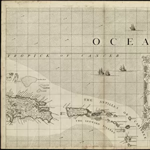
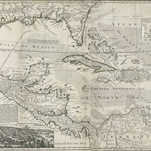
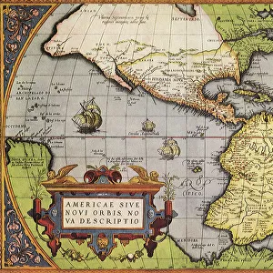
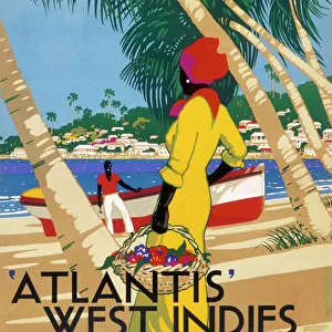
Trading map of the West Indies, 1707 (hand coloured print)
")
![]()
Wall Art and Photo Gifts from Fine Art Finder
Trading map of the West Indies, 1707 (hand coloured print)
XOS1765725 Trading map of the West Indies, 1707 (hand coloured print) by English School, (18th century); New York Public Library, USA; (add.info.: A new and correct large draught of the tradeing part of the West Indies from a sea-atlas containing an hydrographical description of most of the sea-coasts of the known parts of the world by Samuel Thornton.); English, out of copyright
Media ID 12742641
© www.bridgemanimages.com
Atlantic Ocean Atlas Caribbean Caribbean Sea Cartography Central America Gulf Of Mexico Hydrography Islands Latitude Longitude Navigation New Spain North Sea Pilot Sea Chart Shipping Terrestrial Tropic Of Cancer
FEATURES IN THESE COLLECTIONS
> Fine Art Finder
> Maps (celestial & Terrestrial)
> Fine Art Finder
> Schools
> English School
> Maps and Charts
> Spain
> Maps and Charts
> World
> North America
> Mexico
> Related Images
> North America
> United States of America
> Maps
> North America
> United States of America
> New York
> New York
> Maps
> North America
> United States of America
> New York
> New York
> Sights
> New York Public Library
> South America
> Related Images
EDITORS COMMENTS
This hand-coloured print, titled "Trading map of the West Indies, 1707" offers a captivating glimpse into the world of navigation and cartography in the 18th century. Created by an English School artist, this meticulously detailed map showcases the vast expanse of the West Indies region, stretching from Central America to South America. The map is part of Samuel Thornton's sea-atlas, which provides hydrographical descriptions of various coastlines around the world. It serves as a valuable resource for sailors and traders seeking accurate information about sea routes and trade opportunities. With its vibrant colors and intricate illustrations, this print invites viewers to explore not only the islands of the Caribbean but also adjacent bodies of water such as the Gulf of Mexico and Bay of Mexico. The presence of major landmarks like North America and South America further emphasizes the significance of these trading routes during that era. As we delve into this historical artifact, we gain insight into early maritime exploration efforts. This map played a crucial role in guiding ships through treacherous waters while facilitating international trade across continents. Its inclusion in New York Public Library's collection highlights its enduring value as both a work of art and an important piece in our understanding of global history.
MADE IN AUSTRALIA
Safe Shipping with 30 Day Money Back Guarantee
FREE PERSONALISATION*
We are proud to offer a range of customisation features including Personalised Captions, Color Filters and Picture Zoom Tools
SECURE PAYMENTS
We happily accept a wide range of payment options so you can pay for the things you need in the way that is most convenient for you
* Options may vary by product and licensing agreement. Zoomed Pictures can be adjusted in the Cart.