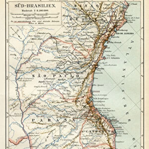
Home > South America > Brazil > Maps
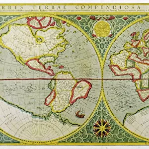
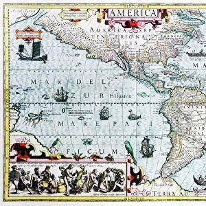
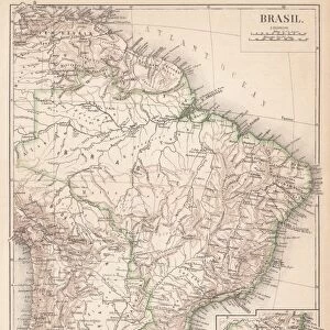
Map of Americas history 1895

![]()
Wall Art and Photo Gifts from Fine Art Storehouse
Map of Americas history 1895
Meyers Konversations-Lexikon. Ein Nachschlagewerk des allgemeinen Wissens, 5th edition 17 volumes Bibliographisches Institut - Leipzig 1895-1897
Unleash your creativity and transform your space into a visual masterpiece!
THEPALMER
Media ID 13611813
© This content is subject to copyright
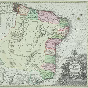
Atlas Mythological Figure Brazil Central America Colonialism North America Paper South America World Map
FEATURES IN THESE COLLECTIONS
> Fine Art Storehouse
> The Magical World of Illustration
> Palmer Illustrated Collection
> Fine Art Storehouse
> Map
> Historical Maps
> Fine Art Storehouse
> Map
> USA Maps
> Maps and Charts
> Early Maps
> Maps and Charts
> World
> North America
> United States of America
> Maps
> South America
> Brazil
> Maps
EDITORS COMMENTS
This print showcases a remarkable piece of history - the "Map of Americas history 1895" from Meyers Konversations-Lexikon, a renowned encyclopedia published in Leipzig between 1895 and 1897. The map, beautifully illustrated on paper with intricate engravings, takes us back to an era when cartography was both art and science. The antique charm of this world map is evident in its detailed depiction of North America, USA, Central America, Brazil, and South America. It offers a glimpse into the colonialism prevalent during that time period while also highlighting the physical geography of these regions. As we explore this vintage masterpiece by THEPALMER at Fine Art Storehouse, our eyes are drawn to mythical figures adorning the atlas. These mythological representations add an air of mystique and wonder to an already fascinating piece. In today's digital age where maps are readily available at our fingertips, this print serves as a reminder of how far we have come in terms of technological advancements. Yet it also reminds us to appreciate the craftsmanship and dedication that went into creating such intricate works centuries ago. Whether you're a lover of history or simply captivated by beautiful illustrations, this print is sure to transport you back in time and ignite your imagination with tales from Americas' past.
MADE IN AUSTRALIA
Safe Shipping with 30 Day Money Back Guarantee
FREE PERSONALISATION*
We are proud to offer a range of customisation features including Personalised Captions, Color Filters and Picture Zoom Tools
SECURE PAYMENTS
We happily accept a wide range of payment options so you can pay for the things you need in the way that is most convenient for you
* Options may vary by product and licensing agreement. Zoomed Pictures can be adjusted in the Cart.