Home > North America > United States of America > New York > New York > Maps
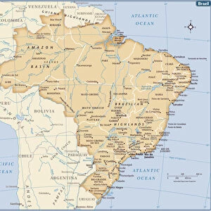
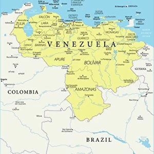
Map of South America 1869

![]()
Wall Art and Photo Gifts from Fine Art Storehouse
Map of South America 1869
Cornells Grammars-School Geography - S.S. Cornell - New York D. Appleton and Company 1869
Unleash your creativity and transform your space into a visual masterpiece!
THEPALMER
Media ID 13669023
© Roberto A Sanchez
Argentina Atlantic Ocean Backgrounds Brazil Colombia Direction Latin America Pacific Ocean Paper Patina Sepia Toned South America Textured Effect Uruguay Venezuela Obsolete Retro Styled
FEATURES IN THESE COLLECTIONS
> Fine Art Storehouse
> The Magical World of Illustration
> Palmer Illustrated Collection
> Maps and Charts
> World
> North America
> United States of America
> New York
> New York
> Maps
> South America
> Argentina
> Maps
> South America
> Brazil
> Maps
> South America
> Colombia
> Maps
> South America
> Uruguay
> Maps
> South America
> Venezuela
> Maps
EDITORS COMMENTS
This print showcases a vintage map of South America from 1869, taken from the renowned "Cornells Grammars-School Geography" by S. S. Cornell. The retro-styled image exudes an air of nostalgia and takes us back to a time when physical geography was meticulously studied on paper maps. The sepia-toned photograph beautifully captures the textured effect of the aged paper, adding to its charm and authenticity. With intricate details and precise cartography, this map provides a fascinating glimpse into the continent's past borders and geographical features. From Venezuela to Uruguay, Colombia to Brazil, Argentina to Chile, every country is clearly delineated along with their respective coastlines bordering both the Pacific Ocean and Atlantic Ocean. The vastness of South America's sea territories is also depicted in this stunning illustration. The patina that has developed over time further enhances the historical significance of this piece. It serves as a reminder of how far we have come in terms of technological advancements in mapping techniques. Whether you are an avid collector or simply appreciate art with educational value, this print offers a unique opportunity to own a piece of history while admiring the beauty inherent in old-world cartography.
MADE IN AUSTRALIA
Safe Shipping with 30 Day Money Back Guarantee
FREE PERSONALISATION*
We are proud to offer a range of customisation features including Personalised Captions, Color Filters and Picture Zoom Tools
SECURE PAYMENTS
We happily accept a wide range of payment options so you can pay for the things you need in the way that is most convenient for you
* Options may vary by product and licensing agreement. Zoomed Pictures can be adjusted in the Cart.