Home > North America > United States of America > New York > New York > Maps
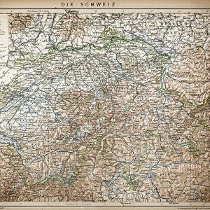
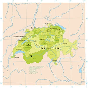
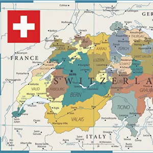
Switzerland map 1875

![]()
Wall Art and Photo Gifts from Fine Art Storehouse
Switzerland map 1875
The Independent Course Comprehensive Geography by James Monteith, A.S. Barnes & Co, New York & Chicago 1875
Unleash your creativity and transform your space into a visual masterpiece!
THEPALMER
Media ID 13612215
© This content is subject to copyright
Globe Navigational Equipment Paper Switzerland Drawing Art Product
FEATURES IN THESE COLLECTIONS
> Europe
> Switzerland
> Maps
> Fine Art Storehouse
> The Magical World of Illustration
> Palmer Illustrated Collection
> Fine Art Storehouse
> Map
> Historical Maps
> Maps and Charts
> Early Maps
> Maps and Charts
> Switzerland
> Maps and Charts
> World
> North America
> United States of America
> Maps
> North America
> United States of America
> New York
> New York
> Maps
EDITORS COMMENTS
This print showcases a piece of history frozen in time - the Switzerland map from 1875. Taken from "The Independent Course Comprehensive Geography" by James Monteith, this vintage artifact was published by A. S. Barnes & Co in New York and Chicago, making it a true testament to the rich cartographic heritage of the United States. The intricate details etched on paper through engraving techniques transport us back to an era when maps were meticulously crafted works of art. The beauty lies not only in its historical significance but also in its aesthetic appeal. The horizontal composition allows for a panoramic view of Switzerland's diverse topography, while the delicate lines and shading bring out every contour and feature with precision. This old-world charm is further enhanced by the antique quality of the image, evoking nostalgia for a time long gone. As we gaze upon this mesmerizing illustration, we are reminded of nature's grandeur that has remained unchanged over centuries. From majestic mountains to serene lakes and winding rivers, Switzerland's physical geography unfolds before our eyes like a masterpiece waiting to be explored. "The Independent Course Comprehensive Geography" map serves as both an educational tool and a window into another era. It invites us to appreciate the artistry behind cartography while igniting our curiosity about Switzerland's past and present landscapes. Thanks to THEPALMER's skillful capture, this remarkable piece can now be admired as an exquisite drawing art product that transcends time itself.
MADE IN AUSTRALIA
Safe Shipping with 30 Day Money Back Guarantee
FREE PERSONALISATION*
We are proud to offer a range of customisation features including Personalised Captions, Color Filters and Picture Zoom Tools
SECURE PAYMENTS
We happily accept a wide range of payment options so you can pay for the things you need in the way that is most convenient for you
* Options may vary by product and licensing agreement. Zoomed Pictures can be adjusted in the Cart.