Home > Maps and Charts > Early Maps
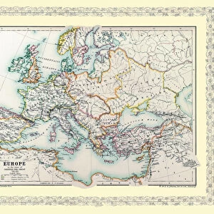
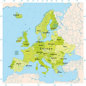
Europe map 1886

![]()
Wall Art and Photo Gifts from Fine Art Storehouse
Europe map 1886
Europe map 1886 Maps Monteith Physical Geography 1886
Unleash your creativity and transform your space into a visual masterpiece!
THEPALMER
Media ID 14549483
© This content is subject to copyright
FEATURES IN THESE COLLECTIONS
> Europe
> Related Images
> Fine Art Storehouse
> Map
> Historical Maps
> Maps and Charts
> Early Maps
EDITORS COMMENTS
In this print titled "Europe map 1886" we are transported back in time to the late 19th century, immersing ourselves in a world where cartography was both an art form and a scientific endeavor. The intricate details of this vintage map, sourced from the esteemed collection of Maps Monteith Physical Geography 1886, offer us a glimpse into Europe's geographical landscape as it stood over a century ago. The careful craftsmanship evident in every stroke and contour reminds us of the immense dedication and precision required to create such masterpieces before the advent of modern technology. As we explore this historical artifact, our eyes trace the delicate lines that delineate borders between nations, rivers meandering through vast landscapes, and mountain ranges rising majestically across the continent. This particular print captures not only Europe's physical geography but also its rich history and cultural diversity. It invites us to ponder how boundaries have shifted over time while marveling at how certain landmarks have remained unchanged for centuries. The faded hues lend an air of nostalgia to the image, transporting us further into bygone eras when explorers embarked on perilous journeys to chart uncharted territories. "The Palmer" whose name is attributed to this remarkable piece, has skillfully preserved this slice of European history for future generations to appreciate. Through their lens or scanner, they have immortalized an exquisite work that serves as both an educational tool and a testament to human curiosity about our world. As we gaze upon "Europe map 1886, "
MADE IN AUSTRALIA
Safe Shipping with 30 Day Money Back Guarantee
FREE PERSONALISATION*
We are proud to offer a range of customisation features including Personalised Captions, Color Filters and Picture Zoom Tools
SECURE PAYMENTS
We happily accept a wide range of payment options so you can pay for the things you need in the way that is most convenient for you
* Options may vary by product and licensing agreement. Zoomed Pictures can be adjusted in the Cart.