Home > Maps and Charts > Early Maps
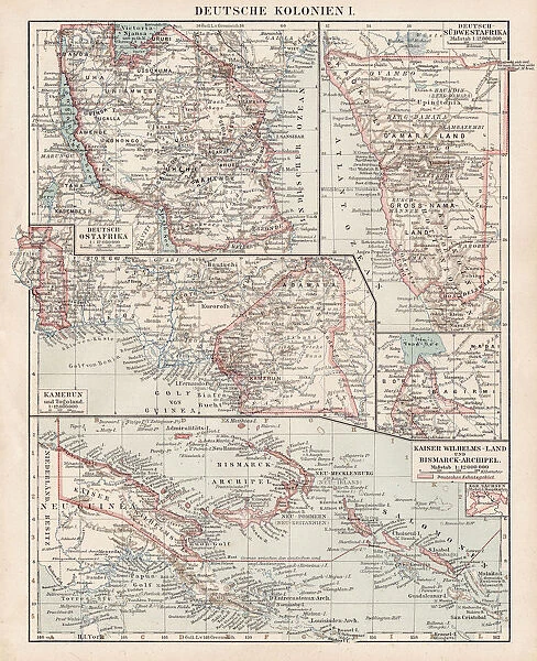
Map of German Colonies 1900
![]()

Wall Art and Photo Gifts from Fine Art Storehouse
Map of German Colonies 1900
Meyers hand-Atlas Leipzig und Wien Verlag des Bibliographischen Instituts 1900
Unleash your creativity and transform your space into a visual masterpiece!
THEPALMER
Media ID 18106927
© 2014 Roberto Adrian Photography
FEATURES IN THESE COLLECTIONS
> Fine Art Storehouse
> Map
> Historical Maps
> Maps and Charts
> Early Maps
EDITORS COMMENTS
This print showcases a historical treasure, the "Map of German Colonies 1900" sourced from Meyers hand-Atlas Leipzig und Wien Verlag des Bibliographischen Instituts in the year 1900. Crafted with meticulous detail and precision, this map offers a fascinating glimpse into Germany's colonial territories during that era. The intricate lines and vibrant colors on this print bring to life an important chapter in global history. From Africa to Oceania, it highlights the vast extent of German influence across various continents at the turn of the 20th century. Each colony is meticulously labeled, allowing viewers to immerse themselves in an exploration of these distant lands. As we gaze upon this remarkable piece, our imagination takes flight as we envision explorers charting unknown territories and settlers establishing new communities far from home. The map not only serves as a geographical reference but also sparks curiosity about cultural exchanges and interactions that must have occurred between Germans and indigenous populations. "The Map of German Colonies 1900" by THEPALMER is more than just a decorative piece; it is a window into history—a testament to human ambition, discovery, and colonization. Whether displayed in homes or educational institutions, this print invites us to reflect on past events while appreciating its artistic value. It serves as a reminder that maps are not merely tools for navigation but also gateways to understanding our collective heritage.
MADE IN AUSTRALIA
Safe Shipping with 30 Day Money Back Guarantee
FREE PERSONALISATION*
We are proud to offer a range of customisation features including Personalised Captions, Color Filters and Picture Zoom Tools
SECURE PAYMENTS
We happily accept a wide range of payment options so you can pay for the things you need in the way that is most convenient for you
* Options may vary by product and licensing agreement. Zoomed Pictures can be adjusted in the Cart.


