Home > Europe > Greece > Maps
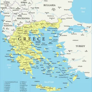
Map of Greece 1900
![]()

Wall Art and Photo Gifts from Fine Art Storehouse
Map of Greece 1900
Meyers hand-Atlas Leipzig und Wien Verlag des Bibliographischen Instituts 1900
Unleash your creativity and transform your space into a visual masterpiece!
THEPALMER
Media ID 18106923
© 2014 Roberto Adrian Photography
FEATURES IN THESE COLLECTIONS
> Fine Art Storehouse
> Map
> Historical Maps
> Maps and Charts
> Early Maps
EDITORS COMMENTS
In this print titled "Map of Greece 1900". THEPALMER takes us on a journey back in time to the turn of the century. The image showcases an exquisite reproduction of a map originally published in Meyers Hand-Atlas Leipzig und Wien Verlag des Bibliographischen Instituts in 1900. The map, meticulously crafted with intricate details and vibrant colors, offers a glimpse into Greece's rich history and geographical features during that era. It beautifully captures the essence of cartography as an art form, blending accuracy with artistic flair. As we explore this vintage map, our eyes are drawn to the various cities, towns, rivers, and mountains that define Greece's landscape. Each line and symbol tells a story about ancient civilizations that once thrived within these borders – from Athens' majestic Acropolis to Olympia's sacred grounds where the Olympic Games originated. This print not only serves as a visual delight but also sparks curiosity about Greece's cultural heritage. It invites us to imagine what life was like at the dawn of the 20th century when transportation was still primarily by horse-drawn carriages or steam-powered locomotives. "The Map of Greece 1900" is more than just an artwork; it is a window into history itself. Whether displayed in homes or offices, it serves as both an educational tool and a conversation starter for those fascinated by geography or Greek mythology enthusiasts eager to trace Odysseus' legendary journey through these lands. THEPALMER has masterfully
MADE IN AUSTRALIA
Safe Shipping with 30 Day Money Back Guarantee
FREE PERSONALISATION*
We are proud to offer a range of customisation features including Personalised Captions, Color Filters and Picture Zoom Tools
SECURE PAYMENTS
We happily accept a wide range of payment options so you can pay for the things you need in the way that is most convenient for you
* Options may vary by product and licensing agreement. Zoomed Pictures can be adjusted in the Cart.


