Home > Maps and Charts > Early Maps
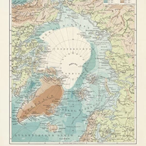
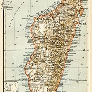
Map of the South Pole 1900

![]()
Wall Art and Photo Gifts from Fine Art Storehouse
Map of the South Pole 1900
Meyers hand-Atlas Leipzig und Wien Verlag des Bibliographischen Instituts 1900
Unleash your creativity and transform your space into a visual masterpiece!
THEPALMER
Media ID 18106929
© 2014 Roberto Adrian Photography
FEATURES IN THESE COLLECTIONS
> Fine Art Storehouse
> Map
> Historical Maps
> Maps and Charts
> Early Maps
EDITORS COMMENTS
In this print titled "Map of the South Pole 1900" we are transported back in time to an era of exploration and discovery. The image, sourced from Meyers hand-Atlas Leipzig und Wien Verlag des Bibliographischen Instituts in 1900, showcases a meticulously detailed map that unveils the secrets hidden within the icy realms of the southernmost point on our planet. The map itself is a testament to human curiosity and ambition as it depicts uncharted territories waiting to be explored by intrepid adventurers. Its intricate lines and markings trace the contours of vast glaciers, jagged mountain ranges, and treacherous seas surrounding this remote polar region. It serves as both a historical artifact and a window into an age when cartography was at its zenith. "The Map of the South Pole 1900" transports us beyond mere geography; it invites us to embark on an imaginary journey through unexplored lands where few have dared to venture. As we gaze upon this remarkable piece, we can almost feel the chill in the air and hear echoes of past expeditions echoing across frozen landscapes. This print by THEPALMER captures not only the beauty but also evokes a sense of wonderment about our planet's most extreme corners. It reminds us that there is still much left for humanity to discover and explore—a timeless reminder that ignites our adventurous spirit even today.
MADE IN AUSTRALIA
Safe Shipping with 30 Day Money Back Guarantee
FREE PERSONALISATION*
We are proud to offer a range of customisation features including Personalised Captions, Color Filters and Picture Zoom Tools
SECURE PAYMENTS
We happily accept a wide range of payment options so you can pay for the things you need in the way that is most convenient for you
* Options may vary by product and licensing agreement. Zoomed Pictures can be adjusted in the Cart.