Home > Asia > Israel > Lakes > Sea of Galilee
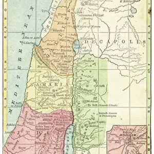
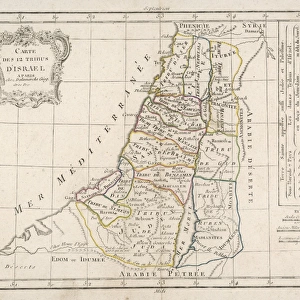
Historical map of Palestine with the twelve tribes of Israel

![]()
Wall Art and Photo Gifts from Fine Art Storehouse
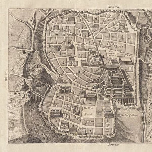
Historical map of Palestine with the twelve tribes of Israel
Historical map of Palestine with the twelve tribes of Israel. Colored steel engraving, published in 1886
Unleash your creativity and transform your space into a visual masterpiece!
Media ID 14756854
© This content is subject to copyright
Bible Canaan Dead Sea Israel Jerusalem Jordan Judaism Mediterranean Sea Middle East Old Testament Palestine Religious Sea Of Galilee Steel Engraving Topography Tribe Twelve Golan Kinneret Lake Of Gennesaret Lake Tiberias
FEATURES IN THESE COLLECTIONS
> Asia
> Israel
> Lakes
> Sea of Galilee
> Asia
> Palestine
> Jerusalem
> Fine Art Storehouse
> Map
> Historical Maps
> Fine Art Storehouse
> World Religion
> Maps and Charts
> Early Maps
> Maps and Charts
> World
EDITORS COMMENTS
This print takes us on a journey back in time, immersing us in the rich history of Palestine. Created in 1886, this colored steel engraving showcases a historical map adorned with intricate details and vibrant hues. As we explore its contours, we are transported to an era when the twelve tribes of Israel roamed these lands. The map encompasses the vast expanse of Palestine, stretching from the Mediterranean Sea to the Jordan River. It highlights significant landmarks such as the Sea of Galilee (also known as Lake Tiberias or Kinneret), Lake Gennesaret, and even the enigmatic Dead Sea. The topography is meticulously depicted, allowing us to envision Canaan's diverse landscapes - from its coastal regions to its mountainous terrain. As our eyes wander across this ancient civilization's homeland, Jerusalem stands out prominently at its heart. A city steeped in religious significance for Judaism and Christianity alike, it serves as a reminder of how faith has shaped this region throughout millennia. This remarkable piece not only captures geographical accuracy but also symbolizes cultural heritage and spiritual devotion. Its presence evokes contemplation about biblical tales intertwined with real-life events that unfolded here centuries ago. A testament to human ingenuity and artistic craftsmanship, this vertical steel engraving invites us into an enchanting world where past meets present. Let it serve as a window through which we can glimpse into history's pages while appreciating both artistry and reverence for our collective pasts.
MADE IN AUSTRALIA
Safe Shipping with 30 Day Money Back Guarantee
FREE PERSONALISATION*
We are proud to offer a range of customisation features including Personalised Captions, Color Filters and Picture Zoom Tools
SECURE PAYMENTS
We happily accept a wide range of payment options so you can pay for the things you need in the way that is most convenient for you
* Options may vary by product and licensing agreement. Zoomed Pictures can be adjusted in the Cart.