Home > Animals > Birds > Loons > Pacific Loon
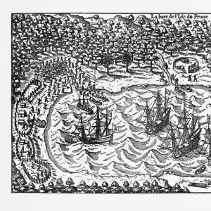
Historical Map of Van Noort at the Island of Principe, 1599

![]()
Wall Art and Photo Gifts from Fine Art Storehouse
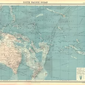
Historical Map of Van Noort at the Island of Principe, 1599
Very Rare, Beautifully Illustrated Antique Engraved Victorian Illustration of Historical Map of Van Noort at the Island of Principe, from The Golden Book of the Dutch Navigators, By Hendrik Willem van Loon, Published in 1899. Copyright has expired on this artwork. Digitally restored
Unleash your creativity and transform your space into a visual masterpiece!
bauhaus1000
Media ID 13667063
© Craig McCausland
103626 16th Century 16th Century Style 78273 Atlantic Islands Bay Of Water Business Finance And Industry Chart Co Pilot Commercial Dock Diagram Direction Discovery Dutch Culture European Culture Exploration Explorer Fort Freight Transportation Harbor Image Created 16th Century Industry Island Journey Market Vendor Papua New Guinea Passenger Craft Passenger Ship People Traveling Retail Occupation Sailing Ship Sea Passage Ship Shipping South Pacific Ocean Tropical Climate Village West Africa Sao Tome And Principe Victorian Style
FEATURES IN THESE COLLECTIONS
> Africa
> Sao Tome and Principe
> Sao Tome
> Animals
> Birds
> Loons
> Pacific Loon
> Animals
> Mammals
> Soricidae
> Navigator
> Fine Art Storehouse
> Map
> Historical Maps
> Maps and Charts
> Early Maps
> Oceania
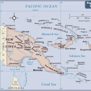
> Papua New Guinea
> Maps
EDITORS COMMENTS
This beautifully illustrated antique engraving takes us back in time to the 16th century, showcasing a historical map of Van Noort at the Island of Principe. The print, which is a digital restoration of an original woodcut illustration created in the 16th century, captures the essence of European culture and exploration during this era. The image depicts a passenger ship sailing through the sea passage towards the island, with people traveling on board. A co-pilot guides the ship as it navigates its way through uncharted territories. This scene represents both adventure and discovery as explorers set out to explore new lands. The map showcases various landmarks including forts, commercial docks, harbors, and villages that were significant during that time period. It also highlights other locations such as Sao Tome and Principe in West Africa and Papua New Guinea. With its intricate details and black-and-white design reminiscent of Victorian style illustrations, this print offers a glimpse into history while capturing the spirit of travel and exploration. It serves as a reminder of how far we have come in terms of navigation technology and our understanding of different cultures around the world. Overall, this rare piece from "The Golden Book of Dutch Navigators" allows us to appreciate both artistic beauty and historical significance within cartography.
MADE IN AUSTRALIA
Safe Shipping with 30 Day Money Back Guarantee
FREE PERSONALISATION*
We are proud to offer a range of customisation features including Personalised Captions, Color Filters and Picture Zoom Tools
SECURE PAYMENTS
We happily accept a wide range of payment options so you can pay for the things you need in the way that is most convenient for you
* Options may vary by product and licensing agreement. Zoomed Pictures can be adjusted in the Cart.