Home > North America > Canada > Maps
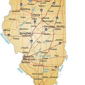
Manitoba map 1897

![]()
Wall Art and Photo Gifts from Fine Art Storehouse
Manitoba map 1897
The World-Wide Atlas of Modern Geography, Political and Physical W. & A.K. Johnston - London 1897
Unleash your creativity and transform your space into a visual masterpiece!
THEPALMER
Media ID 14757124
© Roberto A Sanchez
Atlas Canada Country Geographic Area Earth North America Paper Prairie World Map Manitoba Retro Styled
FEATURES IN THESE COLLECTIONS
> Europe
> United Kingdom
> England
> London
> Related Images
> Fine Art Storehouse
> Map
> Historical Maps
> Maps and Charts
> Early Maps
> Maps and Charts
> World
> North America
> Canada
> Maps
EDITORS COMMENTS
This print takes us back in time to the year 1897, showcasing a meticulously detailed map of Manitoba. Extracted from "The World-Wide Atlas of Modern Geography, Political and Physical" published by W. & A. K. Johnston in London, this vintage piece exudes an irresistible retro charm. The engraving technique used to create this map adds an extra layer of allure, with its intricate lines and delicate details. The paper's aged texture further enhances the antique feel, transporting us to a different era altogether. Manitoba, nestled within the vast Canadian landscape of North America, is beautifully depicted on this map. Its prairies stretch as far as the eye can see while rivers gracefully meander through its territory. This engraving not only showcases Manitoba's geographic area but also provides insight into its physical geography. As we gaze upon this historical artifact, we are reminded of how maps were once treasured possessions that guided explorers and adventurers across unknown lands. It serves as a testament to human curiosity and our innate desire to understand our world better. "The Manitoba Map 1897" by THEPALMER offers more than just cartographic information; it invites us on a journey through time itself. Whether displayed in a study or living room, it will undoubtedly spark conversations about history and geography while adding an air of sophistication and nostalgia to any space.
MADE IN AUSTRALIA
Safe Shipping with 30 Day Money Back Guarantee
FREE PERSONALISATION*
We are proud to offer a range of customisation features including Personalised Captions, Color Filters and Picture Zoom Tools
SECURE PAYMENTS
We happily accept a wide range of payment options so you can pay for the things you need in the way that is most convenient for you
* Options may vary by product and licensing agreement. Zoomed Pictures can be adjusted in the Cart.