Home > Africa > Sudan > Maps
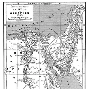
Poster Print : Map of Egypt and Sudan 1896


![]()
Poster Prints from Fine Art Storehouse
Map of Egypt and Sudan 1896
Andres Allgemeiner Handatlas - Bielefeld und Leipzig 1896
Unleash your creativity and transform your space into a visual masterpiece!
THEPALMER
Media ID 18356811
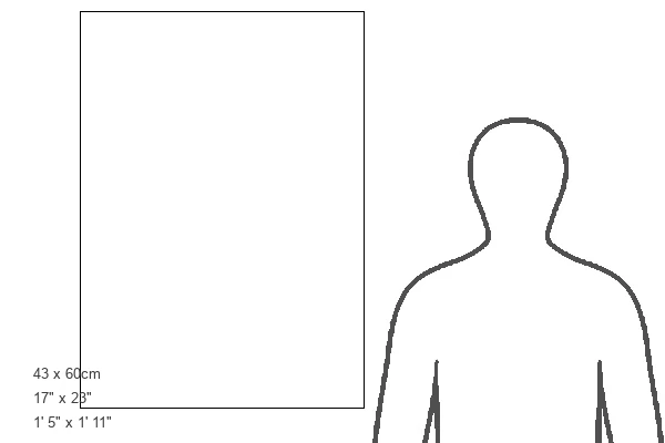
A2 (59.4 x 42cm) Poster Print
Step back in time with our vintage Map of Egypt and Sudan print from THEPALMER's Andres Allgemeiner Handatlas, published in 1896. This intricately detailed poster showcases the geography of the region as it appeared over a century ago. A captivating addition to any home or office space, this historic map print is a perfect conversation starter and a great way to add a touch of nostalgia to your decor. Made from high-quality materials, this poster print is not only visually stunning but also durable and long-lasting. Order yours today and travel back in time with every glance!
Premium quality poster prints are printed on luxurious glossy or matte 270 gsm paper. Our meticulously crafted poster prints offer an affordable option for decorating any space, making them ideal for living rooms, bedrooms, offices and beyond. To ensure your poster arrives in good condition, we roll and send them in strong mailing tubes.
Poster prints are budget friendly enlarged prints in standard poster paper sizes (A0, A1, A2, A3 etc). Whilst poster paper is sometimes thinner and less durable than our other paper types, they are still ok for framing and should last many years. Our Archival Quality Photo Prints and Fine Art Paper Prints are printed on higher quality paper and the choice of which largely depends on your budget.
Estimated Image Size (if not cropped) is 38.8cm x 59.6cm (15.3" x 23.5")
Estimated Product Size is 42.6cm x 59.6cm (16.8" x 23.5")
These are individually made so all sizes are approximate
Artwork printed orientated as per the preview above, with portrait (vertical) orientation to match the source image.
FEATURES IN THESE COLLECTIONS
> Africa
> Egypt
> Related Images
> Africa
> Sudan
> Related Images
> Fine Art Storehouse
> Map
> Historical Maps
> Maps and Charts
> Related Images
EDITORS COMMENTS
In this print titled "Map of Egypt and Sudan 1896" we are transported back in time to the late 19th century, where cartography was an art form in itself. The intricate details and craftsmanship of this map, sourced from Andres Allgemeiner Handatlas - Bielefeld und Leipzig 1896, truly capture the essence of a bygone era. As we gaze upon this historical artifact, our eyes are immediately drawn to the rich colors that adorn its surface. Shades of deep blues represent water bodies like the Nile River and Lake Victoria, while earthy tones depict vast deserts and fertile lands. Every contour line meticulously etched onto the paper reveals mountains, valleys, and plateaus with remarkable precision. The Map of Egypt and Sudan transports us to a time when these regions were still under colonial rule. It serves as a reminder of their complex history intertwined with European powers seeking control over strategic territories. This print offers not only geographical information but also provides insights into political boundaries during that period. "The Palmer" has skillfully captured this piece from Fine Art Storehouse, allowing us to appreciate its beauty up close. Whether you're an avid historian or simply fascinated by vintage maps, this print is sure to ignite your imagination as you explore the intricacies of Egypt and Sudan's past through cartographic mastery.
MADE IN AUSTRALIA
Safe Shipping with 30 Day Money Back Guarantee
FREE PERSONALISATION*
We are proud to offer a range of customisation features including Personalised Captions, Color Filters and Picture Zoom Tools
SECURE PAYMENTS
We happily accept a wide range of payment options so you can pay for the things you need in the way that is most convenient for you
* Options may vary by product and licensing agreement. Zoomed Pictures can be adjusted in the Cart.