Home > Europe > Republic of Ireland > Maps
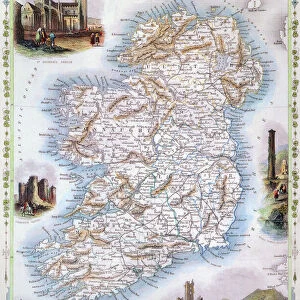
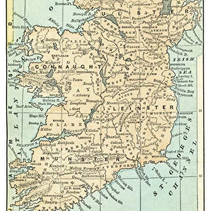
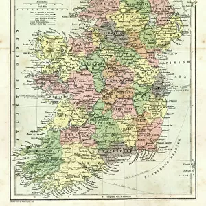
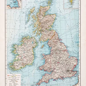
Map of Ireland 1889

![]()
Wall Art and Photo Gifts from Fine Art Storehouse
Map of Ireland 1889
Comprehensive Geography by James Monteith - American Book Company 1882, 1889
Unleash your creativity and transform your space into a visual masterpiece!
THEPALMER
Media ID 18357267
FEATURES IN THESE COLLECTIONS
> Europe
> Republic of Ireland
> Maps
> Fine Art Storehouse
> Map
> Historical Maps
> Maps and Charts
> Early Maps
EDITORS COMMENTS
In this print titled "Map of Ireland 1889" we are transported back in time to the late 19th century, where cartography was a true art form. The map, originally featured in James Monteith's Comprehensive Geography published by the American Book Company in 1882 and updated in 1889, showcases the intricate details and craftsmanship that went into creating these historical navigational tools. As our eyes wander across the image, we are immediately drawn to the rich colors and fine lines that outline every contour of Ireland's landscape. From its jagged coastlines to its rolling hills and majestic mountains, this map beautifully captures both the geography and topography of this enchanting island nation. The careful placement of cities, towns, rivers, and lakes provides us with a glimpse into Ireland's past; it allows us to imagine what life might have been like during that era. As we examine each region closely, we can almost hear echoes from history whispering tales of ancient Celtic traditions or stories about Irish folklore passed down through generations. "The Map of Ireland 1889" is not just a mere representation of geographical boundaries; it is an invitation for exploration. It beckons us to embark on a journey through time as we trace our fingers along forgotten roads or follow winding rivers towards hidden treasures waiting to be discovered. This remarkable piece by THEPALMER serves as both an educational tool for those interested in history and geography while also being a stunning work of art that captivates viewers with its
MADE IN AUSTRALIA
Safe Shipping with 30 Day Money Back Guarantee
FREE PERSONALISATION*
We are proud to offer a range of customisation features including Personalised Captions, Color Filters and Picture Zoom Tools
SECURE PAYMENTS
We happily accept a wide range of payment options so you can pay for the things you need in the way that is most convenient for you
* Options may vary by product and licensing agreement. Zoomed Pictures can be adjusted in the Cart.