Home > Asia > Georgia > Maps
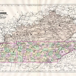
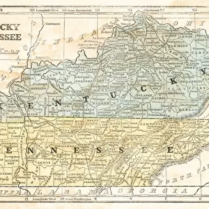
Map of Kentucky and Tennessee

![]()
Wall Art and Photo Gifts from Fine Art Storehouse
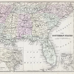
Map of Kentucky and Tennessee
Map of Kentucky and Tennessee - Scanned 1886 Map
Unleash your creativity and transform your space into a visual masterpiece!
benoitb
Media ID 14756880
© This content is subject to copyright
Alabama Arkansas Georgia Kentucky Mississippi Missouri North Carolina Ohio Sketch State Tennessee Virginia Classical Style Victorian Style
FEATURES IN THESE COLLECTIONS
> Fine Art Storehouse
> Map
> Historical Maps
> Fine Art Storehouse
> Map
> USA Maps
> Maps and Charts
> Early Maps
> North America
> United States of America
> Alabama
> Related Images
> North America
> United States of America
> Arkansas
> Related Images
> North America
> United States of America
> Georgia
> Related Images
> North America
> United States of America
> Kentucky
> Related Images
> North America
> United States of America
> Maps
> North America
> United States of America
> Mississippi
> Related Images
> North America
> United States of America
> Missouri
> Related Images
EDITORS COMMENTS
This print takes us back in time to the late 19th century, offering a glimpse into the rich history of Kentucky and Tennessee. The intricately detailed map showcases the artistic prowess of engraving during this era, with its Victorian style illustration that exudes an air of elegance. The map encompasses not only Kentucky and Tennessee but also neighboring states such as Georgia, Ohio, Missouri, Arkansas, Virginia, North Carolina, Mississippi, and Alabama. It serves as a testament to the vastness and interconnectedness of these regions during that period. Every line etched on this antique piece tells a story - from the winding rivers to the sprawling cities marked with tiny dots. It is evident that great care was taken in creating this engraved image; each curve meticulously crafted to capture every contour of the land. As we gaze upon this historical artifact today, it sparks curiosity about how life must have been like for those who inhabited these lands over a century ago. It invites us to explore their journeys across state lines or imagine what bustling towns may have thrived along those riverbanks. Benoitb's masterful reproduction allows us to appreciate both the artistry behind this classical-style map and its significance as a window into our past. A true collector's item for history enthusiasts or anyone seeking timeless beauty within their home decor.
MADE IN AUSTRALIA
Safe Shipping with 30 Day Money Back Guarantee
FREE PERSONALISATION*
We are proud to offer a range of customisation features including Personalised Captions, Color Filters and Picture Zoom Tools
SECURE PAYMENTS
We happily accept a wide range of payment options so you can pay for the things you need in the way that is most convenient for you
* Options may vary by product and licensing agreement. Zoomed Pictures can be adjusted in the Cart.