Home > South America > Uruguay > Maps
South America Physical map 1897

![]()
Wall Art and Photo Gifts from Fine Art Storehouse
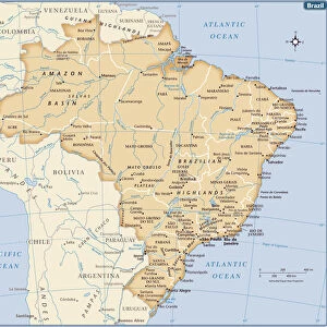
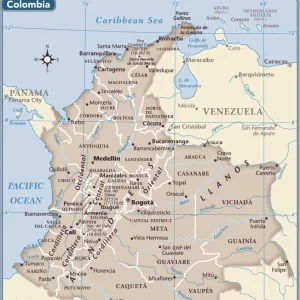
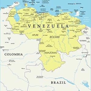
South America Physical map 1897
The World-Wide Atlas of Modern Geography, Political and Physical W. & A.K. Johnston - London 1897
Unleash your creativity and transform your space into a visual masterpiece!
THEPALMER
Media ID 14757130
© Roberto A Sanchez
Argentina Atlantic Ocean Atlas Backgrounds Brazil Colombia Country Geographic Area Direction Earth Latin America Pacific Ocean Paper Patina Sepia Toned South America Textured Effect Uruguay Venezuela World Map Retro Styled
FEATURES IN THESE COLLECTIONS
> Europe
> United Kingdom
> England
> London
> Related Images
> Fine Art Storehouse
> Map
> Historical Maps
> Maps and Charts
> Early Maps
> Maps and Charts
> World
> South America
> Argentina
> Maps
> South America
> Brazil
> Maps
> South America
> Colombia
> Maps
> South America
> Uruguay
> Maps
> South America
> Venezuela
> Maps
EDITORS COMMENTS
This print takes us back in time to the year 1897, when cartography was a meticulous art form. The South America Physical map featured in this image is part of "The World-Wide Atlas of Modern Geography, Political and Physical" by W. & A. K. Johnston - London 1897. With its retro-styled appearance and antique charm, this engraved image showcases the intricate details of South America's physical geography. From Venezuela to Uruguay, Colombia to Brazil, Argentina to every country within the region, each geographic area is meticulously depicted with precision and accuracy. The sepia-toned textured effect adds an extra layer of nostalgia, as if we are peering into a treasured relic from another era. As we gaze upon this piece, we can almost feel the texture of the paper and imagine how it would have been held in hands long ago. The vastness of South America unfolds before our eyes as we observe its borders stretching across both the Pacific Ocean and Atlantic Ocean. The sea surrounding these landmasses serves as a reminder of their connection to the rest of our planet Earth. Every line etched onto this map carries with it a sense of history—a patina that speaks volumes about exploration and discovery during that time period. This print by THEPALMER transports us back in time while simultaneously reminding us of the enduring beauty found within old maps like these.
MADE IN AUSTRALIA
Safe Shipping with 30 Day Money Back Guarantee
FREE PERSONALISATION*
We are proud to offer a range of customisation features including Personalised Captions, Color Filters and Picture Zoom Tools
SECURE PAYMENTS
We happily accept a wide range of payment options so you can pay for the things you need in the way that is most convenient for you
* Options may vary by product and licensing agreement. Zoomed Pictures can be adjusted in the Cart.