Home > North America > United States of America > New York > New York > Maps
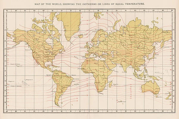
World map temperature 1893
![]()

Wall Art and Photo Gifts from Fine Art Storehouse
World map temperature 1893
Johnsonas Universal Cyclopedia - Charles Kendall - New York 1893 vol 2
Unleash your creativity and transform your space into a visual masterpiece!
THEPALMER
Media ID 14756550
© This content is subject to copyright
Continents Temperature World Isotherms
FEATURES IN THESE COLLECTIONS
> Fine Art Storehouse
> Map
> Historical Maps
> Maps and Charts
> Early Maps
> Maps and Charts
> World
> North America
> United States of America
> New York
> New York
> Maps
EDITORS COMMENTS
In this print titled "World map temperature 1893" we are transported back in time to an era when scientific exploration was at its peak. Taken from Johnson's Universal Cyclopedia, a renowned publication of the late 19th century, this mesmerizing image showcases Charles Kendall's groundbreaking work on mapping global temperatures. The print presents us with a beautifully detailed world map, adorned with isotherms that elegantly trace the contours of each continent. The isotherms serve as visual representations of temperature variations across different regions, allowing viewers to gain insights into climatic patterns around the globe during that period. As we delve deeper into this historical artifact, it becomes apparent that every inch of the map holds immense value and significance. Each line and curve tells a story about our planet's intricate climate system and how it has evolved over time. It serves as a reminder of humanity's ceaseless quest for knowledge and understanding. "The World Map Temperature 1893" by THEPALMER offers us an opportunity to appreciate both the artistry behind cartography and the scientific advancements made centuries ago. It invites us to reflect on our own place within this vast interconnected web of climates while marveling at how far we have come since then. This print from Fine Art Storehouse transports us through time, reminding us that even in today's rapidly changing world, there is still much more left to explore and discover about our planet's fascinating past.
MADE IN AUSTRALIA
Safe Shipping with 30 Day Money Back Guarantee
FREE PERSONALISATION*
We are proud to offer a range of customisation features including Personalised Captions, Color Filters and Picture Zoom Tools
SECURE PAYMENTS
We happily accept a wide range of payment options so you can pay for the things you need in the way that is most convenient for you
* Options may vary by product and licensing agreement. Zoomed Pictures can be adjusted in the Cart.


