Home > Animals > Birds > Gruiformes > Rallidae > Water Rail
MA Hampshire Huntington Vector Road Map

![]()
Wall Art and Photo Gifts from Fine Art Storehouse
MA Hampshire Huntington Vector Road Map
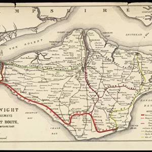
MA Hampshire Huntington Vector Road Map. All source data is in the public domain. U.S. Census Bureau Census Tiger. Used Layers: areawater, linearwater, roads, rails, cousub, pointlm, uac10
Unleash your creativity and transform your space into a visual masterpiece!
Frank Ramspott
Media ID 20690855
© Frank Ramspott, all rights reserved
City Map Computer Graphic County Digital Composite District Geographical Border Hampshire Massachusetts Road Map Text Vector Digitally Generated Image Huntington Mount Pisgah Norwich
FEATURES IN THESE COLLECTIONS
> Animals
> Birds
> Gruiformes
> Rallidae
> Water Rail
> Animals
> Mammals
> Cats (Wild)
> Tiger
> Animals
> Mammals
> Cervidae
> Water Deer
> Arts
> Landscape paintings
> Waterfall and river artworks
> River artworks
> Arts
> Portraits
> Pop art gallery
> Street art portraits
> Arts
> Street art graffiti
> Digital art
> Digital paintings
> Europe
> United Kingdom
> England
> Hampshire
> Related Images
> Fine Art Storehouse
> Map
> Reference Maps
> Maps and Charts
> Related Images
EDITORS COMMENTS
This print showcases the MA Hampshire Huntington Vector Road Map, a stunning piece of cartography designed by Frank Ramspott. The image is a digitally generated composite that beautifully combines various layers of data from public sources such as the U. S. Census Bureau Census Tiger. The map's intricate details are brought to life through vibrant colors and precise vector graphics, highlighting the physical geography of Massachusetts' Hampshire County district. From sprawling rivers and serene lakes to bustling towns and charming cities, every element is meticulously depicted with utmost accuracy. While this visually striking artwork does not feature any people, it serves as an invaluable resource for anyone seeking to explore or navigate through this region. With clearly labeled streets, roads, and railways, it provides a comprehensive guide for travelers and locals alike. Notable locations within the map include Norwich Bridge, Goss Heights, Deer Hill, Mount Pisgah, Knightville, Fomer, North Chester among others. Each place is marked with text labels ensuring easy identification. Whether you're an admirer of cartographic design or simply appreciate digital artistry at its finest; this MA Hampshire Huntington Vector Road Map print will undoubtedly captivate your imagination while offering valuable insights into the geographical wonders of Massachusetts' Hampshire County district.
MADE IN AUSTRALIA
Safe Shipping with 30 Day Money Back Guarantee
FREE PERSONALISATION*
We are proud to offer a range of customisation features including Personalised Captions, Color Filters and Picture Zoom Tools
SECURE PAYMENTS
We happily accept a wide range of payment options so you can pay for the things you need in the way that is most convenient for you
* Options may vary by product and licensing agreement. Zoomed Pictures can be adjusted in the Cart.